
Eruption activity continued in Holuhraun at the same rate as on Monday (10-November-2014) and yesterday (Tuesday 11-November-2014). While bad weather has making observation of the eruption in Holuhraun difficult and close to impossible there are no signs of the eruption ending any time soon. A lava lake has now formed that is around 400 meters long and 100 meters wide. This is the first lava lake in Iceland in a long time. I don’t know when last lava lake existed in Iceland, but that was a while ago.
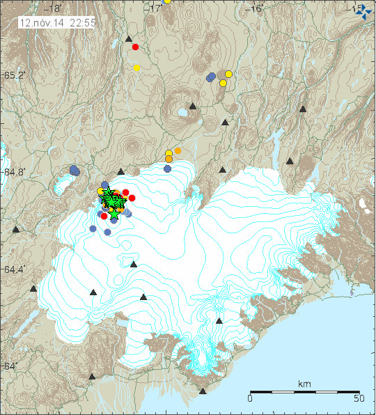
Earthquake activity in Bárðarbunga volcano for the last 48 hours. Copyright of this image belongs to Icelandic Met Office.
Earthquake activity in Bárðarbunga volcano continues as it has been doing for the past two and half months. This means that the caldera continues to subside at unchanged rate. I do not know how much the area has grown that is now subsiding, I think there is limited information on that due to limited access to this area in the winter time. At the moment nothing seems to be changing and GPS data is supporting that view of mine. Comments on this blog and blogs posts by people how have gone to the eruption site in recent days say that new fractures are appearing south of current eruption crater. This means that rifting is continuing, this also means that new eruption south of current crater might start at any time without warning. Since magma is at shallow depth at this location, with depth being only 1 – 2 km at most, it is possible that it might even be at shallower depth closest to the eruption crater (but has not erupted yet).
Tungafellsjökull volcano
There has been minor increase in earthquake activity in Tungafellsjökull volcano. At the moment this looks just like a tectonic stresses are adjusting to all the changes in Bárðarbunga volcano. Earthquake activity in Tungafellsjökull volcano might increase in next few days or weeks. I don’t expect any eruption to take place at this point in time.
Bad weather warning
For the next two days there is going to be bad weather in Iceland. This means that detection of earthquakes is going to be limited in Holuhraun and around Bárðarbunga volcano. This means that only largest of earthquakes are going to be properly detected. Visibility to the eruption site on web-cameras is not going to be awful to none due to the snowstorm that I expect might follow this storm in the highland (it might rain, but I am not sure on that detail yet). It is storm season in Iceland so expect a lot of storms all winter.
Thanks for the update.
Thank you Jon for the update.
I appreciate the effort of IMO and other scientists who have gone into the field in difficult circumstances to upgrade and maintain the monitoring facilities just as the winter storms arrive.
The tremor graphs are rising…or is it because of the pesky weather again?
Ref “pesky weather”…its good that its blowing the pollution away
Small swarm and increased activity at VON..
Could this be purely coincidental with the VON activity being weather related?
Magnitude mb 4.6
Region ICELAND
Date time 2014-11-13 01:18:30.3 UTC
Location 64.67 N ; 17.91 W
Depth 10 km
EMSC
USGS has it as:
4.6 109km S of Akureyri, Iceland 2014-11-13 01:18:30 UTC 8.2 km
Thanks again for the update, I had missed the blogs about the fissures to the South. I do think Tung is going to be involved in all this since there is eq evidence of some connection between BB and Tung (similar to that between BB and Holuhraun) and the Von sil has been the highest readings of all sil’d consistently since 16th August.
Interesting videoloop showing plate movements around Bardarbunga in mid-August, based on the IMO GPS data, showing the tectonic stresses that the caldera was subject to at the time of dike initiation:
BBGlidnar 203: http://youtu.be/LcutrOW9YFo
He is implying large coordinated short periodic regional movement.
I doubt that he can support that from the IMO data. That’s because there are multiple forces on each individual station, some global, some local. There are large weather, processing, and other unrelated influences. There is random fluctuation in the readings.
He would need to show that he eliminated all these misleading factors before he came to his theory. He needs to prove that he knows how he knows. I wild guess is not good enough, even if it should turn out to be correct in the long run. If I predict that BB will erupt on my birthday, and it actually does, did I have a scientific theory? If so, was my theory correct? Was it justified?
Can anyone tell me ? Regarding the subsidence being measured , i believe the top of the caldera is being measured as the bottom is under a great thickness of ice , so , is the ice melting at the bottom and so lowering the top , and this is what the measurements are telling us . Or is the rock under the ice dropping into the magma below and carrying the ice down with it , how long can this dropping continue before the ‘ caldera plug’ lets the collosal lump of ice on top of it mix into the magma ? Would England be safe from the blast if it goes ‘BANG’ .
The subsidence has been measured with ground penetrating radar as well as surface scanning LIDAR radar. If you look back about a week you can find a posting about this. As far as the UK we would not be effected first hand if BB erupted. You might hear the bang if it was big enough and the wind was in the right direction, but I think that is also doubtful. The only effects we might get a few days after could be a fine dusting so ash. The long term effects would depend on how large an eruption took place. These could range from some spectacular sun sets to a slight drop in temperature, if enough SO2 was ejected high enough. The likely result could be some very odd sunsets and some disruption to air travel.
However only time will tell and it his just as likely nothing will happen here. Wishing everyone there in Iceland the best, and keep safe.
The most insight and easy to understand video for you all, done by the IMO:
https://www.youtube.com/watch?v=LcutrOW9YFo
Two motions happen: Hreppar pushes into Bardarbunga direction, while causing sideways movement near Hamarinn and Tunganfellsjokull, and rifting to initiate in two regions, Kistufell and Dyngjojukull-Holuhraun. Only the longest rift has erupted so far.
As Hreppar microplate pushes into Bardarbunga, it squeezes magma into the rifting zones and the caldera sinks. But faulting and magma only move significantly in the NE corner of Bardarbunga, as it happens.
In the future, this is a perfect scenario to trigger further rifting eruptions along Kistufell, Askja and perhaps at a more long-term, in the dead zone, along Veidivotn.
This is a MUST-SEE video.
This makes
Really great video. Why is the Hreppar plate pushing into Bardarbunga? How do we know that it is?
GPS movements. Not only Hamarinn but other nearby GPS stations too.
But this video is just estimated from the data of about 20 to 25 GPS stations. If much more different data, perhaps the movements would be more accurate and slightly different.
This video does NOT originate from IMO
Great video.
That’s what I’ve wanted to see from the beginning.
Thanks thanks.
Great video, but I wish we really knew if it is what is really happening? Perhaps barbarbunga is just to large to drop like a fast collapse. Perhaps it acts like a small tectonic plate.
From the video it does look that way! Perhaps this is why Big B has such a large caldera. ???
It’s not a tectonic plate. It is just rifting within and therefore it widens and sinks.
In many places in Iceland, rifting causes sinking as magma can’t find all the voids around.
This is making me thinking more and more that there is NO mantle plume in Iceland. We don’t need a plume to explain the volcanism and activity. Tectonics does well on its own.
The mantle plume is needed to explain why Iceland is a fast-growing geo-stationary island in the middle of the ocean. Continental drift pulling the crust apart is not enough. Note, that on the magnetic maps, Iceland is like a fixed obstruction in the way of the westward shifting mid-atlantic ridge.
@SteveG
For me it looks like this mantle plume is a memory for gravity forces from beneath, so maybe that’s a reason for the great gravity field anomaly around Iceland (see GOCE-data). Because the mass of crust itself is no explanation at all, like in the Himalayas…
Maybe there are some hints or facts for that to find in the lava of Iceland (very high saturation of gases in the magma or much higher density, or even higher amounts of heavy weight elements) then for others not mantel sourced lava.
Does anyone know if there are larger and/or wider mantel plumes than the one in Iceland on earth, if not that would really be a good explanation of the gravity field anomalies, wouldn’t it?
Don’t know what this energy rich magma means for BB itself, if it is richer. Or why in Iceland and not in the south of MAR…
Being that I’m not a geologist, just an interested bystander, you should take or ignore the following ‘explanation’.
The best example of a mantle plume to me are the Hawaiian islands and seamounts.
xxxhttps://en.wikipedia.org/wiki/Seamount
Most of the earth is mantle, a hot mushy liquid ball. Like the depths of the ocean, there are 3-dimensional currents within, which sink huge sheets colder upper layers into the depths, and return much hotter deep flows up toward the crust. The mid Atlantic ridge (MAR) might (or might not) be on top of such a rise. The relatively thin crust we love so dearly rides on the surface of the Earth.
But the plumes probably originate much deeper from mountainous peaks of the core-mantle boundary (CMB) layer, which might look similar to the mountainous Himalayas. Therefore, These plumes rise vertically in seemingly fixed spots in relation to their origin down below.
xxxhttps://en.wikipedia.org/wiki/Core%E2%80%93mantle_boundary
xxxhttp://seismo.berkeley.edu/annual_report/ar01_02/node37.html
This is even nicer
http://www.geotimes.org/jan01/earthsinterior.html
A tectonic plate is always surrounded either by subduction zones, transverse faults and mountain belts. On the movie it might look like a little plate tossed around, but it’s just faulting related to rifting. Interesting is that Bardarbunga is exactly at a spot where a transform fault meets the rift fault. The whole tectonic activity is strongly enhanced by the rising magma, caused by the underlying mantle plume activity. Irpsit, I think there is no question that there is a well established hot spot below Iceland. The result of the hotspot activity is Iceland. On Iceland we can witness the normal rift and transform faulting which we can trace all along the mid ocean ridges. You would have to rewrite many geology books, if you could prove that there is no mantle plume beneath Iceland.
Thanks for this great video. I now can see more clearly what is going on with Big B! 🙂 No wonder the sinking, shaking, and lava eruption. I wonder if this kind of activity is normal with this volcano and has been going on for other eruptions in the past. I now have a new set of questions racing through my mind after seeing all the stretching and squeezing that is going on.
Yes, this is normal and it has happened many times before.
Year 1862 and 1875. Year 1783, 1784 and 1789. Year 1720s. Year 1620. Year 1477- Year 934. Year 874. Etc etc etc.
We just have not seen it in modern times.
SteveG. If you are referring to the video, it isn’t a theory. I would guess it is based on 3D trigonometri analysis of successive measured displacements at the array of individual IMO GPS stations – hence the idealized straight-line segments.
Heklubyggð geophone is off-line due to a failed power converter (best idea on what is wrong). It won’t be fixed until tomorrow at the earliest.
Comment on the video from the maker:
“Gudmundur Jonsson
Riftin is mostly stop, and it has been quite a long time (60 days). This model is to show how mekanic might work in this.
I´s 100.000 years of movements, so there is not much chance of eruption in the caldera in the next few years as a direct result of this. But this suddent moves that occurred in august appears to have launched a process in which magma travels up to Bárðarbunga, it could cause an eruption in our future “
I´s 100.000 years of movements: can’t be truth. It’s exageration.
In reality, its more like 200 years of movements.
2cm/year 200 years = 4 meters (agrees with GPS)
Otherwise, rifting would have be in the order of:
2cm/year x 100000 years = 200 meters. Not seen, by far. Impossible. If it would occur, it would be a truly massive eruptions, 10 times larger than Veidivotn (rifting then, back in 1477 was 10-20 meters)
Maybe I speak only for myself . . . maybe it’s a cultural thing. Maybe it’s a personality thing . . .
HOWEVER, IT APPEARS THAT
a number of Icelandic folks are extremely terse in their communications. . . . terse too often, to the point of being mystifying.
I’d DEARLY appreciate a significant elaboration on your post–an explanation as to what you were trying to communicate. So far, I don’t have much of a clue. Sorry.
I do not know whether you reply to me. Anyways I am not Icelandic but I agree that my reply might have been too sharp and little self-explaining.
I was meant to correct the seemingly exagerated comment by Gudmundur Jonsson, the maker of video showing the plate movements as deduced by the GPS movements.
This event has triggered tectonic movements equivalent to nearly 200 years of history, because the plates move on average 2cm per year (hence, giving a total of 4 meters which is nearer the amount measured by the IMO GPS devices) Perhaps it’s slightly less or slightly more.
Other events in Icelandic history has shown even greater degrees of GPS movements (which were opbviously not measure at that time, but only estimated). Veidivotn in 1477 is one of them, with about 10-15 meters of estimated rifting, so about a few times larger than this event.
Which shows how amazing this event really is, but not yet gigantic.
Iceland Eruptions @wslangerak · 13 min Há 13 minutos
Extra page added to our website with various info, pictures and video’s about #Bardarbunga #Holuhraun #Nornahraun http://icelanderuptions.com/various.html
Thanks, Luisport. Very helpful.
This is tetonic. No? A rift or should I say,the rift is opening up under BB. This is causing both the deepening of the cauldera and the dyke eruptions. One event, many facets,
Very helpful vid 🙂 Will be interesting to see how the momentum of magma and plate movements interact.
I read on IMO about the high innacuracy of depth measurements of EQs. Anyone know about this? How inaccurate?
Yes, England would be TOTALLY safe.
At the most extreme scenario, a couple mm ashfall could occur in Scotland and northern UK. But besides that and airlines stopping for a week, nothing else would happen for the UK.
In fact, England has never been more safer than today.
England, and in fact Europe, face very little remote thread from volcanoes. And also from most natural disasters.
People give way too much importance to catastrophes. I am not speaking about the trivial flood or storm, but the epic volcano eruption, or large tsunami, and stuff like that.
It occurs so seldomly, that probability of affecting our lifetimes is very remote. It is just a question of seeing statistics:
– in 10000 years, only twice in Europe there was a large volcanic eruption: Laacher See, and Santorini.
– Tsunamis: maybe a few times in 10000 years; every few centuries, a tsunami from the SW Portugal M8+ earthquakes. But those are also rare.
Much more likely in my opinion is a manmade disaster. Of a few types: wars, for instance.
Take statistics again. In 250 years, we just had 4 big wars in Europe. That’s an average of one per 60 years. SHould be much more of a worry, especially considering how things are nowadays. Still the doomers only worry with dwarf planets, comets, large tsunamis and solar storms.
Pandemics are another likely disaster, but not as likely as the wars. They tend to occur every few centuries. Last big ones were black plague and spanish flu. Smaller ones in between.
of course nowadays we have possible new threads, with unpredictacble statistical behavior: terrorist attacks, and large manmade environmental disasters. Think nuclear reactors, and stuff like that.
Anyways, I am going offtopic, and trying just to justify the reason why Bardarbunga is not a concern for Europe, except airlines. But it is for Iceland.
So much M3 and M4 today…
There have been so many you just lose count.
IMO verified much more EQs than in the past weeks. This results in higher values. Some examples from today:
21:51:51 M 1.6 -> M 3.8
21:51:41 M 0.7 -> M 3.1
21:51:18 M 1.3 -> M 2.8
21:47:54 M 1.1 -> M 3.3
This is a tectonic event?It is all tectonic in origin,but that does not help in determining if the caldera will erupt,nor does a stress field.If the intiator was purely tectonic,would there not have been a significant earthquake,6.5 mag of greater to set things off.Pinatubo a year or so before it’s eruption had a >7 mag quake,so that could be considered a tectonic trigger to a volcanic sequence.
Wednesday 12 eqs > 3M, Thursday 25 eqs > 3M. Twice as many. More near ‘simultaneous’. Fewer > 5M
Magma extrusion getting closer to the surface,so quakes smaller and more concentrated?The surface in this case maybe under the caldera rim,so there is extra over pressure from the 700m high mass of rock in that location?
Please note that I have just updated my email address. The new address can be found on the contact page. I have to do this due to an spam problem that my current email address has.
Hi all,
Something which isn’t discussed much is the SO2 gas dispersion. When this goes on for longer time, wouldn’t more and more people in Iceland be getting health problems?
Any thoughts about that?
There is a risk of long term effects due to this. I don’t know what exactly that means. You have to ask a doctor for a better answer.
Have a look at this link, it explains what SO2 will do to the human body. It’s not very pleasant.
http://www.nature.nps.gov/air/AQBasics/understand_so2.cfm
Hope this helps.
I hate to say it, but the long term effects of Sulfur Dioxide are pretty bad. I would definitely not want to expose kids or pregnant women to the amounts that I am reading about. Since it is a pollutant from the politically powerful oil lobby here it is not much talked about here but here is a scientific paper from a defense research contract that was investigating its use as a chemical weapon:
It is pretty scary stuff. One would expect permanent long term lung damage (COPD and RADS) but it is also associated with cancer, damage to the reproductive system (especially testes!), fetuses, cerebrovascular problems and heart disease.
“Multiple systems can be affected as a result of sulfur dioxide exposure. In mice, exposure to inhaled SO2 at 6 hours per day for 7 days caused oxidative damage to the following organs: brain, lung, heart, liver, stomach, intestine, spleen, kidney, and testis (Meng et al 2003; Meng 2003) Chronic exposure, usually associated with high air pollution levels, has been associated with increased morbidity and mortality.”
I am tired of this volcano, and so are most Icelanders.
The SO2 is not good, but can be lived. Hopefully, as we start breathing fresh air with good healthy habits, we can revert the damage done. If not, hell with it, we will all die anyways, eventually, some day.
Anyways, we have to deal with this problem now. At least today the air is neat clean. And I am leaving Iceland, not because of that, but it feels good to leave this volcanic event behind.
I would find it quite interesting what impact the SO2 has on the athmosphere. Maybe there is a little hibt in this paper : http://seismo.berkeley.edu/~manga/LIPS/thordarson03.pdf
Thursday
13.11.2014 21:51:51 64.669 -17.384 8.7 km 3.8 99.0 7.5 km ENE of Bárðarbunga
Thursday
13.11.2014 21:51:41 64.661 -17.378 19.2 km 3.1 99.0 7.5 km ENE of Bárðarbunga
Thursday
13.11.2014 21:51:18 64.731 -17.331 8.1 km 2.8 99.0 8.0 km SW of Kistufell
Thursday
13.11.2014 21:47:54 64.686 -17.426 8.4 km 3.3 99.0 7.0 km NE of Bárðarbunga
Thursday
13.11.2014 20:46:18 64.651 -17.533 3.3 km 4.9 99.0 1.2 km N of Bárðarbunga
Thursday
13.11.2014 19:55:47 64.680 -17.509 7.2 km 4.1 99.0 4.5 km NNE of Bárðarbunga
Thursday
13.11.2014 18:56:34 64.664 -17.507 7.5 km 3.9 99.0 2.8 km NNE of Bárðarbunga
Thursday
13.11.2014 23:08:22 64.660 -17.420 0.0 km 4.7 50.5 5.6 km ENE of Bárðarbunga
Thursday
13.11.2014 23:08:43 64.675 -17.412 1.1 km 2.2 90.05 6.7 km NE of Bárðarbunga
Thursday
13.11.2014 23:08:43 64.675 -17.439 3.7 km 4.8 99.0 5.8 km NE of Bárðarbunga
Other than being really cold here, it is very quiet on the western edge of the NA plate. Not so under BB where there appears to be an extraordinary amount of activity. It’s easy to hazard a guess that a large amount of magma is on the move and BB may suddenly awaken – that’s what it looks like.
OTOH this very complex volcanic system has fooled me before and the magma may instead head to the northeast into the Holuhraun fissure. Just based on Holuhraun alone this is a record setting eruption, at least in modern times, and based on what we know of the nearby volcanic centres this could still become a larger event. It’s amazing to read about Laki and Eldgjá and contemplate the shear volume and destruction of those events. Meanwhile, lets hope the weather clears so we can see what, if anything is happening.
I more or less agree with that. The complexity makes BB and the rift system interesting. One never knows what’s next.
Thanks for the reactions.
Reading the above, isn’t this a much bigger potential problem than the risk of Barda erupting violently? I mean, we all follow the event regarding the caldera collapse, earthquakes and alike. Very interesting of course and very impressive to see nature do it’s work, but…
Without being fear-mongering (I really don’t want to be!!), shouldn’t IS-authorities take more measures to control this? With winter with it’s high-pressure systems coming and all.
But you’re right, Jón, maybe this is a bit off-topic here.
For some reason my reply is not at the right place. It’s about the SO2.
which is apropo for the impact the so2 and its compounds are substantially implicated in the upper Midwest little ice age following the Askja 1875 event. ironically the upper Midwest is where most Icelanders fled to as did many other Scandinavian people. I live in Manitoba Canada which has 32000 descendants of these Icelanders in cities and towns named Hekla Arborg Rekjavik and Gimli. every time one of the great volcanoes burp we have a climatic catastrophe.for the next two or more years They include the upper Midwest LIA of 1875 to 1889 The massive Red River floods of 1850 and 1862 and the biggest flood in history in 1826 . This century has been no better with the largest floods being 1950 1979, 1996, 1997. 2009, 2011, 2013? and our last two winters coldest since the 1870s
Has one mentioned it’s not polite to burp?
Take a look on the tremor graf from Slysaalda
http://hraun.vedur.is/ja/oroi/sly.gif
Friday
14.11.2014 08:10:31 64.673 -17.453 12.7 km 3.7 99.0 5.1 km NE of Bárðarbunga
Friday
14.11.2014 08:06:49 64.673 -17.465 3.8 km 4.2 99.0 4.7 km NE of Bárðarbunga
Friday
14.11.2014 07:55:02 64.677 -17.422 8.8 km 3.2 99.0 6.5 km NE of Bárðarbunga
1879.5m… Big dropin GPS since the M4.2 quake!
Cameras are clearing, can see fire again, still looks the same.
There some nice pictures to bee found on this site in Iceland
http://www.reykjavikhelicopters.com/volcano-iceland/
I need my glasses be found
Looks like a big EQ is coming in.
5+
5.3 unverified says IMO
Friday
14.11.2014 11:25:46 64.612 -17.433 2.6 km 5.4 99.0 5.5 km SE of Bárðarbunga
Are you suggesting that Iceland should tax earthquakes and outlaw eruptions? 😉
Sorry. That was meant for Iceland Eruptions, way above, in response to her/his suggestion/question that Iceland authorities should do more about SO2 pollution. Do more what?
Yes, they should ban eruptions 😉
But seriously, what I mean is protection of the sensitive groups of citizens, I don’t know how you should do that without evacuating. I guess it’s too early to consider that, but I only hope they’re not too late in a few months.
Hey, sounds like a reasonable thing for a government to do. They like to do things like that.
Cameras still clear, nice winter wonderland. I wonder how much the snowfall will cool the lava field? Obviously not “enough” so far since the field is still clear of snow.
I calculated how much snow will be needed to cool down the complete lava field to 0 °C. Result: a lot
Even more than “a lot”
Snow does not have any significant effect in cooling the lava field.
If there is a large glacial flood from Bardarbunga, let’s say 2km3 of water, running over Holuhraun (and that wouldn’t happen due to topography of region), it would interact with 2km3 of cooling lava at an average temperature of 600ºC because its very hot. It would cool it down to around 100ºC the entire lava field. But since the flood would only pass by the side and egdes, it would probably only cool it to 500ºC. And these are insane amounts of water!
So, any snow, or rain, would not have a measurable effect.
@irpsit: that´s what I wanted to say with a lot… 😉
http://avd.is/en/?page_id=352
In todays met office notes they say large quakes seem to be decreasing, obviously written before 11.30 today!
same is true for subsidence
There is a little swarm at the southend of the dyke, i think…
I’m seeing it too.
Those of you talking about evacuations, I don´t thing you really understand the situation. The SO2 can reach high levels almost anywhere in the country, it all depends on which way the wind is blowing on a given day. Also, if there is already pollution in a specific area, starting to move people will only expose them even more, so it´s better for them to stay inside and follow the directions given.
Luckily (in this case) the weather is pretty unstable during the winter, so the pollution doesn´t stay in one place long enough to cause prolonged exposure.
Jón’s webicorder of Hekla just came back!
http://www.jonfr.com/webicorders/tremoren.htm
Does anyone know where Slysaalda (sly) tremor station is?
This one is going strange today?!? Weather related – the storm only at this station?!?
http://hraun.vedur.is/ja/oroi/allarsort.html
North of Myrdalsjökull
Near Katla..
http://hraun.vedur.is/ja/skjalftar/silstn.html
At the moment all stations are showing lower tremor – it looks more quiet than the days before, but there is a weather warning for the southeast – so i don’t know if something has changed?
Slysaalda is directly north of Katla. It´s still pretty stormy in the area so yes, this is probably weather related.
Friday 14-November-2014 update for Bárðarbunga volcano is up. 🙂
reference above
http://www.museedufjord.com/inondations/manitoba_eng/tumultuous_past.htm
a survey of hydro climate flooding and runoff in the Red river Basin prior to 1870 wF Rannie University of Winnipeg
with a bang not a whimper The winter of 1887 1888 (the end of the Upper Minnesota LIA). Thomas St Martin. Woodbury Minnesota
the Children’s Blizzard. David Luskin
Smash overview and related ash projects at University of Oxford
so2 Signal of the Grimsvotn eruption in May 2011 Antje Inness
EWMCF
VOLCANOES AND THEIR EFFECT ON CLIMATE David Viner & Phil Jones
Laki, Iceland – 1783
the 1875 series of eruptions started in 1872 with Bardarbunga Grimsvotn region and the largest of which was a VEI 4 and culminated in the VE I 5 Askja VITI crater lake in 1875 and continued each year to 1878 ex 1877
Started up again in 1883 every year to 1889 with VEI 2 s in 1885 and 1887 Iceland Eruption Timeline
http://volcano.oregonstate.edu/education/gasses/Laki.html
Acidity spike and 4.8 f winter temperature drop 14 months 1783 4) chart
Volcanic eruptions and Climate. Alan Roebock Dept of environmental studies Rutgers University
Ignore this if you are averse to unconventional ideas, but we are now close to a minimum in the Reykjavik tide tables. Next high Spring Tide at Reykjavik will be on Mon 24 Nov. I’m not looking for a major event then, just an increase in the number of low magnitude quakes.
http://www.tide-forecast.com/locations/Reykjavik-Iceland/tides/latest