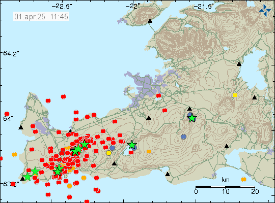
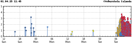
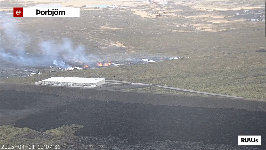
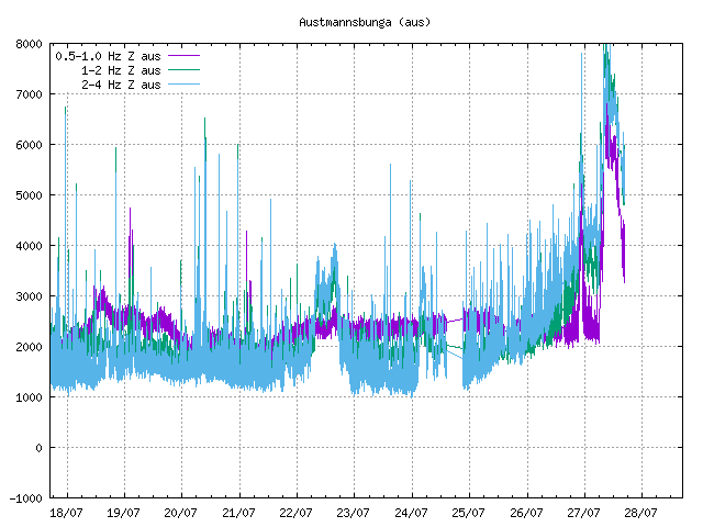
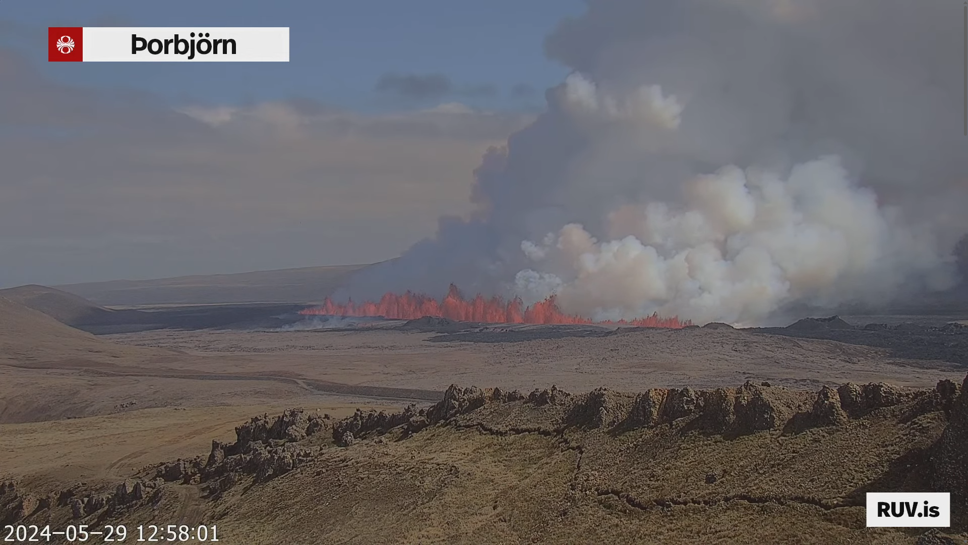
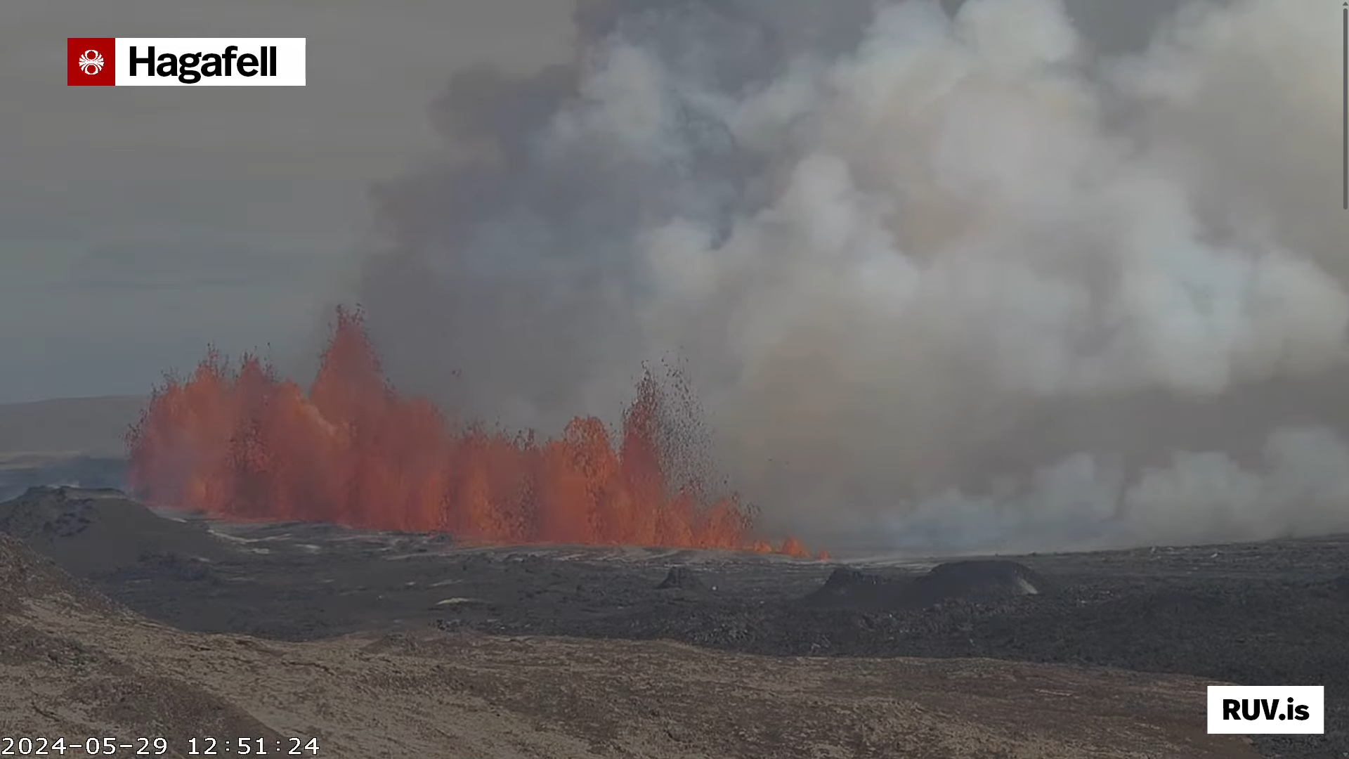
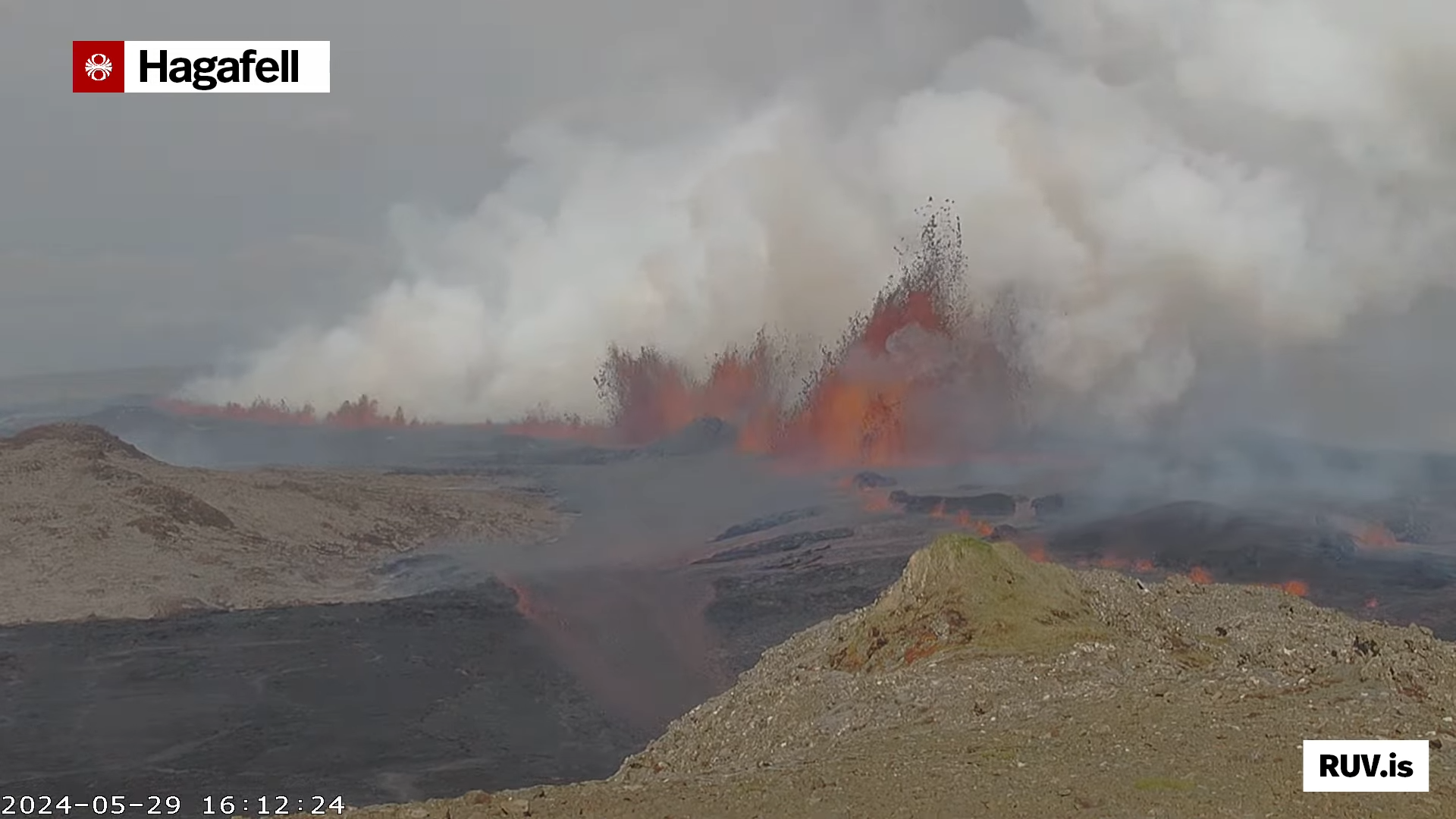
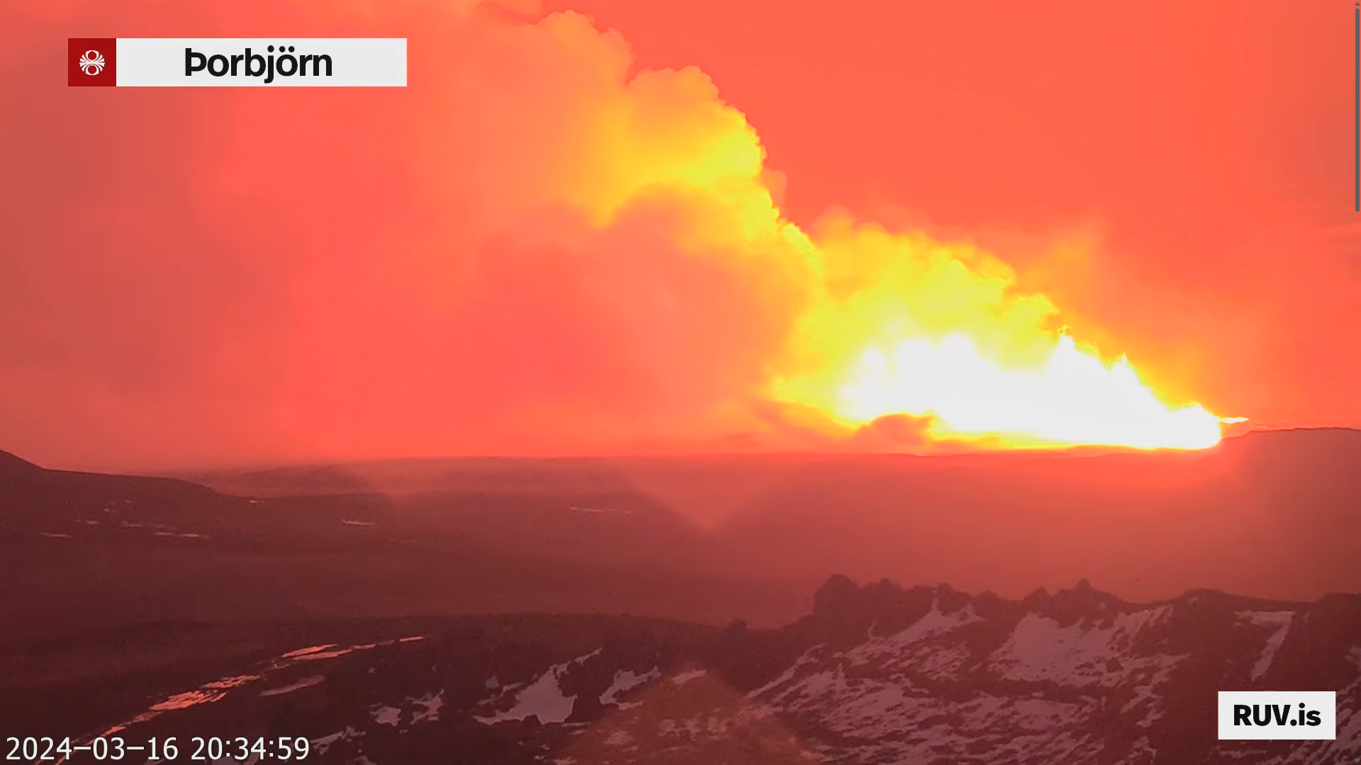
Today (16-July 2025) at 03:53:31 UTC an eruption started in Svartsengi volcano in Sundhnúkagígaröðinni crater row. This is the most northern part of the eruption area. Far from anything important. The eruption fissure doesn’t look large based on what can be seen on web cameras.
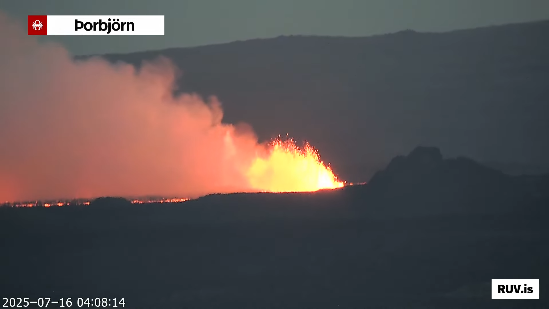
It is impossible to know how long this eruption is going to last. It might be few hours and up to few days. If needed. I’ll post updates about the eruption. Normally in this type of eruption that is not required.