I am sorry that I am late on this. I’ve been working on my new server computer and its taken longer then expected.
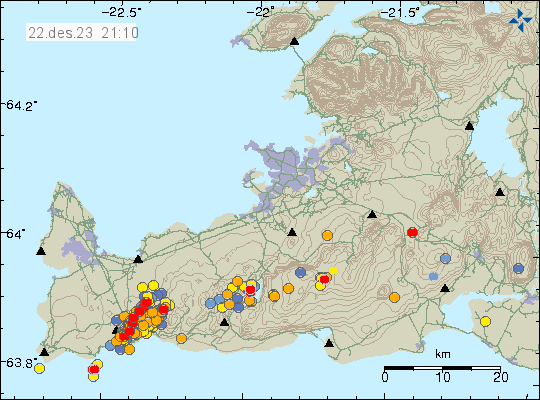
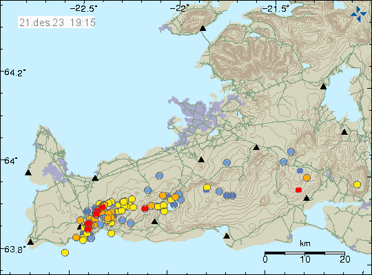
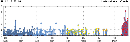
The eruption has ended and it only lasted about 41 hours. The lava did burn down three houses and cause damage to road, cold water lines, hot water lines and electric lines into Grindavík town. A new rift valley formed east of the rift valley that formed on 10. November 2023. This has resulted in that Grindavík town is now an extreme danger area because of cracks in the ground that are up to 40 meters deep until a ground water level is reached. GPS data is a mess because all this been moving the crust up and down, depending if the area is either east or west of the rift valleys that have formed. It takes few days to see how fast the inflation is now in this area. The magma that erupted now did come from a sill that is located in Skipastígahrauni and Eldvörpum area to the west of the eruption site. It doesn’t seems like the sill close to Svartsengi erupted this time, since no deflation was detected there during this eruption.
The maximum amount of time until next eruption is around 30 days, with error of eight days at maximum. This might be shorter, because it seems that inflation speed is increasing. There’s lot of uncertainty in this because how the crust is now around Grindavík town.
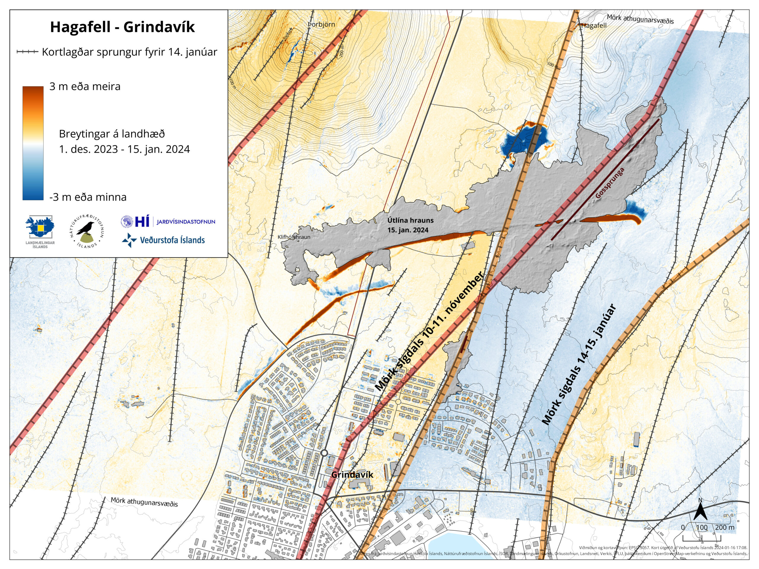
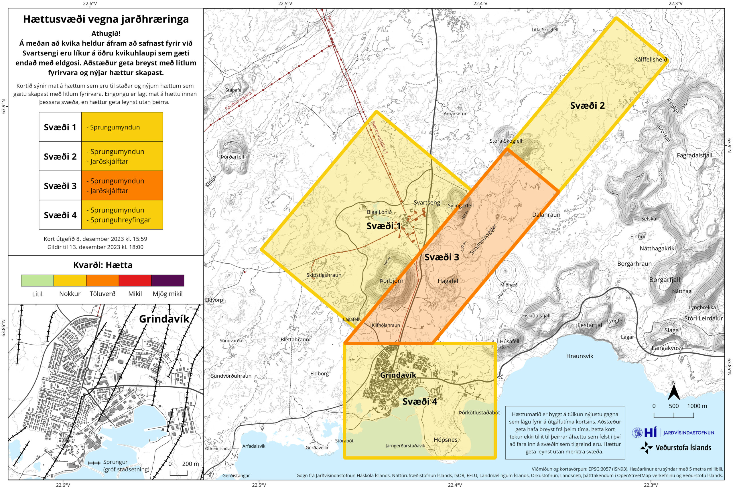
The eruptions are moving south along this area and that’s bad news, because that places the next eruption in middle of Grindavík town, once it happens in around 30 days. As is, the town of Grindavík can’t be lived in because of dangers from the faults and cracks in the ground. There has also been a major damage to infrastructure inside Grindavík already and added to the already damaged houses, roads and more.