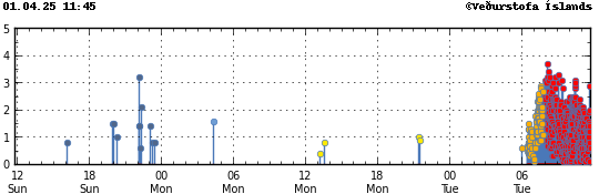
Update on the eruption in Sundhnúkagígar in Svartsengi volcano at 17th July 2025 at 00:43 UTC

This is a summary update with best information I have at the moment. Some information might be out of date without me knowing about it.

  • The eruption fissure reached 2,5 km when it was at the longest length. It has started to get smaller as the eruption has dropped in intensity over the last few hours.
  • This is the most northern eruption in Svartsengi volcano so far.
  • The lava flow is towards Fagradalsfjall volcano and into Fagradals valley and is now filling up, if it has not done so already.
  • Harmonic tremor looks stable at the writing of this article. This can change quickly and without warning.
  • Early GPS data suggest that deflation of Svartsengi volcano is around 100mm for the last 12 hours where it is most. Depending on the GPS station location in the volcano system.
  • Earthquake activity has stopped or almost stopped in the area.
  • I don’t expect this eruption to last more than few days. However eruptions in this area sometimes continue in one crater at very low volume for a several weeks. At current time its impossible to know if that happens.
  • Fog is currently blocking all view of the eruption. So its impossible for me to know what is happening visually.
  • Gas pollution has been a problem in this eruption and wind direction. This might not improve until the eruption ends.

If there is anything more to report. I’ll post update here about it. I don’t expect there is going to be any need for any future update at the writing of this article.

Updated at 00:59 UTC on 17th of July with missing information.

Eruption has started in Sundhnúkagígaröðinni in Svartsengi volcano

Today (16-July 2025) at 03:53:31 UTC an eruption started in Svartsengi volcano in Sundhnúkagígaröðinni crater row. This is the most northern part of the eruption area. Far from anything important. The eruption fissure doesn’t look large based on what can be seen on web cameras.

The eruption as seen on the web camera Þorbjörn. The lava strokes are clearly visible and are orange red in colour.
The eruption in Sundhnúkagígaröðinni in Svartsengi volcano. Screenshot from Rúv web camera on YouTube.

It is impossible to know how long this eruption is going to last. It might be few hours and up to few days. If needed. I’ll post updates about the eruption. Normally in this type of eruption that is not required.

Strongest earthquake in Ljósufjöll volcano system so far

Yesterday (16-June 2025) at 18:05 UTC an earthquake with magnitude of Mw3,7 took place in Ljósufjöll volcano system at the depth of 18 km. It was felt in nearby area that does not have any dense population.

Green star showing the earthquake in the mountain area of Ljósufjöll volcano system in western part of Iceland. Just north of Borgarnes town.
The earthquake activity in Ljósufjöll volcano system. Copyright of this image belongs to Icelandic Met Office.

This earthquake activity continues to happen because of magma inflow into the crust at this location. Since the inflow of magma started at this location, the magma has not moved up into the crust that can be noticed. Resulting in pressure building up at the lower end of the crust in this part of Iceland. The crust in this area is not giving into the pressure from the magma easily and this crust is also old, dense and brittle. Making it much more difficult for any magma to move to the surface.

Strong earthquakes in Reykjanes volcano

Around 17:00 UTC today (01-April 2025) an earthquake with magnitude of Mw5,3 took place in Reykjanes volcano. This might not be earthquakes because of tension changes in the crust in this area. It is a possibility, but at the moment what is going on is unclear.

A lot of green stars showing large earthquakes in Reykjanes volcano along with all earthquake activity in Svartengi volcano.
Earthquake activity in Reykjanes volcano. Copyright of this image belongs to Icelandic Met Office.

If the earthquake activity in the Reykjanes volcano are not tension earthquakes an eruption might stat out in the ocean. That would be explosive eruption. It is too early to know if that is the case. But next few hours should show if that is the case or not. Earthquake activity is ongoing and the this situation can change quickly and without warning.

Eruption in Svartsengi volcano, Sundhnúkagígar crater row

This morning around 06:30 a dyke intrusion started in Svartsengi volcano with a strong earthquake swarm. An eruption started at around 09:50 UTC. This eruption is happening only in the area south of the area that erupted on 21. November 2024. A dyke formed in this even and is around 11 km long. This dyke might get longer and is possibly getting longer at the writing of this article.

A lot of red dots on Reykjanes peninsula because of the eruption in Svartsengi volcano, in Sundhnúkagígar crater row.
Earthquake swarm because of dyke intrusion and eruption in Svartsengi volcano. Copyright of this image belongs to Icelandic Met Office.
A view of the earthquake swarm. Showing the sharp increase of the earthquake around 06:30 UTC.
How the earthquake progressed today in Svartsengi volcano. Copyright of this image belongs to Icelandic Met Office.
Picture showing the eruption south of the defense barrier. Abandoned greenhouse next to the defense barrier. Picture from Rúv web camera.
The lava flow from Rúv web camera on YouTube. Screenshot from Rúv web camera.

This situation is still developing and can change quickly. I’ll post update as needed if anything major happens.

Dyke intrusion into Bárðarbunga volcano

Today (14-January 2025) at 06:08 UTC an dyke intrusion started in Bárðarbunga volcano. This dyke intrusion lasted until around 09:00 UTC and might still not be over, even if the activity has stopped at the writing of this article. Largest earthquakes had the magnitude of Mw5,2 (USGS, EMSC). More than a dozen earthquakes with magnitude from Mw3,0 to Mw5,0 took place in this earthquake swarm.

Row of green stars in Bárðarbunga volcano caldera. Few small earthquakes are in Grímfjall volcano, an activity unrelated to this activity in Bárðarbunga volcano.
The earthquake activity in Bárðarbunga volcano. Copyright of this image belongs to Icelandic Met Office.

The main activity was in the western part of the caldera. According to the experts, this earthquake swarm looks close to what happened in Bárðarbunga volcano before it erupted in Gjálp (Wikipedia, Icelandic) in the year 1996. Then a earthquake swarm started like this, slowed down for few days before it increased again and the eruption happened. It is unclear what direction the dyke might move to, but most likely is south-west in the direction of Torfajökull volcano and Katla volcano. If that happens, such dyke activity might get those volcanoes upset or start and eruption in them.

I am going to post update as needed for Bárðarbunga volcano as this activity continues.

Small dyke intrusion into Sundhnúkagígar in Svartsengi volcano during the night (4-November 2024)

During the night of 4th November 2024 at 02:30 to around 03:00 UTC an small dyke intrusion took place in Sundhnúkagígar crater in Svartsengi volcano. Around 20 to 25 earthquakes took place in this minor dyke intrusion that stopped as quickly as it had started.

Dots of small earthquakes all over Reykjanes peninsula. The dots in Svartsengi volcano, in Sundhnúkagígar crater row. This group of small earthquakes is the dyke intrusion that was trying to happen during the night.
Earthquakes in Svartsengi volcano, Sundhnúkagígar crater row. Copyright of this image belongs to Icelandic Met Office.

There is a ongoing risk of more sudden dyke intrusion like this. Those can go on for hours and might not even erupt at all. A lot more earthquake activity is going to happen if such a dyke intrusion happens.

Update on the eruption in Svartsengi on 23. August 2024 at 17:39 UTC

This is a short update on the eruption in Svartsengi volcano. This information might go outdated quickly.

  • The eruption is now on a 2 km long fissure. It is located just north of Stóra Skógfell. This is the most north part of the eruption fissure so far. Total length of the eruption fissure is 7 km, but most parts of it have stopped erupting.
  • The eruption can be seen from Reykjanesbraut on the way to Keflavík or Keflavík airport.
  • It is impossible to know how long this eruption is going to last. But harmonic tremor is already dropping and has been doing that since around 06:00 this morning. This eruption might last a day or it might last a month, at current time it is impossible to know.
  • Icelandic Met Office lost a seismometer (Litla Skógarfell) and a GPS station under lava in this eruption. So far, its only two stations. Since one (Norðurljósavegur) GPS station had been moved out of harms way earlier in August.
  • Largest earthquakes had the magnitude of Mw4,1 and Mw3,3. The larger one was just off Fagradalsfjall volcano and the smaller one was in Keilir mountain. The larger one was felt in Reykjavík and nearby areas.

This eruption can change without warning. If anything worth reporting happens. I’ll write a new article about what is going on.

Update on the eruption in Sundhnúkagígar on 30. May 2024 at 00:49 UTC

This is a short update on the eruption in Sundhnúkagígar on 30. May 2024 at 00:49 UTC. This might be the only update on this eruption, since normally, eruptions in Sundhnúkagígar only last one to three days normally. If that happens now remains to be seen.

Yesterday (29. May 2024) at 12:46 UTC an eruption started in Sundhnúkagígar, close to a small mountain called Sýlingafell and other nearby mountains. This is also the same area that has had eruptions in recent months. This eruption was large and peaked at 2000m3/sec. Since then it has slowed down and is maybe only around 200m3/sec to 600m3/sec for now. The flow from the eruption is going to change without warning and quickly. The eruption fissure today was at the longest around 4 km long. Currently, at the writing of this article, the eruption fissure is around 1 to 2,5 km long. How long the fissure is going to change without warning.

The eruption fissure seen from Þorbjörn mountain today at 12:58:01. A large gas cloud is coming from the eruption in a day that is slight cloudy but with sun at that moment.
The eruption just as it had started. Picture from Rúv web camera.
The eruption at 12:47:48 UTC as it was starting. The lava fountains are reaching up to 70 meters up in the air and the gas cloud keeps growing.
The eruption as it was starting. The picture is from Rúv web camera.
The eruption as it was at 12:51:24. The peak lava fountains are reaching slightly more than 70 meters up in the air and the fissure is expanding to the south and north. Gas cloud is growing and drifting to the east.
The eruption at the start. Screenshot from Rúv web camera.
The eruption as it was at 16:12:24 UTC and reaching peak of its activity. I am not sure what the peak is on this image, but based on the lava flow that is going over a small hill. It was high and a strong lava flow was happening.
The most active hour in the eruption. Screenshot from Rúv web camera.

Eruption has started in Svartsengi, Sundhnúkagígar area

Eruption started in Sundhnúkagígar area í Svartsengi volcano. The start of eruption seems to have been at 12:47 UTC or around that minute. The fissure is getting longer as this article is being written.

The fissure and the eruption column in red and orange colour. A large gas cloud drifts to the east from the eruption.
The eruption in Sundhnúkagígar. Screenshot from Rúv web camera.