
Bárðarbunga volcano eruption in Holuhraun did reach one big milestone today (17-October-2014). It is now the largest eruption in Iceland since the eruption in Laki (Skaftáreldar) in 1783 – 1784 eruption. By volume the lava field in Holuhraun is now larger than the 1947 eruption in Hekla volcano that is 0,8 km³ by volume and took 13 months to erupt that amount of lava. Current size of the lava field in Holuhraun is larger then 59 square kilometres (km²) in size, or around 0,83 km³ by volume according to University of Iceland Tweet on this matter. University of Iceland also has new map of the lava field, I just don’t know how to link to that image here.
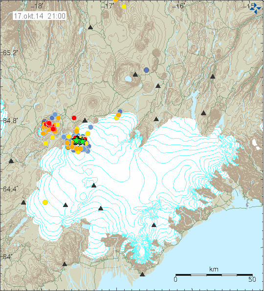
Earthquake activity today in Bárðarbunga volcano and Tungnafellsjökull volcano to the left. Copyright of this image belongs to Icelandic Met Office.
Largest earthquake today had the magnitude of 4,4. Second largest earthquake today had the magnitude of 4,2. Other earthquakes have been smaller today and there has been less earthquake activity today compared to earlier this week (Week 42). There was not big change in the eruption in Holuhraun today according to the news, the magma that did erupt today was reported to be more gas rich then in past few days or weeks. There is no major change taking place in the dyke area according to GPS measurements from the area around Bárðarbunga volcano. The GPS mesurements can be found here. New images of the eruption in Holuhraun can be found here. So far I have not read or seen anything more taking place in Bárðarbunga volcano. If everything stays quiet (I’m sure it won’t do that), I plan to have next update on Monday 20-October-2014 if no major activity takes place.
I wish everyone a good weekend.
Article updated at 23:46 UTC.
Deeper quakes in subduction zones than rifting zones.
Thanks, Andy.
Sumatra is subduction . . . assuming that description is accurate to reality.
I don’t recall about Etna.
The setting of Etna is a bit complicated, but generally it is also placed within the influence of a subduction zone, in this case subduction of the African Plate under the Eurasian Plate, a movement which has also caused (and is continuing to cause) faulting of the Alpes.
Here is a post by geologist Boris Behncke (INGV, Catania) on Etna. The post actually comes in 3 parts on Erik Klemetti’s “Eruptions” blog. The first part describes a.o. the geologic setting of Etna: http://www.wired.com/2010/08/etna-week-part-1-brief-anatomy-of-an-exceptional-volcano/ The other parts of the Etna posts are linked in.
Maybe this smaller rectangle is more interesting . . .
http://www.iris.edu/3dv/index.html?caller=IEB&st=1970-01-01&et=2025-01-01&ob=time-desc&li=3500&xla=67.876&nla=61.932&xlo=-13.345&nlo=-34.453&sbl=1&pbl=1&zm=1&mt=ter&sz=med
It seems to me that the quakes near Bard are well & plentiful on both sides of the MAR.
BTW, for those unfamiliar with the display–you can rotate it on all 3 axes.
I don’t know how far back this collection of quakes goes . . . I think I set the total at 3,500 or some such number of quakes . . . but it’s interesting, to me . . .
1. The quakes on and off the North East coast of Iceland look more plentiful than those around Bard.
2. The same for the MAR to the South of Iceland as well as along the Southwestern coast.
Wonder what the implications are of that.
There are always movements at the MAR, would be interesting to know the time frame of the quakes shown here. Also which magnitudes are taken into consideration.
BTW around Bárðarbunga during this volcano-tectonic event up to now there have been more than 25.000 earthquakes. See eg. http://www.vedur.is/skjalftar-og-eldgos/frodleikur/greinar/nr/2996 (16. september 2014, scroll down)
Actually, it’s hard to tell the number in each location from the image. It could be that Bard’s quakes are merely piled tons and tons on top of one another in the image and so–not being spread out–look to be fewer, in total.
For comparison . . . here’s Mt Etna area . . .
Some 300-500 km deep quakes:
http://www.iris.edu/3dv/index.html?caller=IEB&st=1970-01-01&et=2025-01-01&ob=time-desc&li=3500&xla=48.458&nla=34.874&xlo=24.623&nlo=-0.703&sbl=1&pbl=1&zm=1&mt=ter&sz=med
And Summatra:
http://www.iris.edu/3dv/index.html?caller=IEB&st=1970-01-01&et=2025-01-01&ob=time-desc&li=3500&xla=28.922&nla=-8.421&xlo=124.467&nlo=79.453&sbl=1&pbl=1&zm=1&mt=ter&sz=large
With some 300-800km deep quakes.
What’s the deepest in Iceland? 50km? 70?
I think that at the MAR quakes don’t get so deep, because there are no earthquakes in mush zones. Quakes indicate breaking of rock, in zones of fluid / half-fluid material nothing can break. There is this big plume head of molten rock under Iceland.
See eg. http://www.mantleplumes.org/WebDocuments/bjarnason_schmeling.gji.2009.pdf
At the rest of the MAR there is also connection to the mantle asthenosphere from where the decompression melt is rising to the surface. Mush again, I think. So there can’t be deep earthquakes there.
Da Xin’s questions and Andy’s answer made me curious. It is late, but in a quick search I found this http://www.virtualuppermantle.info/DeepEarthquakes.htm
on deep earthquakes. Perhaps it is of interest. Will read more tomorrow.
Good morning – it is completely logical that the earthquakes at subduction zones would be much deeper than those at rift zones. Sleep is good. 🙂
Volcanoes can and do sometimes produce the unexpected. Perhaps the best example is right here in NZ: Tarawera. That hadn’t erupted in many hundreds of years, and wasn’t even really recognized as a volcano – until one night in 1886, when it went from zero to strong quakes & VEI 5 eruption, back to zero, within 6 HOURS. No felt or observed precursory activity whatever. An eruption of incredible violence and speed.
The first warning code, if such a system had existed back then, would have been “Get the FUCK out of there RED!”
IMO clearly don’t feel a small quake swarm at Tungnafellsjökull is near the level of activity required to raise a warning level. I think it’s a bit cheeky (to say the least) to question their judgement here.
Bardarbunga has already given 2 months of precursory activity.To me this is suggesting a rhyolite component to this event.This being Iceland,basalt is in plentiful supply,as can be seen by the fissure and most people seem to be expecting an eruption of basalt from the caldera and its interaction with the ice being a worst case scenario.This seems like a rather self limiting scenario,whereas rhyolite would be a game changer.Tarawera probably dodged a caldera forming bullet in 1886 as the basalt erupted to quickly through the rhyolite dome complex,hence its rapid build up and completion.
Actually I think if the Tarawera event occurred today,by the time the civil defence etc got their act together ,the eruption would have occurred,it was too fast even with modern monitoring to have evacuated and would they think to evacuate a 17km stretch?I do not think so,I think the result would oddly be the same as 1886 with more loss of life because of greater population density.
I agree entirely with your comments re. dodging a bullet.
Tarawera was a large basaltic dyke intrusion all the way to the surface that took place with astonishing speed.
I’ve long speculated about what would happen if such a large fast-moving intrusion intersected a large body of near-eruptible rhyolite. NZ has the most active and voluminous rhyolite systems on the planet; I think it’s quite possible for one of those to go from nothing to a BIG eruption, VEI 7 or maybe even 8, with very little warning – days or hours perhaps.
I don’t, however, understand how the precursory activity at Bárðarbunga leads you to infer that rhyolitic material must be involved somewhere? We’ve seen no evidence of that so far.
The explanation so far has been that the roof or lid of the caldera is 10km thick and this 10km x 10km plug is subsiding into the magma chamber which is emptying via the fissure eruption at Holuhraun.With all the earthquake activity,why has there not been another obvious fissure eruption if this was an event involving just basalt magma?Why have the number of quakes at the caldera increased,even though a lot of magma has drained from the caldera?I think these questions are answered if there is a viscous body of magma at <10km depth?Hey it's an exercise in thinking.Tarawera was basalt eruption in the domain of rhyolite and this would be a rhyolite event in the domain of basalt.
Tarawera was quick because it involved basalt,I do not think a large explosive rhyolite eruption could occur without substantial buildup.Rhyolite explosive eruptions are uncommon because rhyolite is not particularly eruptible,that is why NZ does not have anywhere near the number of volcanic eruptions that some other similar sized countries have,but when they do erupt they are not small!
Geyser,
“Tarawera was quick because it involved basalt,I do not think a large explosive rhyolite eruption could occur without substantial buildup.”
That was my point; even in a rhyolitic province, basaltic events can happen. And if one of those intersects a body of rhyolite, it could trigger it to erupt virtually instantly, at least in comparison with when it would have ‘naturally’ erupted.
In fact, I’m pretty sure I recall reading that that’s precisely the mechanism that’s believed to have touched off the Oranui VEI8 eruption at Taupo – and you have to go back to *Toba* to find a bigger eruption than that!
On the Tarawera eruptions:
http://www.teara.govt.nz/en/historic-volcanic-activity/page-2
And Erik Klemetti on the same:
http://bigthink.com/eruptions/the-1886-eruption-of-mt-tarawera-new-zealand
Regarding Etna. It is in a subduction situation just as Indonesia. As I recall, it is a rather complex subduction of the northern African plate under southern Europe. It seems the really deep quakes are associated with the furthering breakup at depth of the subducting plate. You would not find that under Iceland.
Good morning – it is completely logical that the earthquakes at subduction zones would be much deeper than those at rift zones. Sleep is good. 🙂
Sorry. I should have said “regarding the deep quakes under Etna region and Indonesia”
There have been a lot of very shallow EQs in BB in the past hours, compared to the past weeks this looks like a different behavior. The overall pattern in the area seems to be changing. Any thoughts what this could mean?
Are the shallow earthquakes clustered in any particular area of the caldera?
They seem to be in pretty much the same area as the 5.4 earlier today, lots of small EQs.
Magma intrusion reaching shallow depth?magma dome?This is uninformed speculation.
I am seeing harmonic tremor on SIL stations at considerable distance now. One is on the SIL station clear to Esjufjöll volcano. It is clearly from Bárðarbunga volcano. This might indicate a minor eruption is now taking place. It appears to be larger than many of the minor eruptions under the glacier so far.
Wow! The web cams, #1 and #2, are out. I guess it is the weather, but it would be nice to see if anything is going on in the area. I wonder if this will continue through tomorrow.
It appears to be over already. Maybe it was an explosion of some type under the glacier. Difficult to know with out observation.
I’m a new commenter, looking at the issue completely out of context, But if you ask me, Id say if the rule doesn’t fit the facts then the rule needs bending, not the facts. It’s philosophical, not scientific. Does that help?
aarggh. that was in reference to Tungnafellsjökull
What are the “facts”.What is the rule?
The rule is a fixed but very rough statement as to when color code should be raised.
Scientific facts are determined, and revised, by the consensus of qualified specialists, not us. Facts can be more or less obvious. Decision is based on considered judgment.
If Barda erupts or is at risk of erupting does it really matter what the color code on a nearby volcano that has not erupted for 10000 years is?The bases are already covered.
So, if depth of 1.1 is an indication of indeterminate or uncertain depth of an EQ, then all those 1.1’s could well be above geodesic zero but below surface at a mountain site?
Those of you how are trying to understand how depth of an earthquake is calculated. Please read this information from USGS on that subject.
http://earthquake.usgs.gov/learn/topics/seismology/determining_depth.php
Will do, thank you.
Steve I think you misunderstand very slightly. You are trying to describe a prescriptive rule when in fact it’s an interpretive rule.
The IMO say ‘yellow warning level means xxx’.
They do not say ‘xxx means yellow warning level’.
It all depends on the system.
A few days ago we had a small swarm, with one quake larger than M3, smack in the middle of the Katla caldera. Katla has swarms from time to time. No yellow alert. Not even close.
That same swarm with an M3 smack in the middle of Hekla – the alert would very probably have been orange or red instantly.
Ik vermoed als er daadwerkelijk een nieuwe uitbarsting dichter bij de bron plaats gaat vinden zou deze wellicht. meer kracht moeten hebben dan de huidig, die van 40 km verderop .omdat er behoorlijke druk ervoor nodig is om lava 40 km onder de grond te bewegen om verderop uit te stromen.
Maar wat me wel weer opvalt is dat geregistreerde diepe bevingingen duidelijker aan het verminderen zijn. en gaat mij erom 5 km en dieper. is die aanvoer van uit die hotspot nog wel van toepassing? of zien we nu alleen nog een reactie uit het huidig voorraad
Thank you, Andre C. Now I get it. I am no expert, but I am not sure whether more pressure would be required for an eruption closer to B than the current eruption. I would think that if magma breaks through the caldera floor and comes into contact with water/ice in larger quantities, that would result in enough power to cause an eruption to burst throught the ice. I also think that the lack of large earthquakes at deeper than 5 km in B, and lots of little ones instead, are signs that magma can move more freely and is therefore closer to the caldera floor than before, probably building up pressure there and causing larger earthquakes there. But an expert would be able to tell you whether there is any logic in my thinking or not.
through not throught
The magma coming in contact with the ice will not automatically result in an eruption.If the magma is already de-pressurized it will just melt the ice.The ice contact does not cause the explosive eruption,the explosive eruption comes first and the ice will influence the style of the eruption?
How do you think this de-pressurizing is taking place and if so were is the gas going?
There is a lot of gas coming out of the fissure eruption, also the caldera is possibly degassing.Extrusions of degassed magma have possibly already surfaced under the ice,but the majority of the ice melt is probably hydrothermal related.My theory involves the presence of evolved high silica content magma at shallow depth under the caldera contributing to the development of a hydrothermal system and ground deformation around and in the caldera.This magma would only erupt explosively given the right gas content ,temperature and pressure .Interesting to see what any updated scenarios from the experts indicate.
On subglacial eruptions (in this post and paper mostly re. rhyolite) and the relation to gas content: http://all-geo.org/volcan01010/2012/12/gas-makes-subglacial-rhyolite-explode/
Thanks, Mike. That makes sense.
IngeB’s link to Vonaskard caldera floor paper was very interesting. Supports crosspatches view of possible processes that could happen on bb caldera floor. I think water circulation between ring faults probably is happening. This would increase the temperature gradient cracking rocks. However such events would, in my experience many years ago in geothermal energy usinv water to extract heat from igneous rock at depth, not rezult in the large quakes observed. Mostly we observed M1-M2 and very rarely M3 which were felt at the surface causing local newspaper entries and uninformed fear and speculation. The big EQs seem to be, according to focal mechanism beachball plots, associated with fault slipping (plug model) rather than explosions. All these sytems are connected if you go deep enough. I think a simple pipe to holraun explains a lot. The rifting allowed bb to start emptying and bbs magma probably did flow along the dyke to holraun where it met resistence then heat from below and the plug weight (plug is over 1km higher than holraun) drove it upwards. The post eruption pressure release in bb and holraun has allowed more magma melt from depth. Gas increase of erupted lava is also explained by the connection. Would be good to see some gas analysis results. Getting more acidic due to increased water content ?
Would an drate of rusting be an indication of acidity (btw. this news article is from end of September), the plough shown in the picture was without any rust after the summer work, says the interviewed farmer. And he observed increased rusting also at the arms of his windscreen wipers and other car parts which were not covered by protective colours. http://www.austurfrett.is/frettir/2518-malmur-til-sveita-rydgar-vegna-eldgossins-eitthvad-sem-vid-hofum-ekki-sed-her He lives in Fljótsdalur, East Iceland.
Sorry, erased too much here at the beginning.
Should have been “an increased rate of rusting”
Sample analysis here
http://earthice.hi.is/petrology_holuhraun_lava_gudmundur_heidar_gudfinnsson_and_sigurdur_jakobsson
Not much on gas quantities, but helpful none the less –
http://earthice.hi.is/sites/jardvis.hi.is/files/myndir/Bardarbunga/volcanic_gas_hazard_enska.pdf
Fissure currently visible on the stills cam, from http://brunnur.vedur.is/myndir/webcam/2014/10/19/webcam_mogt_kverkfjoll.html#
Another big BB earthquake early this morning showing up on drumplots – see examples on:
http://icelanderuptions.com
I can’t help feeling that the (relatively) constant size and approximately daily spacing of these large earthquakes is telling us something about the mechanism involved – if only there was a longer history of detailed monitoring, including hydrological data, to go on!
Could be this one http://geofon.gfz-potsdam.de/eqinfo/event.php?id=gfz2014ulyb.
The automatically measured GFZ EQ are mostly a little bit under the IMO’s manually measuring. So it could be near 5 +.
The regularity is really interesting, It goes on, no matter how much smaller EQ happen.
This animation by ATS’s “Muzzy” may be of interest:
https://0eff62a31180fbe8b19a9fc934e675d08cea5c5c.googledrive.com/host/0B4z7bEYG56MqdzJKdnFwWFowLWM/11Aug-17OctAniV2Slower.gif
His VOLCANIC TREMORS animation on the topo map:
http://volcanictremor.wordpress.com/bardarbunga-topo-maps-and-animation/
From the Volcano Watch thread:
http://www.abovetopsecret.com/forum/thread988594/pg56
Please note that above top secret is a conspiracy forum. It should not be taken seriously.
While above top secret is a conspiracy forum, some of the people posting in the earthquake and volcano threads, including “muzzy”, are knowledgeable and educated about the topics. In the past, there have been many robust discussion concerning geophysics, seismology, and volcanology.
I wouldn’t dismiss everything posted on that site concerning Earth Science topics.
Just thought you may want to know. 🙂
Btw, “Conspiracy Theorist” is a derogatory term used to discredit a Critical Thinker.
This last very much depends on the context!
Such as libor rate fixing, gulf of tonkin, weapons of mass destruction, gold price fixing, bengazi, osama bin laden and libya, im sorry, you have to be critical about every thing you’re told
Thanks, Jon, et al for your kind replies.
In my near 70 years, I’ve observed that Main Stream Media has been extremely manipulative toward engineering a public mindset on a long list of topics. Have studied globalism for more than 45 years.
One of the reasons I watch the Iceland volcano situation so closely is to try and anticipate what the powers that be might be confronted with and how they might use it toward their evil goals. They are notorious for using every kind of crisis–particularly those they foster, generate–as well as natural ones.
I was heartened when Iceland stood up to them on banking and economics. I was thankful when Iceland was not immediately crushed for doing so.
If you don’t want other quality posts from other sites mentioned on this blog, I’m willing to comply. In terms of ATS, I’ve read some of the finest SCIENTIFIC discussions and posts on ATS that I’ve read anywhere–including in my PhD program.
“Muzzy” is a tireless, very self-educated bloke who presents high quality data and images on quakes and volcanoes. I respect his efforts and results highly.
He spends a lot of time making the videos depicting the movement of the quakes in Iceland over time. I have found them illustrative, interesting and potentially predictive of trends. Certainly they show trends well.
I’m getting old enough that bothering about conflicted discussions is increasingly unattractive.
I come here to share what little I come across of interest on the topic . . . and to learn as much as I can from Jon and others.
That’s my agenda here–to learn all I can about the Iceland context and events.
They are exceedingly fascinating as well as dramatic and beautiful in their own powerful way.
I’m quite willing to CONSIDER reasonable information from whatever source. I’ve learned over the years that I am very far from ‘knowing it all.’ . . . and . . . that very often, the most useful bits of information come from some of the most unlikely sources.
As my rare boss at the Univ library noted . . . it was the very flaky fringe groups that first and most accurately declared who Hitler was and what he would do.
Cheers.
Well said Da Xin, I’m not far behind you in age and agree with you 100% quite often the most useful bits of information come from some of the most unlikely sources. Never dismiss something just because it has a shady source, you never know what little jems are hidden there.
It is like getting people on the internet to look over satellite photos to find a missing plane,they may not know what they are looking for but they may see something that could be analysed by people with the knowledge to do so.
Intersting to read about emergency plans :
http://www.ruv.is/frett/loka-gaeti-thurft-virkjunum-i-storu-hlaupi
“We need to put everything on the table that we are thinking about and getting people to participate in the discussion.” Víðir Reynisson.
Meaning: we have not put everything we are thinking about onthe table…
I said that on VC several weeks ago and nearly got banned for suggesting it.
That’s dangerous close to conspiracy theory ‘they’re hiding things from us!’ stupidity.
I spent three weeks in Iceland, shooting a documentary. I made two visits to the eruption site. We showed up unannounced at the Husavik police station and they showed us straight in to the emergency control room. We spent several hours there, we interviewed people, we saw the operation running, they showed us all their evacuation plans, they couldn’t have been more open if they tried.
They’re hiding nothing. We met Víðir back in Reykjavik. He’s a stand-up guy. He’s Almannavarnir – that means civil defence emergency planning. That’s what he was talking about in the interview; contingency plans for evacuation and power failures. They’ve been upfront; their worst-case contingency is a massive eruption, a pretty much nationwide power failure, and they have to evacuate the entire south coast of Iceland.
They’re hiding NOTHING.
Mike did they tell you what the other scenarios were when you were there?The ones that would entail evacuating the whole of south Iceland and swore you to secrecy,or have they recently formulated this alarming plan?
This an unfolding event. They probably didn’t know yet how the development would be, everybody hoped that it would stop before.
Sorry, perhaps it’s a little bit missleading. The guy is from Almannavarnir, not vulcanologist and my point was the “getting people to participate in the discussion.”.
That would be nice…
Saturday
18.10.2014 23:04:02 64.675 -17.489 4.0 km 4.7 99.0 4.3 km NNE of Bárðarbunga
Saturday
18.10.2014 20:17:05 64.682 -17.479 3.0 km 5.0 99.0 5.2 km NNE of Bárðarbunga
Sunday
19.10.2014 09:47:37 64.683 -17.471 8.6 km 4.5 99.0 5.4 km NNE of Bárðarbunga
Sunday
19.10.2014 03:22:06 64.661 -17.390 0.1 km 5.2 99.0 7.0 km ENE of Bárðarbunga
They are revising and updating the EQs late and only the “interesting” ones. Which means the big EQs won´t show correctly on 3dbulge. I´m guessing they are prioritizing more now.
Magnitude M 4.1
Region ICELAND
Date time 2014-10-19 13:31:53.1 UTC
Location 64.43 N ; 18.05 W
Depth 10 km
Distances 189 km E of Reykjavík, Iceland / pop: 113,906 / local time: 13:31:53.1 2014-10-19
140 km S of Akureyri / pop: 16,563 / local time: 13:31:00.0 2014-10-19
http://www.emsc-csem.org/Earthquake/earthquake.php?id=404893
Sunday
19.10.2014 13:31:50 64.672 -17.521 9.3 km 4.7 99.0 3.5 km N of Bárðarbunga
ROTTEN weather! oops – caps – sorry – rotten weather!
Snowing on the webcams.
In a medium where there’s no facial expressions available;
no voice tones available;
no raised eyebrows available;
no posture of the head available; . . .
CAPS are an important way to add meaning, information, emphasis to the text-based mode of communications.
I’ve often thought the compulsive, reflexive wail about “SHOUTING CAPS” was wayyyyy overblown and silly. That notion is a net convention that the masses have jumped on the bandwagon of.
AS far as I’m concerned–PLEASE use caps whenever you think fitting. They help me focus quickly on what you think deserves emphasis.
And with these volcanoes . . . noting something needing emphasis could be . . . welllllll . . . critically important.
SHADDAAAAAP 😉
I am against the use of caps here, because for me, they often indicate some sort of hysterics. And this is something which is really not helpful in a crisis like this.
I go with IngeB, but for you Da Xin, I know it’s your style.
At the beginning of this (and other) eruptions, some people think they are seeing a new eruption cloud or something like that and they are screaming with caps… mostly for nothing…just clouds…
Using Caps is equal to shouting in real live. You can use the strong feature in the comments.
You add < b > and < / b> (with out the space) with the text that you want to add emphasis on.
Cams are clear again. Lot of activity on cam 2
Since we’re having a discussion about collapses, I thought I’d add a couple of links of Pu’u “O” crater floor collapses:
http://gallery.usgs.gov/videos/426#.VEP1i2f1u60
https://www.youtube.com/watch?v=fFgmLwf-3ug
These are quite interesting time-lapse vids. The first collapse was on March 5, 2011 and the floor dropped ~115 meters in “a few hours”. The second was on August 3, 2011 and the drop was a little less. I’m certainly not suggesting any comparison to what might happen eventually at Bárðarbunga, but it’s some nice eye candy.
BTW I refer to Pu’u “O” (“O” Cone) rather than the customary Pu’u O’o because the vent was originally named by its proximity to the second “O” in the name “Hawai’i Volcanoes Park” on the map! The current name was chosen for its reference to the long-extinct o’o bird; since there will never be an o’o on that hill, I prefer the original.
I wouldn’t call an event like the one shown esp. on the first video “eye candy”, for me, this would mean playing down a potentially catastrophic event.
Please. I’ve followed this eruption since 1983 when it began, and would never use that term had there been a bad outcome. These events were “witnessed” only by webcams. The crater of Pu’u “O” is a couple orders of magnitude smaller than Bárðarbunga’s caldera, and Hawaiian eruptions are almost always effusive rather than explosive.
In fact, I’m quite concerned about the lava flow currently less than a mile from the town of Pahoa. Much discussion here about Almannavarnir. My concern about Hawaii Civil Defense is that they’re considering all sorts of things except using explosives to breach the lava tube uprift close to its source, which would surely stop the leading edge of the flow and cause the lava to spread out widely over existing lava flows where they’d do no damage. It’s a mystery to me why they aren’t considering this. Pahoa is a lovely little town and I’d hate to lose it the way we lost Kalapana in 1990. That’s my present state of mind.
This forum has taken a very strange turn lately towards testiness and prickly feelings. My option at this point is simply to stop contributing if a couple of links that are surely of interest to volcano watchers can be so grossly misconstrued. I have no desire to add to the bad feelings that are quite evident here at the moment.
Explosives would not work. At all. That is why they are not used. Now please keep such nonsense away from this website. Thanks.
Hey Jon, The ATS forum is an outlet that a few people with an interest in earthquakes and volcano’s can come to to present their thoughts and discuss events as they happen with like minded people from other parts of the world. Quake Watch and Volcano Watch are two of the better threads on there. Sure some of the other threads are crap, but I have read some comments on your post replies that are as off the mark as any on ATS.
ATS is generally about seeking the truth behind the BS put out by Govt. agencies.
At least my maps are original, and not just copied and pasted from IMO. They are all based on data from IMO.
From what I have read on the Scientific Advisory Board of the Icelandic Civil Protection http://earthice.hi.is/bardarbunga_2014 they haven’t got a clue as to what may happen next, so any spectulation by posters on Volcano Watch on ATS is as valid as theirs (or yours)
THANKS Muzzy. I still keep tabs on your threads. Given that it’s now been 3 months “sidelined” . . . I may well inquire about what it would take to alter that status there. LOL. I miss being able to cheer you on.
Much appreciate all you do. Besides . . . I’d love to ask you about a roofing leak or two. LOL.
Greetings also to Puterman. I wonder if he’s caught wind of any of the gas pollutants from Iceland there in Ireland.
I particularly appreciate the Iceland maps with the progression of quakes sequentially. I would like to see on those, though, at the end the whole compilation presented en mass.
Do you have any experienced hunches from your years of studying such things . . . as to what the next dramatic thing will be in Iceland vis a vis the volcanic dynamics?
Nobody knows for sure what is happening in Bárðarbunga volcano. Not even the people who works with this on daily. Reason is that current eruption is the first one since monitoring started in Iceland.
Scientists do have theories and ideas based on studies, older eruptions and other knowledge on workings of volcanoes. There is still however a lot that is not known. All conspiracy websites do is to cloud the what is happening with some nonsense that often has nothing to do with reality.
I know that might offend people who believe in such things. I just don’t really care. Since I am going to provide the best information and the most correct information that I can provide. For that reason and many other conspiracy nonsense does not belong here.
The biggest of those reasons is that people lives are at risk here from Bárðarbunga volcano, mostly in Iceland but I do not exclude effects far off Iceland coastline. That is why I am committed to provide the best and the most correct information that I can provide.
If people want to discuss there own ideas that might not be based on facts (or on the edge) there is plenty of space to do so elsewhere on the internet. People can discuss ideas here. I would however appreciate that they where in the realm of facts and what we actually know at the moment.
Thanks.
Inge, psychologists are used to dealing with hysterics . . . and with ignoring them when fitting. It’s not really that hard on a text based communications system. It’s not as though a “hysteric” is going to reach out of the screen and grab one by the throat!
Besides . . . it’s all merely a matter of convention and taste. Each of us CHOOSES to make of it what we will.
Robust communication is usually better than sparse, confusing or incomplete communication–PARTICULARLY in a crisis–unless one needs to yell merely !STOP! to prevent a child from running in front of a Mac truck.
Besides . . . one person’s “hysterics” is another person’s interesting highlight.
And I’m not aware of any election of anyone to the status of CHIEF POSTING CZAR on such sites.
If I’m scanning this blog quickly for the latest important points when I have limited time, HIGHLIGHTS HELP me find the meaty stuff faster. I really appreciate that.
You can highlight with before and behind the word (without space)…
It looks like that.
Again:
You can highlight with before and behind the word (without space)…
It looks like that.
Ok, I can’t explain it, but you can read it under the comment section…the b between two flashes… 😉
People, can we please get some perspective here and focus on the one very important thing that should be uniting us. We are all looking for answers and I guess if we are on such sites as this then we care about the outcome of the events that are unfolding. This could become catastrophic, I hope to God it doesn’t but as mere mortals trying to fathom the power and ways of our physical world we should put aside any personal issues and forget wasting time on things, that I can assure you will appear petty, if something serious happens.
NB: I am not referring to any one particular ‘spat’ in case any one here takes this personally – it is not intended that way.
How is this going to become catastrophic from the predicted caldera subsidence with resulting subglacial basalt eruption?These eruptions are quite common in Iceland,or is this thought to be a developing explosive VE5 or greater ,previously not witnessed caldera event,like a smaller scale Taupo or Toba?
You miss my point but I am not surprised.
I thought ,I asked a fair question,what in the Iceland context is considered catastrophic ,as they deal with eruptions quite frequently?Just because Bardarbunga is a large system ,does not infer a catastrophic eruption.I have continuously mentioned the possibility of a rhyolite eruption and been met with quite some derision,but lets be honest if anyone wants to think very large explosive caldera eruption ,that is the direction their thinking would have to go.
Biggest eruption in Iceland are all VEI=6 and so far no eruption have gone above that. Lava eruptions are different due to other factors (gas and other type of pollution).
Biggest eruption in Bárðarbunga / Torfajökull volcano was VEI=6 that happened in 1477.
http://www.volcano.si.edu/volcano.cfm?vn=373030
There is talk about closing down some big power stations, in case of a big eruption in Bárdarbunga (which could mean electricity shortages), also about having to deal with heavy ash fall like in the village of Kirkjubaejarklaustur in connection with the 2011 Grímsvötn eruption (which could mean 1-2 days darkness for the whole country) and there are evacuation plans for the south of the country, but these are not yet finished in all detail. I think this could be enough to define a catastrophic situation.
http://www.ruv.is/sarpurinn/flokkar/frettir
PS: There is no talk about rhyolite in the Icelandic media as far as I can see.
I will reply but will not get into a discussion about this as this was not my point and in fact this just highlights my point.
I did not say a catostrophic eruption, that was your inference. I was referring to the unfolding events which could be many things – a sudden jökulhlaup for example, livelihoods destroyed. The adjective catastrophic means ‘involving or causing sudden great damage or suffering. This could be to an individual, a family, a town, a city or indeed a nation. We cannot predict what may happen tomorrow let alone in a few months or years. I hope you can see beyond the words and understand the spirit of what I was trying to say.
The reality of life in iceland is grim but in many ways better than elsewhere where a false sense of security prevails.
The mantly pume is a very slowly moving force.
Our electric grid, financial system and accomplishments of medical science on the other hand have set us up for sudden,
unforseeable collapse of the civil order:
1. Solar flare hits, grid goes down, water and fuel pumps fail immediately, civil order breaks down in matter of days.
2. A major country defaults on it debt, container ships fail to depart from asia, population goes insane on account of iphone withdrawal
3. A crossbreed between the common cold and ebola is finally
achieved and released (accidentally or otherwise).
Personally I would rather deal with water or ash than violent cannibals.
This is not funny, and this is not a situation to make fun of!
Torfajokull is a rhyolite volcano and there as yet has been no official statement in regards rhyolite at Bardarbunga?
Basalt dyke from Bárðarbunga volcano reached Torfajökull volcano in the year 1477. The dyke did go ~100 km underground far as I know. There is a possibility that it erupted a long the way as it extended to the south. This is a risk that remains today, so far no dyke has gone south, it cannot be ruled out at current time.
The dyke from Bárðarbunga in SW direction did produce eruptions, it produced a chain of maars and explosion craters called Veiðivötn as well as lava flows, before it entered the Torfajökull system and stopped there after having also intiated an eruption in Torfajökull. But there was no dyke in this direction now, as far as I know. http://www.sciencedirect.com/science/article/pii/0377027384900349
I think, they don’t know yet, if there is rhyolite in Bárðarbunga. They would have to drill down into the ice, in order to know, which they can’t now in this dangerous situation.
Torfajökull has a special place between the Icelandic central volcanoes in regards to rhyolite, as it is the one with the most of it.But most eruptions in Bárðarbunga have not touched Torfajökull, this happens just sometimes.
The evacuation plans re. the south of Iceland, are esp. because of the jökulhlaup situation. As this volcano can send water masses down most of the rivers in the south and north of the country. It can go down the rivers Tungnaá and Þjórsá, but also into Grímsvötn and from there into Hverfisfljót, Djúpá, Skeiðará or others. People in these areas could be cut off the airports and communication. And in the north, the water is expected to go into Skjálfandafljót and Jökulsá á Fjöllum.
Also such a situation – should it come up (I really hope it won’t) – may well be called “catastrophic”.
Ok the potential flooding situation seems a good explanation,I would think estimating the timeline when this becomes are risk,would be rather difficult?There just seemed like a disconnect between the catastrophic talk and the eruption scenarios currently outlined which did not seem that potentially catastrophic.
Geyser, it’s the floods that are potentially catastrophic. Everyone knows this, this is a standard feature of Icelandic subglacial eruptions. They happen quite regularly and they know how to deal with them.
Just for example, we interviewed the most important man in Iceland – Gunnar, the roadmaker from Myvatn. They build the roads such that there’s a built-up section approaching bridges over major rivers. When a huge flood comes down, they have a few hours warning – so Gunnar and his men go up with a digger and destroy the road next to the bridge, dig it all away to make a channel for the flood to go. The idea is to encourage the flood to go through the channel to spare the bridge; it’s easy to build a new bit of road but hard to build a new bridge. Gunnar’s job is to try to save the bridge on the main ring road around the country – so he’s the most important man in Iceland 🙂
Thing is, there has been no eruption in Bárðarbunga since these things were monitored by science. So this is new. There’s clearly a risk of a serious subglacial or caldera eruption, but no-one is quite sure what way the water will go, or how bad it might be. But there’s obviously a possibility it will be plenty bad. So they plan and prepare.
No disconnect with what’s happening *now* – just preparing for what may happen *next*.
I guess others reading this blog will see the fantastic answers to my questions,so the questions were worth it in regards to clearing up any misconceptions,thank you good stuff.
The ErUpTiOn (childish, yes I know!) looks good tonight. Iv’e missed it!
From a human welfare perspective the need to be evacuated from the place where one lives and works because of flood can feel catastrophic. There is always so much uncertainty and disruption on so many levels within a previously close community when this happens. On a smaller scale the Boscastle flood in Cornwall caused a complete evacuation of the village which was devastating for the residents to experience. Of course, we hope a major flood will not occur, nor any other cause of disruption, but unfortunately the possibility remains a real one.
There has been all this talk over the last 2 days on various forums about civil defence plans etc.How much of this is substantiated or does it even deviate from the routine?But there has been no change that I am aware of any eruption scenarios by those monitoring or that any eruption is imminent,other than what is already occurring?
Yes, there have been meetings and work on evacuation and emergency plans in all the parts of the country which could be touched by a bigger eruption. First in the north and east, meetings eg. with volcanologists like Ármann Höskuldsson and people from Almannavarnir, now there was a big meeting at the weekend also in Reykjavík and the aforementioned exercice organised by the Red Cross in the whole country. No reason not to confide into their organisation. Here eg. news about a meeting in East Iceland: http://www.austurfrett.is/frettir/2540-vinna-hafin-vid-gerd-sameiginlegrar-vidbragdsaaetlunar-ekki-haegt-ad-vona-thad-besta-og-slappa-af
RÚV fréttir (television) from yesterday: http://www.ruv.is/sarpurinn/frettir/18102014-15 (see from 01:39) It is in Icelandic, but it shows some pictures from the 2011 Grímsvötn eruption and the situation in Kirkjubaejarklaustur at the time, so it’s possible to imagine … (BTW: This is not snow falling, but ash, and it was in the daytime dark as night, 50 km from the source.)
The Icelanders even have special trucks, they bought from the American military (they were used for desert warfare, I think). These vehicles are ash-proof and have special lights which can pierce even heavy ashfall, so in 2011, they were used for communication and transport of necessary goods between the isolated farms. Normal vehicles can’t be used in such an ashfall, most filters will be clogged up asap and the motors stop.
I have to ask people to keep the peace. Please do not post conspiracy theories here. This website is not the one to do so, there are websites to do so elsewhere on the internet. I won’t link to them, but please use them, not this website.
I like to keep with the facts and what is known, even if that is little to nothing at times. Ideas and speculations are fine if they are based on what we know today.
Thanks.
1. Re CAPS vs [b]bold[/b] . . . they are different . . . obviously. . . . and therefore [b]not equal[/b]. Therefore, one communicates more one type of emphasis and the other a different type of emphasis. If they were the same, ya’ll would be wailing about [b]bold[/b] as much as CAPS.
[b]Nevertheless, Jon,[/b] it’s YOUR turf. I’ll try hard to minimize my use of caps. And certainly, you are welcome to delete any post of mine that annoys you that much.
2. I’ve [b]never[/b] seen Muzzy post anything but [b]scientifically accurate FACTS[/b] from reputable scientific sources on ATS. If he has an opinion about those facts, he owns it as his [b]opinion[/b].
Criticizing him for valid reasons would be quite fine with me. Criticizing him as being UNscientific when he’s typically meticulously scientific to the max, is offensive, to me.
I find his posts on ATS on [u]the quake and volcano threads[/u] [b]AS[/b] scientific and high in quality as [b]anyone’s[/b] posts on this blog.
3. I’d like to think that all of us are working toward maximum understanding of the related phenomena as well as maximum distribution and discussion of such in a rational and constructive way. I think anyone earnestly endeavoring to do such about the Iceland and related stuff deserves grace and support.
None of our sensibilities and perspectives are going to be identical to anyone else’s. We [b]could[/b] see that as a strength vs something to attack and quibble over.
Sincerely,
Doc (DX)
Using image boards codes does not work in WordPress. You have to use < b > and < / b> without spaces. If you want I can correct your message with correct codes tomorrow. 🙂
Is there a grinning smiley board code also? It’s not 🙂 or 😉
It looks like:
http://spcockpit.startpagina.nl/prikbord/mods/smileys/images/smilie5.gif
Well Jón, I admire your take on the unfolding events as well as your critical thinking. Geology, especially when it’s as visceral as it is when an island is perched right on top of the Mid Atlantic Ridge, and seeing it unfold in real time, is fascinating. Nonetheless, losing sight of how this eruption impacts the people whose families have lived there for generations is irresponsible. The balance between reporting, speculation, and concern is a difficult line to tread, but this site does it well.
Magnitude M 4.1
Region ICELAND
Date time 2014-10-19 20:07:33.5 UTC
Location 64.41 N ; 17.96 W
Depth 2 km
Distances 193 km E of Reykjavík, Iceland / pop: 113,906 / local time: 20:07:33.5 2014-10-19
142 km S of Akureyri / pop: 16,563 / local time: 20:07:00.0 2014-10-19
134 km W of Höfn, Iceland / pop: 1,695 / local time: 20:07:33.5 2014-10-19 http://www.emsc-csem.org/Earthquake/earthquake.php?id=404927
I have been watching the 11 minute median filtered tremor plots for dyn and von for the past week or so.
http://hraun.vedur.is/ja/vatnajokulsvoktun/dyn1_trem.gif
http://hraun.vedur.is/ja/vatnajokulsvoktun/von1_trem.gif
Over that period, the low points on the low frequency traces (red) at both stations have slowly and more-or-less steadily risen, and are now about twice as high as they were when I stated watching. The mid and high frequency traces are much more variable. Could this increase in low frequency tremor be related to the reported increase in gassiness of the eruption?
In addition there are many short spikes of higher level tremor on all three bands together. These spikes tend to occur at the same time on both stations, though their relative sizes (between the two stations) vary a lot. Also, many of these spikes happen at the same time as quakes (see jon’s webicorder or the dyn drumplot). Could they indicate movement of magma within the barda system, or very short eruptions into the caldera or elsewhere?
Strong earthquakes create a lot of signal on the low bands (0.1 – 0.5Hz) as well as on the high bands (1 – 5Hz). So the spikes are because of the earthquakes. I don’t know why the red band would be going up, it might be just the weather (a lot of noise) or it might be something else. No way to know for sure at the moment in my view.
Thanks for the reply, Jon.
It’s a bit hard to tell, due to the scale of the plots, but some of the tremor spikes seem to last for ten minutes or more. For instance, just after 3 a.m. on 19 Oct, dyn plot, looks as if it lasted almost half an hour. Would the “noise” of the triggering quake carry on that long?
But maybe I’m just trying to extract more information from the plots than is really there!
Harmonic tremor pulses have been taking place. I’ve been seeing them too. You might have just have spotted one on the harmonic tremor plots.
Higher frequencies are known to be more attenuated (thus are sensing more local events) than lower frequencies. I am thinking that the red curve (low frequencies) can be thought of as a longer range measurement (among other things).
in the seismic industry , we sometimes apply an amplitude and phase compensation called “Q” compensation, based on Ursin’s formula :
http://en.wikipedia.org/wiki/Standard_linear_solid_Q_model_for_attenuation_and_dispersion
Ah!
Rather like lossy and dispersive electrical signal cables and transmission lines.
Nothing was secret, no secrecy was asked for or offered.
The guys at Husavik were mostly concerned with local matters of course – the evacuation plans for the Jokulsa river. But they also discussed the possibility of floods going in multiple directions, especially southwest, into the Thjorsa river, because that would have major implications for hydro power. So they laid plans for the highest risk – Jokulsa – first, in detail, but never lost sight of the other possibilities.
There’s a place called Ásbyrgi – Google it – which shows exactly what BB floods on the Jokulsa are capable of.
The plans aren’t ‘alarming’ and you’re being a bit alarmist by using the term; they’re thinking sensibly about the worst-case scenarios. And large floods on multiple rivers, with long-term power outages in winter might well mean the best plan is to evacuate the whole area. You’re talking thousands of people remember, not tens or hundreds of thousands.
I will not hear any nonsense about secret plans; Icelanders are very open, and Iceland is a very small country; everyone knows everyone, and you can’t keep significant secrets!
That is a good explanation,because to one that is unfamiliar with geography,evacuating the whole of south Iceland sounded very drastic,so they are at worst expecting some widespread glacial flooding that would require evacuations and damage to hydroelectric systems?
In a nutshell, yes. The hydro stations would have to be shut down and all gates and valves closed in the event of a flood, to spare the turbines from being damaged, and tunnels filled, with silt and debris from the flood. But the flood could easily still have sufficient energy to damage or destroy the water intake structures, or bury them in debris. So it might (or might not) take a long time to get those hydro stations back online.
Iceland, outside of Reykjavik, is a sparsely populated country – small towns and villages and farms. So the entire south coast is a lot of territory but not all that many people. Evacuations might be best option due to loss of infrastructure – roads and power. Might be easier to move the people to resources than resources to the people in that instance.
Now that is a good way of explaining the situation,well said.There is no expectation of heavy and widespread ash fall?
Mike the “secret” thing was tongue in cheek and probably a little provocative in hindsight.Remember the other blog a month or so back had a dramatic article stating that they had in their wisdom decided a very large caldera eruption was on the cards,that went counter to anything IMO stated at the time or have stated since but no one holds them accountable ,but I am expected to have to word statements like a politician,strange.
Apart from anything else, the whole *point* of civil defence plans is to publicize and disseminate them as widely as possible, so people know what to *do*!
Even a month ago they were reminding people about long-wave radio; saying that if things really do turn to crap and power is out for an extended period, news and information may only be available on long-wave radio.
Does that sound like an organisation that’s trying to keep things secret?
This kind of talk needs to stop, now, once and for all.
Exactly my opinion, too.
I have been following this blog with great interest for several weeks now. Have learned a great deal for which I am very grateful. Have been watching Webcam 1 for the last half an hour and it seems to be going balistic- Have they changed the camera angle or is some kind of event happening?
Good day, just found some pages of info for anyone who wants to explore volcanoes like I do. Thanks for the links that everyone posts, lots of great info.
http://onlinelibrary.wiley.com/doi/10.1029/2010GL046264/pdf This one on Askja.
http://onlinelibrary.wiley.com/doi/10.1029/2008GL035079/pdf This is on mantle plumes, a good read for anyone who wants more info.
http://onlinelibrary.wiley.com/doi/10.1029/2002JB002019/pdf This one talks about the magma chamber and how it evolves in an effusive eruption. One opinion, but still an interesting read nonetheless. (Most of these articles are free access by the way, until Dec of 2014 and then they are no longer free access.)
Thank you, Susan. 🙂
Something new ?
Look at that : http://brunnur.vedur.is/myndir/webcam/2014/10/19/webcam_mogt_kverkfjoll.html#
Nothing at 21:20 and 21:40, but at 21:30 ?
No idea but what ?
Car headlights, the mountain is top middle
Looks like reflection of light on a cloud. Nothing spectacular.
I was on good old Google earth checking out the Atlantic and Icelandic plates/ ridges when I spotted this strange feature around the Azores. It appears to be somewhat circular, under the water, and consisting of 2 circles within in one. It looks like a possible crater to me.. a very large one at that. The shape pattern of the ridges don’t conform to the pattern in the surrounding areas.
Does anybody know what this is?
An ancient super volcano or even asteroid crater maybe, perhaps?
http://s32.photobucket.com/user/ianspictures85/media/azores_zpsabcabdc0.jpg.html
Submerged caldera?
Re. geology of the Azores, see: http://www.earthzine.org/2011/04/12/geological-hazards-and-monitoring-at-the-azores-portugal/
More on the region: http://www.azoresbioportal.angra.uac.pt/files/publicacoes_PVAA.pdf
Interesting read thanks, I didn’t see any mention of it in the link but if that is a sunken caldera then it’s huge!! Bigger then any of the current Azores island .
Whatever it may be , it’s probably millions of years old.
Why would it not be a good idea to blow up the caldera rim at an opportune location to create a channel for the water to drain before it accumulates to unmanageable proportions?
The US could provide bunker busting bombs which dropped in series bore
themselves through the glacier ice. This could be followed up with the
large ordnance
which the US has created as a replacement for small nukes.
Or, if this does not suffice Russia might be willing to test its
father of bomb
for the benefit of the icelandic people.
It would not work. That is why and this is the nonsense I did mention earlier. Keep out from this website please.
Who in their right mind would start bombing an already unstable volcano?
Just one of these: http://www.flamewarriorsguide.com/warriorshtm/evilclown.htm
Hello, is normal increased HAU, Hekla has just jealous that you can not ignore.
http://hraun.vedur.is/ja/oroi/hau.gif
(Translated by Mr. Google)
greetings
Don’t think this is something special, because MJO and FED are just normal: http://hraun.vedur.is/ja/oroi/mjo.gif Whatever it may be (human noise?), it is just local, not Hekla.
So my move back to Gentoo Linux from FreeBSD did not work out. So I am moving back to FreeBSD. This means that I am going to be little bit busy tomorrow with the move back to FreeBSD so updates might be running late if nothing special happens.
I was trying to run my Minecraft server on Gentoo Linux. It was a disaster and did not work. It was a lot easier to getting it work properly on FreeBSD then Gentoo Linux.
End off topic. /
Something appears to have happened close to Kistufell, at least there was an magnitude 4,0+ earthquake there at 01:00 UTC. I don’t know what happened at this moment. Maybe a new eruption starting?
Any tremor at all?
Not that I can see at the moment. Eruption might not have started right away if this earthquake location is confirmed. There is also a change this might just have been a earthquake and nothing more (I doubt it).
Jon it looks like a magnitude 5 and going by the plots it was felt a long distance. Rift quake close to Bardarbunda or within 10km of it
I have the web cams up, and the eruption is going strong. It is not showing a lot of change from 2 hours ago. There is nothing that I can see that is unusual, just a very strong lava flow and plumes.
Sorry, Jon,
that was my thoughtless error. I was trying to comply with your request/suggestion but slipped unthinkingly into the other mode. Sorry.
NO. It’s not necessary at all for you to bother correcting all that. It’s a rather low priority and you have enough priorities on your plate.
Cheers.