
Since around 06:00 this morning (13-June-2020) a sharp increase in earthquake activity took place north of Grindavík town. The most dense earthquake swarm was located west of the Blue lagoon with other minor swarms in other nearby areas. The active volcano is Reykjanes and Svartsengi (no Global Volcanism profile). Map can be found here and here (go to Höggunarkort).

The clusters of earthquake activity close to Grindavík town. This map can be found here (Icelandic only). Copyright of this image belongs to Icelandic Met Office.
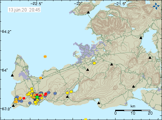
Current earthquake activity close to Grindavík town. Copyright of this image belongs to Icelandic Met Office.
Largest earthquakes at the writing of this article have a magnitude of Mw3,5 (at 20:27 UTC) but since this earthquake swarm in ongoing that number can change without warning.
There was also considerable noise during the earthquake swarm earlier. Suggesting that something is going on but I do not know what might be for now. The noise results in the blue band thickens during the earthquake swarm.
The termor plot during the earthquake swarm. Copyright of this image belongs to Icelandic Met Office.
Current GPS data (can be viewed here) doesn’t show any major changes at the writing of this article. That might change in next few days.