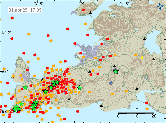
Since Saturday, 23rd of May 2026 an earthquake swarm has been taking place in Reykjanes volcano. This earthquake swarm does not signal a start of an eruption, but it might be a long term signal in that direction. Largest earthquake in this earthquake swarm at the writing of this article had a magnitude of Mw3,5. Second largest earthquake had a magnitude of Mw2,9.
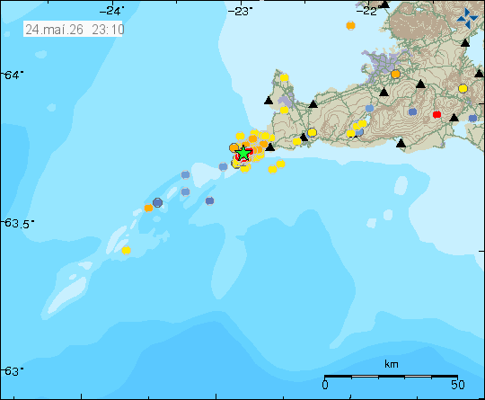
At the writing of this article, the earthquake swarm is ongoing, but in a much slower phase. It is possible that this earthquake swarm is already ending or might end in next few hours. It is also common for earthquake swarms to increase suddenly again in this area. Currently, this is a wait and see situation.