
This information is going to get outdated quickly.
Current status on Bárðarbunga volcano
- There are now two lava lakes (at least) in the fissure that has been erupting in Holuhraun. The eruption has not yet stopped, but it is less powerful but the flow of magma from the craters has not slowed down based on latest observations.
- Bárðarbunga caldera is getting lower by 80 cm/day according to GPS measurements and other measurements that have been made. Total drop in the caldera so far is 21 meter. Cracks have started to form in the glacier that fills the caldera. Normally there are no cracks in that glacier. Most of the cracks are in the central caldera.
- More magma is flowing into the dyke than out of it. Eruption has not yet increased yet, this also increases the risk of new eruptions along the dyke.
- The central crater in the eruption continues to erupt, other craters have mostly stopped erupting and several of them are just emitting gas now.
- Largest earthquake since midnight was a magnitude 4,7 at 09:32 UTC.
- The lava field continues to flow into Jökulsá á Fjöllum glacier river. It is slowly blocking it, some explosions might take place, but due to the thickness of the lava that does not seem to happen often.
- SO2 pollution is a big problem now in parts of East Iceland. The pollution goes depending on wind, so for the moment it is East Iceland that is having this issue.
- GPS data shows that inflation continues in the dyke. This is because more magma is flowing into it than erupting from as I did mention above.
Icelandic Government preparing for major eruption
It seems that Icelandic government has started to prepare for major eruption in Iceland. This is evident when they put up a banner like this on Rúv website.
Rúv radio blackout alert banner due to an eruption at the bottom of this image. Screen-shot of Rúv.is website.
When the national radio of Iceland sets up a image like that. I take it as they know that things are bad in Bárðarbunga volcano. Same way as I know it. The website in question that the banner connects to can be found here, it has English text.
Updates 12-September-2014
- The amount of SO2 in Reyðarfirði has now around 4000 µg/m³ (at 22:45 UTC). People in that village and nearby area advised to stay indoors and don’t go outside.
- The largest crater in Holuhraun is now getting close to being 70 meters high.
Updates 13-September-2014
- Largest earthquake since midnight was a magnitude 4,9 earthquake at 07:58 UTC. At that same time the caldera dropped 25 cm according to news on Rúv.
- GPS stations show fast movements around Bárðarbunga volcano. This means the current activity is far from over, even there has been a minor drop in activity at the moment.
- Instability in Bárðarbunga volcano continues to increase.
There appears to be a fast inflation in Grímsfjall volcano. It is unclear why this is happening, but it might be due to influence from Bárðarbunga volcano. The sudden inflation in Grímsfjall volcano appears clearly on GPS measurement that are being done on top of the volcano. This might not lead to an eruption, since Grímsfjall volcano can take a lot of magma into its system. The eruption that took place in 2011 was the largest one in at least 140 years.Turns out this was just snow on the GPS antenna. So this is false alarm when it comes to Grímsfjall volcano.- Dangerous levels of SO2 are problem in eastern Iceland and where the wind blows it. Gas at the eruption site is also huge risk to anyone working in close proximity to the eruption site. It is also blocking the view to the eruption at Míla cams, along with dust storm that appears to be taking place now due to wind.
- The eruption at Holuhraun is about the same as yesterday (12-September-2014).
- The eruption is now confined mostly to the main crater in the fissure. Other craters have stopped erupting currently. That might change without warning.
Updates 14-September-2014
- The eruption in Holuhraun seems to be ending. During the day the power of the eruption has dropped. The largest central crater is still erupting, but at a lot less power than yesterday and on 12-September-2014. Eruption has stopped in smaller craters in the eruption fissure.
- The lava has stopped moving forward into Jökulsá á Fjöllum. It no longer has the energy to progress into the glacier river. New fields of lava are forming closer to the crater that continues to erupt.
- Largest earthquake today (when this is written) is a magnitude 5,3 earthquake that took place at 14:06 UTC. Second largest earthquake today was a magnitude 4,0 earthquake that took place at 06:54 UTC.
- The caldera continues to drop. Since this activity has continued to total drop is now 23 meters according to latest measurements (from yesterday). Most drop is taking place in north-east part of the caldera. More information can be found here, text is in Icelandic.
- Harmonic tremor suggest that the pressure is increasing in Bárðarbunga volcano again. There is also high chance of small eruptions taking place under the glacier.
- There is no rapid inflation taking place in Grímsfjall volcano. GPS signal got distorted by snow or ice on the GPS antenna.
News bits 12-September-2014
Stærsti gígurinn í Holuhrauni að ná 70 metra hæð og fer stækkandi (Vísir.is, video, Icelandic)
News bits 13-September-2014
“Like breathing from the exhaust pipe” (Rúv.is)
Botn Bárðarbunguöskju seig um 25 sm (Rúv.is, Icelandic)
Other
This is shorter updated today due to there has not been a lot of change since yesterday and it is Friday.
More on comments
Please remember to be nice to each other. Not everything is known about geology, but please remember that this website deals with facts, science and ideas based on known facts. If your idea sounds crazy, it might just be too crazy for this website. There are places for those ideas elsewhere on the internet. Use them, I don’t know about them so don’t ask.
If your comment is on hold for me to approve it. Please wait. I will get to it. If your comment just vanish it means it was false flagged with my spam system so I have to manually check it. If a spam comment goes appears without me knowing about it, please send me a link to the comment so that I can remove it.
I get few emails about the volcano activity in Bárðarbunga. I can answer some of them, but not all of them. I try to put what I know here, so please read it rather than to send me an email. I answer all emails about comments and this website.
Article updated at 19:35 UTC on 12-September-2014.
Article updated at 22:56 UTC on 12-September-2014.
Article updated at 14:54 UTC on 13-September-2014.
Article updated at 22:33 UTC on 13-September-2014.
Article updated at 02:53 UTC on 14-September-2014.
Article updated at 18:17 UTC on 14-September-2014.
Article updated at 18:28 UTC on 14-September-2014.
http://mashable.com/2014/09/11/iceland-bardabunga-volcano-eruption-photos/?utm_content=feature_img&utm_cid=mash-prod-email-topstories&utm_emailalert=daily&utm_source=newsletter&utm_medium=email&utm_campaign=daily
Really beautiful pictures, thank you for sharing. 🙂
Strong quake just happened, 5+
yes, another at 10km depth in Bárðarbunga.
not 10 km but 1.1km
1.1 is not measured, it’s automatic. We have to wait until they will have a look at this…
Jón posted this excellent link at the start of this article. It is well worth watching! at around 30 seconds into video you really do get an idea of the scale of the current eruption, as two vehicles drive in front of the lava fountain (but still at a good distance from it). It is easy to forget how big all this is, when watching the footage from the Mila cameras.
http://www.visir.is/staersti-gigurinn-i-holuhrauni-ad-na-70-metra-haed-og-fer-staekkandi/article/2014140919557
Wonderful video of lava and water – the river? New angle than Mila cams.
thank you
Some kind of pollution is here around Egilsstadir at the moment. So high yesterday we could barely see the surrounding mountains and the sky above was blue. If, as is said, the SO2 levels are very high, how are, I wonder the birds and insects affected. The Redwings here are feeding as they prepare for their migration south. They seem very active. And the plants. How are they affected by these gasses?
SO2 Sulphur dioxide
SO2 can kill fish, sulphur dioxide is Acid rain which can affects plantation, aquatic life and wild life.
Sulphur dioxide is very toxic, it will cause your lungs to get burnt from the fumes and if it has contact with eyes it may cause blindness.
http://www.answers.com/Q/What_impact_does_sulfur_dioxide_have_on_humans
Those birds best migrate soon. I have seen videoes of sea life leaving areas just before a big quake or undersea volcano. They know.
I saw a video of a farm woman in Iceland. She lost some lambs even tho she moved them indoors. In a year when she butchered some, they had dark spots in their lungs.
Sept. 13
Cam 1 smoke is coming back toward our left again
Cam 2 I do not see much
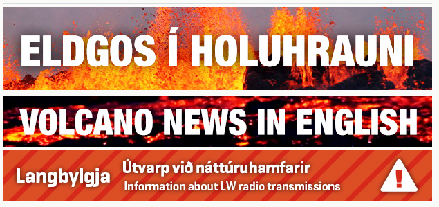
‘Rúv radio blackout alert ‘
I do not understand what this means
I saw the lava is blocking a river to a hydro electric plant.
Is Iceland electric power affected?
I see toxic smoke blows at least 2 directions.
‘People in that village and nearby area advised to stay indoors and don’t go outside.’
Only stay indoors? Gasses go thru homes, a mask not much help.
Evacuating the entire island of humans and animals would take lots of TIME – and if Bar blows, no air evacs. If I am reading writeups correctly – shouldnt evacuations have been occuring?
I know a lot about earthquakes and other things – but volcanoes not so much, so be patient. I am just trying to analyse and translate data I read by others. My function as a reporter on this earth is to make news very simple and basic. This is occuring and this is what it means and this is how it affects you.
‘Rúv radio blackout alert ‘
I do not understand what this means.
From RUV:
“Radio broadcasts during natural disasters
Should natural disaster or other circumstances have an impact on the Icelandic electricity system and inhibit electricity distribution, regular FM-radio transitions will be severely limited. RUV‘s distribution network is powered by electricity. Only a portion has backup generators. Hence, the primary distribution on radio will be on long wave (LW). Many modern radios do not receive long wave but car radios often do. It is also advisable to have a small, battery-powered LW-radio at hand in case of emergency as RUV radio is the primary method of conveying information from Civil Protection Authorities.”
For American readers, that would be analogous to the AM band (amplitude modulation). It all requires electricity though, so losing the hydroelectric facilities would affect long wave transmission and reception just as much as short wave. The reason long wave transmission might be used is that those radio waves are typically reflected off cloud layers and bounce back back to the ground to be received again at substantial distances, while the short wave transmissions can pass through the cloud layers and be lost beyond line-of-sight distance from the antenna.
There are long wave transmission towers in Iceland which can reach all the country and are very far from the area in question. One is on the westernmost tip of the peninsula of Snaefellsnes, the other I think near Langanes peninsula in the northeast.
Some of the hydrothermal Powerstation may affected by a glacierflow. Th river where the lava flows has (as I know) no powerstation, but many others around Vatnajökull:
http://www.landsvirkjun.com/company/powerstations
Thank you – makes sense.
Disaster prep – wisdom!
Do you know how to increase air pressure inside a house so it does not let SO2 leak inside indoors?
Also: does anyone suggest some substance that I could blown into the air with a fan or a vaporizer so that reacts with the SO2 or H2SO4 and neutralizes its acidid effects? Of course I know of masks with making soda, but I want something to create an alkaline air in the household air.
You can’t achieve positive pressure in a whole house. It just isn’t feasible. You would have to move far too much air. A positive pressure room is possible. You would need to seal it extremely well and have a single point for inflow and outflow. The inflow point would be filtered with something capable of binding or neutralizing the SO2, with a fan that pulled enough air in to keep the room at a slightly higher pressure than the outside air. That would prevent air from leaking in anywhere else.
The Icelanders being affected were told to turn their heaters on.
Why does turning on the heater help? Does that help to burn of the SO2 when the air passes through the heater?
heaters have filters. that’s one simple thing. Turn it on, and you are filtering air through whatever filter you have installed on your heater. Might not help much or might help a lot, depending on filter type. Might or might not be the main reason for turning on a heater, but I don’t think it would hurt, and it might help
Heaters on and closed windows = inside air expands, preventing any inflow of polluted outside air. This is plenty good enough to deal with fairly extended (several hours at least) of pollution spikes.
Same principle applies to water mains; they will inevitably have leaks all over the place, but the positive pressure means no crud/dirty water enters the pipes. Instead, some water escapes, but that’s how you’d want things to work.
Thanks to Scots John and les francis for the correction. That’s why I love this blog.looking at the comments on the gas production we can be fairly certain that the price of commodities will rise if not just in Iceland then soon the EU. Does anybody think it worth buying in gas masks for the family?
In Iceland yes. Outside Iceland, no.
I think this would depend on where you live stilton. This could change quick if the wind direction came your way. If there is a large eruption in the caldera this could affect all of the Eu.
Scott
Yup, some places in Norway has already noticed increased gases.
Is it possible that you relocate to another part of the island until this calms down? If you can’t, I’ve read turn the oven on. Lime in the vaporizer? I use lime in my garden to neutralize the soil.
Sorry this post was in response to Irpsit.
“gas” warning on IMO was canceled. Do you anybody know why?
The concentration is going down at the moment:
From RUV.is:
“Has diminished concentration of sulfur dioxide in the plant, but was, now just eight more than 350 micrograms per cubic meter. Concentration reached almost 4,000 micrograms last night its highest rate since begun to measure the concentration of sulfur dioxide from the eruption of lava blowout” (google translation)
Irpsit, if duck tape was to be placed on window and door joint forming a seal, the fireplace can still be used for heat as heat will push SO2 up out the chimney.
Thick plastic sheeting for one door to be used as entry/ exit point where you can create a poor mans air lock.
Most importantly to neutralise the acid SO2 air alkaline elements are needed, the eggy sulphur smell will remain but the vapour droplets can be brought to a more neutral ph level.
Using and old spray bottle you would need to find gypsum, calcium, dilute in water and spray home.
During spells of heavy SO2 level for movement outside HAZMAT industrial respirators.
I know others know more my IQ used to be higher, it’s all I’ve got at moment
This mornings quake has verified at M4.9
Newbie here. Camera #1 is quite clear at the moment. Looks like a lake behind the vent erupting right now. Is that a lake and is that lake the calder? (I don’t think it needs saying, I am not a scientist)
Interesting article on RUV news, apparently during the 4,9 quake the caldera sunk 25 cm!
holy cow!
Something going on with Grimsvotn:
http://strokkur.raunvis.hi.is/gps/GFUM_3mrap.png
That’s not good.
Kre harmonic tremor spiked as well
http://hraun.vedur.is/ja/oroi/kre.gif
Jón,
I’m such a newbie, but I’ve been studying to the detriment of sleeping.
You do an amazing job here! The way in which you write does make it very clear for someone like me, so thank you very much. I will be sending a donation here shortly.
I’ve been reading about Grimsvötn, too, and viewing the charts…seeing that there is some rapid inflation there. Is that correct?
Or, could this possibly instead be involvement the volcano just SW named Haäbunga, such as new dikes or sills be heading her way? In reading, I see little is known about her.
This is interesting!
I think the center of inflation is further south. Maybe Háabunga or Thordarhyma. Not sure.
Kaldafell, SW of Grimsvotn, near Laki, is also rapidly moving northwards. This makes me think it can’t be Grimsvotn, but that this is due to the large tectonic movements across a wide area. Or maybe something in the system further south (Oraefajokull).
Do you mean Kálfafell station?
Or simply in the southwest side of all the action:
every station north of Bardarbunga fissure swarm moves south
every station south of it moves northwards
As if the wide rifting area is all sinking.
an you provide link to that GPS station. I can’t seem to find it.
Sorry Jon.
Link to the Kalfafell station:
http://strokkur.raunvis.hi.is/~sigrun/KALF_08.png
Map with all stations:
http://strokkur.raunvis.hi.is/gps/cgps.html
Many stations also here:
http://strokkur.raunvis.hi.is/gps/#VATN
– Grimsfjall and Kalfafell (SW Grimsvotn) move North.
– Hamarinn and Vonarskard move towards Bardarbunga caldera
– Station to the west and north of Tungnafellsjokull move West or NW
– Stations towards the east of Holuhraun move East, including those quite far away, like Saudarháls, near Karahnjúkar.
– Stations very near Askja caldera also show rifting occuring there (Hrímalda moves W; Thorvaldshraun moves E)
Looking at the GPS it would seem that everything under the glacier has started to creep? 😮
How is that even possible? How big are the forces are at work here?
Jon you say ” thats not good” re the comment on grimsvotn, can you expand a bit on what you think may be happening?
I think it was Magnús Guðmundsson who talked of the Grimsvotn system potentially being aggravated by the Bardarbunga system and viceversa. If I recall correctly that was based on historical evidence.
Apologies if I have cited the wrong person!
Carl on VolcanoCafe posted an explanation and a reference to an article he had comparing the current eruptive potential of Grimsvotn to Yellowstone. Grins has much more eruptible magma and is poised for its own next caldera event in geological terms. The magma chamber is huge and full of melt. That it erupted in 2011 is pretty immaterial.
So even ex-the issue of this event now involving multiple volcanic systems, anything around Grimsvotn is real dangerous.
Here is a timelapse of GPS for Hamarinn. The extreme movements since august are quite something! http://strokkur.raunvis.hi.is/gps/HAMA.html
Look at the tremor in Kreppuhraun, something interesting is going on:
http://hraun.vedur.is/ja/vatnajokulsvoktun/kre_trem.gif
Article has been updated with newest information.
Thanks Jon, we were just talking about Grimsvotn when you came in with that. Do you know of any historical evidence linking the two systems? Thanks SJ
I guess the inflation in adjacent volcanoes only becomes a concern if it continues for any length of time?
throughout history has iceland ever experienced post glacial rebound? could it be happening now? (probably way off target but thought i would ask the question)
Yes, it is happening now. There was eg. isostatic rebound of some meters in recent years near the town of Höfn south of Vatnajökull, and scientists think it has to do with the glaciers melting.
Is there anywhere to look at the data from the new GPS installed yesterday in the caldera?
I am searching like you but i think nobody find this link on the web. Only for scientist i guess…
http://brunnur.vedur.is/pub/vatnavakt/bardarbunga/ is this it?
@Lady Bunion
It looks like it is, thanks. This is very interesting data.
Frankly, the data hoarding was starting to get ridiculous. If it’s a public link, it’s public, there’s no point in hiding it besides pretending to have access to exclusive, restricted information.
The IMO web admins probably already know how to manage their bandwidth in case they really need it (although I really think they have private servers for internal uses).
to Lady Bunion
I think that’s it! But i dont know how to read it, no translation?
I think the 3 lines are raw data (grey), 30 min moving average (red) and 180 min moving average
movement from where it started is on the left and is in metres, so now it is 75cm lower and shows the 25cm drop
Thank you very much, I will be following this very closely 😉
Esotwoo
As someone who posted a re-hosted link on VolcanoCafe I must point out that it is their (VC’s) explicit policy not to allow IMO links but with certain exceptions. I have again asked for clarification as to whether that link is allowed there as someone else has posted the link there anyway.
Not a matter of “pretending to have access to exclusive, restricted information.” – just their rules and their blog. Carl has also said that IMO specifically asked them not to link to certain data because they actually had crashed an IMO server at one point.
I think IMO server load is an overblown issue. All public-facing (web access / Google-indexed) *.vedur.is servers are on the same network (130.208.87.xxx) and network packets toward them follow the same route besides the last hop (which times out on my connection).
http://i.imgur.com/a7c0Vl5.png
Actually, vedur.is has two entire subnets reserved (130.208.87.xxx and 130.208.86.xxx) which makes it difficult for me to think they have anything less than a premium/priority connection to the Internet.
I think the problem was perhaps more that their WordPress plugin configuration automatically takes image links and converts them to inline hot-linked images if the URL is on a line of its own – so posters were unintentionally hot-linking. At one point before they introduced the rule they had a huge number of hot-linked images to one particular server thus generating potentially hundreds of requests for images per second and one particular server apparently couldn’t cope. Something simple like keep-alive being enabled/too long can kill a server (especially “pre-fork2 Apache!) when all the instances are stuck in timeout wait.
Anyway all speculation!
http://hraun.vedur.is/ja/oroi/allarsort.html gives the tremor graphs. The fissure may well set off those adjacent volcanoes and cause grim,ketla and Aya as well as barda to pop off, worst case scenario.
this sums it up well i think!
https://www.youtube.com/watch?v=Uwzg7SYZKF0
Observations from Bada cam 1 since inflation show increased SO2 emissions from fissure via plume.
Weather conditions to keep it in the Highlands until a slack low pressure system moves in by Monday 15th and and pushes it Eastwards.
For once West coast is thankful of prevailing North Atlantic westerly wind
Weather for Iceland next week is very slack and the pollution will just sit there. NOT what they want.
I find all these updates fascinating but very scary. And I’m sitting in my kitchen in Folkestone, England ! so my prayers are with the people of Iceland.
Toxic gases, the threat of glacial floods and potentially a massive volcano blowing its top on a relatively small island is frightening. In my town we had a 3.1 EQ a few years ago and it felt like someone had picked up my house and then dropped it from 2 mtrs. I cant begin to imagine whats going on below Bunga.
I live near Market rasen England (8 miles NE)and had that 5.2 in 2008 in the middle of the night. We thought our boiler had exploded, although I reckon the chalk absorbed quite a lot of the shock as on top of the Wolds escarpment here.
Funnily enough but a little off topic
http://earthquakes.bgs.ac.uk/research/folkestone_v_marketrasen.html
I live in the UK as well, but we don’t get them up in the London area. I worked out in the Pacific for a bit, you get the a lot out there. I was in Vanuatu when they had the 7.8 in 2009 not very nice !!!. My feelings go out to the people in Iceland I just hope things work out for all of them lets hope they will be safe.
And Lady Bunion many thanks for posting the link, It is most interesting.
Oh yes the market rasen earthquake – I am in North Yorks and was woken by the wardrobe doors rattling, my son was woken by his lava lamp rattling and nearly falling off the bedside table.
Very interesting Jonathan….10 times is a big difference !
Does it look to anyone else as though the southern portion of the rift may be opening up again? The camera operator on Mila-1 has cranked the video gain up twice now, as though to get a better view, but there is some kind of problem with the optics when they turn it up (purple rectangle in the lower left, green spots in the upper center) and they keep turning it back down. But I’ve seen what looks like increased smoke and one ‘fire ado’ from where the lava was erupting earlier.
Looking at them again now, I think the purple and green spots are just sun dogs. But i still think I see more smoke coming from the southern end of the rift. Could be just my imagination.
It seems that the smoke coming from the rift is blacker than usual.
I think the SO2 content changes from times to times. It the “smoke” is darker, then it would mean more sulfur and perhaps a bit of (local) ash.
The new bardabunga gps station data is also being shown on burre01 you tube live link to mila camera’s. I always watch through this as can’t view the web cams by directly connecting. Type ‘ bardabunga live’ into you tube and select live video with viewers…
What is this showing? http://brunnur.vedur.is/pub/vatnavakt/skafta/
This is in skaftárkatlar cauldrons in Hamarinn volcano.
Here is a link, but the text is only in Icelandic.
http://jardvis.hi.is/joklar_og_flod_voktun
This may sound amazing, but I think there may be a correlation between the movement of the GPS receiver on Bárðarbunga volcano as reported here: –
http://brunnur.vedur.is/pub/vatnavakt/bardarbunga/
and the tide, this link shows marine tide
http://www.tide-forecast.com/locations/Siglufjorour-Iceland/tides/latest
Earth Tides explained here
http://geography.about.com/od/physicalgeography/a/Land-Tides-Or-Earth-Tides.htm
the fontains seem to be very high now
Hi Jon very interesting site you have I look every day to see the updates. I have friends and family in Europe at the moment and I advised them to get Ash Cover on their insurance just in case, your site is invaluable and I use it to give them the current situation as it is known.
One question if you or anyone can answer it for me, When I look at the Bardabunga webcam the one with the trailer and white dome, incidentally what is that for, I see what I think is steam rising from the riverbed sometimes as mini whirlwinds, what is happening here it looks a long way from the Lava fields, the view into the valley is obscured by the foreground.
Many thanks
it’s a special radar unit (r2d2) measuring air composition (quality) and gasses from the eruption.
The heat of the lava creates strong updrafts over the lava “river”, which flows from the vent towards the lower left (in the webcam view). The updrafts form vortexes, which are whirlwinds or mini-tornados. Whenever the wind dies down, you can usually see several of these form and re-form all along the lava flow.
I suppose with all the stresses going on below the glacier, we are going to have some abrupt movements from time to time as this event progresses. We have a sinking mountain and it’s going to start affecting the surrounding environment in a big way, especially the glacier.
I made a comment last night concerning the aurora reflecting off the steam. In cam 1, the steam had a pinkish color to it. I thought maybe the aurora were the cause. Here is a picture taken from New Hampshire, USA by Chris Georgia last night of the aurora. Beautiful! The red, pink, and purple coloration of this event is stunning.
http://www.solarham.net/archive/georgia2.jpg
I didn’t get to see them because of cloudy weather that was suppose to clear off but didn’t.
Some pictures from last night from someone who is on tour in Iceland:
http://islandauftour.blogspot.de/2014/09/polarlichter.html
Just out of interest, did any of you guys in Northern England & in Scotland see the aurora last night (just seen an aurora pic from North Norfolk).
Has there been any more news on Grinsvotn inflation?
Just compiled the wind forecasts for SO2 dispersal (and potencial ash). And which regions will be more affected in Iceland. And where acidic rain or volcanic smog will affect. Nice to know in order to prepare in advance. Forecast up to 15 days:
Saturday 13: SW wind. East Fjords
Sunday 14: S wind. Myvatn
Mondat 15: SSW wind and rain. Myvatn/East Fjords. Possibly acidic rain there.
Tuesday 16. Calm, dry.
Wednesday 17. E and rain. Central Highlands (depending on wind, a minor risk gas might reach Akureyri, northwest Iceland or south Iceland)
Thrusdat 18. S. Myvatn
Friday. NE and dry. South Iceland, Possible first day of haze near the more heavily populated areas of Iceland. Can be first snow in Holuhraun, and cold elsewhere in Iceland.
Saturday 20. SE. Northwest Iceland
Sunday 21 S and rain. Myvatn.
MOnday 22, W and rain: East Fjords. Models forecast more moist and stormy weather in days ahead.
Tuesday 23: SE and rain: Akureyri, Northwest Iceland. Possible acidic rain there.
Wednesday 24. E gale. Western side of Iceland, possibly south Iceland. Possible acidic rain
Thrusday 25. NE gale. South Iceland. Possible acidic rain. Could reach North Ireland too. Probability of affecting Reykjavík. Possibly cold weather across Iceland.
Friday 26. Calm wind. Mild dispersion across Iceland
Saturday 27. SE gale. Akureyri, Northwest Iceland
Sunday 28. SE gale. Akureyri, Northwest Iceland
Monday 29 W gale. possibly N. East Fjords, Hofn, possibly Faroe Islands
Just watching the cam what an amazing sight just seen what looks like a tornado all along the back line in front of R2D2 ,I am in awe of all this.
Would like to congratulate you on a fine web site.my first look at it and iam impressed.much more information than the news channels give out.
Jon, do you think this could be the birth of a new shield volcano in Iceland?
Eruption is localized to a central vent or two, forming a small shield already (around 0.4km3), and the region around is full of shield volcanoes. What do you think?
On the left hand side of R2D2 just behind the ridge it looks like there is fire starting you can see a flame.
That is where lava meets the river. The lava is hot at the surface so it shines, everywhere between the vent and the river.
But near the river, the steam rises above it (because of the river) and helps to reveal it.
Saw a light for two times flaring in the glacier! On the webcam 1
Same spot, but it could have been an airplane. Or is it a vent that came to surface????
I see an orange glow to the left of R2 also (quite small).
I think it is a new vent that may be opening as the orange flame colour is getting stronger.
Where the lava meets the river. ..is that like where the bullet meets the bone? Hopefully, not, and this calms down after a few eruption events….
Mila cams are spectacular right now.
Just out of interest, how many kilometres away are the Mila cams positioned from the fissures?
The cams are on Vadalda mountain, appr. 20 km from the eruption site, the lava has approached the bottom of this mountain to appr. 1 km. Here the lava reaches the river Svarta, and that’s what you see right behind the radar r2d2 unit (the glow and smoke). For the topograpy of the area this site might help you: http://www.bgu-geoservice.de/zoomifyer/Island.htm
Cheers for this TvS, that’s really useful stuff.
I hope the Bardarbunga stays calm until after we vote ‘Ja’ in Scotland on Thursday!
New article is up. Please note that I am going to continue to update this one until Monday.
This article has been updated with one new item.
If Jon publishing his biography it will not take him ten years to earn his living by writing. Provided he sits down to write it, and I appreciate at the moment he has no time, he will be able to earn his living from writing in under two years. The suggested title of “Prophet of Fire” would be excellent.