This is a short update on what is happening in Grindavík on 15. November 2023. Information here might go outdated quickly.
In general, not much has changed since yesterday (14. November 2023).
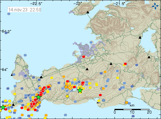
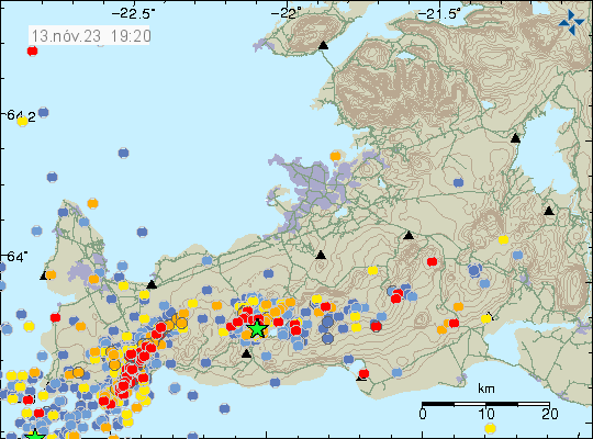
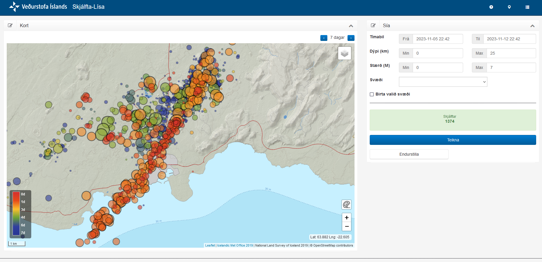
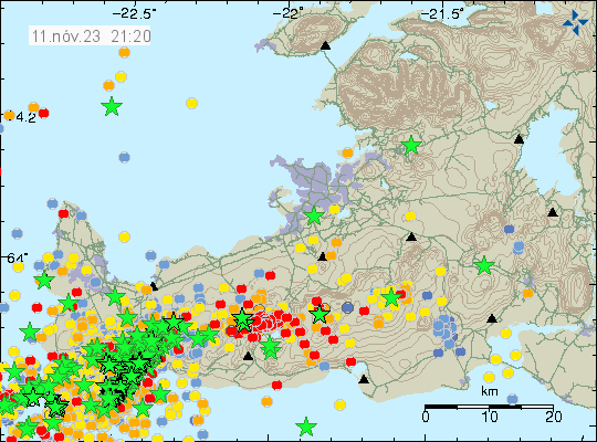
- There’s no change in earthquake activity. Strong wind in the Reykjanes peninsula might be masking some of the smaller earthquakes.
- Part of the harbour area has started to sink according to news. I am not sure how much, but I think it might be considerable sink.
- Speed of the sink in some areas of areas inside Grindavík has increased from 7 cm for each 24 hours to 12 cm for each 24 hours since yesterday. Some areas inside Grindavík have lowered as much as 2 meters or more.
- Inflow of magma into the dyke continues to be at 75 m3/second according to news reports today. This is a lot of magma inflow into the dyke. The eruption in Holuhraun in 2014 and 2015 had an flow of 90 m3/sec when it was the most.
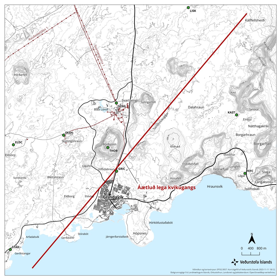
- It is reported on mbl.is that it is now considered that magma might be flowing directly from the main magma chamber at 20 km to 40 km depth under this location in Reykjanes peninsula. That news is in Icelandic here.
- Parts of Grindavík town has lost power, hot and cold water because of sinking of the ground and movements. Emergency repair is going to be attempted tomorrow if it is safe.
- Eruption might happen at Sundhnúkar and Hagafell, where the highest flow of magma is happening according to Icelandic Met Office and the news.
- Eruption at many craters at the same time is what is going happen here. Based on what I am seeing. That means more lava covering larger area quicker than the small eruptions in Geldingadalir, Meradalir and at Litli-Hrútur. Where it was just one crater and a small eruption.
- Something is holding back the magma from reaching the surface. What that is unclear. But magma is at shallow 500 meters or less according to measurements done by Icelandic Met Office. This shallow depth means that magma can start erupting without much warning or notice in the dyke.
There is a chance that parts of Grindavík town might sink under the ocean because of the ground sinking. When eruption starts, what goes under lava depends on where the eruption is going to start and where the lava is going to flow. Both are random events that is impossible to know anything about.
If anything happens. I’ll post update soon as I can. If anything happens tomorrow I’ll write about it. Otherwise I plan on publishing next article on Friday 17. November 2023. Since changes at the moment are not that big changes between days currently.