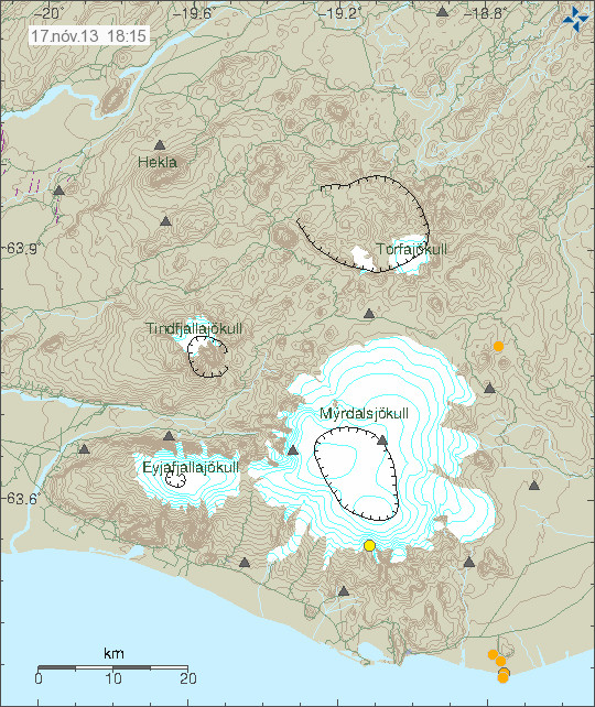
Today (17-November-2013) a minor earthquake swarm took place in Katla volcano at 06:21 UTC and it lasted to 07:09 UTC. The largest earthquake has the automatic magnitude of 1,8 with the depth of 18 km. This earthquake swarm took place under an former island in the area called Hjörleifshöfði (in Deutsch, English is not available). It is possible that this former island has it’s origin is in an volcano activity in the area, while I do not have it confirmed it is at least an idea. The deepest earthquake in this area had the depth around 22 km according to automatic results from Icelandic Meteorological Office.

Based on the depth of this earthquake swarm, the origin of this earthquake swarm was in magma movement or dike intrusion. It is not a tectonic activity, since such earthquakes are not so common in this part of Iceland, but they do happen. I am not sure what this means for activity in Katla volcano since I have not seen this before as it appeared now. This area of Iceland can be viewed in Google Maps and with Street View here.
