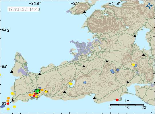
Yesterday (18-May-2022) I forgot to write about the earthquake activity that is ongoing north of Grindavík town. This earthquake activity is either in the new dyke that has formed or ongoing path of the dyke in Svartsengi that has now reached north of Grindavík town. I don’t know what applies here. Skjálftalísa map that Icelandic Met Office has strongly suggests a second dyke, but the results are bit unclear. In the area east of Þorbjörn is a older eruption fissure, I don’t know when it erupted, but it might have been as early as 12th to 13th century.

Yesterday (18-May-2022) total of five earthquakes happened with magnitude larger than Mw3,0. Largest earthquake had a magnitude of Mw3,5. Today (19-May-2022) at the writing of this article, only one earthquake with magnitude of Mw3,0 has happened. Earthquake activity seems to be slowing down. I am not sure why that is.
Donations
Please remember to support my work with donations. Everything helps me to get trough the month. Thanks for the support. 🙂

The earthquakes seems to be very close to town. Are the inhabitants preparing for evacuation in case of an eruption?