Earthquake swarm far north of Kolbeinsey Island

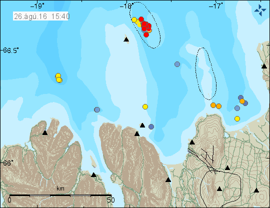
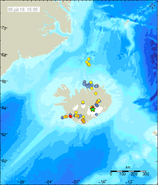
Today (5-March-2016) an earthquake swarm place took place around 190 km north of Kolbeinsey Island. Two largest earthquakes detected had the magnitude of 3,3. Other earthquakes where smaller in magnitude. Due to distance exact location is difficult to confirm, along with exact magnitude. This earthquake activity did not appear on EMSC seismic network.

160305_1730
Green stars show the location of this activity. Its only a best estimate by Icelandic Met Office. Copyright of this image belongs to Icelandic Met Office.

At this location there might be a volcano, it is unconfirmed at the moment. Last eruption is suspected to have taken place between 1997 or 1998. This volcano doesn’t have any name that I know of.

Earthquake swarm in Bárðarbunga volcano (Week 09)

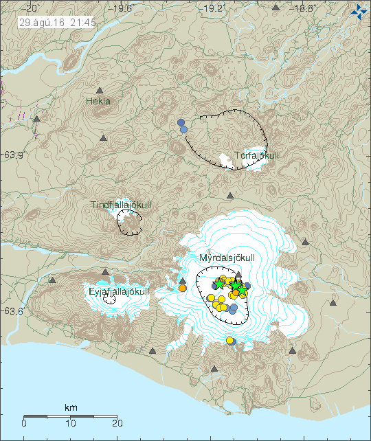
Bárðarbunga volcano continues it earthquake activity and it has now been a year since the eruption in Bárðarbunga volcano ended in Holuhraun (article I wrote about it can be found here). This activity (image) took place on 2-March-2016.

160302_2155
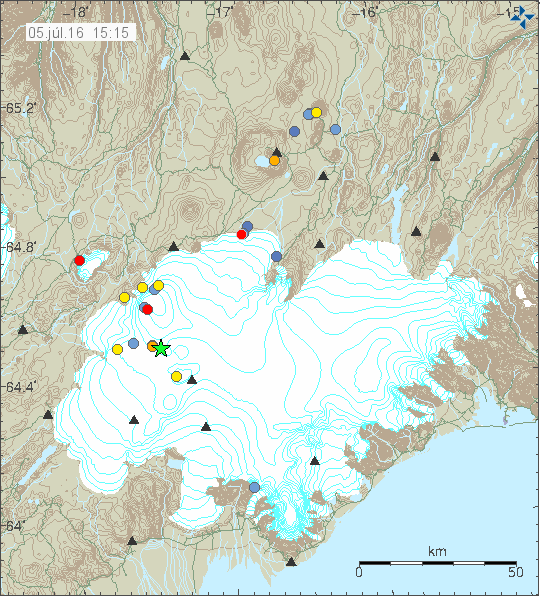
The earthquake activity in Bárðarbunga volcano. Green stars are earthquake with magnitude above 3,0. Copyright of this image belongs to Iceland Met Office.

Largest earthquakes in this swarm had the magnitude of 3,1, 3,3 and 3,6. Other earthquakes where smaller in magnitude. The reason for this earthquake swarm seems to be a developing weakness in the north and western part of the caldera. Activity in south part of the caldera seems to be crust adjustment to this weakness (stress changes). The weakest area is long one (I didn’t find information on how large the caldera is, but it is large). This weakness is going to continue to develop until an eruption happens or the magma finds it self a new path and that is more likely than an eruption taking place in the caldera rim, however I cannot rule out an eruption in the caldera at this point. This is all just wait and see situation at the moment. Interesting earthquake also took place in Hamarinn volcano, it had the depth of 13 km and magnitude of 0,7.

Deep earthquakes also took place in Tungnafellsjökull volcano. That earthquake had the magnitude of 0,8 but depth of 17,9 km. Suggesting that some stress changes at depth are taking place. In this case I doubt magma created the earthquake.

If an ash eruptions takes place in Bárðarbunga volcano, the resulting ash fall would be devastating (besides the following glacier flood). Last time larger eruption took place in 1477 half of Iceland got covered in volcano ash (that’s 50% of land), the volcano ash eruption in 1711 covered north Iceland and large parts of east Iceland. In 1711 to 1729 total of nine glacier floods took place and the source of them is believed to be Bárðarbunga volcano. Glacier floods from other volcanoes (Grímsfjall, Kverkfjöll, Þórðarhyrna, Hamarinn) are also highly dangerous. The volcano ash had thickness up to 100 meters next to the eruption area in 1477 (see map in link 1).

Source 1: Hvaða tjón gæti mögulega hlotist af gosi í Bárðarbungu? (Icelandic)
Source 2: Hvað eru mörg gos þekkt í Bárðarbungu og hefur orðið mikið tjón af þeim? (has gravity map of Vatnajökull glacier, Icelandic)

Short overview of earthquake activity in Iceland

This is a short update of earthquake activity in Iceland on 28-February-2016.

Bárðarbunga volcano

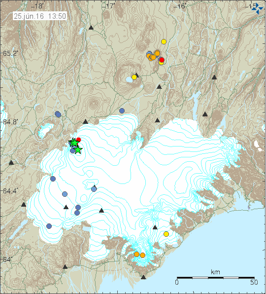
Over the past 48 hours there has been earthquake activity and dyke activity in Bárðarbunga volcano. Some of this earthquake activity has been on around 15km depth. Suggesting magma movements within Bárðarbunga volcano system. Earthquake activity always seems to increase few hours to days after a swarm of deep earthquakes appear in Bárðarbunga volcano.

A dyke activity has appeared on the edge of Bárðarbunga volcano, it is located south-east in the volcano. In a area that has seen this type of dyke activity before. It is interesting that this activity seems to persist at this location.

Tungnafellsjökull volcano

Over the past few days few earthquakes have appeared in Tungnafellsjökull volcano. Some of those earthquakes have had the depth around 15 km. This suggest some type of magma movements inside the volcano, but nothing that suggests that its going to reach the surface any time soon.

Askja volcano

Earlier this week (Week 08) an deep earthquake swarm took place in Askja volcano. With earthquakes having the depth down to around 22 km. Suggesting that magma is flowing into Askja volcano magma chamber at depth. This has been happening at regular basis since 2010. At the moment there is nothing suggesting that eruption is going to happen any time soon in Askja volcano.

160228_1940
Earthquake activity in Bárðarbunga, Tungnafellsjökull and Askja volcano. Copyright of this image belongs to Iceland Met Office.

Katla volcano

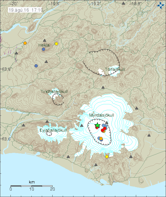
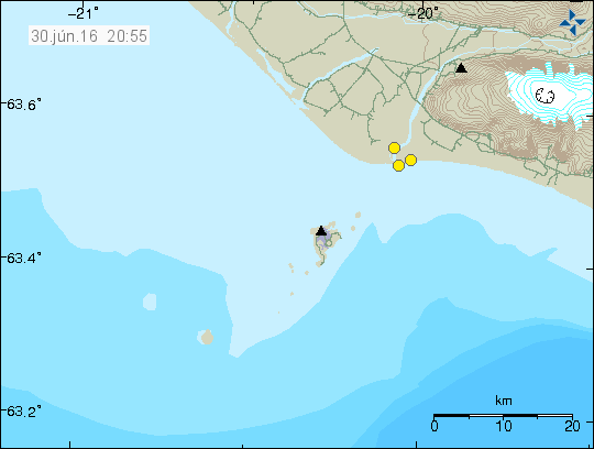
There was some minor earthquake activity in Goðabunga in Katla volcano. This appears to be normal activity for this region of Katla volcano. No other interesting activity took place this week (Week 08) in Katla volcano.

Hekla volcano

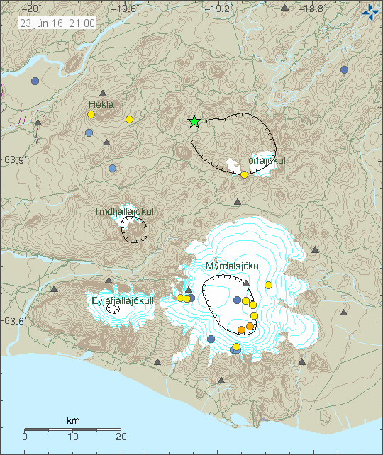
Two earthquake where detected in Hekla volcano. Nothing else happened following this earthquake activity. Why this earthquake activity happens remains unclear.

Torfajökull volcano

A minor earthquake activity took place in Torfajökull volcano during the weekend. This activity is possibly due to changes in hyrdrothermal areas in Torfajökull volcano.

160228_2120
Earthquake activity in Katla, Torfajökull and Hekla volcano. Copyright of this image belongs to Iceland Met Office.

Other than this activity things remain quiet in Iceland. There are few minor earthquake swarms on Reykjanes peninsula and Tjörnes Fracture Zone. But they are too small at the moment to write about.

Donations

Please remember to support me with donations. The new computer left a big hole in my budget and any support in order to cover it are welcomed. Thanks for the support. 🙂

Move to Denmark

It is now official. I’m moving back to Denmark on 14. April, with just few minor details left to work out (getting a loan for the apartment insurance and few other things). I’ll move into my new apartment on the 15th April. More details later next weeks when I know about the apartment loan.

Deep earthquake activity in Bárðarbunga and Askja volcano

Today (18-February-2016) and yesterday (17-February-2016) there has been deep earthquake activity in Askja volcano and in Bárðarbunga volcano.

Askja volcano

Since March 2010 Askja volcano has been having period activity taking deep inside Askja volcano. This suggests that both deep dyke intrusions are taking place in the volcano system, yesterday and today (close to Dreka area and Herðubreiðartögl volcano). None of those dyke intrusions is going to reach the surface. They are going to remain at depth. This does show that since 2010 magma activity at depth is possibly increasing in Askja volcano. When a eruption might take place is impossible to know, but it might be a really long time until it happens. Unless Bárðarbunga volcano enters the mixture and speeds things up. Earthquake activity close to Herðurbreið are normal tectonic earthquakes at shallow depth >10km.

Bárðarbunga volcano

Most of this week Bárðarbunga volcano has been quiet. That might be about to change, since today few deep earthquake appeared in the northern part of the volcano. This suggests that fresh magma from deep magma chamber is pushing up now. The resulting earthquakes are due to pressure change inside the volcano that fractures the rock in the process. Earthquake activity has also been in the dyke (Holuhraun eruption) at the edge of the glacier. I don’t know why that is. A clear dyke intrusion took place in Hamarinn volcano on 17-February-2016, with earthquakes at the depth of 12 – 13 km. This is the first dyke activity in this volcano for a while now. Magma is shallow in Hamarinn volcano, making it sensitive to pressure changes and possible eruptions.

160218_1445
Earthquake activity in Askja and Bárðarbunga volcanoes. Along with earthquake activity close to Herðurbreið area. Copyright of this image belongs to Iceland Met Office.

Maps of Iceland

For people who want to know what I’m often taking about there is a map that can be bought. This is a geological map of Iceland, it shows all the volcanoes, both active and extinct ones in Iceland. Along with fault zones and fissure swarms. It can be bought from here. Please note that I don’t get anything from this, it’s just so that people can have access to information about Iceland. The prise of this map is €13,80 without shipping, or 15,31 USD without shipping today.

Donations

Please remember to support my work with donations. I’m getting rather broke as it currently stands. Thanks for the support.

Earthquake swarm in Bárðarbunga volcano (Week 06/2016 #2)

On Saturday 13-February-2016 at 19:32 UTC an magnitude 3,6 earthquake took place in Bárðarbunga volcano. Depth of this earthquake is registered 1,1 km. Swarm of smaller earthquakes followed the main earthquake, deepest earthquakes had the depth around 12 km.

160214_1720
The earthquake swarm in Bárðarbunga volcano. Copyright of this image belongs to Iceland Met Office.

Tungafellsjökull volcano

On Sunday 14-February-2016 an earthquake swarm started in Tungafellsjökull volcano. It’s still not known what is creating the earthquake activity in Tungnafellsjökull volcano. The most popular idea (among geologists) is that stress changes from Bárðarbunga volcano is resulting in earthquake activity in Tungafellsjökull volcano. I don’t know if that is true or not, since earthquake activity in Tungafellsjökull volcano started several years before the eruption in Bárðarbunga volcano in August-2014.

Donations

Please remember to support my work with donations or by using the Amazon banners I have up here and under Amazon Store banner. Thanks for the support.

Minor earthquake swarm on the Reykjanes peninsula

Yesterday (11-February-2016) at 08:47 UTC an earthquake swarm started on the Reykjanes peninsula. This has so far been a small earthquake swarm and largest earthquake so far had the magnitude of 2,7 other earthquakes have been smaller in magnitude.

160211_2340
The earthquake swarm on the Reykjanes peninsula. This is at the moment a small earthquake swarm. Copyright of this image belongs to Iceland Met Office.

This is classic earthquake swarm pattern on the Reykjanes peninsula at the moment. It does appear that this earthquake swarm is over, but it might start again without warning. This earthquake swarm is not connected to a volcano activity in the area, but it is forming a rift valley in the area.

Article updated at 00:53 UTC.

Update on Bárðarbunga volcano (Week 06/2016)

Short update on Bárðarbunga volcano.

Bárðarbunga volcano continues to inflate at the depth of 15 – 10 km. Making it hard to observe it on the surface. Earthquake activity continues to increase, with regular earthquake swarms with magnitude of 3,0 – 3,5 at the moment. The reason for this earthquake activity is the inflation currently taking place in Bárðarbunga volcano at depth of 10 – 15 km and at shallower depth. I expect that hydrothermal activity is going to continue to increase in Bárðarbunga volcano for the next few weeks and months as magma pushes up to shallower depths inside the volcano.

160208_1335
Magnitude 3,1 earthquake (if my memory is correct) in Bárðarbunga volcano on Monday 8-February-2016. Copyright of this image belongs to Iceland Met Office.

160211_1835
Today (11-February-2016) magnitude 3,3 earthquake in Bárðarbunga volcano. Copyright of this image belongs to Iceland Met Office.

No other changes have been observed in Bárðarbunga volcano. Current pattern of activity in Bárðarbunga volcano is going to continue for a really long time. There is at the moment no need for to write about all of it. Unless something changes in Bárðarbunga volcano. Rift episodes like the one that has started in eastern rift zone in Iceland take a long time, the longest one can go for up to 20 years and they happen slowly most of the time. The biggest risk now is a new dyke intrusion and eruption (or both). That might start without warning and only last for few hours to days at most.

Icelandic News about Bárðarbunga volcano

Hæg at­b­urðarás und­ir Bárðarbungu (mbl.is, Icelandic) – Attempt Google Translate at own risk. It might bring trolls and elves into existence.

Noise on SIL stations

I did have a conversation about Icelandic Met Office about the strange tremor spikes I’ve been seeing on SIL stations around Bárðarbunga volcano over the past few weeks. It turns out that is connected to 3G (900Mhz) interference. It has two factors in it, the 3G stations loosing signal, creating a dropout in the data stream to Iceland Met Office and what I suspect a signal leak into the hardware that Iceland Met Office has (in the same was as I’m seeing on my Böðvarshólar geophone) when the quality of the 3G signal is poor due to ice and snow on the transmitters antenna, that forces the 3G hardware to boost it’s transmitter power up to 2W. This issue won’t go away until they move to 4G (maybe) or something else.

Other

I’ve decided that I’m first going to move to Denmark and then maybe I’m going to move to Germany. To the village of Andernach. The time frame on this plan is 10 to 15 years at the shortest. I don’t know if this plan is going to happen, it might do so and then it might not do so. I plan on to save up for a house in Germany, the reason for long preparation time is that I need to learn German and learn on the system in Germany. The town I’ve chosen is close to the West Eifel Volcanic Field. This is not the first time I’ve planned to move there (to Koblenz, but that town is too big I think), but those plans are now gone, replaced with this one. I don’t know yet if this plan is going to happen, it might do so in about 10 to 15 years if everything works out.

Magnitude 3,1 earthquake in Tjörnes fracture Zone (TFZ)

Today (04-February-2016) an magnitude 3,1 earthquake took place in south Tjörnes Fracture Zone. I don’t know if this earthquake was felt in nearby village of Kópasker.

160204_1550
The earthquake swarm on Tjörnes Fracture Zone, the green star is the magnitude 3,1 earthquake. Copyright of this image belongs to Iceland Met Office.

This earthquake swarm has now been going on for almost a month now and there doesn’t seems to be any sign of this earthquake swarm stopping any time soon. The activity drops at times, but always continues, even at low levels. Activity did increase after the magnitude 3,1 earthquake, but it has since dropped again into the same low it was before. I do expect this earthquake activity to continue.

Magnitude 3,9 earthquake in Reykjanes peninsula

Tonight at 19:50 UTC a magnitude 3,9 earthquake took place in Krýsuvík volcano. This earthquake is not volcano related, this is a tectonic earthquake and has started a minor earthquake swarm in Krýsuvík area. Other earthquakes so far have been small, with largest aftershock having the magnitude of 1,6. The magnitude 3,9 earthquake was felt in Hafnarfjörður and in the Reykjavík area (and nearby towns).

160203_2215
The earthquake activity in Krýsuvík volcano tonight. Copyright of this image belongs to Iceland Met Office.

This earthquake swarm is currently ongoing, but it doesn’t appear to be a strong or a highly active earthquake swarm at the moment. It’s unclear if that is going to change since it’s impossible to predict how this earthquake swarms behave.

Short update on Bárðarbunga volcano activity (Week 05/2016)

The activity in Bárðarbunga volcano continues to slowly increase, at the moment there seems to be a small lowdown in the activity but that might change without warning. There has been some change in the activity inside the caldera and that is important. There appears that two spots are forming inside the south part of the caldera, suggesting that magma has found a weak spot in the crust plug. The space between them is not big, at most 800 meters to 2 km. The weak spots might not erupt, the magma that is pushing up at this location might fail breaking trough the crust if the pressure is high enough to break trough the crust.

160202_1705
The green star marks the second weak spot in the caldera of Bárðarbunga volcano. Copyright of this image belongs to Iceland Met Office.

Yesterday (02-Februar-2016) signal appeared on the SIL stations around Bárðarbunga volcano. This signal was seen good distance from Bárðarbunga volcano, this does not appear to any type of failure in the SIL network, I’ve been looking for such and not found any. What this signal means is unclear and why it happens is unknown.

dyn.svd.03.02.2016.at.00.42.utc
The strange signal starts around midnight at 02-February-2016 and continues until at least 05:00 UTC. It is not known why it happens. Copyright of this image belongs to Iceland Met Office.

The largest earthquake in past 48 hours had a magnitude 3,0 and was in the newly formed weak spot in the north-east part of the Bárðarbunga volcano caldera. Both weak spots in the Bárðarbunga volcano caldera have been having earthquakes this week and past week, in most of the caldera there has been some earthquake activity taking place. In late August-2014 the north-east caldera rim did leak some magma, creating a row of cauldrons above it. Both above the dyke and on the cauldron rim. I did try to find pictures of the cauldron in question, but I didn’t have any luck doing so.

Magma pressure inside Bárðarbunga volcano seems to be increasing faster then I expected. Something might have changed inside the volcano, or deep underneath it allowing for magma going inside the volcano at higher rate then before. It is not possible to know when next eruption in Bárðarbunga volcano happens, the time frame (based on historical data) is from 1 year and up to 10 years when a eruption cycle is going on.