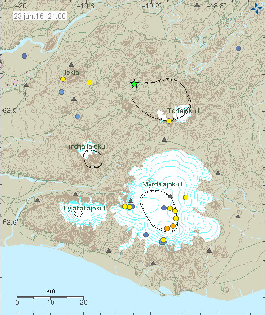
Today (23-June-2016) at 20:36 UTC an magnitude 3,2 earthquake (current data, might change) took place in Torfajökull volcano. The depth was 2,1 km.

Green star in Torfajökull volcano shows the location of the earthquake. Copyright of this image belongs to Iceland Met Office.
If anyone was close to this earthquake, it would have been felt. No other earthquake have so far followed this earthquake, that might change in few hours. It does happen once in a while that just one magnitude 3,0 earthquake happens and nothing more. I don’t know if there is any hydrothermal activity in the location where this earthquake took place.
Update at 22:24 UTC
According to an announcement from Iceland Met Office. This earthquake was felt in a nearby camping area.
Article updated at 22:24 UTC.

Looks like things are still shaking there!
Friday 24.06.2016 02:42:02 63.969 -19.316 5.6 km 1.3 90.01 12.7 km W of Landmannalaugar
Updated Map to Jun 24 1400 GMT
https://vatna.cartodb.com/viz/b765b472-3869-11e6-9b2c-0e31c9be1b51/public_map
Probably due to melting snow, making contact with geothermal heatsource?
No. This is area is mostly snow free this time of the year.
25.06.2016 07:19:44 64.625 -17.469 7.9 km 3.5 99.0 3.3 km ESE of Bárðarbunga
Big rumble !
Eeven bigger one again(with aftershocks) Saturday
25.06.2016 13:17:14 64.670 -17.533 1.8 km 3.8 99.0 3.3 km N of Bárðarbunga
Third one:
Saturday
25.06.2016 13:18:57 64.667 -17.508 4.6 km 3.2 99.0 3.1 km NNE of Bárðarbunga
Upgraded:
Saturday
25.06.2016 13:17:14 64.670 -17.537 2.2 km 4.0 99.0 3.4 km N of Bárðarbunga
New one:
Saturday
25.06.2016 13:45:01 64.674 -17.528 3.6 km 3.9 99.0 3.8 km N of Bárðarbunga