This is a short update on the activity in Grindavík on 19. November 2023. Information here might go out of date without warning. This article is written at 22:28 UTC.
Krýsuvík earthquake
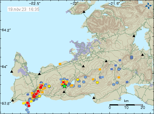
This morning an earthquake with magnitude of Mw3,7 took place in Krýsuvík-Trölladyngja volcano. This earthquake was felt in Reykjavík area. This earthquake happens because of all the displacement that is now happening next to Grindavík town.
Daily update
This is also an update for 18. November 2023. I was trying to get a little time off from writing.
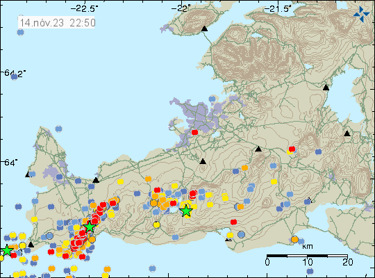
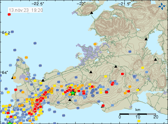
- Little has changed in last two days. Parts of Grindavík town continue to sink or rise depending on location. Most measured movements is around 25 cm last I did see. If that is correct today I am not sure.
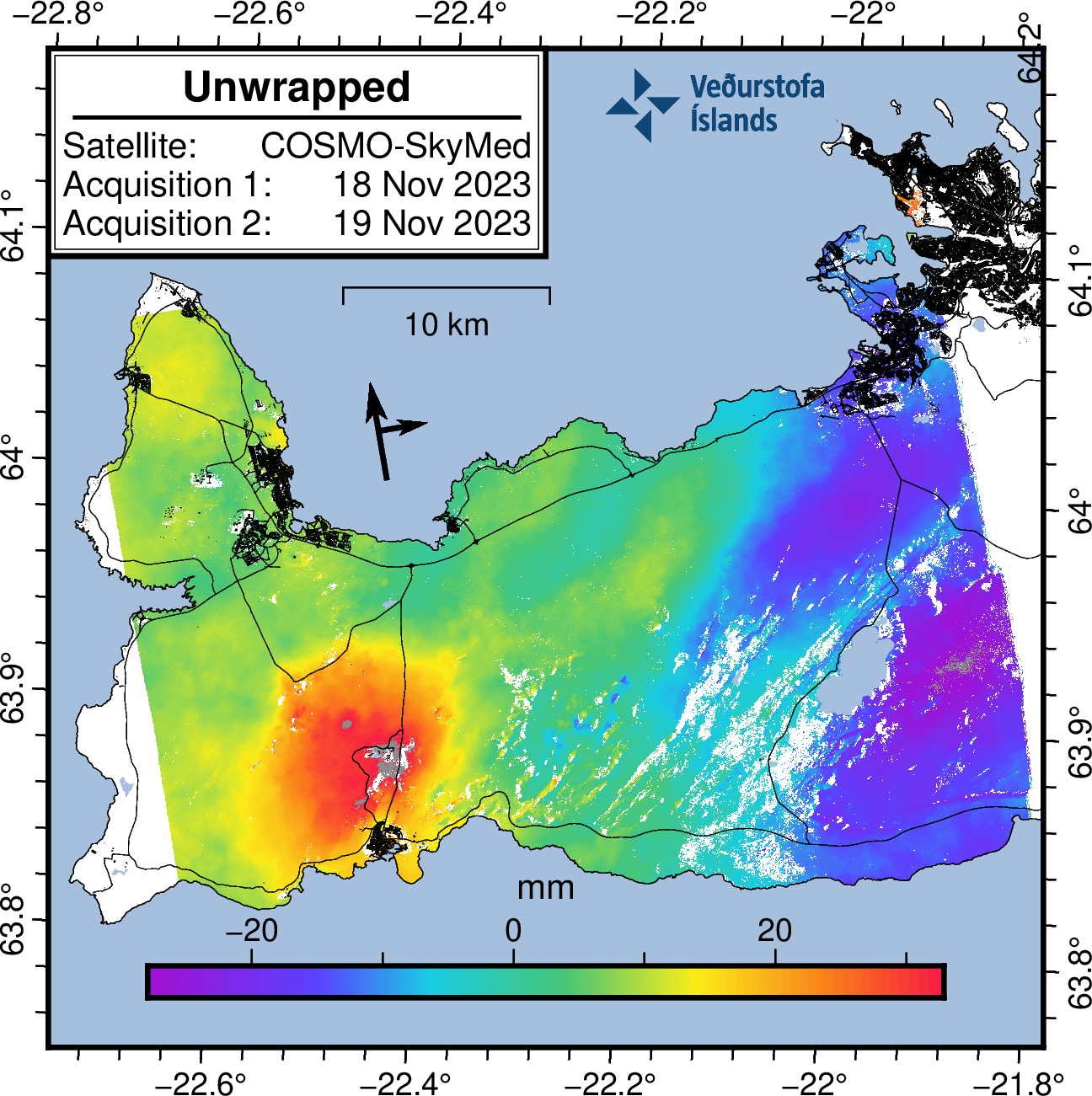
- Inflation in Svartsengi is around 130mm since Friday 10. November 2023 according to GPS measurements and satellite measurements.
- Inflow of magma into Svartsengi is estimated to be around 50m3/sec when this article is written according to the news. Inflow of magma into the dyke was 75m3/sec or more few days ago. That has possibly changed to a lower number in last few days.
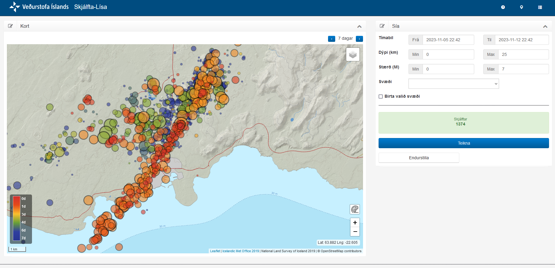
- Earthquake activity remains about the same in the dyke. Around 800 to 2000 earthquakes a day along the 15 km long dyke.
It is impossible to know when this area is going to erupt. It can take up to three to four weeks to happen. It might be a shorter time period, it is impossible to know what happens when it comes to volcanoes and dyke activity.
If anything happens. I’ll post an update quickly as I can.