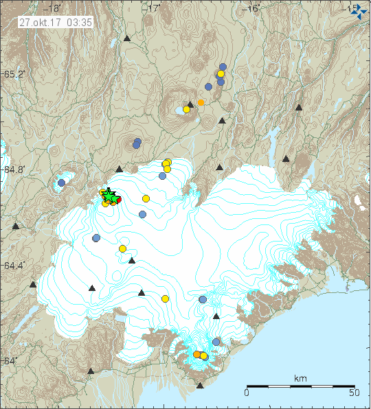
Yesterday (26-October-2017) and today (27-10-2017) two strongest earthquake took place in Báðarbunga volcano since end of the eruption in February 2015. The magnitudes of earthquakes so far are two Mw4.7, One magnitude Mw3,9 and one Mw3,2 earthquake. So far other earthquakes have been smaller in magnitude. No harmonic tremor has been detected so far, but given the location an eruption might start in other part of the caldera without warning even if the earthquake swarm activity is happening in the northern part of the Bárðarbunga volcano caldera.

The earthquake activity in Bárðarbunga volcano. Copyright of this image belongs to Icelandic Met Office.

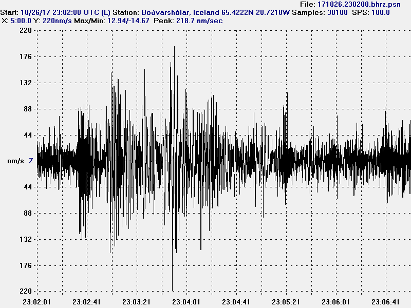
The magnitude 3,9 earthquake as it appeared on my geophone in Dellukot. This image is under Creative Commons Licence, please see CC licence for more details.

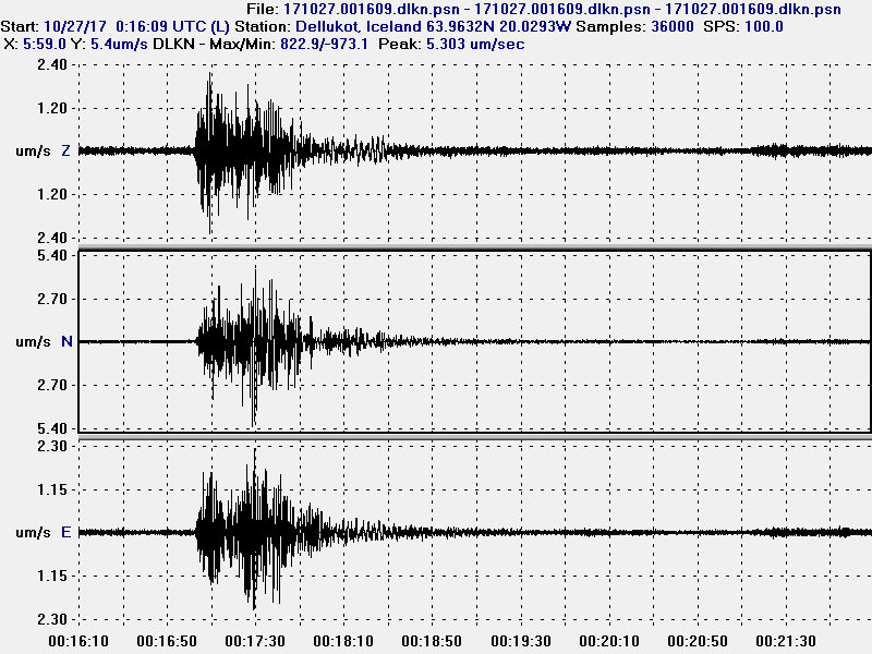
The magnitude 3,9 earthquake as it appeared on my geophone in Böðvarshólar. This image is under Creative Commons Licence, please see CC licence for more details.

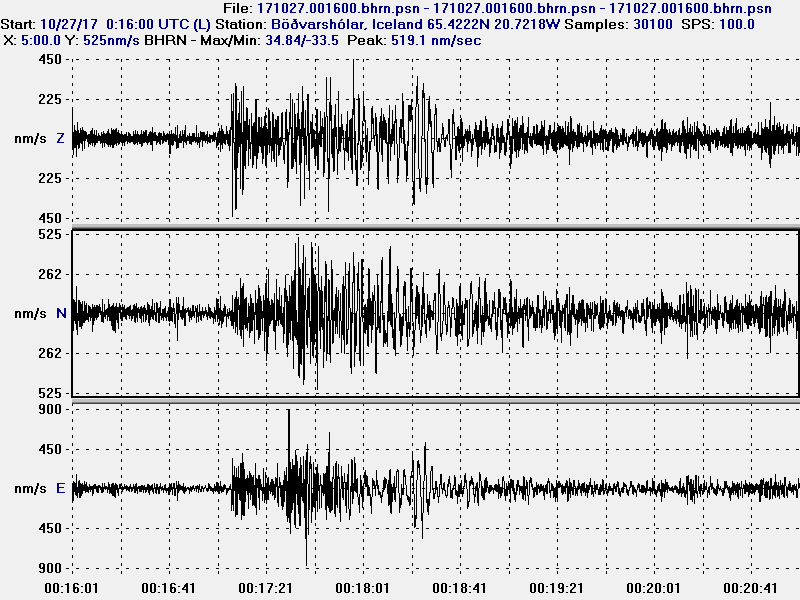
The second magnitude 4,7 earthquake as it appeared on my geophone in Dellukot. For some unknown reason (maybe bad weather) I was unable to properly record the magnitude 4,7 earthquake at 23:26 UTC. This image is under Creative Commons Licence, please see CC licence for more details.

The second magnitude 4,7 earthquake as it appeared on my geophone in Böðvarshólar. For some unknown reason (maybe bad weather) I was unable to properly record the magnitude 4,7 earthquake at 23:26 UTC. This image is under Creative Commons Licence, please see CC licence for more details.
At the moment no eruption has been detected. But this strong and increasing earthquake activity suggest that magma pressure inside Bárðarbunga volcano might be reaching critical point. If it has not reached critical point already. For the next 24 – 36 hours really bad weather is forecasted in Iceland. With wind gusts forecasted up to 45m/s in the highland and in northern Iceland. This bad weather is going to cause problems in detecting earthquakes in Bárðarbunga volcano and elsewhere.
Donations
Please remember to support my work with donations. Thanks for the support. 🙂

Hallo Jon,
look at the Seismo. Storm ? http://icelanderuptions.com/index.html
shit
it is not good, really…
Gone quiet in the Vatnajökull area now since those EQ’s last night, no other EQ’s picked up since
There’s stormy weather, which always interferes with the sensors.
http://vmkerfi.vedur.is/vatn/vdv_historical.php
Level in Austurland: Hrafnkela; V288 – Óyfirfarin gögn
Rain or Jökulhlaup ?
This is just rain. It is not possible to link to the river monitoring system directly. All links are invalided when clicked. Not sure why that is.
?? very strange
http://en.vedur.is/#tab=vatnafar
here.
Click in Jökulsa’s link
Cheers
The wind has started to drop down a little in Iceland. The worst of the storm is over in Iceland.
This is how bad the weather was in Iceland, this happened in south Iceland where wind gusts did go up to 45m/s and this house trailer got caught in one of them. The temperature in parts of Iceland reached 19C.
http://ruv.is/frett/hjolhysi-fauk-i-19-stiga-hita-vid-jokulsarlon
19 degrees Celsius? Wow, that must be extremely warm for late October?
It is but this sometimes happens in Iceland for a day during this time in October.
Hey Jon, do you think the last big earthquarke are tektonic ?
The earthquakes are tectonic in nature, mostly, as there are elements of magma in them for sure. Difficult to see, but I did notice them a little in the traces I recorded.
Ok Massive snow storm in Canada in October and your basking in 19 degrees somebody got their weather delivery mixed up!!
This happens regularly in Iceland during the winter times. Hot air from the Azores islands gets pulled up to Iceland with a storm system or for some other reason to Iceland resulting in a change of temperature that is often in the range of 30 degrees (Celsius). It is common to have -10C one day and the next it is 15C or something close to it. The temperature also drops as fast it warmed up.
I’m currently living in Denmark so I’m not getting any of that weather. Tomorrow and on Sunday I’ll get the leftovers of this storm in Denmark with the usual wind problems that come with it.
USGS lists these as:
4.6 119km S of Akureyri, Iceland 2017-10-27 00:16:43 (UTC) 10.0 km
4.6 118km SSE of Akureyri, Iceland 2017-10-26 23:26:35 (UTC) 10.0 km
Bardur’s Mountain is waking up?
http://en.vedur.is/earthquakes-and-volcanism/articles/bigimg/2970?ListID=0
to compare with data from Bárðarbunga today.
As an amateur geologist, I wonder wether most of the lava accummulation is situated in the direction of horizontal layers underground or wether the ice cap of the Vatnajokull is being lifted up. A jokullaub is a good indication of an impending eruption, but just reporting on earthquakes doesn’t predict an eruption. Does the Bardarbunga caldera show signs of filling up? The outstream of lava in 2014-2015 corresponded to the loss in volume in de Bardarbunga caldera. Is the caldera showing signs of filling up? Are there signs of uplifting of the glacier itself? Are there signs of big cracks in the glacier? By reporting on all these things, we can learn lessons for the future on how to predict an impending eruption. Anyway, the longer the wait, the bigger the bang?
Perhaps you should read Jon’s accounts going back to the 2015 event before you post! Inflation has been steady since then.
There seems to be a possible eruption happening or starting at the north pole. Two Mw5,7 earthquakes have been recorded so far and at least one Mw5,9 or Mw6,1 earthquake happened just few moments ago.
This is under the ocean and in middle of nowhere so there is no to minimal risk of any damage.
EMSC information.
https://www.emsc-csem.org/Earthquake/earthquake.php?id=626770 (Mw5,7)
https://www.emsc-csem.org/Earthquake/earthquake.php?id=626773 (Mw5,7)
https://www.emsc-csem.org/Earthquake/earthquake.php?id=626812 (Mw6,0)
Reykjanes Ridge has been very active, also.
Bardarbunga’s instability could make it erupt like Saint Helens.
If you mean Saint Helens 1980, not likely. Or are you suggesting a Bardarbunga eruption like in 1477? It is the only known eruption of similar magnitude on record (actually more violent).
St Helens was a case of the whole flank of the volcano being blown away I don’t see that happening here, as there is so much extra weight of ice holding it down. It could be more like the type of eruption that Eya had, with loads of ash and debris though! But we saw with the last eruption, Bardarbunga could find a release miles away through a fault type event. Could be a while though.
Jon is there anyone who monitors the far north as with the USGS site it is very hard to see that area?
Part of the area is Canada along with U.S, some of it is part of Norway and the closest one is part of Russia. I don’t think there is much of any type of monitoring going on there due to how extremely remote this area is and difficult due to that reason.
The eastern side of Bardarbunga is crossed by a gigantic split.Also visible on the glacier.
In addition, the volcano is inflating.
https://2.bp.blogspot.com/-7z-Ix3NRyBk/WfM6uDvMjOI/AAAAAAAAxzg/tUewU81wIr8jBcu5khkXrcz3UbZFYPpRQCLcBGAs/s1600/landsat_Bb_20140920_1221.jpg
This is I think the dike track that formed during the Holuhraun eruption. There possibly were small eruptions in that area in the days before the big eruption in Holuhraun started.
Again some deep quakes (nearly 20 kms) on the ESE part of Barđarbunga, not strong, but deep…
Jon, that fracture compromises the stability of the volcanic complex.
It is divided from the inside outward.
Just found this:
https://uk.news.yahoo.com/iceland-apos-enormous-bardarbunga-volcano-201505236.html