
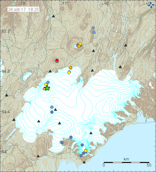
Today (24-October-2017) at 14:18 UTC a magnitude 4,1 earthquake took place in south part of the Bárðarbunga volcano caldera. Few moments later at 14:54 UTC a magnitude 3,4 earthquake took place and few other earthquakes followed.
The earthquake activity in Bárðarbunga volcano. Copyright of this image belongs to Icelandic Met Office.
What is different now is that the earthquake activity is now happening in south part of the caldera. Close to the area where deep cauldrons have appeared due to shallow magma at this location. This makes the earthquake activity at this highly interesting and possibly highly dangerous if magma has now started to push it’s way up at this location. A small eruption at this location could result in a serious glacier flood, even if such an eruption only lasted for few hours.
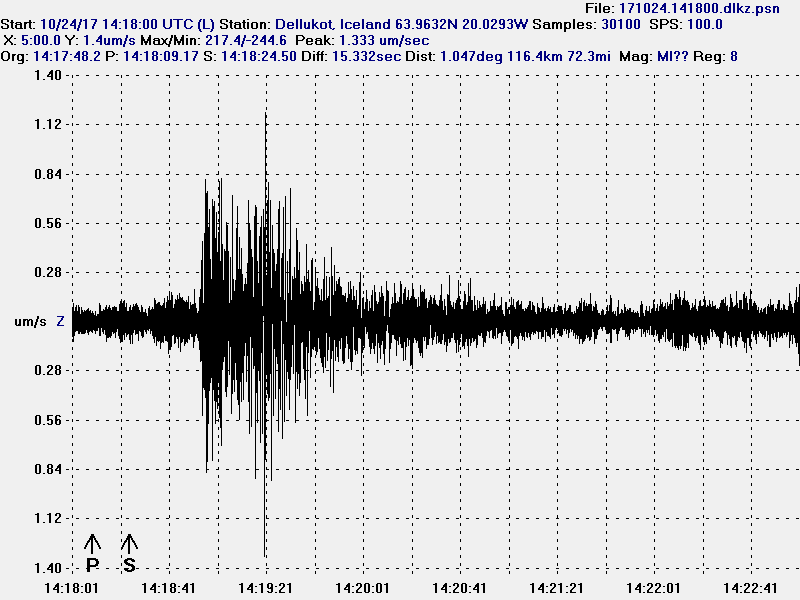
The magnitude 4,1 earthquake as it appeared on my geophone in Dellukot. This image is under Creative Commons License, please see CC License for more details.
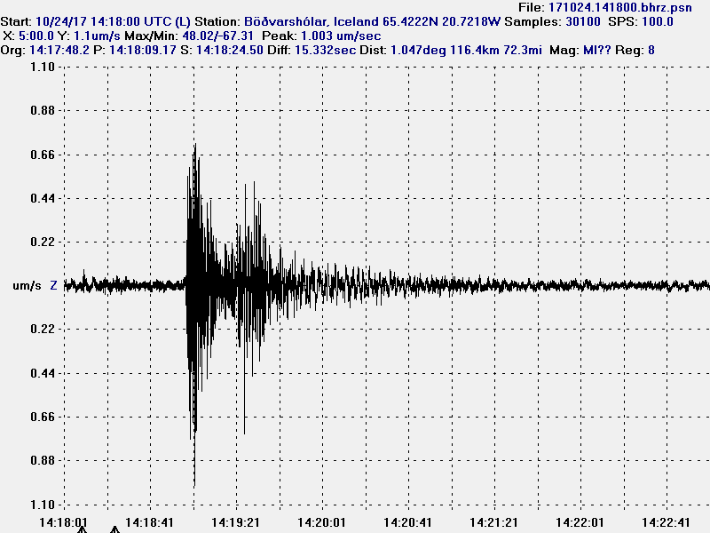
The magnitude 4,1 earthquake as it appeared on my geophone in Böðvarshólar. This trace has been filtered at 4Hz. This image is under Creative Commons License, please see CC License for more details.
It remains a question if an earthquake is going to happen in north-east part of the Báðarbunga volcano caldera in next few days. That seems to happen when a earthquakes takes place in south part of the caldera. I don’t know why that happens, it is just seems to do.
Article updated at 23:48 UTC. Text fixes.
Donations
Please remember to support my work with donations. It helps me keeping this website running and other things. Thanks for the support. 🙂
Thanks Jon been busy following a swarm of my own coast 7 quakes all between 3.3 and 3.7 roughly 250 k west of here.
Another green star coming up (at least one):
http://hraun.vedur.is/ja/alert/2017/oct/26/079.html
Make that four
So, even more coming up. That second ‘burst’ looks like it was very close to DYN station from these readings.
http://hraun.vedur.is/ja/alert/2017/oct/26/079.html
sorry wrong link. meant this:
http://hraun.vedur.is/ja/alert/2017/oct/26/082.html
3.9 and 3.1 showing atm at Bárðarbunga, low quality though for the time being
Now a 4.7
“The two M4.7 earthquakes are the biggest earthquakes since the eruption at Holuhraun ended.
Written by a specialist at 27 Oct 01:17 GMT”
-imo
Your prediction was right on Jon.
hi . there look like 2 4.7mag at different depths . one at 5km then 0.8 km
Two comments by Pyter deleted by request.
I am seeing in the harmonic tremor data something that looks like a harmonic tremor of the type seen just before the eruption in 2014. That might however just be noise from the two earthquakes that had a massive ground waves going by my geophones recordings. This means the displacement taking place in the two earthquakes was considerable going by the early data.