
For the past few weeks something has been going on in the deep ocean far north of Kolbeinsey Island. The area north of Kolbeinsey Island has been having strong earthquake swarms for several weeks now, what is creating them is less clear.
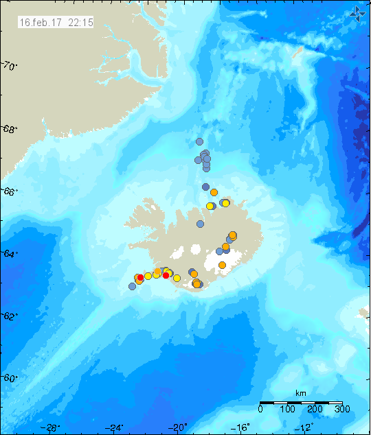
The earthquake activity north of Kolbeinsey Island (blue dots). Copyright of this image belongs to Icelandic Met Office.
All magnitudes are under-estimated at this location. I managed to record the last earthquake swarm (largest earthquakes) and it was clear by this activity that something was going on. Five earthquakes that where at least magnitude 3,2 (estimate) took place in the space of 4 – 8 minutes. This where only the earthquakes that I was able to record, distance from my geophone to this area is ~230 km at shortest distance. Making it difficult for me to record earthquakes on my simple geophone. Icelandic Met Office SIL network is not having much better luck recording earthquakes at this location, due to distance the SIL network underestimates the magnitude and location of the earthquakes has higher than normal error margins (up to several dozen of km at most).
There is a possibility that an eruption is taking place at this location now. There was a possible eruption or dyke injection at this location in October of the year 1999, the Global Volcanism Program report on that activity can be found here.
I will go offtopic, but its still related to Iceland.
I was playing around with data recetly, analysing Katla, to be specific and its underground systems, based on seismic data. The most unusual thing that I could find is thi: An area of earthquakes in a ring formation, spanning fron around 8-10km down to around 18-20km.
http://shrani.si/f/3q/iz/10ejGrGX/area.png
Yes, that is Katla. And it might be a ring fault, but I dont know. Given its other characteristics, this could very well be the secondary (deeper) magma reservoir under Katla.
This feature or shape is not evident in the 1999-2010 period. It appeared, (or at least became noticeable), in the 2011-2016 period. It coincided with the deep dike intrusions, or with a little delay, which got me thinking it might be a magma body there, with earthquakes on the wall of this body as the strain increases as the new magma might enter into the system. It is around 8-10km to 18-20km deep, which is where it was estimated a magma body should be, based on petrology studies (Budd, D. A., V. R. Troll, B. Dahren, and S. Burchardt (2016)).
This was said from the study (Quote):
“To characterize Katla’s recent plumbing system, we established mineral-melt equilibrium crystallisation pressures from four age-constrained Katla tephras spanning from 8 kyr BP to 1918. The results point to persistent shallow- (≤8 km depth) as well as deep-crustal (ca. 10 – 25 km depth) magma storage beneath Katla throughout the last 8 kyr. The presence of multiple magma storage regions implies that mafic magma from the deeper reservoir system may become gas-rich during ascent and storage in the shallow crust and erupt explosively. Alternatively, it might intersect evolved magma pockets in the shallow-level storage region, and so increase the potential for explosive mixed-magma ash eruptions.”
It was not determined at what location it might be, but just the depth, so this is one of the possibilities.
Looking at the caldera, there are some main areas:
The blue line is the fissure area of the 1755 eruption.
The red square is the area of activity in 2011 and also in the past 2 years with the stars (the M3+ quakes). Note that M3+ quakes also appeared on the 1755 fissure and also on the east caldera seismic area (white ellipse), which is where I also see the potential next eruption site down the line. This east area and the red square area, are also the two areas where there are evident EQ stacks right down to this anomaly, so it might be a vent formation or an old vent with water running down and causing the hydro-thermal earthquakes. There are many possibilities.
Yellow star is the 1918/1823 eruption site, and the pink star is the area of 1955 possible subglacial eruption.
Pink ellipse is the outline of the ring of earthquakes, or the anomaly from the past years.
The yellow line is another ring-like area of earthquakes, but it is around 2-4km deep, and was present also in the 1999-2010 dataset.
http://shrani.si/f/1s/t6/E436FiW/dda.png
Looking at the bedrock topography (Katla without ice), there does not seem to be an initial connection of the ring anomaly with surface features, excrpt for some shape similarity with the caldera rim on the south-east side.
http://shrani.si/f/7/qL/3hhMvDYY/snip20160929131755-1.png
Its fairly easy to say that there is much more at Katla than meets the eye. Or at least what we can see on the official simple plots from IMO. That is why I decided to start making my own plots in HD and 3D, which can really reveal things that are usually not seen simply.
I have also wrote an email about this subject to 3 people that are respected professionals in this area, P. Einarsson, T. Thordarson and M.T. Gudmundsson.
I am expecting repies from at least one,to see if this is a know feature at Katla or something new, since this did appear in recent years, but they have better data than me.
Will keep you informed.
Best regards,
Andrew
Very good and informing essay on Katla, Andrew! It’s excites to see what happens next!
Kind regards
Henk Weijerstrass
Holland
You might want to add Ármann Höskuldsson to that list; he did a lot of work at the Holuhraun eruption.
What’s on that spot with a lot of earthquakes? Can’t remember seeing so many earthquakes on that spot…
This is the volcano cone Presthnjúkur, it’s a vent from the volcano in South part of Langjökull glacier. Last eruption took place in the year 3350 BCE. This appears to be just a normal earthquake activity for this area, but I’m waiting to see if this develops any further before I write an article about it.
Details: https://volcano.si.edu/volcano.cfm?vn=371070
Ok, thanks!
Thanks Jon. One note I found said that the last eruption of Presthnjúkur was in 900 BC so if there was one at that time and before it was the 3350 BC then could we be looking at some kind of event there, one could almost say its a few hundred years overdue if its history was any factor?
Wrong article? The article on the earthquake activity close to Herðbreið/Presthnjúkar is the next article.