Strong earthquake swarm north of Kolbeinsey island [Updated]

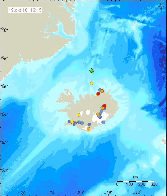
Today (14. February 2023) at 01:24 UTC an earthquake swarm started around 70 to 90 km north of Kolbeinsey island. It might be in Kolbeinsey island. Largest earthquakes recorded at the writing of this article had a magnitude of Mw3,5 according to Icelandic Met Office. EMSC is reporting two earthquakes with magnitude of mb4,5 at the writing of this article.

Two green stars far north of Iceland in the ocean. Showing the location of the earthquakes north of Kolbeinsey island. This is all view map of Iceland and shows all the other earthquakes that have taken place in Iceland for the last 48 hours.
Earthquake activity north of Kolbeinsey island. Copyright of this image belongs to Icelandic Met Office.

Distance from land makes it difficult for the SIL network that Icelandic Met Office runs to detect the smallest earthquakes. This means there can be a lot more going on that appears on earthquake maps. There’s always a chance of stronger earthquakes in this area north of Iceland.

Update
Update at 16:50 UTC on 14. February 2023

Icelandic Met Office has finished reviewing the earthquake activity north of Kolbeinsey and around eight earthquakes with magnitude above Mw3,0 took place. Largest earthquake had a magnitude of mb4,6 according to EMSC. Information about that earthquake can be found here.

Ten green stars far north of Iceland showing the earthquake activity north of Kolbeinsey island. Other earthquakes that also happen in Iceland are visible on this map.
Earthquake activity far north of Iceland. Copyright of this image belongs to Icelandic Met Office.

This earthquake activity appears to be over, but distance from seismic detection networks in Iceland prevents detection of smaller earthquakes that might be happening at this location.

Earthquake swarm north of Kolbeinsey island

This morning (5-March-2022) an earthquake swarm started north of Kolbeinsey island. Three earthquakes with magnitude above Mw3,0 took place in this swarm and there where few smaller earthquakes recorded. Because of distance from the SIL network only the strongest earthquakes have been detected.

Green stars on the top of the map showing the location of the earthquake swarm. Few orange dots showing smaller earthquakes
Green starts show the location of the earthquake swarm in Kolbeinsey island. Copyright of this image belongs to Icelandic Met Office.

The strongest earthquakes with magnitude of Mw3,1 and Mw3,2. There is still a chance of stronger earthquakes in this area. It is unclear what is going on because this area is remote and under the ocean. If an eruption happens at this location there is a chance it won’t be noticed or just noticed on SIL seismometers.

More earthquakes far north of Kolbeinsey island

This morning (15-April-2021) more earthquakes where recorded far north of Kolbeinsey island. This activity is probably outside of Kolbeinsey ridge but I don’t know the name for this part of the north Atlantic ride. Largest earthquake took place at 09:29 UTC and had a magnitude of mb4,4 according to EMSC. Information about the earthquake can be found here.

Green stars out in the ocean where strong earthquake activity is happening
Earthquake activity far north of Kolbeinsey island. Copyright of this image belongs to Icelandic Met Office.

It is not possible to know what is going on at this location. It is extremely remote and under 2 to 4 km deep ocean. If anything more happens at this location it is only going to be detected by seismometers.

Earthquake swarm far north of Kolbeinsey island

Early morning (14-April-2021) an earthquake swarm took place far north of Kolbeinsey island. Largest recorded earthquake had a magnitude of Mw3,5 but it possibly was larger but because of distance from the SIL network the magnitude is underestimated. I did record this earthquake on my only seismometers and it showed a lot of surface wave activity, suggesting a larger magnitude than Mw3,5.

Green stars far north of Iceland that show the loaction of the earthquake swarm out in the ocean
The earthquake swarm far north of Iceland. Copyright of this image belongs to Icelandic Met Office.

Because of remote location of this earthquake swarm it is not possible to know what is going on there. The area is also under an ocean that is 2 to 4 km deep at this location. If anything happens it is not going to be noticed outside of being detected with seismometers.

Donations

If you want to support my work it is possible to do so with the donation button or regular donations option. Thanks for the support. 🙂

Earthquake in Kolbeinsey island

Yesterday (24-January-2021) at 09:16 UTC an earthquake with magnitude Mw3,1 took place in Kolbeinsey island. Two unconfirmed earthquakes with magnitude of Mw2,5 and Mw2,6 took place at 17:37 UTC and 19:06 UTC.

Green star at the edge of the image shows the location of Mw3,1 earthquake of Kolbeinsey island
Earthquake in Kolbeinsey island shown by the green star. Copyright of this image belongs to Icelandic Met Office.

The area is remote and it is difficult to know if there has been any more earthquake activity there. There is also a storm going on and has been going on for last several days and that limits detection of small and remote earthquakes in Iceland.

Earthquake swarm around 42 km north of Kolbeinsey island

During the night of 3-September-2020 an earthquake swarm took place around 42 km to 50 km north of Kolbeinsey island. Because of distance from the SIL network the earthquakes that where detected do not have accurate location or magnitude.


Earthquake activity north of Kolbeinsey Island (green stars). Image used with permission and copyright belongs to Icelandic Met Office.

This might just be regular earthquake activity that happens on the Kolbeinsey ridge or in Kolbeinsey island. This area is all under a deep ocean and that makes it impossible to know for sure what is going on at this location.

Magnitude Mw3,3 earthquake on the Reykjanes ridge

Today (24-January-2020) at 05:04 UTC an earthquake took place on the Reykjanes ridge. This earthquake had a magnitude of Mw3,3. This earthquake is as far away as the SIL network can detected earthquake activity in any good way and that might explain why there has not been any record of other earthquakes in this area.


The green star on the far left is the Mw3,3 earthquake. Copyright of this image belongs to Icelandic Met Office.

There has been a lot of earthquake activity on the Reykjanes ridge in January 2020. I don’t know if that trend is going to continue or not.

Donations

Please remember to support my work with donations. Thanks and thanks for the support. 🙂

Earthquake swarm north of Kolbeinsey island

Yesterday (22-May-2019) at 15:47 UTC a magnitude 3,4 earthquake took place around 12 km north of Kolbeinsey Island. This earthquake was part of a small swarm in this area yesterday. It appears to be over but there is a risk of more activity in this area. Due to distance from the coastline and next populated island this earthquake was not felt.


Earthquake north of Kolbeinsey island (green star north of Iceland). Copyright of this image belongs to Icelandic Met Office.

Earthquake swarms happen in this area frequently. This is not part of the TFZ but borders it just a little south of this earthquake activity.

Donations

Please remember to support my work with donations. They help me to keep everything going. Thanks for the support. 🙂

Added

If you donate with a bank please update your information. I have changed the bank information again in April and the new information can be found here. The Icelandic bank account that I have been using is going to be closed soon.

Personal note

I have added a personal note on what is going on with me in the comments. It explains why I changed my mind on moving back to Denmark and other issues that I’ve been dealing with in recent months.

Updated at 13:45 UTC. Added updated information about bank donations.
Updated at 14:11 UTC. Added updated information about bank donations.

Earthquake swarm north of Kolbeinsey island

Today (19-October-2018) a earthquake swarm took place north of Kolbeinsey island. Due to distance from the SIL network only the largest earthquakes are being recorded.


Earthquake swarm north of Kolbeinsey island (green star). Copyright of this image belongs to Icelandic Met Office.

Largest earthquake detected so far has a magnitude of 3,3 and the second largest has a magnitude of 3,0. Other earthquakes that are being detected are smaller in magnitude but all are over 2,5 in magnitude. The sensitivity of the SIL network isn’t good this far from the coastline. It is unclear if this earthquake swarm is ongoing or not.

Donations

Please remember to support my work with donations. Thanks for the support. 🙂

Strong earthquake swarm 88 – 90 km north of Kolbeinsey Island yesterday (8-September-2018)

Yesterday (8-September-2018) there was a strong earthquake swarm 88 to 90 km north of Kolbeinsey Island. Due to distance from the SIL network it is impossible to know how large and strong this earthquake swarm actually was. Largest earthquake reported by Icelandic Met Office had a magnitude of 3,3. Total of ten earthquakes with magnitude 3,0 or larger happened during this earthquake swarm.


Earthquake activity north of Kolbeinsey Island (green stars). Copyright of this image belongs to Icelandic Met Office.

Total around 30 earthquakes were detected but it can be assumed that total number of earthquakes might have been higher. At the distance from the SIL network smaller earthquakes are not detected. It is not possible to know for sure what is happening at this location due to distance from the coast and the SIL network.

Donations

Please remember to support my work with donations. Thanks for your support. 🙂