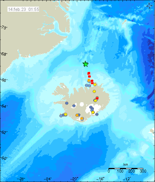
Today (14. February 2023) at 01:24 UTC an earthquake swarm started around 70 to 90 km north of Kolbeinsey island. It might be in Kolbeinsey island. Largest earthquakes recorded at the writing of this article had a magnitude of Mw3,5 according to Icelandic Met Office. EMSC is reporting two earthquakes with magnitude of mb4,5 at the writing of this article.

Distance from land makes it difficult for the SIL network that Icelandic Met Office runs to detect the smallest earthquakes. This means there can be a lot more going on that appears on earthquake maps. There’s always a chance of stronger earthquakes in this area north of Iceland.
Update
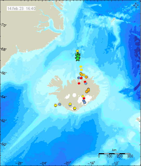
Update at 16:50 UTC on 14. February 2023
Icelandic Met Office has finished reviewing the earthquake activity north of Kolbeinsey and around eight earthquakes with magnitude above Mw3,0 took place. Largest earthquake had a magnitude of mb4,6 according to EMSC. Information about that earthquake can be found here.

This earthquake activity appears to be over, but distance from seismic detection networks in Iceland prevents detection of smaller earthquakes that might be happening at this location.

Hi Jon the USGS has listed these for Iceland area
Monday
13.02.2023 05:45:16 PM 67.801 18.597 10.0 km 4.6 USGS 184 km N of Siglufjörður, Iceland
Monday
13.02.2023 05:43:02 PM 67.613 18.673 10.0 km 4.5 USGS 163 km N of Siglufjörður, Iceland
Monday
13.02.2023 05:31:53 PM 67.541 18.435 10.0 km 4.5 USGS 156 km N of Siglufjörður, Iceland
Might help for info on Kolbeinsey , just a thought
Thanks. This is also what EMSC was showing.