
Today (18-June-2014) at 10:20 UTC a magnitude 3,2 earthquake took place in Katla volcano caldera. A swarm of smaller earthquakes did happen after the main event. Depth of the main earthquake was 2,5 km.
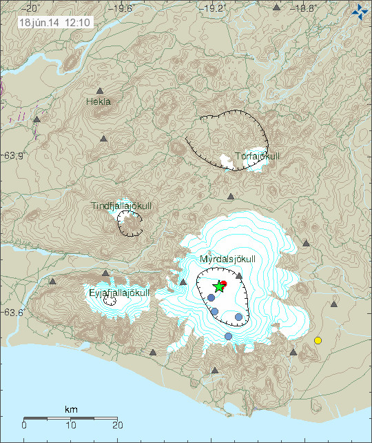
The magnitude 3,1 earthquake in Katla volcano. Copyright of this image belongs to Icelandic Meteorological Office.
Following this earthquake few minor earthquakes appeared. None of them had a magnitude above 1,0. So far things remain quiet in Katla volcano and it is difficult to know for sure if this is something more than just summer earthquake activity in Katla volcano. I am at least going to keep an eye out for activity in Katla volcano.
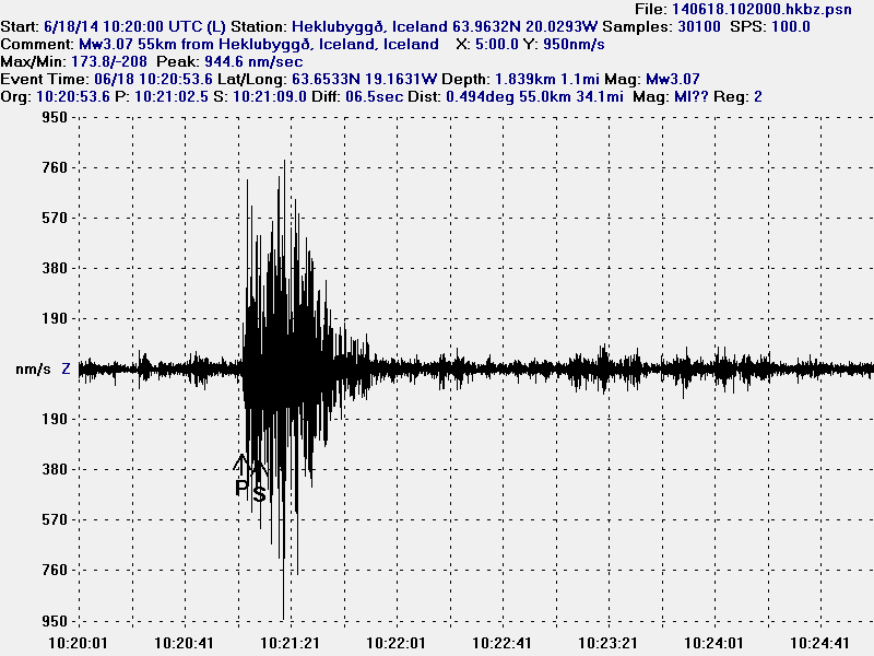
The magnitude 3,1 earthquake as it did appear on my geophone in Heklubyggð. This image is under Creative Commons Licence. Please see CC Licence page for more details.
Donations: Please remember to donate. Donations help me keep working and writing about earthquake activity in Iceland and Europe. Thanks for the support.
Post updated at 14:45 UTC.
Hi,
I have been following your website for several years. I live in Philadelphia in USA. I am a causal observer of Icelandic volcanism. From time to time, I look at the Mila cams because they are so beautiful. Today, the Katla cam image is jumping all around, wind or seismic energy I don’t know. The cam image gives the appearance of a glacial
flood about a quarter the way from the left but it is impossible to see for certain as it may just been fog.
There is no eruption in Katla volcano. So this is just strong wind with clouds above Mýrdalsjökull glacier. There is also no unusual activity in the rivers from Mýrdalsjökull glacier.
You can check on the river and earthquake activity in the link below.
http://en.vedur.is/#tab=vatnafar