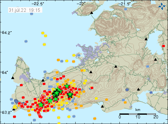
Today (31-July-2022) at 17:48 UTC an earthquake with magnitude of Mw5,4 took place 3,2 km east of Grindavík town. This earthquake was felt over a wide area of Iceland and all the way to Westfjörd in few towns that are there. Damage has been reported in Grindavík town, with cold water main breaking and damage to house items, damages to houses is unclear at the writing of this article. New news reports show that items in grocery stores have been thrown out of their shelf.

This earthquake is a fault earthquake and as such not directly connected to a magma movement in Fagradalsfjall mountain, however, the magma movement in Fagradalsfjall mountain is the engine that makes this earthquake possible in this location. There is a chance that two magnitude Mw5,4 earthquakes took place at the same time east of Grindavík town. This was mentioned in Rúv news about the earthquake, such earthquakes are a lot more complicated and harder to get correct magnitude for. More earthquakes like this can be expected in this area or closer to Reykjavík city at any time without warning.
