This is a short update. I am still a little sick (sigh) so it’s a bit hard for me to work properly.
Information here is going to get outdated quickly and without warning.
Few short points on current activity in Bárðarbunga volcano.
- Earthquake activity is high today (22-August-2014). There is less earthquake activity today than was yesterday (21-August-2014).
- Dyke formation continues at depth of 5 to 10 km. The push north seems to have stopped or slowed. Currently it is estimated that the dyke is getting wider. There also less resistance in the crust (appears to be), leading to fewer earthquakes taking place. This dyke is now estimated to be 25 km long.
- Bárðarbunga caldera appears to have given away due to less magma holding it up. As magma has flowed into the dyke. It is now estimated that 200 million m³ of magma has flowed into the dyke.
- Inflation so far is 20 cm according to news on Rúv with information from Icelandic Met Office.
- So far around 5000 earthquakes have been recorded since this activity started on 16-August-2014.
There are also signs that this might be a start of a new eruption cycle for Bárðarbunga volcano. Not all events in this cycle are going to lead to an eruption. This is the same pattern as took place in Krafla volcano during it’s eruption cycle [Wikipedia information, University of Iceland information]. It remains to be seen if this idea is true in part or whole.
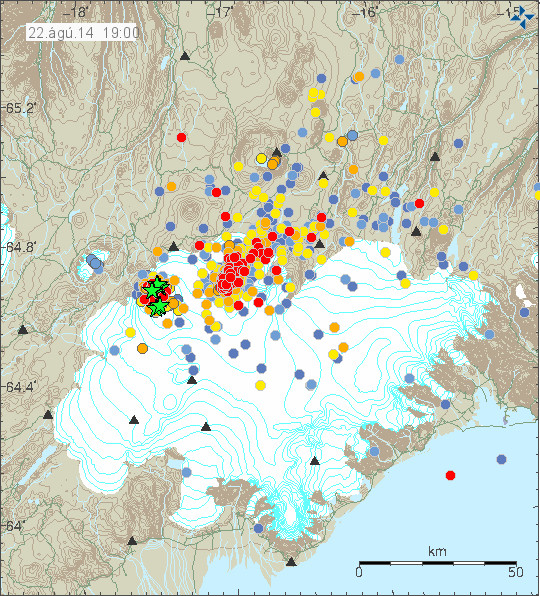
There is less earthquake activity today then yesterday. Copyright of this image belongs to Icelandic Meteorological Office.
Earthquake activity remains stable, it goes up and down and currently there has been less activity then yesterday (21-August-2014).

Less earthquake activity clearly shows on IMO earthquake graph. Copyright of this image belongs to Icelandic Meteorological Office.
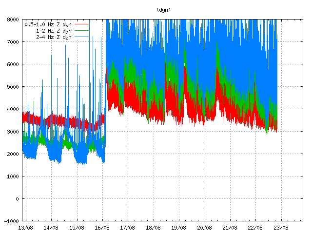
Harmonic tremor remains high even during less earthquake activity. The high harmonic tremor is most likely taking place due to magma inflow under ground. It does not appear to be connected with earthquake activity (for most part). Copyright of this image belongs to Icelandic Meteorological Office.
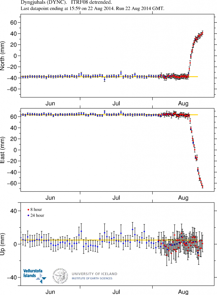
GPS data clearly shows the inflation that has been taking place in Bárðarbunga volcano. Inflation to the north has slowed down, while inflation to the west continues. More GPS information can be found here. Copyright of this image belongs to University of Iceland.
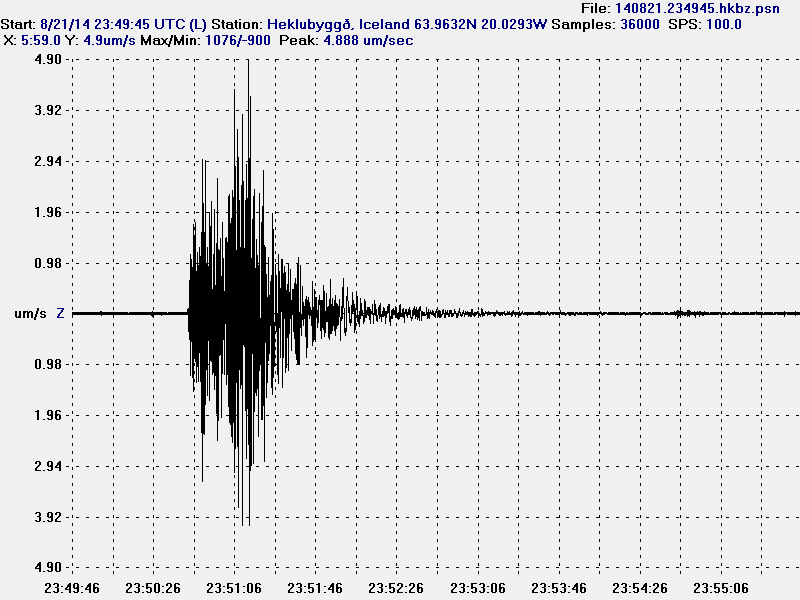
The magnitude 4,7 earthquake as it appeared on my geophone in Heklubyggð. This image is released under Creative Commons Licence. Please see CC Licence page for more details.
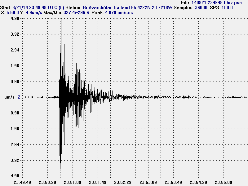
The magnitude 4,7 earthquake as it appeared on my geophone in Böðvarshólar. This image is released under Creative Commons Licence. Please see CC Licence page for more details.
Largest earthquake so far is an magnitude 4,7 earthquake (EMSC information here) that took place yesterday (21-August-2014). A magnitude 4,3 earthquake (EMSC information here) took place today (22-August-2014) at 15:41. This strong earthquakes happened due to the lowering of the caldera as explained above. If the dyke intrusion continues, more earthquakes are going to start happening. It is not known how much magma, if any is coming from depth (mantle depth) at current time with lack of deep earthquakes in all this activity, it is impossible to know if any magma is coming up from the mantle.
News in English
Met Office: 25 km long dike formed (Rúv.is)
Strongest earthquake yet in Bardarbunga (Rúv.is)
Updated at 21:17 UTC.
Updated at 21:19 UTC.
Updated at 21:41 UTC.
Updated at 23:22 UTC.
