This is a update on the activity in Bárðarbunga volcano. This information might get outdated quickly as things change.
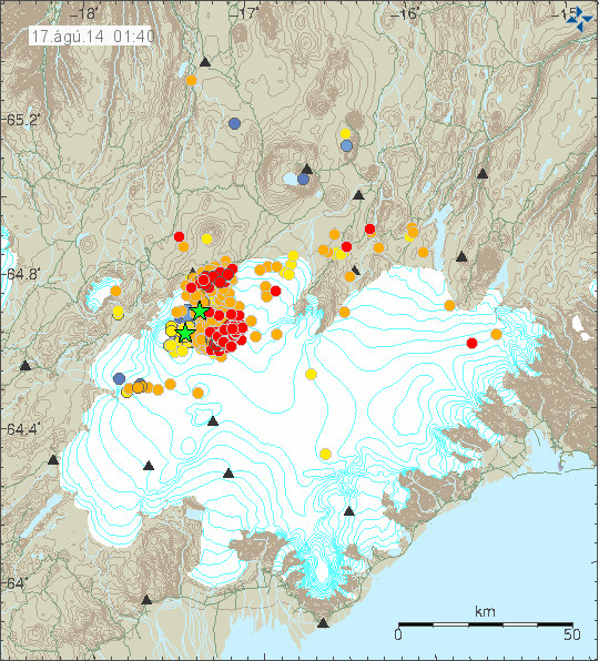
Earthquake activity continues in Bárðarbunga volcano with no signs of stopping. Since midnight the total earthquake count for Iceland has now reached 578 (at 18:14 UTC) this number gets outdated quickly due the continuous earthquake activity in Bárðarbunga volcano. The total amount of earthquakes recorded yesterday was around 480 for the whole day, so it seems that earthquake activity has increased today from what it was yesterday. It is possible to see the largest earthquakes on my geophone website here. I want to note that my geophones are both more then 100 km away from Bárðarbunga volcano, so only the largest earthquakes appear on my geophones.
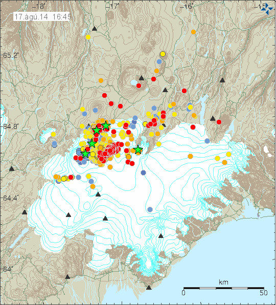
The earthquake activity in Bárðarbunga volcano. It has now moved into two groups of activity. Copyright of this image belongs to Icelandic Met Office.
The earthquakes are forming an line south-south-east in Bárðarbungu volcano. I don’t know why that is, but this might be a feature of the SIL network, rather then actual alignment of the earthquakes. There also chance that the earthquakes really are aligning them self into a line like this.

Earthquake activity continues to be dense. A minor drop in activity was seen around 12:00 UTC, but it increased again around 13:00 UTC. Copyright of this image belongs to Icelandic Met Office.
There has been little drop in activity, besides the drop in activity seen around 12:00 UTC, that drop in activity however only lasted for about one hour, maybe less. There has overall not been much change in activity during the past 24 hours. I don’t know if that is going to change, but for the moment there are no signs of the activity slowing down.
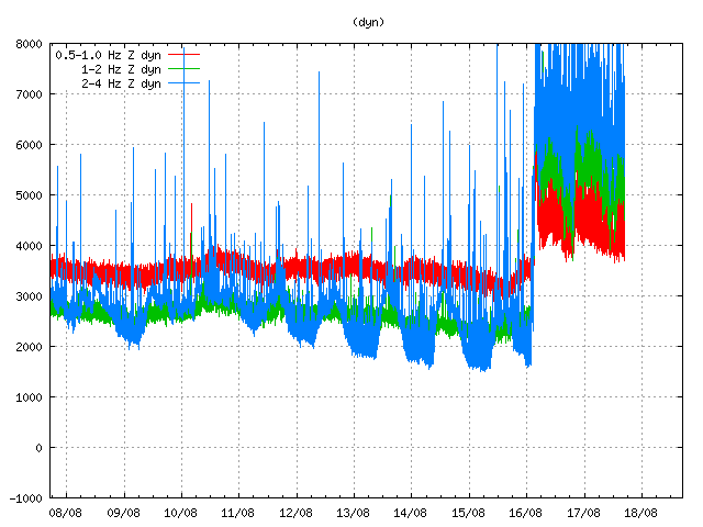
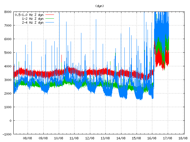
Harmonic tremor at Dyngjuhálsi SIL station. It moves up and down with the earthquake activity. Copyright of this image belongs to Icelandic Met Office.
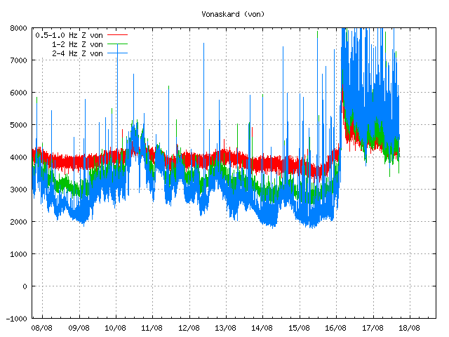
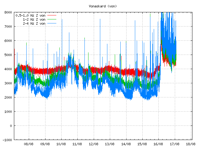
Harmonic tremor at Vonaskarð SIL station. It shows the changes in activity as other SIL stations around Bárðarbunga volcano. Copyright of this image belongs to Icelandic Met Office.
There are interesting theories on why the harmonic tremor is as it is. Currently there is nothing to suggest that an large eruption has taken place, there is a chance that a small eruption started all this, but I expect by now that it is over if it took place. It has not been confirmed. There is also a chance that earthquake activity is so high in Bárðarbunga volcano that it is registering as continuous harmonic tremor. It does not happen often, but it can happen. There is also chance that the harmonic tremor is due to boiling of hydrothermal systems in Bárðarbunga volcano, or something other related to magma under heavy pressure. Whatever the reason for this tremor, it’s there and an eruption does not seems to be the reason behind it.
Visual observations have now been made of Bárðarbunga volcano and nothing has been seen on the surface of the glacier. Scientists are also installing new monitoring hardware and a web-camera on Bárðarbunga volcano in order to get proper visual observations of the volcano when something happens. I don’t expect the web-camera to be a public at the moment.

