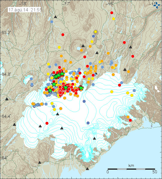
This is short update on Bárðarbunga volcano. Due to ever changing nature of this events this information is going to get outdated quickly.
Icelandic Met Office has moved the warning level for air traffic up to Orange level (see here). GPS measurement have confirmed magma movements inside Bárðarbunga volcano and this movement is fast.
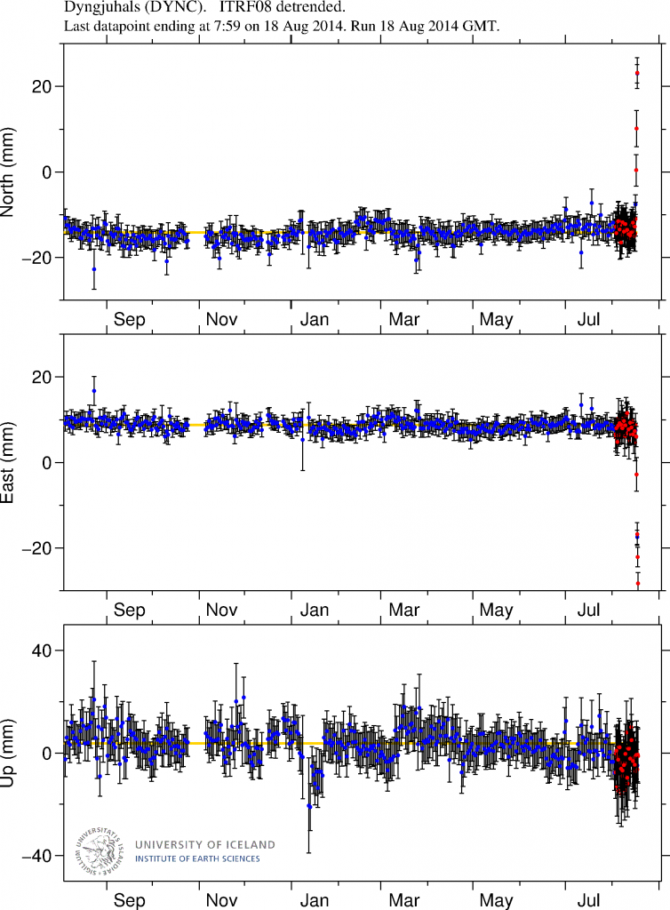
GPS data from University of Iceland. This data shows how fast the change has been in the past few days. More GPS data can be found here. Copyright of this image belongs to University of Iceland.
Earthquake activity has remained about the same, with regular fluctuation in activity. Overall however the activity has remained constant.
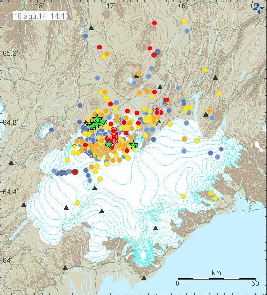
The earthquake activity in Bárðarbunga volcano. Copyright of this image belongs to Icelandic Met Office.
The earthquake activity in Bárðarbunga volcano has been migrating to the north-east over the past 10 to 18 hours. The activity close to Dyngjuháls appears to be stable at that location for the moment. Earthquake activity in other parts of Bárðarbunga have quieted down for the moment, that might change without warning.

Earthquake activity has remained stable in Bárðarbunga volcano. Copyright of this image belongs to Icelandic Met Office.
Harmonic tremor levels have remained stable since this started. They do drop a little in sync with the drop in earthquake activity.
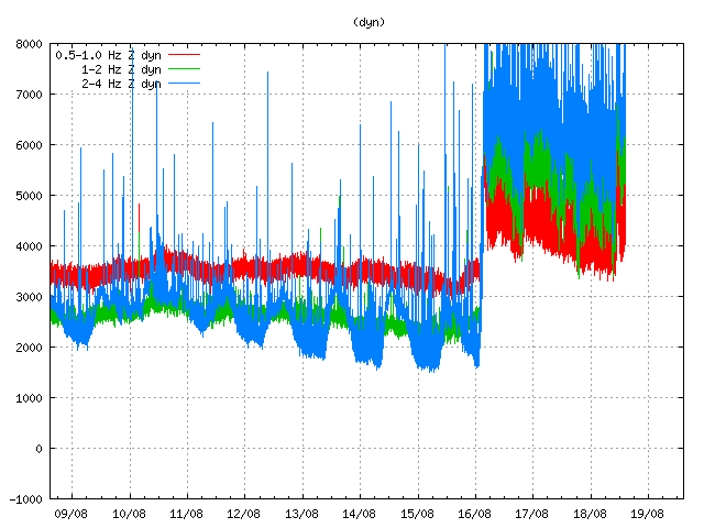
The harmonic tremor at Dyngjuháls SIL station. Copyright of this image belongs to Icelandic Met Office.
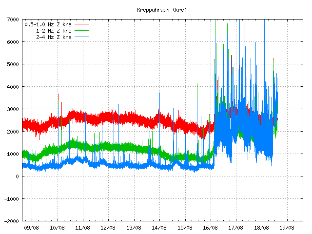
Kreppuhaun SIL station shows the harmonic tremor also. Along with interesting jump in the past hour of harmonic tremor activity. I am not sure why that is. Copyright of this image belongs to Icelandic Met Office.
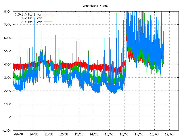
Vonaskarð SIL stations shows pattern that is close to what appears on Kreppuhraun SIL station. Copyright of this image belongs to Icelandic Met Office.
I am not sure why the harmonic tremor levels are what they are at the moment. Since no eruption has started. This might be due to changes in hydro-thermal areas under the glacier, or there might be some other reason for this that is not known to me.
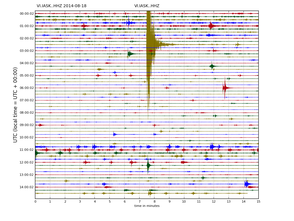
Drum plot that Icelandic Met Office has on-line are showing interesting activity. Around 11:00 UTC there is a string of earthquakes, following this activity a increase in harmonic tremor takes place. Copyright of this image belongs to Icelandic Met Office.
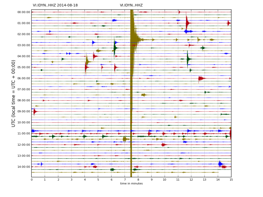
This can also be seen on Dyngjuháls SIL station. Copyright of this image belongs to Icelandic Met Office.

This also appears clearly on Kreppuhraun SIL station. Copyright of this image belongs to Icelandic Met Office.
As for amount of earthquake detected today, so far the amount recorded today is around the same as yesterday, might even be slightly higher.
Updated at 16:43 UTC.

