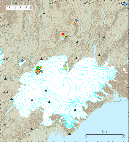
On 27-Oktober-2016 at 02:08 & 02:09 UTC an magnitude 3,5 and 3,3 took place in Bárðarbunga volcano. During the day several smaller earthquakes happened in the same place in the Bárðarbunga volcano (close to North-East of the caldera).
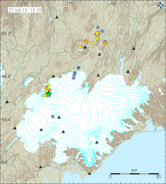
The earthquake activity in Bárðarbunga volcano. Copyright of this image belongs to Icelandic Met Office.
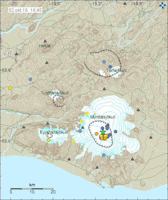
Currently Bárðarbunga volcano is inflating with fresh magma from deep mantle. This process started in September-2015 and is going to continue until a new eruption starts from Bárðarbunga volcano (or in Bárðarbunga volcano).
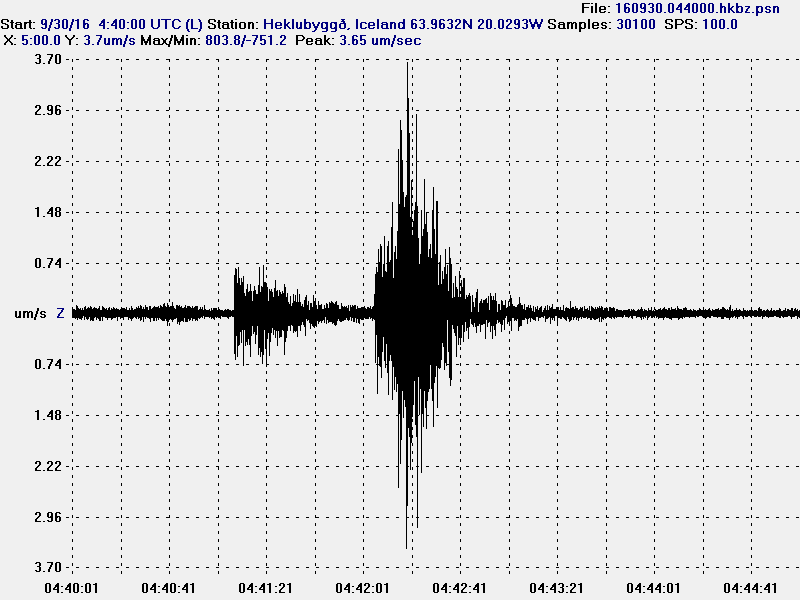
Italy earthquakes
Since I’m living in Denmark I did record the earthquakes in Italy. I did record the magnitude 5,5 earthquake (poorly) and the magnitude 6,1 earthquake (clearly).
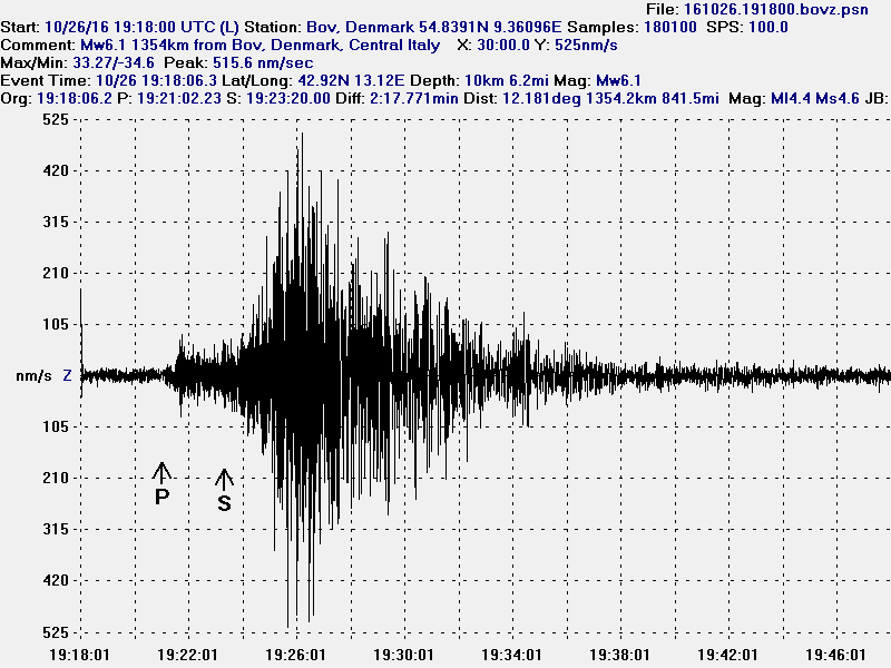
The earthquake in Italy, this is the magnitude 6,1 earthquake. This image is under Creative Commons licence, please see CC Licence for more details.
I can record those earthquakes in Denmark since the distance is only ~1500 km. The minimum magnitude for my hardware to record earthquakes at this distance is around magnitude 5,4. Due to high background noise where I live.
Laptop and other hardware issues
Since I never got the laptop I was promised (It never showed up in the mail) I might not have any computer in December when I go to Iceland. I might resort to buying a new laptop with a loan from a store I know of. If I do that, I’ll go for a cheap laptop (that is also best, since I only use them when I travel). I also did not get a used hard drive that I promised and other hardware, the persons that told me that they wanted to donate that hardware to me just vanished and have not contacted me again over that. I have gotten hardware donations in the past and that is not a issue to get them if they are sent with the mail from within the EU.
Donations
Please remember to donate. I have to pay a high electric bill next month due to problem they had for the past six months. At least they gave me a discount (I think) since it was entirely their fault. Yet that is going to leave me rather broke in November. Thanks for the support. 🙂