This is a short update on Bárðarbunga volcano. Due to the fast change that is now taking place in Bárðarbunga volcano this information is going to get outdated quickly.
- Earthquake activity now is extremely dense. With 3 to 5 earthquakes taking place every second (best estimate that I have made).
- Earthquakes have increased in magnitude.
- General activity appears to have increased in Bárðarbunga volcano. Even if no major eruption has yet taken place.
- There is currently no signs of this activity stopping any time soon.
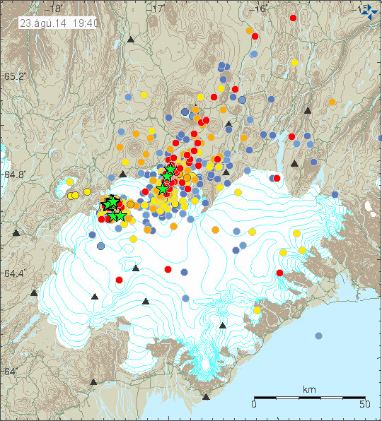
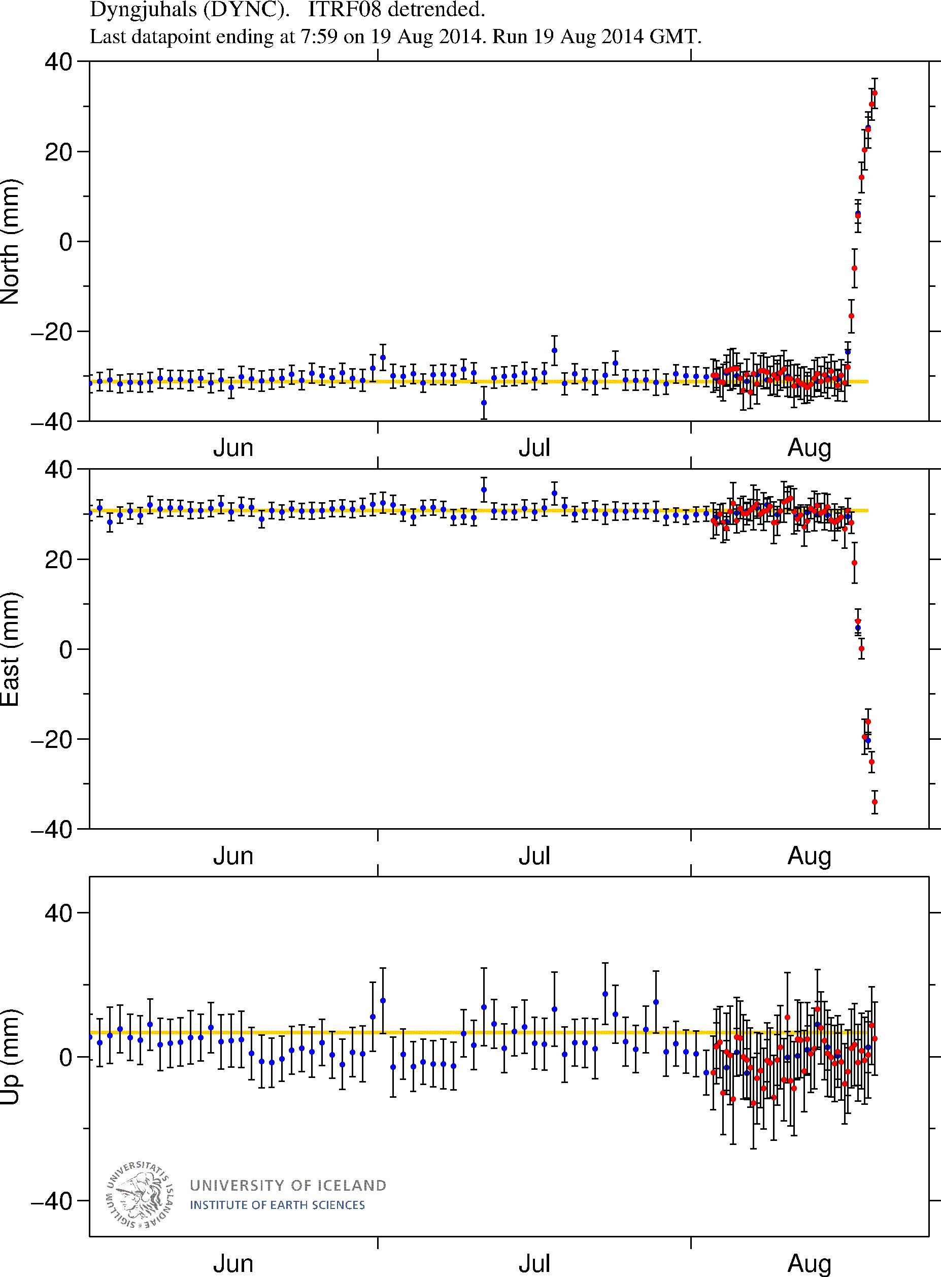
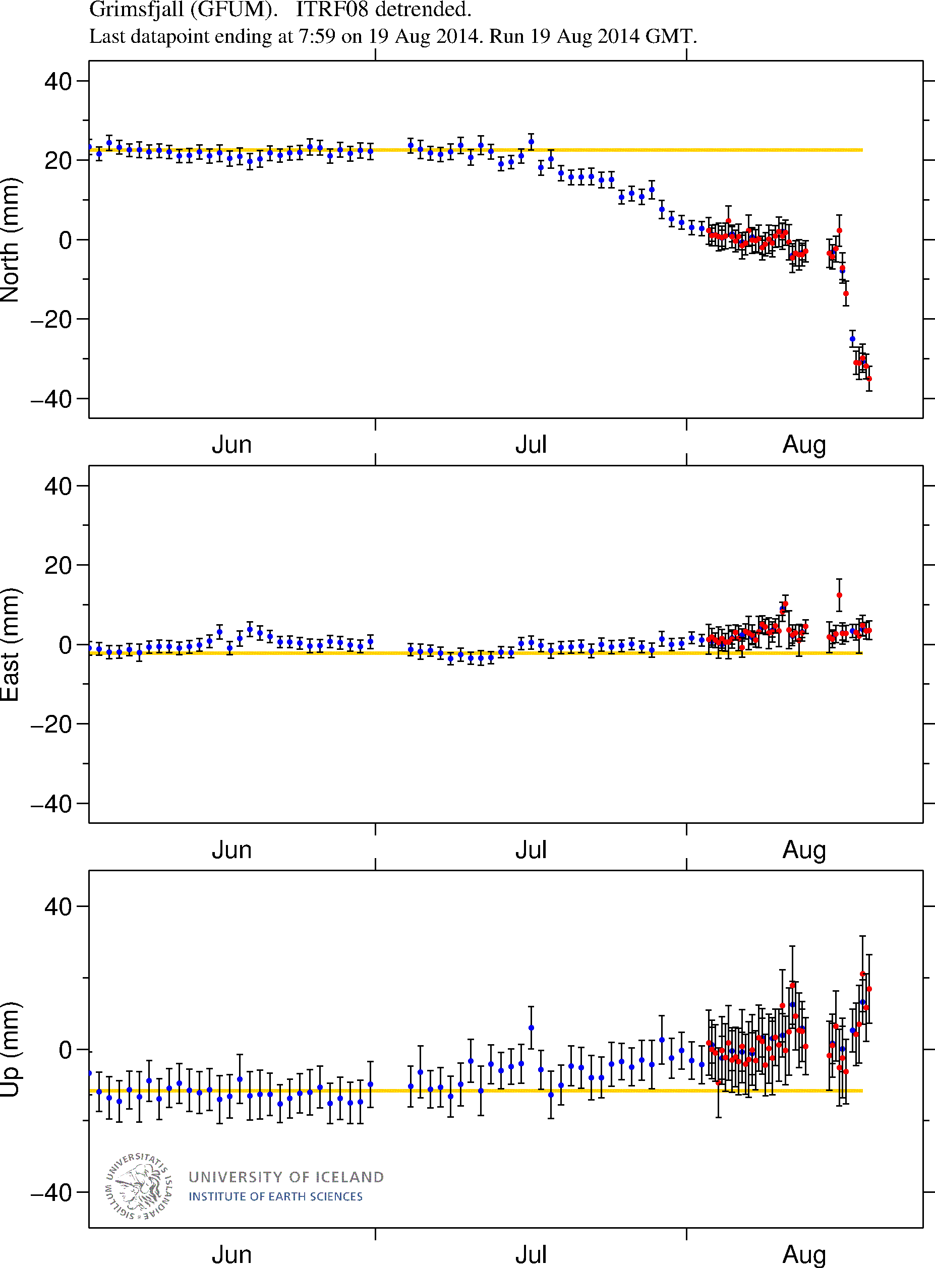
- The dyke in Bárðarbunga volcano continues to get longer and wider, it is now over 40 km long (I think). Formation of this dyke has slowed due to more difficult crust in the area he is now in (that means more earthquakes).
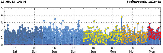
The current earthquake activity in Bárðarbunga. Copyright of this image belongs to Icelandic Met Office.
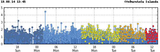
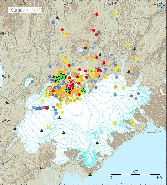
The extremely dense earthquake activity in Bárðarbunga volcano. Copyright of this image belongs to Icelandic Met Office.
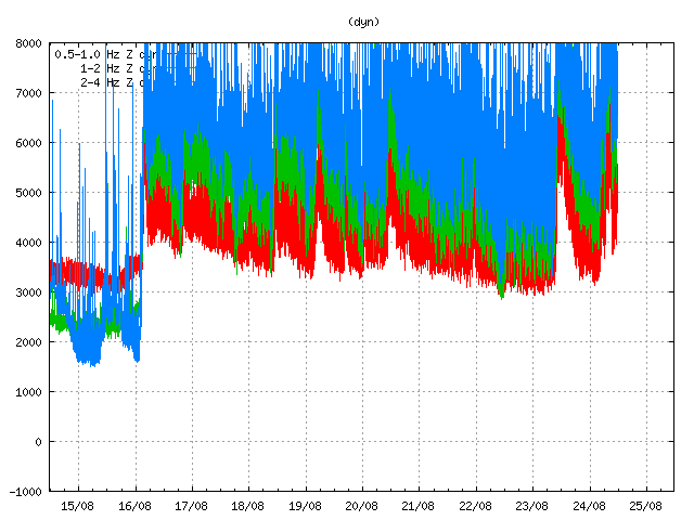
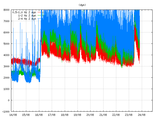
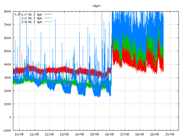
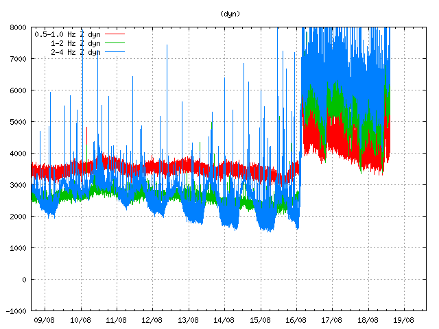
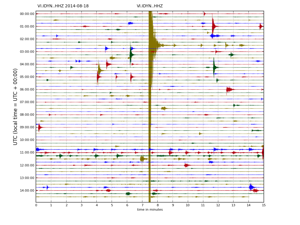
Harmonic tremor is getting off the tremor plot that Icelandic Met Office has on its website. This is the harmonic tremor at 11:33 UTC. This is Dyngjuháls SIL station. It is closest to the dyke at the moment. Copyright of this image belongs to Icelandic Met Office.
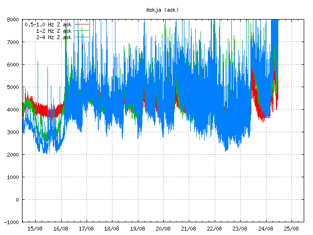
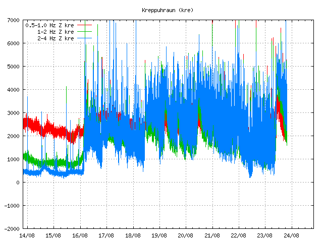
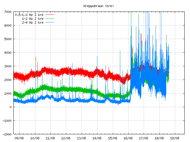
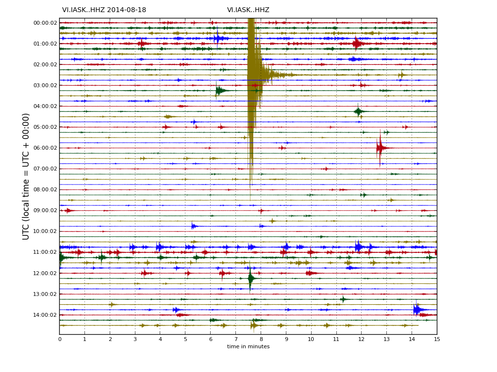
The SIL station in Askja volcano is also showing the massive activity in Bárðarbunga volcano. This is the harmonic tremor at 11:33 UTC. Copyright of this image belongs to Icelandic Met Office.
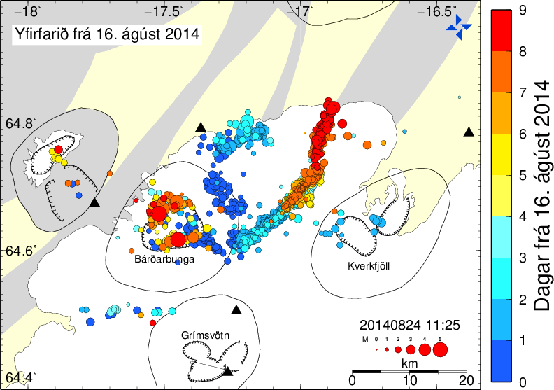
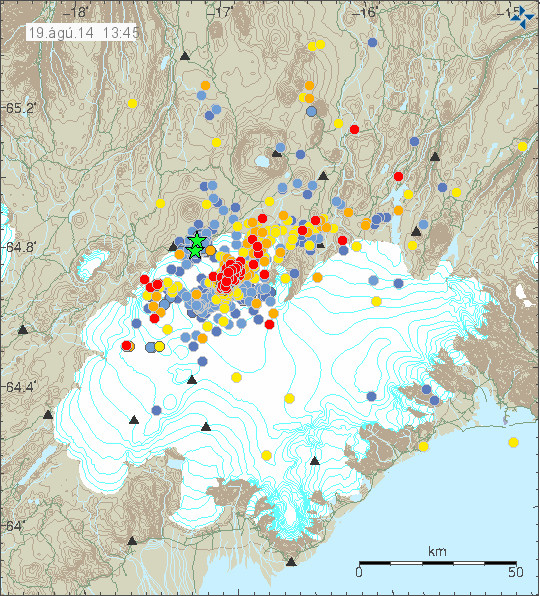
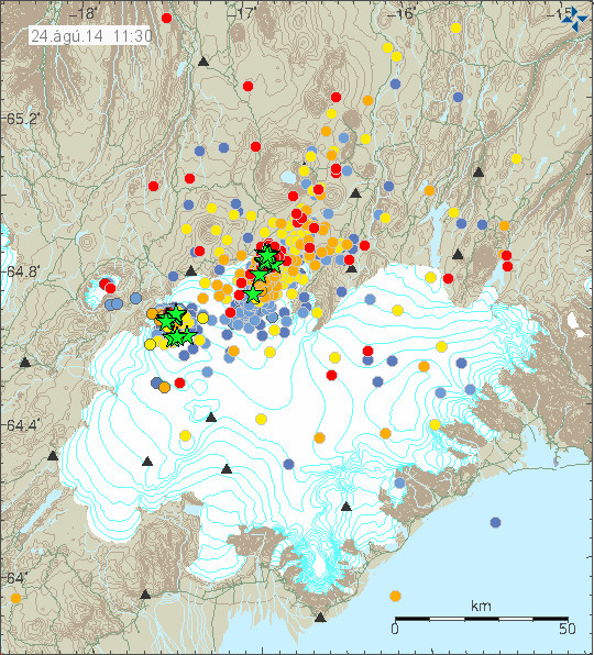
Current length of the dyke from Bárðarbunga volcano. Blue dots are the oldest and the red ones are the newest. This shows the earthquakes from 16-August-2014. Copyright of this image belongs to Icelandic Met Office.
The harmonic tremor seems to increase when there is a new flow of magma at depth into the dyke. Large earthquakes happens in Bárðarbunga caldera when it adjust to this flow out of the magma chamber above it. There are clues that magma at depth might have triggered this, but there is a lack of deep earthquakes in Bárðarbunga volcano so it is difficult to say for sure.

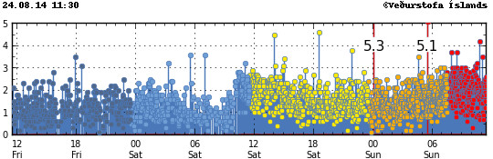
This is the magnitude 5,3 earthquake that took place today (24-August-2014) at 00:09 UTC. This is my geophone in Heklubyggð. This image is released under Creative Commons Licence. Please see CC Licence page for more details.
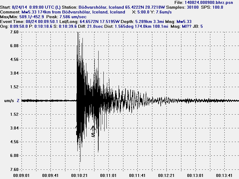
This is the magnitude 5,3 earthquake that took place today (24-August-2014) at 00:09 UTC. This is my geophone in Böðvarshólar. This image is released under Creative Commons Licence. Please see CC Licence page for more details.
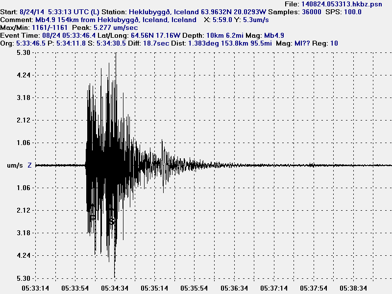
This is the magnitude 5,1 earthquake that took place today (24-August-2014) at 05:33 UTC. I use data from EMSC that explains different magnitude in the image. This is my geophone in Heklubyggð. This image is released under Creative Commons Licence. Please see CC Licence page for more details.
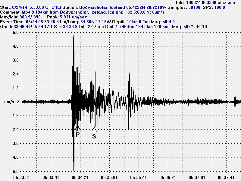
This is the magnitude 5,1 earthquake that took place today (24-August-2014) at 05:33 UTC. I use data from EMSC that explains different magnitude in the image. This is my geophone in Heklubyggð. This image is released under Creative Commons Licence. Please see CC Licence page for more details.
As explained above the earthquake activity is dense under Dyngjujökull at the moment. The dyke is also now in part on glacier free area, so if any minor eruptions happen they can be seen on the surface. The dyke seems to be under high pressure, but I don’t know yet if that is going to result in an eruption. But I find it highly likely at this point and given current data.
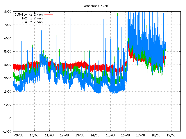
My geophones can be seen here. Some of the activity that is now taking place in Bárðarbunga appears on them. Larger earthquakes (magnitude 3,5 and above) appear always at this distance. Wind appears on my geophones if weather is bad in Iceland.
Updated at 14:12 UTC.