
Today (16-March-2016) there was an earthquake swarm around 110 km north of Kolbeinsey Island. At this location there are no registered or known volcanoes, there however might be one, but it is difficult to confirm. This earthquake activity however appears to be related to an rift valley that is at this location, rather then any volcano activity.
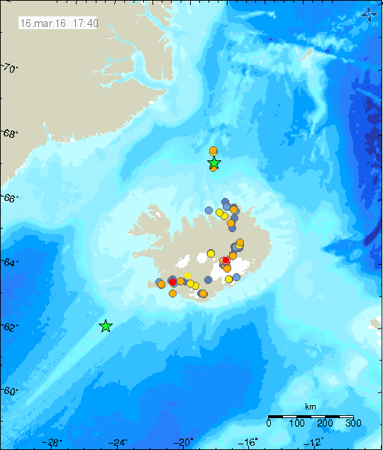
The earthquake activity around 110 km north of Kolbeinsey Island. Green star shows the location of the largest earthquake. One magnitude 3,0 earthquake was deep on the Reykjanes Ridge (green star). Copyright of this image belongs to Iceland Met Office.
Largest earthquake in this swarm had the magnitude of 3,1. That magnitude is possibly an underestimate of magnitude due to distance from the SIL network. Other earthquakes have been smaller, but one earthquake had the magnitude of 2,9. That earthquake might have had a magnitude above 3,0 in reality. I suspect more earthquake activity has taken place without being detected by the SIL network.
Donations
Please remember to support my work with donations. Thanks for the support.
Thanks Jon, still think we should call any volcano up there Mt Frimann! Looks busy near Bárðarbunga bunch of 1 pluses then a 3.3
Looks like 21 quakes in the last 48 hours around Bárðarbunga including a 3.4