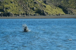
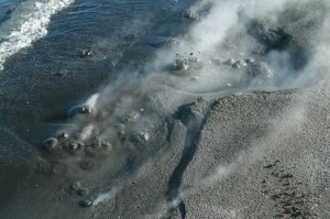
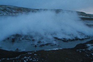
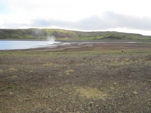
I got this pictures in a email from a person how wants to remain nameless. Don’t ask me why, it is just a request that I got with the email and I see no reason not to grand it.
The hot springs at the south end of Kleifarvatn lake hot springs. The hot springs there are not new. But they do get lost when the water level rises in Kleifarvatn lake. When the water level dropped after the year 2000 years in the area this hot springs where for the first time visible to humans.
Click on all the pictures to get a full resolution.
The earthquakes swarm at Krísuvík (close to this area) continues with few breaks it seems.


What the heck is it that is in the water on the first picture???
A Geyser through a sub-merged log?
Looks like boiling hot water in the shallow part of the lake.
When I was at Kerlingarfjöll this summer, I was wondering about the boiling noise I heard while standing on a bridge over a small river. After a while I noticed the steam bubbles in the river at several places…
Looks like the Icelandic version of the Loch Ness monster.
Lovely photos, takk fyrir Jón!
Oh, and by the way;
Thanks whoever you are for the pictures!
Cudos!
Do you know, when these pictures where taken? The activity last week was much higher. See here: http://temp.snaefell.de/krysuvik/
I do not know when the pictures where taken. But one picture was marked for September. But I do not know what year that was.
The EXIF-data which is in the file says it has been taken on 22.09.2010.
How beautiful these pictures!
Question on strain data.
If we are looking at: http://hraun.vedur.is/ja/strain/str_corr/index.html
how is this strain measured, and why is it measured? How is it possible to distinguish strain caused by geological activity from atmospheric lows and groundwater fluctuations?
And what exactly is strain?
nanostrain (nstrain)
an engineering unit measuring strain. An object under strain is typically deformed (extended or compressed), and the strain is measured by the amount of this deformation relative to the same object in an undeformed state. One nanostrain is the strain producing a deformation of one part per billion (10-9). Strains in geological formations are often measured in this unit.
http://www.unc.edu/~rowlett/units/dictN.html
The sensitivity of the equipment that is needed to detect this level of deformation, is also sensitive enough to register barometric and tidal effects. In order to get just the deformation related to the tectonic/volcanic processes, a separate measurement would need to be made that is not effected by tectonic/volcanic forces, then that curve/offset would be subtracted from actual measured data to yield only the tectonic/volcanic signal.
At least that the way it should work. I’m not a geophysicist, but I have messed around with instruments before.
Yes, and the most important to offsett is barometric pressure, and that is also easiest to remove. After all you only have to have an onsite barometer.
I do not know the version they have around Hekla, but you can also measure the hole pressure of the strain bore-hole. Som of them also uses a laser that measures how much the bottom and the sides of the bore-hole moves, but that is not so good if you have large movements.
Is it just me or have the last little swarm been deeper then normal for Krýsúvík?
Most of them have been between 7,3km and downwards, before they where more shallow. This trend started on wednesday at 06.54.
It is also migrating to the east. This some times happens. But the depth is something of a interesting factor. But it is hard to know if it is just tectonics in the area or a magma related movement.
Yes, but I think that the upwards trend on Sigrún Hreinsdottirs cgps-plot of Krýsúvík might be indicative of magma influx. But what the meaning of the quakes moving downwards might be I can’t understand. And the tremors are still unusually high.
I made the prettiest little plot of that area using two years of quake data, only to realize that I had missed the actual location and plotted the area next to it.
Eventually I’ll get the box right.
That must have sucked doing all that work for nothing… 🙁
What lovely photo’s! I guess it is very dangerous to bath in the lake though, even if it is warm enough? Is it acid from the rising sulphur anyway? Water in our mines gets turned into sulphuric acid by bacteria which eat sulphur minerals.
No, this is not yet a problem. The lake is pretty big and the activity relatively small. It will take a while until effects like this are noticable.
A bit OT:
Jón, or any other Icelander, do you know anyone with knowledge on Icelandic mineral law, and or mining regulations? I tried to google it, but came up with naught.
If you do, or can direct me to such a person I would be very happy.
Thanks beforehand;
Carl
The Icelandic laws in this regards are in most part in line with EU law. But Iceland doesn’t have a special mining law that I am aware of. But companies need permission from the government anyway.
Here is news about the last gold search in Iceland.
http://www.grapevine.is/News/ReadArticle/Search-for-Gold-in-East-Iceland-Ends
Thank you, then I know that it is “The National Energy Authority” I have to contact next.
I must say that Iceland is fantastic, a lot of rare earth minerals and ultra-low energy prices. There just have to be a reason that not every mining company isn’t there allready. Wonder what it might be?
I don’t expect many mining companies would find it easy to get people to want to live in places like the middle of Vatnajokull or similar tundra wastes.
Yes and no, we have some rather remote mines here in Sweden. It depends on the size of the installation and so on. But preferably you have a mine close to some kind of community.
In the end though it is up to what you pay. Money talks, just look at the Inuvik mines…
Also I expect that where the minerals are, the ground is badly fractured, so miners would keep hitting crosscourses and losing the lode, which would limit mines rather.
Additionally, here in te UK amature miner explorers are very nervous about entering any mine where a little tiny earthquake has occurred recently. That would be all the time in Iceland. I would not want to go down a mine in an area which has as many earthquakes as Iceland! I would be terrified to be underground during an earthquake!
FYI, the Kirunawaara mine has loads of quakes all the time. They are normally up to 3,1 ML.
But, you can alwys use continous strip-mining. It is all depending on what you are going to mine, and where, and what the geology is at the site.
I read an interesting treatise/post over on the Oil Drum (blog about energy) that detailed long wall mining (used to mine coal). With that process, they actually allow the roof to collapse behind them as they pull the supports in order to have the rubble support the area that is being actively worked on. It’s not an instantaneous collapse and it does generate a bit of seismic noise as it happens.
I guess that illustrates the some one is always crazy enough to do it.
Normally now you do a room-pillar-room version where you leave support columns behind you, and when the mine is emptied then you sequencially take out the pillars as you move out. While doing so you reuse mining sludge to form concret pillars for safety and as a means of waste disposal.
The reason for the green line on my webicorders is that I was re-placing the cpu fan on the earthquake computer.
Now I got a more louder and better cpu cooling on my earthquake monitoring computer.
We just got an earthquake in England – not common here, so it is interesting to us:-
EDIS Number: EQ-20101215-196769-GB
Magnitude: 2.9
Mercalli Scale: 1
Date-Time[UTC]: 15 December, 2010 at 10:27:26 UTC
Local Date:Time: Wednesday, December 15,2010 at 10:27 in the morning at epicenter
Location: 49° 57.600, 0° 39.000
Depth: 10 km (6.21 miles)
Region: Europe
Country United Kingdom
Distances:45.65 km (28.37 miles) of East Stratton,
Source: EMSC
Yes, Iceland is much more interesting – definitely. UK seizmology is boring isn’t it. our single 2.9 quake will make the news here!!!!!!!!!!
Believe me our may 4,2 made it bigtime into the news here…
If I am correct we will have a quake-swarm soon at Krýsúvík.
It doesn’t seem to be able to keep quiet for long, but how about Herðubreiðartögl. Won’t that have a swarm again imminantly too? Isn’t Askja more likely to erupt than Krýsúvík?
The most likely volcano to erupt in statistical order of occurance considering state of readiness:
1. Hekla
2. Grimsvötn
3. Askja
4. Bardarbunga
5. Katla
Hekla and Katla does not need anything special to erupt. All of the above mentioned volcanos are showing signs of impending eruption, ie. inflation, quake-swarms, water-changes, and soforth.
If I would put in a bet I would say Hekla is next to erupt. Remember that it is statistically speaking the next most likely volcano to have a large eruption.
Thing with Krýsúvík is that we do not have a clue what it is doing. It might erupt, it might have a large quake, it might eat a lake, it might sprout wings and fly away to have a hot date with Krakatoa. That is what makes it interesting 🙂
Why do Hekla’s streams dry up before eruptions?
During the last couple of hours Krysuvik has had powerfull micro-tremors with the highest energy spikes in the 0,5Hz (red) band.
Those low spikes are normally a precursor to quake-swarms. But this time they have been much more powerfull than normal. I thought we would have a quake-swarm by now.
The quakes recorded in the tremor plots are predominantly showing in the 2-4Hz band (blue).
Any ideas what these unusual spikes are anyone?
http://hraun.vedur.is/ja/oroi/kri.gif
I did call IMO. The geologist on duty was not sure what this was. But the spikes did start and stop sharply according to what she was watching on here computer screen.
I regards this spikes as highly unusual. But I have no idea what they mean.
I was thinking of borehole explosions. But I have seen the pattern before quake-swarms, but this time it is on a different order of scale entirely.
When you say borehole, do you mean like what we call volcanic vents here in the UK. What we have is tubes reaching to the surface from underground, where volcanic vapours historically used to rise. Now ours are completely lined with quartze crystals – sometimes amethyst!
The link below shows me emerging from one.
Of course, Iceland’s would still be actively venting gases I presume!
Are these what you mean by boreholes?
Oh my… Looks like you are crawling out of a volcanic pizza!
No, with borehole I mean exactly a hole that has been drilled down into the ground to function as a part of a hydrothermal powerplant, or as an integral part of a borehole-strainmeter. The holes are normally between 80 and 150mm wide.
Here is a site where you can check the latest experiments on boreholes for hydrothermal powerplants.
http://iddp.is/about.php
Ooops! not doing well with these posts I must be more careful exactly where I am posting – I thought this post had disappeared, but it is merely not in the place I intended – whoops!
I will learn – I promise to do better.
When you say borehole, do you mean what we call volcanic vents when our UK mines intersect them?
What we have is tubular holes where volcanic gases rose in prehistoric times, which are now completely lined with quartze crystals – sometimes amethyst.
The picture below shows me emerging from the bottom of one in Virtuous Lady mine.
Is this the type of thing you are referring to?
Whoops! – got my HTML link wrong
Proper link I hope
Thanks for link Carl.
The peaks seem to contain tremor at all three frequency bands. So, is it harmonic tremor or tornillos?
A new blog post has been written about Krísuvík volcano.