Picture and video of Eyjafjallajökull volcano

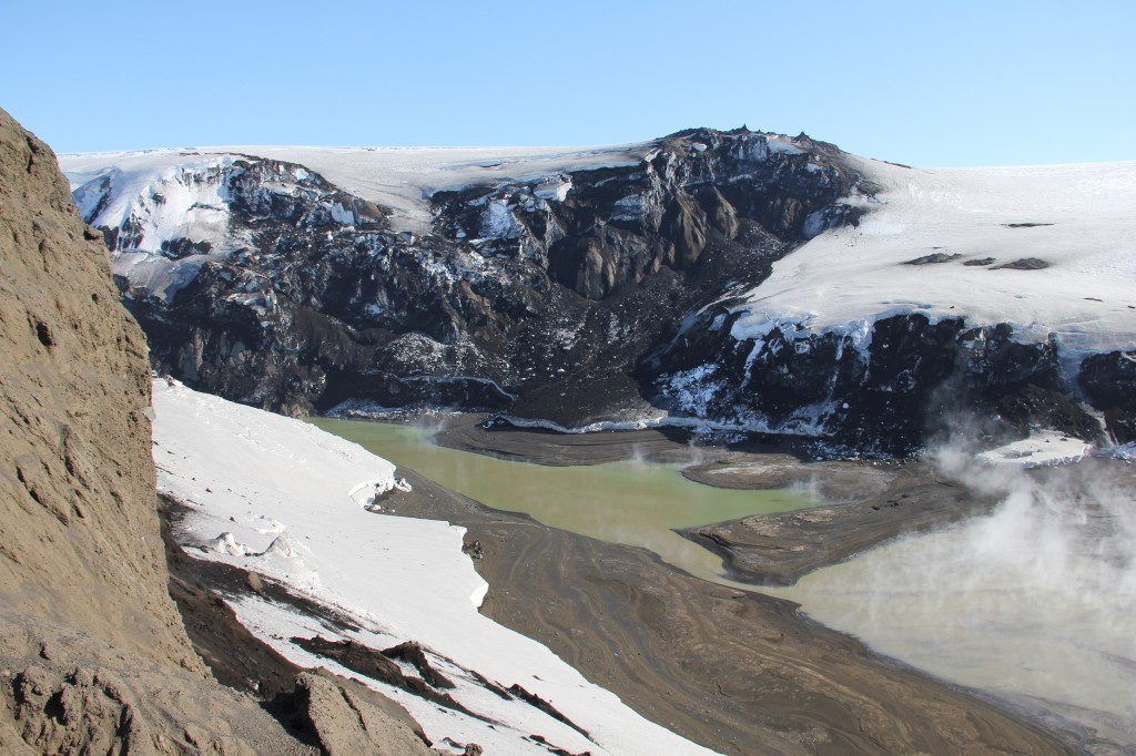
Here is a picture of Eyjafjallajökull volcano that I took in December 2012. This is not a good picture. But that is mostly down to bad weather and strong wind at the time.


Click on the image for full size. This image is released under Creative Commons licence. Please see the CC Licence page for more details on this licence.

Here is a video that I took from this same area. It shows how bad the weather was.

New pictures of Grímsfjall volcano crater

Rúv News has just published pictures of Grímsfjall volcano craters. This pictures where taken by Ómar Ragnarsson. The pictures show among them a Island that has formed inside the 1.5 km long and 800 meter wide crater that did erupt in May of last year.


The Grímsfjall volcano crater that erupted on 25. May 2011. Copyright of this picture belongs to Ómar Ragnarsson.

More pictures can be found on Rúv News web site. I recommend that people click on the images to get full size (or click and open in new tab).

Undraveröld Grímsvatna – Myndir (Rúv News, Icelandic, Pictures)

Iceland this morning

I am just testing to see if everything works properly on the new server. That means I am looking for bugs.


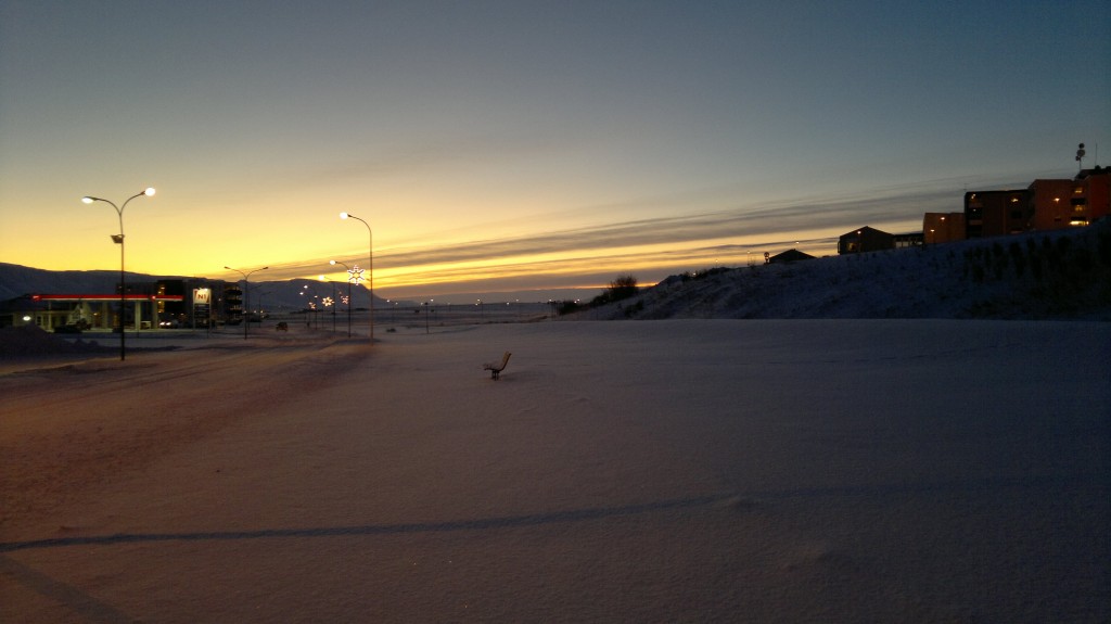
This is the town of Sauðárkrókur, where I have been for the past few months in school. This picture is released under Creative Commons Licence. Please see the top bar for more information.

If you see any bugs. Please let me know about them. Thanks!

Earthquake swarm north of Langjökull glacier and volcano, new hole found in Selfoss town

This is a short update.

Langjökull glacier: Yesterday there was a minor earthquake swarm north of Langjökull glacier and volcano. This area did last time was last year when a good sized earthquake swarm did happen in this area, but last year it did start around this time of year and lasted until November. It remains to be seen if that happens now. So far all the data suggests that this earthquake swarm is just tectonic in nature. It also appears that earthquake swarms in this area start slowly with long breaks between them. So I am expecting more earthquakes there. Unless this has just been a single event with no repeats.

SISZ: On Selfoss town they have just found a new strange hole in the road. The opening of the hole is about 1.5 meter in size. But the depth is about 6 meters (guess?) and area that is hollow under the hole is few hundred meters (guess?) according to the news. It is believed that this did happen because of the SISZ Mb6.3 earthquake that did happen in this area in the year 2008.

Here are news about, with pictures of the hole.

Jarðskjálftahola á Selfossi (Rúv.is, Icelandic, Picture)
Hola myndaðist í jörðinni á Selfossi (Vísir.is, Icelandic, Pictures)

Katla volcano: I think that something might be about to start in Katla volcano. But that is just a speculation that I am doing now. I am far from sure about it. But it should be clear in few hours if something is happening in Katla volcano or not. I base my assessment on rather odd changes in the tremor plot. They are hard to spot, but still there and appears to be growing it seems. But I am going to check and see what happens in few hours time. This might be nothing. But only time is going to tell us that for sure.

Quiet in Iceland. Picture of Grímsfjall volcano new crater lake

It has been quiet in Iceland. Some minor earthquake swarms have taken place. But they where all less then 50 earthquakes with sizes for most part less then ML3.0. So this is going to be an short blog post.

At Eruptions at BigThink Erik did link to an interesting picture of the aftermath of last eruption in Grímsfjall volcano.

Due to how quiet it is in Iceland. I am not going to have this blog post longer. But on other note, I am going to make fewer blog post this summer since I am working during the day and I am really tiered after I finish working. But I am going to due my best in keeping new blog post coming.

How to get Icelandic media in a case of a eruption in Iceland

When a eruption starts in Iceland. All media in Iceland covers it. Both in there news web sites and on the radio stations on the internet that publish information in english and other languages if needed. Here is a list of the main media stations in Iceland.

Radio stations:

Rúv Rás 1 – Public radio station. Needs Windows Media Audio player to listen to this radio station. It is also possible to listen to Rás 1 over satellite on 1W.
Rúv Rás 2 – Public Radio station. Needs Windows Media Audio player to listen to this radio station. It is also possible to listen to Rás 2 over satellite on 1W.
Bylgjan FM 98,9 – A radio station with news. A flash might be needed to listen to this radio station.

Tv stations:

Rúv Sjónvarpið – Can be watched on-line here. Both with flash player and Windows Media Video capable player. In Europe Rúv Sjónvarpið can also been watched over satellite on 1W if you have Conax access card to view the channel (only available in Iceland to Icelandic citizen living in Iceland, don’t ask me for it). But Teletext information is still available even if the channel is scrambled and cannot be viewed because of that.
Stöð 2 – Can be viewed on-line on the web-site Vísir.is. But at that web page only news can be viewed. Flash player is required to view it. Stöð 2 does not broadcast over satellite.

When a eruption starts in Iceland. This are the best options to get into touch with Icelandic media that broadcast live video or audio. But other news web sites are mbl.is, dv.is. But this are only news papers that don’t offer any direct and live coverage when a eruption starts in Iceland.

Earthquake activity continues in Krýsuvík volcano [updated]

Early morning today (2. March 2011) there was a spike of earthquakes in Krýsuvík volcano. This earthquake swarm took place west of Kleifarvatn lake as the main center of the activity has been for the past two years. This type of activity can be expected in Krýsuvík volcano in the coming weeks in my opinion. Both long earthquake swarms and short ones, like the one that did happen early morning today.

The Icelandic Met Office has released a picture showing the earthquake activity in Krýsuvík volcano from the year 2004. Along with accumulated strain from those earthquakes and other useful data.
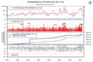

Picture is from Icelandic Met Office web page. The Icelandic Met Office owns the copyright to this picture.

Frame 1: Monthly number of earthquakes.
Frame 3: Total number of earthquakes. Second line: Collected strain from earthquakes.
Frame 4: Depth of earthquakes.

Here is a picture of the location of the last week earthquake swarm in Krýsuvík volcano. This is depth view. This view does not contain all the earthquakes that took place in Krýsuvík volcano.
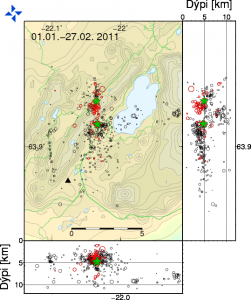

Picture is from Icelandic Met Office web page. The Icelandic Met Office owns the copyright to this picture. Note: Dýpi = Depth

Update: Here is a updated earthquake plot of Krýsuvík volcano. This is the location of the earthquakes in Krýsuvík volcano along with the depth of the earthquakes. This is the earthquakes in Krýsuvík volcano from 25.02.2011 to 02.03.2011. This picture is from here.


Picture is from Icelandic Met Office web page. The Icelandic Met Office owns the copyright to this picture. Note: Dýpi = Depth

A overview picture of the activity in Krýsuvík volcano shows well the fissure direction the earthquakes line them self up on. The direction is almost north-south one. This map does not contain all the earthquake that where recorded in Krýsuvík volcano in last week.
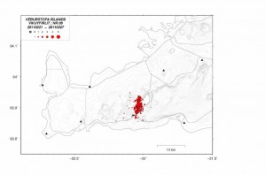

Picture is from Icelandic Met Office web page. The Icelandic Met Office owns the copyright to this picture.

The pictures are from the Icelandic Met Office web site that contains weekly overview of earthquake activity in Iceland. Click on the pictures to get high resolution of them.

I am expecting more earthquake activity in Krýsvík volcano area. But at the moment it is a bit hard to know for sure if this is going to result in a volcano eruption. But in my opinion that is going to be the result in the end. But currently it is all a question about when, rather then if in my opinion.

Update: There was a earthquake with the size ML3.6 at 17:56 UTC according to the automatic data from Icelandic Met Office. This earthquake was a more south the earthquakes that happened last weekend. This can clearly been seen on the map data that Icelandic Met Office has released (see above). The depth of this earthquake was 3.6 km.

Press disclaimer: I am not a geologist and my opinion is not the one of a expert in this matter.

News about the earthquake swarm in Krýsuvík volcano this morning. Use Google Translate carefully.

Enn skelfur jörð í Krýsuvík (Vísir.is)

Blog post updated at 20:25 CET on 02.03.2011. A new picture is added and information about the newest earthquake swarm is added.
Blog post updated at 20:36 CET on 02.03.2011.
Eyjafjallajökull volcano ash – Pictures

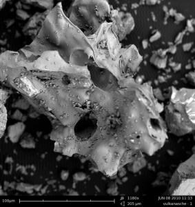
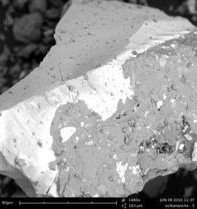
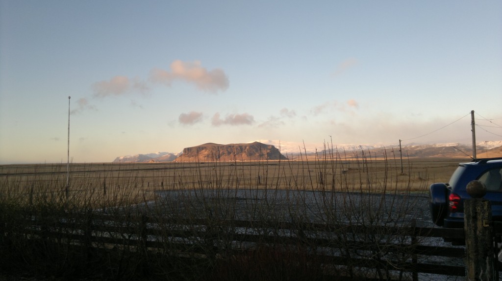
As it is quiet time in Iceland and I currently don’t have a lot to write about volcano activity and earthquake wise. So while that is I am going to put up two pictures that I got of the Eyjafjallajökull volcano ash from last years eruption.

Eyjafjallajökull volcano ash. I release this picture under Creative Commons Licence (see page for more details).

Eyjafjallajökull volcano ash. I release this picture under Creative Commons Licence (see page for more details).

To get full size, click on the picture.

The pictures where taken by Birgit in Austria. With many thanks to here for this great pictures of the volcano ash from Eyjafjallajökull.

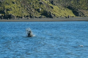
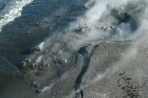
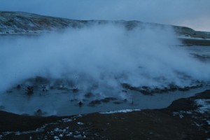
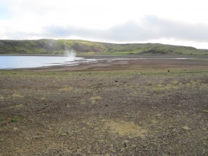
Pictures of Kleifarvatn lake hot springs

I got this pictures in a email from a person how wants to remain nameless. Don’t ask me why, it is just a request that I got with the email and I see no reason not to grand it.

The hot springs at the south end of Kleifarvatn lake hot springs. The hot springs there are not new. But they do get lost when the water level rises in Kleifarvatn lake. When the water level dropped after the year 2000 years in the area this hot springs where for the first time visible to humans.

Click on all the pictures to get a full resolution.

The earthquakes swarm at Krísuvík (close to this area) continues with few breaks it seems.

Maps of geology in Iceland

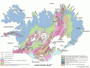
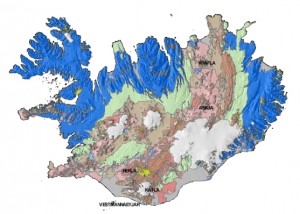
Here are two maps of the geology in Iceland. The first map shows the fault zones with the active volcanoes in Iceland. Also in this map the age of the rock is shown. The second map shows the rock type, if it is acid, basic and so on.


A map of Iceland with fault zones and active volcanoes. This map is not up to date with newest research and stuff like that. Click on the picture to get a full size.


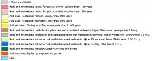
This map shows rock type in Iceland. Explanation is to the right. Click on the picture to get a full size.

Both pictures are from this web site here.