New earthquake swarm in Tjörnes Fracture Zone

Early this morning (27-July-2019) a new earthquake swarm started north of Siglufjörður village. This earthquake swarm is in a different location than the magnitude Mw4,3 earthquake took place on 24-July-2019. This earthquake swarm is slightly more north of that location. That means this is a different fault that is creating this earthquake swarm. It is unclear if this is connected to the magnitude Mw4,3 earthquake that happened on 24-July-2019.
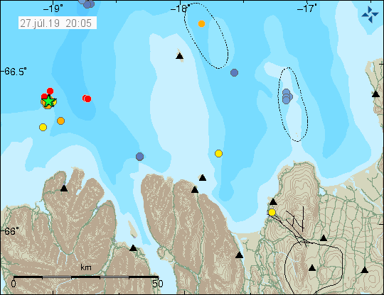

The earthquake swarm (green star) on Tjörnes Fracture Zone. Copyright of this image belongs to Icelandic Met Office.

The largest earthquakes at the writing of this article have the magnitude of Mw3,2. There is a lot suggesting that this earthquake swarm is ongoing as of writing of this article. Last earthquake to happen was at 20:07 UTC and had a magnitude of Mw2,7 (automatic). The risk of new earthquake swarms happening without warning and being bigger than what has happened so far remains high. The location of those earthquake swarm is going to be random and might be on land or out in the ocean. There is not any way to know were the next earthquake swarm is going to happen next.

Donations

Please remember to support my work with donations. Thanks for the support. 🙂

Earthquake swarm on north part of TFZ (north-west of Grímsey island)

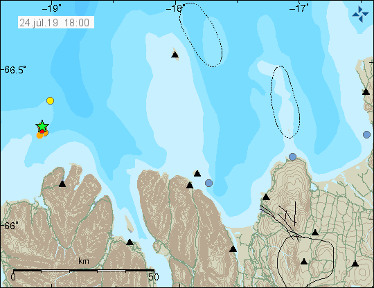
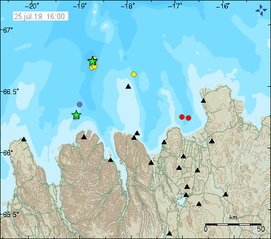
Yesterday (24-July-2019) at 23:40 UTC and 23:42 UTC a magnitude Mw3,3 and Mw3,6 earthquake took place on the TFZ about 39 km west of Grímsey island. The two largest earthquakes were followed by a swarm of smaller earthquakes. Largest of those earthquake had a magnitude of Mw2,5. This earthquakes were not felt due to distance from populated areas.


The earthquakes 39 km north-west of Grímsey island. Copyright of this image belongs to Icelandic Met Office.

It is unclear if this earthquake activity is connected to the earthquake with the magnitude Mw4,3 that happened on 24-July-2019.

Donations

Please remember to support my work. It helps me keep everything up and running. Thanks for the support. 🙂

Update on Tjörnes Fracture Zone earthquake (Siglufjörður village)

Today (24-July-2019) at 00:55 UTC an earthquake with the magnitude of 4,3 took place 20 km north-north-west of Siglufjörður village. The magnitude of the earthquake was downgraded from Mw4,6 to Mw4,3. This earthquake was felt over a wide area and minor damage was reported in Siglufjörður village, it was just items fallen off shelf. Largest aftershock had a magnitude of 2,7. There have been no major aftershocks at the writing of this article. This area had a earthquake swarm in 2012 with at least one earthquake with magnitude of Mw5,6 and one with magnitude of Mw5,5.


The Mw4,3 earthquake close to Siglufjörður village (green star). Copyright of this image belongs to Icelandic Met Office.


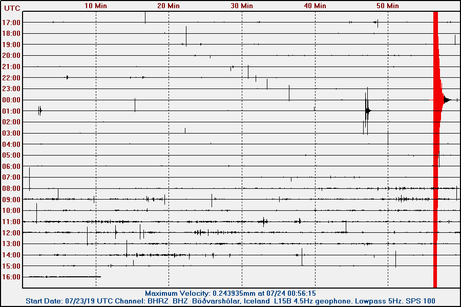
The earthquake as it appeared on my geophone in Böðvarshólar. Copyright Jón Frímann Jónsson.


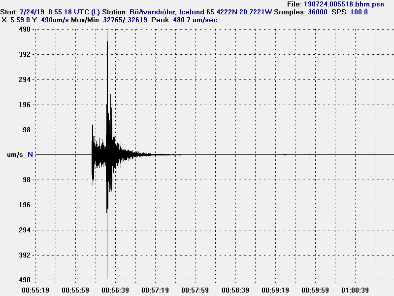
The vertical (Z) movement on my geophone. Copyright Jón Frímann Jónsson.

There is a chance that a earthquake activity is increasing in Tjörnes Fracture Zone overall. Since its been a while since it had a major earthquake activity. With that I mean earthquakes with magnitude above Mw6,0.

Donations

Please remember to support my work with donations. Thanks for the support. 🙂
Magnitude Mw4,6 [automatic magnitude] earthquake felt in northern Iceland

At 00:55 UTC on 24-July-2019 an earthquake with a magnitude of 4,6 (automatic magnitude) happened just outside Siglufjörður town in north Iceland. This earthquake was felt over a wide area. I don’t have any more details at this moment.

Images of the earthquake with no magnitude and distance markers.


The earthquake as it appeared on my geophone in Böðvarshólar. This is vertical (Z).


The earthquake as it appeared on my geophone in Böðvarshólar. This is north-south.


The earthquake as it appeared on my geophone in Böðvarshólar. This is east-west.

I’ll post more updates on this earthquake tomorrow (after work) if nothing more happens.

Earthquake in Torfajökull volcano

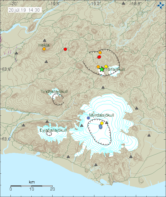
Today (20-Juli-2019) at 14:15 UTC an earthquake with the magnitude of 3,3 took place in Torfajökull volcano. This earthquake took place in south part of the caldera of Torfajökull volcano. This earthquake might have been felt by tourists in the area.


The earthquake activity in Torfajökull volcano. Copyright of this image belongs to Icelandic Met Office.

There has not been a lot of aftershocks following this earthquake for now. Last earthquake with magnitude above 3,0 took place on 12th of July and this means there might be a serious increase in earthquake activity in Torfajökull volcano. There are no obvious signs that Torfajökull volcano is about to erupt but it is also not known what is needed to make an eruption happen in Torfajökull volcano. Best action for now is to continue to monitor the activity in Torfajökull volcano.

Donations

Please remember to support my work. It helps me doing this and to keep this website running. Thanks for the support. 🙂

Earthquake swarm on the Reykjanes ridge

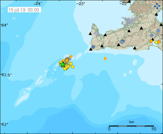
On Saturday (13-July-2019) earthquake swarm started off the coast of Reykjanes peninsula on Reykjanes ridge. The earthquake swarm is located 2 – 4 km south-west of Geirfulgadrangur rock. It is unclear if this earthquake swarm is over. Largest earthquakes in this swarm had a magnitude 3,1. Other earthquakes had smaller magnitude.


Earthquake swarm on the Reykjanes ridge. Copyright of this image belongs to Icelandic Met Office.

Activity in this area has the pattern of stopping and then starting again few hours to week later. This might result in stronger earthquake swarm next time this activity starts up again. There is a volcano in this area that last erupted in 18th or 19th of century. This volcano is not listed in Global Volcanism Program I think. I do not think this earthquake activity is volcano related but that is difficult to know fore sure due to how remote this area is and poorly known as such.

Donations

Please remember to support my work with donations. They help me keep everything running and to keep writing here. Thanks for the support. 🙂

Increase in earthquakes in Katla volcano

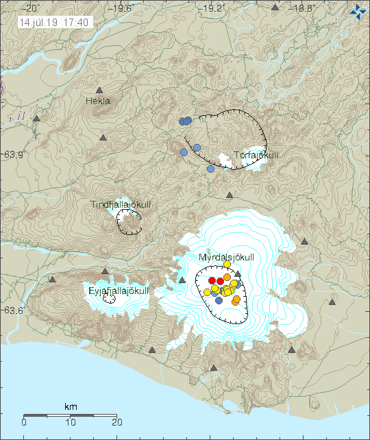
Since yesterday (13-July-2019) there has been a increase in earthquake activity in Katla volcano. There are no signs of anything more happening than just this increase of earthquakes.


Earthquake activity in Katla volcano. Copyright of this image belongs to Icelandic Met Office.

This increase in activity is something to keep a watch for but this has happened before without resulting in a eruption in Katla volcano. There have been reports on high volume of water level in the cauldrons in Mýrdalsjökull glacier. I don’t know if that is connected to this increase in earthquake activity. There is an expatiation that water is going to break out soon and the flood is going to be the largest since 2011. That might increase earthquake activity in Katla volcano once that happens. For now however nothing has been reported in the news of such a event.

Donations

Please remember to support my work with donations. It help me to keep everything running on this website. Thanks for the support. 🙂

Magnitude 3,2 earthquake in Torfajökull volcano

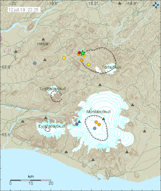
Today (12-July-2019) at 17:16 UTC a magnitude 3,2 earthquake took place in Torfajökull volcano. This earthquake might have been felt by tourists in the area. This earthquake being felt has not yet been reported according to any news media.


The earthquake activity in Torfajökull volcano (green star). Copyright of this image belongs to Icelandic Met Office.

This area of Torfajökull volcano has been having earthquake activity since January 27 when a magnitude 3,7 earthquake took place there. That activity was followed by a larger swarm of aftershocks than have so far happened. That might change without warning. This earthquake activity is interesting but I am not sure if it means anything, at least for now.

Donations

Please remember to support my work with donations. It helps me keeping this site running and with other stuff. Thanks for the support. 🙂

Update on Bárðarbunga volcano cauldrons

According to latest news from Rúv on recent survey on Bárðarbunga volcano the cauldrons that appeared during the Holuhraun eruption (2014 – 2015) continue to grow in size and there has been increase in hydrothermal output in those cauldrons. Distance between the cauldrons is 800 meters and their depth is more than 100 meters. In one of the cauldrons a hot spring has been observed and strong sulphur comes from it. The water in the cauldrons no longer freezes due to heat. Rock has also been exposed that have never been seen before and have been under the glacier for thousands of years.

Video of the cauldrons can be seen here on Rúv News report. Everything is in Icelandic.

Sigkatlarnir í Bárðarbungu stækkað nokkuð (Rúv.is)

Earthquake swarm on the south part of Tjörnes Fracture Zone (TFZ)

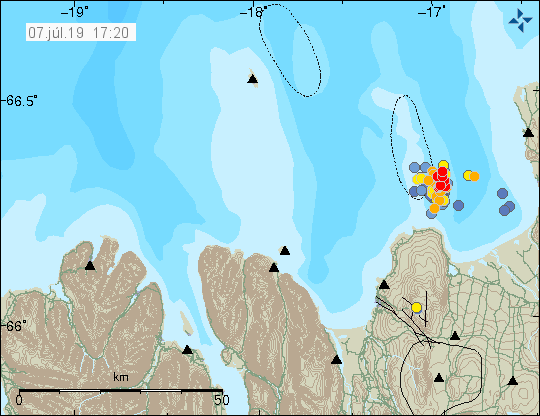
Since yesterday (6-July-2019) there has been a ongoing earthquake swarm in south part of the Tjörnes Fracture Zone (TFZ). The number of earthquakes recorded is close to 170 when this article is written. This number is going to go quickly outdated. Exact largest magnitude is not clear since automatic magnitude is not always correct.


The earthquake activity in south part of Tjörnes Fracture Zone. Copyright of this image belongs to Icelandic Met Office.

At this location there is a volcano that erupted in the year 1868 for about a month (December 1867 to January 1868) according to historical documents. Global Volcanism Information can be found here. There are no sign of this earthquake activity being connected to a volcano activity. I don’t know if that is going to change.

Donations

Please remember to support my work with donations. It helps me buying food and paying hosting costs. Thanks for the support. 🙂