More on the Almannagjá fissure depth increase (Thingvellir)

The evening news on Rúv did show video of the fissure in Thingvellir. The fissure it self appears to be a extension of the current fissure named Almannagjá. That fissure is old. But this formation appears to be fresh. But it hard to know for sure how long it is since it was created. But the road has been there since the late 19th century. One of the ideas why this happened is that there is a connection with this fissure creation and the earthquakes in the SISZ in the year 2000 and 2008. But that however is unproven idea at this point.

Other then this I have not seen or got a lot of information about this fissure.

Here is a video of this fissure in the Rúv news at 19:00 UTC.

More information on Thingvellir and it’s geology.

Geology and tectonics of Þingvellir

A new fissure starts to form in Thingvellir National Park (Almannagjá)

According to a news on Rúv. A new fissure has opened in south part of Almannagjá. It is not clear when this fissure started to form, but it looks to have formed in rather recent time (years?). But this fissure was discovered after a snow and frost started to thaw out of the ground in the last few weeks. This new fissure is about 10 to 14 meters deep and is under the middle of the walking path that is in this area. It has now been closed for safety reasons. Tourists and people how are travelling this area of Thingvellir are asked to respect the travel ban in this area. But this is a deep fissure and it is unmarked and dangerous.

This area is in part of the Hengill volcano fissure swarm. But it on the north-east edge of the end of that fissure swarm that extends from Hengill volcano.

News about this fissure formation. With picture. Use Google Translate with care. After all, it doesn’t understand Icelandic.

Djúp sprunga fannst undir göngustíg (Rúv, Icelandic)
Djúp sprunga myndast í Almannagjá (DV, Icelandic)

Updated at 15:57 CEST on the 31. March 2011. New newslink added.

Changes in Grímsfjall volcano

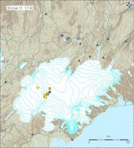
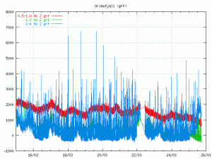
Few days ago changes started to happen in Grímsfjall volcano. It is hard to describe this changes. But they appears to be changes in harmonic tremor levels in Grímsfjall volcano. But they appears to be above background levels and the reason why that is a bit unclear at the moment, but I do not think that this is ice movement as I did think it was first. As this has been lasting for too long. Following this has been a slow increase in earthquakes in and around Grímsfjall volcano. This earthquakes don’t appear on the automatic SIL system, even if they are up to ML2.0 in size. This suggest that there origin is from magma movements, not tectonics one (tectonics earthquakes also happen there).

So far nothing suggest that a eruption is immanent. But that can change without any warning. As Grímsfjall volcano is known to start a eruption with no warning at all.


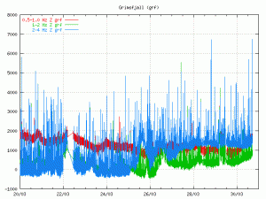
Harmonic tremor levels in Grímsfjall volcano on 30th March 2011. Picture is from around 17:30 UTC. Copyright of this picture belongs to Icelandic Met Office. The picture is from there web site.


Earthquakes in Grímsfjall volcano on 30th March 2011. Picture is from 17:30 UTC. Copyright of this picture belongs to Icelandic Met Office. The picture is from there web site.

All that can be done for now is to wait and see what happens. But my opinion is that something is up in Grímsfjall volcano. But what that is remains unclear at the moment.

A minor earthquake swarm in Krýsuvík volcano

At 20:41 UTC (28. March 2011) a minor earthquake swarm did start in Krýsuvík volcano. This earthquake swarm is small and no earthquake has gone over the size ML2.0. All the earthquakes recorded so far have rather poor quality in the SIL system and therefore it is not possible to say for sure what the the depth of this earthquakes is. But the assumed depth of the earthquakes in this earthquake swarm is around 5 km.

It remains to be seen if this earthquake swarm grows larger or not. But so far it remains small in both number of earthquakes and size.

False alarm at Grímsfjall volcano [updated]

I really did think that something was going on at Grímsfjall volcano today. There was something going on. But whatever it was. That does not appear to be volcanic or related to any volcanic activity so far. Most likely this was a change to hydrothermal activity in Grímsfjall volcano or some movement of the ice covering Grímsfjall volcano close to the seismometer on top of Grímsfjall volcano.

But so far Grímsfjall volcano remains quiet.


Picture is from the web site of Icelandic Met Office. Copyright of this picture belongs to them. Click on the picture to get full size.

The change in the tremor plot can be seen at the end of this tremor plot from the web site of Icelandic Met Office.

Update: This odd behaviour on Grímsfjall seismometer continues. So I am wondering if the false alarm might not be so false after all. But a eruption is not starting. It lacks the earthquakes of a magma pushing it’s way up the crust. But there is something going on at Grímsfjall volcano. That is for sure.

Strong earthquake swarm north of Kolbeinsey Island

There seems to be a rather large earthquake swarm taking place north of Kolbeinsey Island. This earthquake swarm started earlier today (24. March 2011). But do to how far it is away from the SIL monitoring network it is hard to know for sure how strong this earthquake swarm actually is. It is also clear from the data that only the largest earthquakes in this swarm are appearing on the Icelandic Met Office web page.

This earthquake swarm might be part of Kolbeiney Island ridge or part of the SPAR fracture zone that is north of Kolbeinsey Island ridge. It is hard to know for sure due to how poorly this earthquake swarm is being recorded by the SIL network. The largest earthquake so far is a ML3.6 at 9.0 km depth (automatic data, not reviewed). But the SIL network can detect earthquakes in this there down to the size ML2.5, but nothing less then that it appears.

Little information about Snæfellsjökull volcano on the Snæfellsnes peninsula

It is a quiet time in Iceland with just 132 earthquakes recorded last week. While that is happening. I am going to write about volcanoes in Iceland that are less known, but remain dormant for the moment.

This time around I am going to write about volcano named Snæfellsjökull volcano. Snæfellsjökull volcano is a stratovolcano like Eyjafjallajökull volcano, Öræfajökull volcano and many other of Iceland volcanoes (that is most of them). But unlike many of Icelandic volcanoes the cone shape of Snæfellsjökull volcano is clearly visible to people as it is with Eyjafjallajökull volcano and Öræfajökull volcano. But less so with other icelandic volcanoes that are in this same group of volcanoes. The reason for this is the fact that Snæfellsjökull volcano only has glacier on top of it. But not covered by a glacier on most sides like is the case with Bárðarbunga volcano as a example.

Volcanism in Snæfellsnes peninsula has happened in two time periods. The earlier time period was about 15 to 7 million years ago when this area was a active rift zone of earlier Iceland. The second period of volcanism in Snæfellsnes peninsula started again about 2 million years ago (far as I know, might be wrong however as I did not find any information to confirm this) when volcanism started again after a break that had lasted for about 5 million years. It is not clear why volcanism did restart in Snæfellsnes, as this area is not a active rift zone. But most of Iceland volcanism takes place on a active or forming rift zone. Current volcanism in this this area little. But last known eruption in Snæfellsjökull volcano was in the year 200 A.D +- 150 years. The age of the Snæfellsnes volcano is about 700,000 years old according to recent research into the age of the volcanism in this area.

It is hard to know for sure what type of volcanism Snæfellsjökull volcano makes. But given the data it can be assumed that a volcanism that is not far from what witnessed when Eyjafjallajökull volcano erupted.

Pictures of this area.
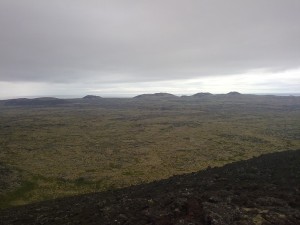

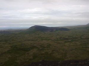
Lava field in Snæfellsnes. This lava field is from Snæfellsnes volcano. Crater rows at distance. Author: Jón Frímann Jónsson. Licence: Creative Commons.
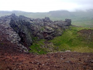

Inside of the one of the craters that are on the Snæfellsnes volcano. Author: Jón Frímann Jónsson. Licence: Creative Commons.

Volcanic cinder cone on the Snæfellsnes. This cinder cone is from Snæfellsnes volcano. Author: Jón Frímann Jónsson. Licence: Creative Commons.
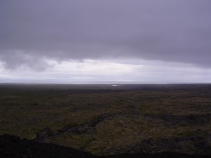

A view over to the Reykjanes Peninsula from a cinder cone. A crack in the lava field can be see below. Author: Jón Frímann Jónsson. Licence: Creative Commons.
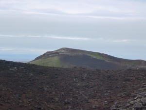

A view from a cinder cone over to the next cinder one in the row. This is on the Snæfellsnes and is part of the Snæfellsnes volcano. Author: Matilde Grácio Licence: All rights reserved. Used with a permission.
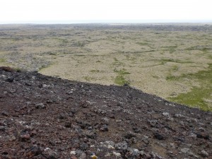

A view from a cinder cone over the lava field. At distance there is the ocean. Author: Matilde Grácio Licence: All rights reserved. Used with a permission.
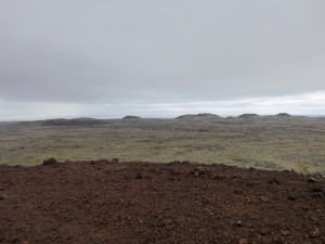

Row of cinder cones at distance. Author: Matilde Grácio Licence: All rights reserved. Used with a permission.
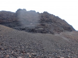

A cut side into a cinder cone. This material was mined by the local population few decades back and used for road construction. This area is now part of Iceland national park. Author: Matilde Grácio Licence: All rights reserved. Used with a permission.

Click on the pictures to get full resolution. But the pictures are large and it might take some time to download them on a slow internet connection.

More information.

Páll Einarsson. „Hvað eru miklar líkur á því að Snæfellsjökull gjósi?“. Vísindavefurinn 30.4.2002. http://visindavefur.is/?id=2347. (Skoðað 23.3.2011). (Icelandic)
JGÞ. „Hvar eru eldfjöllin á Íslandi?“. Vísindavefurinn 29.9.2006. http://visindavefur.is/?id=6219. (Skoðað 23.3.2011). (Icelandic)
Jarðsaga Íslands (Icelandic, Wiki)
Introduction to the geology of Iceland

One year ago since Eyjafjallajökull volcano eruption did start in Fimmvörðuháls

This day exactly one year ago a eruption started in Eyjafjallajökull volcano in Iceland. The first phase of the eruption was a Hawaiian type eruption that took place in Fimmvörðuháls. But that area is glacier free and is part of Eyjafjallajökull volcano system. On 31.03.2010 a second fissure did open close the first one that had been erupting for about two weeks by then.

The explosive phase of the eruption in Eyjafjallajökull volcano started on April 13th 2010. But I am going to write more about that when the day comes (I hope). That eruption did not end until late May and since then Eyjafjallajökull volcano has resumed it’s dormant status. For now anyway.

Here are videos of the Fimmvörðuháls eruption in Eyjafjallajökull volcano that took place in 2010.

Deep earthquakes in Askja volcano. Data on how Japan Mw9.0 earthquake was recored in Iceland

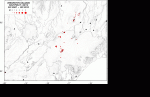
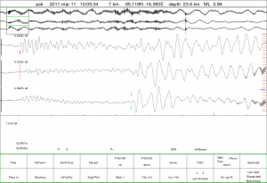
I see that in last week (week 10) that there was a deep earthquake swarm that took place under Askja volcano. This time around the earthquake swarm lasted for about 75 seconds and the depth of this earthquake swarm was about 20 km. The location of the earthquakes was north-east of the main Askja caldera, but within the Askja volcano system it self. The largest earthquake last week in Askja volcano was ML2.2 in size. Last year there was also a deep earthquake swarm in Askja. But that time around it lasted for few hours, not second. That activity took place in Week 09 of the year 2010. Here is a map of that weeks activity. But this deep earthquake swarm suggests that magma is on the move under Askja volcano, as was the case in the year 2010 when a similar event did happen.

Above: Picture of the Vatnajökull glacier area. The deep earthquakes north-east of Askja volcano can be seen here.

Above: The 75 second earthquake swarm north-east of Askja volcano.

Japan Mw9.0 earthquake

Strong earthquakes like the Mw9.0 earthquake in Japan appear all over the world on seismometers. In fact the effect from this earthquake could be seen up to five days at least on long period seismometers. Icelandic Met Office did release in last week overview.

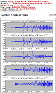
Above: How the earthquake did appear on the IRIS seismometer in Iceland.

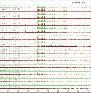
Above: This is how the earthquake did appear on the SIL network. Aftershocks can also been seen in this plot.

Copyright of this pictures in this blog post belong to Icelandic Met Office or other parties unless I notice otherwise.

Blog post updated at 21:57 CET on 16.02.2011.

Special report: Part of Japan moved 4 meters due to the Mw9.0 earthquake

According to BBC News it seems that that part of Japan moved up to 4 meters in the Mw9.0 earthquake. Closest to the epicentre of the earthquake the movement is possibly up to 20 meters, but the movement might have not been all the same within the fault line (100 wide and 500 km long). This earthquake might also have shifted the Earth axis about 16.5 cm. But this earthquake has also changed the sea bead in such way that it needs to be remapped for ships.

Two videos of the earthquake.

BBC News on this.

How the quake has moved Japan (BBC News)
Pictures of the damage from the earthquake (BBC News)

Support Japan and it’s population with donations.

2011 Japanese Earthquake and Tsunami
(Google Information web page)