It is a quiet time in Iceland with just 132 earthquakes recorded last week. While that is happening. I am going to write about volcanoes in Iceland that are less known, but remain dormant for the moment.
This time around I am going to write about volcano named Snæfellsjökull volcano. Snæfellsjökull volcano is a stratovolcano like Eyjafjallajökull volcano, Öræfajökull volcano and many other of Iceland volcanoes (that is most of them). But unlike many of Icelandic volcanoes the cone shape of Snæfellsjökull volcano is clearly visible to people as it is with Eyjafjallajökull volcano and Öræfajökull volcano. But less so with other icelandic volcanoes that are in this same group of volcanoes. The reason for this is the fact that Snæfellsjökull volcano only has glacier on top of it. But not covered by a glacier on most sides like is the case with Bárðarbunga volcano as a example.
Volcanism in Snæfellsnes peninsula has happened in two time periods. The earlier time period was about 15 to 7 million years ago when this area was a active rift zone of earlier Iceland. The second period of volcanism in Snæfellsnes peninsula started again about 2 million years ago (far as I know, might be wrong however as I did not find any information to confirm this) when volcanism started again after a break that had lasted for about 5 million years. It is not clear why volcanism did restart in Snæfellsnes, as this area is not a active rift zone. But most of Iceland volcanism takes place on a active or forming rift zone. Current volcanism in this this area little. But last known eruption in Snæfellsjökull volcano was in the year 200 A.D +- 150 years. The age of the Snæfellsnes volcano is about 700,000 years old according to recent research into the age of the volcanism in this area.
It is hard to know for sure what type of volcanism Snæfellsjökull volcano makes. But given the data it can be assumed that a volcanism that is not far from what witnessed when Eyjafjallajökull volcano erupted.
Pictures of this area.
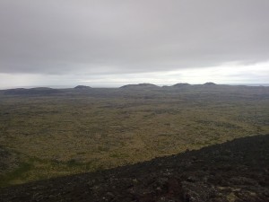
Lava field in Snæfellsnes. This lava field is from Snæfellsnes volcano. Crater rows at distance. Author: Jón Frímann Jónsson. Licence: Creative Commons.
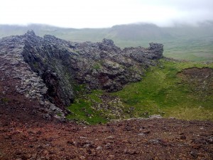
Inside of the one of the craters that are on the Snæfellsnes volcano. Author: Jón Frímann Jónsson. Licence: Creative Commons.
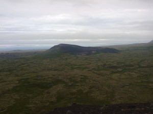
Volcanic cinder cone on the Snæfellsnes. This cinder cone is from Snæfellsnes volcano. Author: Jón Frímann Jónsson. Licence: Creative Commons.
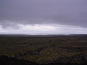
A view over to the Reykjanes Peninsula from a cinder cone. A crack in the lava field can be see below. Author: Jón Frímann Jónsson. Licence: Creative Commons.
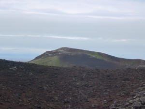
A view from a cinder cone over to the next cinder one in the row. This is on the Snæfellsnes and is part of the Snæfellsnes volcano. Author: Matilde Grácio Licence: All rights reserved. Used with a permission.
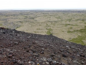
A view from a cinder cone over the lava field. At distance there is the ocean. Author: Matilde Grácio Licence: All rights reserved. Used with a permission.
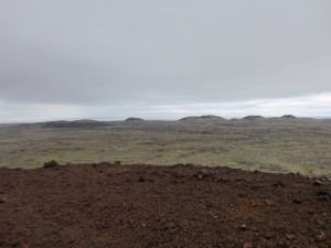
Row of cinder cones at distance. Author: Matilde Grácio Licence: All rights reserved. Used with a permission.
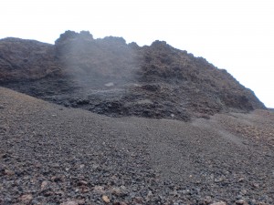
A cut side into a cinder cone. This material was mined by the local population few decades back and used for road construction. This area is now part of Iceland national park. Author: Matilde Grácio Licence: All rights reserved. Used with a permission.
Click on the pictures to get full resolution. But the pictures are large and it might take some time to download them on a slow internet connection.
More information.
Páll Einarsson. „Hvað eru miklar líkur á því að Snæfellsjökull gjósi?“. Vísindavefurinn 30.4.2002. http://visindavefur.is/?id=2347. (Skoðað 23.3.2011). (Icelandic)
JGÞ. „Hvar eru eldfjöllin á Íslandi?“. Vísindavefurinn 29.9.2006. http://visindavefur.is/?id=6219. (Skoðað 23.3.2011). (Icelandic)
Jarðsaga Íslands (Icelandic, Wiki)
Introduction to the geology of Iceland

Fair to say that Snæfellsjökull is the most famous volcano in Iceland due to a certain French writer of the 19th Century.
I’m disappointed to learn that the great Arne Saknussemm fudged his data :’-(
Has Grimsfjall started a deflation period?
http://strokkur.raunvis.hi.is/~sigrun/GFUMstutt.png
Deflation or distortion southwards by the look of it.
If the movement shows a sharp southward and a noticeable downward trend wouldnt that hint that magma might have found another path and is currently building some way north of GRF GPS station and draining beneath?
This might also just be ice/snow on the GPS antenna.
Well the graph usually points out ice/snow with the white markers as it has been done before. I believe that Sigrun marks them manually.
4.7 2011/03/24 05:23:25 59.438 -30.313 8.7 REYKJANES RIDGE
4.7 2011/03/24 05:17:22 59.508 -30.365 10.0 REYKJANES RIDGE
http://earthquake.usgs.gov/earthquakes/recenteqsww/Quakes/quakes_all.php
Also http://www.emsc-csem.org/#2
2011-03-24 05:23:25.0
59.47 N 30.42 W 10 mb
4.7 REYKJANES RIDGE 2011-03-24 07:59
2011-03-24 05:17:21.0
59.52 N 30.36 W 10 mb
4.7 REYKJANES RIDGE
and http://geofon.gfz-potsdam.de/eqinfo/list.php (GFZ Potsdam – Earthquake Bulletin)
2011-03-24 05:23:26 4.3 59.38°N 30.27°W 10 M Reykjanes Ridge
2011-03-24 05:17:21 4.4 59.37°N 30.30°W 10 M Reykjanes Ridge
Something strange happened with me today. I live close to Selfoss, about 4km north of Hestfjall (which was the epicenter of the big quake of 21 June 2000). At 17h14 I felt a small tremor for a brief couple of seconds, while eating a soup at a table, and I was the only one feeling it in a group of 10 people. I came home and checked en.vedur.is and there was a quake at 17h06 (so, 8 minutes before) in Hestfjall but only 0.6!
Now, at 19h59 I felt another small vibration, while working on the computer, again I was unsure but immediately thought “its another earthquake”. I checked again the website and there was a quake again at Hestfjall (is only a few kms south of here) at 19h30 and 0.8. So far, no quake was recorded at 20h00. That mountain, which is close to Selfoss, is known for being the epicenter of major earthquakes on the past. Do you think I felt something? Does Vedurstofa records all earthquakes?
I didn’t record any earthquake at that time. But my geophone is close to Hekla volcano so it is not that sensitive to Selfoss area. But that is a good distance from where you are in Selfoss. I did however record a earthquake at 20:28 UTC on my Hekla geophone. It was a small earthquake and a short distance from my geophone far as I can tell.
Ok. That earthquake in your geophone at 20h28 did not show up so far in Vedurstofa Islands (vedur.is). Maybe the earthquakes I felt at 17h14 and 19h59 were other small earthquakes that happened here at Hestfjall and they did not record.
The Hestfjall usually has no earthquakes, only about one every week.
Today, there were 3 (and also another fourth in Reykholt, a few kms north of here), so it looks like the area had a small swarm. Hestfjall is where the big earthquakes in summer 2000 happened.
This being true, it would be my first earthquakes in Iceland
But thanks for checking that Jon.
I am 50km west of Hekla.
EQ at Hestfjall are easily found at Sólheimar in Grímsnes, so I’d not be surprised if you found it at Selfoss
Here is England we get ground rumbles which do not measure as earthquakes. Here they are usually in spring or automn. They are clearly noticable and the animals run in the fields and methane bubbles rise rapidly in the swamplands.
Our erathquake experts deny any earthquakes have taken place.
My guess is that the rumbles here are vast methane releases.
Mind you, our nearest measuring points are a long way away so would miss small earthquakes here, and we are directly on the sticklepath fault. Perhaps it is the other way around and real small earthquakes shake the methane bubbles out of the swamps.
Is it warming up in Iceland yet, and were you near swampland?
Jon, concerning Snaefellsnes, was the old rift the line between Snaefelljokull, the other volcanoes east on the peninsula, to Grábok, and then to the geothermal area in Husafell and the western part of Langkjokull?
Was this the path of the hotspot, from west to east? Is this the reason, why volcanism is slowly shifting to the east? There is kind a line of activity linking Snaefellsnes to the east.
My other question is: where does the west and east volcanic belts link? At the south fracture zone, or at Langjokull-Hofjokull?
There is a kind of microplate around here where I live, in Grimsnes and Selfoss area.
It looks like the rift is opening at Reykjanes-Hengill-Thingsvellir, and then again at Hekla-Katla-Vatnajokull. To the north there is Hofsjokull and Kerlingarfjall (central volcanoes with less activity). Sometimes it seems that the east rift is extending southwest, with the recent formation of Hekla volcano and Surtsey. Maybe this indicate that volcanic activity could form in the future south and west of Hekla and Katla. What do you guys think?
“Opening?”
Doubtful. Extending, yes. After the MAR makes landfall and transitions to a continental spreading center, the mechanism becomes more akin to the Basin and Range province of the Western US but on a much tighter scale. Any “opening up” is followed with dike emplacement and in some instances, a volcano (provided it makes it to the surface).
On geologic timescales, yeah.. “opening up” is a valid way of putting it. Disaster movie style, not so much.
BTW, the microplates that I am aware of are the Hreppar and Tröllaskagi.
From a defunct website (well, maybe not defunct, just not currently assessable, I had to dig it out of Googles cache)
http://i53.tinypic.com/mwryo9.png
(Olelog, by Ole Nielsen)
And a link to more recent work by Foulger (2003) that discusses a similar subject “A cool model for the Iceland hotspot” Journal of Volcanology and Geothermal Research 141 (2005) 1– 22.
http://www.dur.ac.uk/g.r.foulger/Offprints/FoulgerJVGR1.pdf