
This is going to be a short update.
There are no major changes in the eruption in Holuhraun. From the looks on the web cameras it appears that wall of the crater has possibly collapsed, I don’t have it confirmed. Other possibility is that the eruption in Holuhraun has increased for the time being. Some lava strokes can be spotted on the north edge of the crater at the moment. The lava flow seems to have changed direction at the moment, the size of the lava field is now close to 72 km².
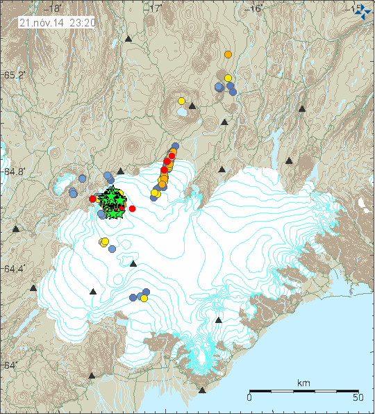
Earthquakes in Bárðarbunga volcano for the past 48 hours. Copyright of this image belongs to Icelandic Met Office.
For the past 48 hours there have been 63 earthquakes with magnitude that are larger than 3,0 in Bárðarbunga volcano. In that same time earthquake activity also appears to be increasing along the dyke. There have not been any change in GPS data, suggesting that flow if magma into the dyke is about the same as before. No other changes have been reported at the moment. The eruption is now clearly visible on Míla Bárðarbunga web cameras (Camera 1, Camera 2).
Other things: Based on my latest calculations it is going to take me 1,6 year (best estimate at the moment) to get out the debt issue that I am now in. Both paying down the overdraft with my Icelandic bank, the tax debt with the Danish state (a large pile of money for me) and what I am going to owe mom and dad due the move back to Iceland. Uggghhhh. Sometimes I hate money.
Article updated at 00:55 UTC.
THANKS. Was not aware that the Home button would work on this site. Silly me.
The little arrows are almost invisible with the screen 4′ from my aging eyes. Sorry.
Thanks for the helpful info.
@Da Xin,
when I click on “Jon Frimann says:” I got the newest article … and then I click on the article headline to see the comments. Hope that helps.
Yes. Thanks. Appreciated.
My eyes are old, too. Windows 8.1…..enlarge or reduce screen size on this new laptop with touchpad functions similar to swiping on an Android tablet.
I have also noticed the increased activity on the Mila 2 cam. and yes, there were some “fountains” of lava last night and at times this evening as well. Mike in OZ and I are on opposite sides of the Pacific but I too see lot that goes un-noticed because of time differences. I seem to be here a lot when it is the wee hours of night in Iceland.
THX THX. I have the font enlarged on my Win 8.1 system.
Yes Jon, I hate money too. The one thing that man pursues with his whole life and it’s the one thing we know for sure we cant take with us when we die. Crazy! Live life for passion and adventure, just maybe you can take your memories with you.
Great Philosophy! 🙂
http://m.youtube.com/watch?v=sor9GzivGbk
I don’t recall seeing it this quiet for some time in BB –
http://snag.gy/YBDRz.jpg
The infrasound noise is just the wind strength in the area it seems.
At the moment, there is no output line in the graph for either VON, GRF and DYN stations.
Also quite a bit of other ones have gone missing for the time being.
I also have a weather eye on Hekla given its unpredictability and these borehole strain graphs are showing quite a fluctuation –
http://snag.gy/7ck4k.jpg
Thanks Daan
It would be great if they could move the mila 2 cam closer to the event, for sure without putting anybody at risk, only if the wind direction allows it (So2). For example on Big Island Hawaii the webcam is standing on the crater rim of Po’u ooh” (not sure if I spelled it right). That would be too close at Baugur, but with a massive tripod (against shaking caused by wind) and better camera there would be SO much more to see. The zooming-in does not really help, as it’s blurry and the wind shaking is intensified by zooming. I will write to the mila guys.
on a hot lava field of >300 Celsius a cam would not survive for long ….
For sure I don’t want them to put the cam on the lava. Just better optics would be great.
we should be glad that there are these two mila cams with relative great views of what’s going on there! if barda will speak we will see it too…. so we are very lucky to have these cams anyway!
Mila cams are sturdy and expensive, they don’t want to lose them, but probably will if there’s a major event –
http://snag.gy/MuGj9.jpg
Thanks for sending that pic. So that’s how a mila cam looks like? I thought it’s much smaller with some sort of solar powered battery system. Maybe they should attach the cam to the container, then it wouldn’t shake so much. But already during Eyjafjallajoekull eruption I was so happy that mila cams just existed! Great work by them!
You can´t rely on solar power there. From mid November to mid February the sun barely makes it over the horizon and only for a few hours a day. And then there is lot´s of fog and clouds.
I guess that they were thinking before placing them. And they for sure placed it in a way they will not loose them in any case of ‘major event’.
Would have been nice if you had credited me for the pic; it took quite a lot of getting.
Where did you find it? If someone is posting my pics around without credit, I would like to know.
https://twitter.com/eruptionchaser/status/510229014011977728/photo/1 is the original
Mike, I didn’t know it was yours, got it off VC from old posts. Apologies I know you spent some time up there and all credit to you for your work.
LOL its called the internet,that picture may end up as a profile pic for a volcano nut on facebook,then you can sue!
I am a bit annoyed at myself over this Mike, I know how miffed I was when someone hijacked some of my online video content and I don’t like upsetting anyone who, like yourself, has put so much effort into getting photo’s/video.
I remembered seeing the Mila cam photo some time ago and couldn’t recall where so I typed in Mila Cam Iceland in google image search and there it was – search results –
http://snag.gy/vgW7Q.jpg The purpose being to show the other poster they were substantial units – not to claim credit. The link under the photo (try it please) says “600×390 – volcanocafe.wordpress.com” and I clicked view image and screen captured it.
I think a few of us, including me, have been pasting screen shots into VC and here for so long that we forget to credit someone, I am going to make a point of doing that now unless for example it has “Mila” on the screen capture.
No worries it’s not a biggie; I wouldn’t put stuff out there if I didn’t want people picking it up and using it.
But I am a pro, all I ask for is credit when it IS picked up and used 🙂
Has anyone noticed that the subsidence on gps chart has changed back to going down in steps, this last happened at the beginning when the chart first started, this step drop lasted for about 12 days and then it changed. It is funny it has changed back to dropping in steps, I wonder if the subsidence is going to speed up again
Also, the quakes seem to be averaging out in magnitude…but increasing in frequency??
Less resistance?
Can’t read too much into short term appearances. Only the gray lines are instrumental (1 second real time?). The red and blue are statistical trailing trend lines that show useful variation within some span of date/time. The wiggles decrease with longer span, but longer span loses important detail. For comparison IMO also shows the long-term graph, which is very smooth. It’s the only one where the slowing of the subsidence at that single point on the ice cap is visible.
However, there is no way for us to know how the entire caldera is behaving. For that, 3 GPS’s would be needed. On the southern side, for instance, it could be rising. Not likely, but possible. In that case, the caldera would be like a hard lid that is tipping down towards north. And the southern rim would be bulging, not dipping.
An example of a multiple-GPS monitoring setup:
http://volcanoes.usgs.gov/volcanoes/yellowstone/yellowstone_monitoring_47.html
Hello again!
Mostly lurking here and on VC (mostly here 🙂 and I find all the information and discussions very helpful in reaching a higher understanding of what is going on in Bardabunga and Holuhraun. Certainly a complex matter to fully understand. Because no one seems to fully do that. But we learn more as it develops and that makes it facinating to follow. Thank you Jon for doing this. 🙂
Out of “nowhere” I had a thought regarding the feed this morning. It might very well be false but here it goes…
Imagine the tunnel making the dyke from BB to Holuhraun is quite soft. The pictures from the start of the eruption shows clearly the ground has subcided along the visible area of the dyke (a fact). Again imagine the feed itself has soft surroundings as a result of heating the crust around it (goes with the territory right?)
Now imagine you bury a hose in soft ground in your garden. It delivers fairly steady pressure and volume as long as it is buried in the unchanged surroundings. But what happens if you put loads and loads of rocks on top of it? It will gradually be restricted.
Could this be what we are seeing now at BB/Holuhraun? That the weight of the everpiling lava is restricting the flow at Holuhraun gradually? And hence the outflow is deminishing and as a result the subcidence at BB is slowing down. ?
It puzzled me that the 3+ EQ’s are going on like before wo. giving the boosts to Holuhraun after large EQ’s like we sometimes saw a month or two back?
It was yesterdays reportupdate found on IMO that started me thinking. Quote; “From midSeptember the productivity of the eruption has decreased.”
Any thoughts on this matter?
Nice. One thing I’d add is that the dykes that lead up to Holuhraun are not round like lava tubes. They’re a network of deep but narrow dykes formed by tectonic rifting, as part of the mid-Atlantic rift zones. Near the surface, basaltic rock is cold, hard but brittle. It splits readily when pulled apart.
Can someone who understands these things quickly look at the tremor chart (link below)
Different looking EQ? on something called JOKUL
http://brunnur.vedur.is/myndir/vala.png
I am sorry I can not post a screenshot 🙁
This IMO link http://gps.vedur.is/index.php?p=list will help you identify sil/gps stations and give you info on them, and this http://gps.vedur.is/mapSIL.php will show you their locations.
At the moment I haven’t seen anything unusual.
Thanks, John. That’s a great help in demystifying that chart.
Ah thanks very much John. That helps a great deal. I was looking at the trace (which passes through quickly) and there was a large ‘tremor’ lasting 3mins not the usual EQ spike which then tails off. Looking at your helpful locations I reckon it was maybe some maintenance or such like at that site causing the anomaly. Thank you again 🙂
Do you mean something like this?
http://www.brisske.de/Fotos/Public/BARDARBUNGA-Screenshots/TEMP/2014-11-22_18-40_vala.jpg
Yes!! It looked very similar to that. 🙂 What would be the cause? Thank you
Saturday
22.11.2014 14:50:17 64.674 -17.490 7.9 km 4.1 99.0 4.2 km NNE of Bárðarbunga
Saturday
22.11.2014 14:21:03 64.678 -17.427 0.7 km 3.7 99.0 6.4 km NE of Bárðarbunga
Saturday
22.11.2014 12:39:33 64.677 -17.448 7.5 km 4.0 99.0 5.6 km NE of Bárðarbunga
Little off-topic: big M6.8 in Japan Nagano…
A big wave of lava just came gushing out !
http://volcanoes.usgs.gov/hazards/gas/index.php
Examples of volcanic gas compositions,
in volume percent concentrations
(from Symonds et. al., 1994)
Hot Divergent Convergent
Spot Plate Plate
Temp. 1170°C 1130°C 820°C
H20 37.1 77.2 97.1
C02 48.9 11.3 1.44
S02 11.8 8.34 0.50
CO 1.51 0.44 0.01
H2S 0.04 0.68 0.23
HCl 0.08 0.42 2.89
The software lost my tabs. too bad.
This table of ‘typical’ magmas is a standard for comparison. The Holuhraun eruption is a good-sized sample of one of the magma reservoirs under Bardarbunga. A chemical analysis of the lava and the gases (which I presume would be proprietary at this point) might help resolve some questions of what’s under Iceland.
@SteveG, late reply to your comment from 19th: For the 6.3% of M5.0+ earthquakes out of M3.0+ using 90% confidence (alpha = 10% vs. 5%), although technically we should select alpha beforehand (a priori), we would look at 9.595% +- 1.645*sigma (using normal approx. to binomial distn), which gives 6.55% to 12.64% so the 6.3% over the 2nd summary period is out of the 90% expected range. Roughly speaking the eyeball method seems to be on the order of 90% confidence as you suggest.
Thanks. Not statistically strong or even usable, but that’s all that’s there. Were they justified in saying anything?
Looks like the gates of hell have opened on the holuhraun with the reflections of light against the clouds at the moment, quite a sight –
http://snag.gy/ZwzQz.jpg
Tomorrow in the German TV:
http://www.zdf.de/terra-x/island-das-tor-zur-anderswelt-faszination-erde-mit-dirk-steffens-35884366.html
Since last sunday marked boldly in my kitchen calendar! 🙂 Come what may, I am at home tomorrow evening.
Saturday
22.11.2014 20:06:33 64.611 -17.443 2.6 km 4.2 99.0 5.2 km SE of Bárðarbunga
Saturday
22.11.2014 19:52:52 64.666 -17.497 4.5 km 4.6 99.0 3.2 km NNE of Bárðarbunga
Saturday
22.11.2014 19:01:24 64.672 -17.458 6.9 km 4.4 99.0 4.8 km NE of Bárðarbunga
Saturday
22.11.2014 18:36:51 64.667 -17.403 8.8 km 4.3 99.0 6.7 km ENE of Bárðarbunga
Saturday
22.11.2014 18:34:57 64.691 -17.425 9.6 km 3.8 99.0 7.5 km NE of Bárðarbunga
Saturday
22.11.2014 18:29:52 64.675 -17.480 0.5 km 3.8 99.0 4.5 km NNE of Bárðarbunga
Impressive activity today…
And this is only from last 2 hours!
GPS not updating…
It’s been doing that off and on all evening. Mostly like now (10.41), the graph still updates every 5 minutes, but there is no new data. But at least once, the graph didn’t update for 25 or 30 minutes.
I’m just starting to keep a tiny little eye on the SW fissure swarm; about 15-20km SSW of the caldera. I’ve seen a few quakes pop up in this area in the last few days…
Gjalp?
Makes sense,as that would be the natural direction for energy release if the NE stress field cannot relieve the system at a greater rate.That’s if something does not give at the caldera rim first?
Heading toward Hamarin or Haabunga a bit or maybe another fissure eruption which would be starting as subglacial? This has been mentioned before, I think by Jon amongst others.
Jon said before that pressure was increasing and perhaps it is pushing into pre-existing fissures or conduits since the BB system (also called Veiðivötn system) is so large, not just encompassing the volcano itself.
http://en.vedur.is/media/jar/Bardarbunga_kafli20140825.pdf
I notice that the southwestern tip of the system is in close proximity to Hekla. Some have speculated the recent eq’s and the borehole strain fluctuations there (http://hraun.vedur.is/ja/strain/1sec/index.html) may be a result of it being ‘tickled’ by current activity in BB.
What are your thoughts on this Mike?
Hekla?
Could be; the larger BB quakes certainly tweak the Hekla strain.
As for ‘pressure;’, I’m not sure we have that good a handle on the chicken and the egg. Is pressure pushing the magma where it ‘wants’ to go? Or is the regional stress field causing things to creak just a little down to the SW, and potentially opening pathways in areas where the magma is ready and waiting to ‘go’?
My thinking tends towards the latter. I think this kind of activity is simply what tends to happen when regional stress reaches a tipping point, especially when the mantle plume is more active; this eruption is primarily influenced by regional tectonic stress, secondarily by the mantle plume, and only tertiarily by the magmatic system of any individual volcano.
I agree about Hamarinn, and it has been restless recently with a presumed sub-glacial eruption a couple of years ago, I think.
It is pretty amazing to think of BB’s plumbing reaching as far as Veiðivötn but we know that it has. Ditto Torfajokull.
Where’s Irpsit?!
BTW as for ‘large’, never forget that when you’re in Selfoss, right on the south coast of Iceland, you’re standing on BB lava flows… the entire reach of the damn system is most of the width of the *country*!
One of the amazing things about being in Iceland, as I’m sure you, Mike, will have experienced, is looking at all that evidence of enormous tectonic and volcanic activity and thinking,”Well, if that went in the 9th century, and that went in the 18th, there’s no reason why something similar can’t happen now.”
Perhaps that’s what we are living through. Prayers with Icelanders.
This regional stress “thing” if true where is it propagating from?The activity here is primarily centred on Bardarbunga and it’s related system.This volcano happens to sit on a very active area,that’s why this edifice is where it is,this is the culmination of a reawakening of the caldera part of this system.This system is the driver for all the current field stress ,what caused the massive magma influx at depth to trigger this,probably plate tectonics,but the volcano is not a tertiary event ,because it has the potential to affect the population and that’s the whole idea of monitoring,to protect the population in the first instance.
JB look at the big picture.
At the risk of belaboring the obvious, remember Iceland sits on a hot spot in the middle of an active spreading MOR. Those two factors drive everything, ultimately.
And they’re episodic; there are periodicities associated with stress buildup and rifting events, and there are periodicities associated with hot spot activity. That’s why we’re seeing these events *now*, not 30 years in the past or future.
Looking at the history, activity jumps from area to area – in the past it’s been Veidvotn/BB, or Eldgja/Katla, last time around it was Grimsvotn/Laki, this time it’s jumped back to BB – but flipped and gone up the northeast fissure swarm, which is a slightly different tectonic regime, and was evidently ‘due’ for action. But still, the principle difference between Holuhraun and Laki is scale; they’re more similar to each other than they are to other Icelandic eruptive episodes.
My 2c, worth what you paid for it 🙂
Mike with the risk of being a bore,this event is happening now because the genesis of the active phase was probably over 30 years ago and the shallow magma enplacement in the caldera has been centuries in the making ,probably before the 1477 event.You are very familiar with Tarawera,600 years between events in albeit a different tectonic setting.
I think the events could just be a mixture of both:
There is – undeniably – a big rifting event going on at the moment (see eg. the fissures found at Tungnafellsjökull or the ones near Holuhraun detected by a.o. Haraldur Sigurðsson). This is part of a bigger circle which started out probably with the Askja 1875 eruption – and continued in pulses with the 1920-30s Askja eruptions, the Krafla Fires in the 1970s and 80s and last the 1996 Gjálp eruption.
But on the other hand, there may well also exist pockets of evolved magma within the central volcano which has had time to develop to a higher viscosity since the last big eruption within the Bárðarbunga and which is being reactivated now by parts of the new magma entering the system from the hot spot below.
These are no contradictory terms for me.
I could also imagine that a small part of this magma is lifting the bottom of the caldera – the “braking effect” on the famous caldera plot -, and the volcano and its surroundings sinking at the same time due to rifting and rotating.
Would this make sense?
It has been confirmed that in past two days there was an increase in activity in Holuhraun eruption. That activity has dropped down since then according to the news.
Icelandic news can be found here.
http://www.ruv.is/frett/enn-gys-kroftuglega-i-holuhrauni
Comment updated.
Is it possible that the reduction in the magnitude 5 earthquakes is due to a reduction in the suppressive effect of the glacier,combined with the subsidence in the caldera roof means that more energy is going up instead of sideways?
Looking at the current EQ map above, one could get the impression that the dyke intrusion disconnected itself from the Bardarbunga volcano system. There is increased EQ acitvity in the dyke since a while, and there is this gap between BB and dyke intrusion. Just a thought and observation of the momentary situation.
What’s with the quakes south of the caldera? Mostly unconfirmed on http://baering.github.io/ but some also visible on http://en.vedur.is/earthquakes-and-volcanism/earthquakes/vatnajokull/
Large quake just in we will have to see what it is , I think 5+
http://geofon.gfz-potsdam.de/eqinfo/list.php
2014-11-23 09:22:51 5.1 64.55°N 17.44°W 10 A Iceland
IMO:
23.11.2014 09:22:46 64.616 -17.431 4.1 km 5.1 99.0 5.3 km ESE of Bárðarbunga
Amanzing view on both MILA cams today! Here are some screenshots from this morning …
http://www.brisske.de/Fotos/Public/index.php?AlbumDir=/Fotos/Public/BARDARBUNGA-Screenshots/2014-11-23
On cam2 there are today nice lava fountains visible and sometimes a lot of lava leaving Baugur.
BTW: One can scroll with your mouse through the pics.
Or the arrow keys
Cool!
@wial: Did you know that your website doesn’t work?
“Fatal error: Call-time pass-by-reference …”
Heh, all the activity comments, as opposed to right now when all is calm and peaceful, at least for the last 5-10 minutes or so. Even the steam from the lava/water interaction on the left looks more substantial than the cloud from the rift.
I don’t know if this has been linked in here before. There was an information meeting in Reykjavík re. the Holuhraun eruption and the influence of its gas emissions on Nov. 18: http://www.visir.is/bein-utsending–hvada-ahrif-hefur-mengunin-fra-holuhrauni-/article/2014141118924
The video (in Icelandic) shows the meeting with lectures. Use Google translator on the ppt shown.
Any talk of importation of fine granular lime to spread in the fields? Would be very expensive but might save the grazing lands.
To me, it seems from what I read – a.o. in the specialised Farmer’s Magazine (Bændabladið) -, that people hoped that the eruption would stop before the crops would be damaged. In this article, a professor of Engineering at University of Iceland, warns repeatedly about the danger the Holuhraun eruption could represent for Iceland’s agriculture. http://www.bbl.is/frettir/frettir/milljonir-tonna-af-brennisteini-ur-holuhraunsgosinu-ut-i-natturuna/4700/ I don’t know about any plans for import of granular lime or others. (But perhaps there are some.)
BTW: Could you explain a bit on the effects such granular lime could have?
A quick look on Google tells me that granular lime is finely divided limestone (calcium and/or magnesium carbonate). Its use would help to neutralise the acidity from the sulphur dioxide (also from hydrogen chloride and any othe acids in the fumes). SO2 and SO3 react with carbonates to produce sulphites an sulphates and CO2, which is still acid, but nowhere near as nasty as SO2.
From RUV.
They added more instruments next to the Bard GPS and are have now been receiving data since Monday. According to this new data, the EQs under BB are more shallow than they thought, 1-3 km deep, instead of 5-8 km as previously thought. So their focus is back on BB, as magma seems to be very close to the surface. Apparently anything is possible, yet nobody knows what this means.
http://ruv.is/frett/kvika-naer-yfirbordi-bungunnar-en-talid-var
By the way… Google Translate fail on this article.
“Preliminary new seismic measurements Bárðarbunga point to hot topics , probably dynamic , is much closer to the surface than has been thought . ”
it should read
Preliminary new seismic measurements Bárðarbunga point to hot material , probably magma , is much closer to the surface than has been thought .
None of that surprises me ,and my guess that hot material is not basalt.
WOW! This is very important new information!
Seems like there are two things there to talk about. The quake zones and the magma zones. I would guess that the concern is with the quake-quiet zone between the near surface quakes and deeper quakes. What’s in the middle is possibly a shallow but extended pancake of mushy magma. It is mushy because it is cooler. However, it is also possible that it is of more evolved or mixed chemical composition, not all basalt.
Good analysis!
Rúv News is reporting that Icelandic Met Office installed a Accelerometer on top of Bárðarbunga volcano, in the same area as the GPS station is. They have been getting data for one week now. This suggests that magma is now only on 1 – 3 km depth, rather than 5 – 8 km depth as they thought earlier. This means that Bárðarbunga volcano can start erupting under the glacier without any warning at all given current earthquake activity.
News in Icelandic.
http://www.ruv.is/frett/kvika-naer-yfirbordi-bungunnar-en-talid-var
The type of sensor used on top of Bárðarbunga volcano.
http://en.wikipedia.org/wiki/Accelerometer
That is a worrying development!
Why this was not done earlier ?It seems like there was too much faith in the drainage model?
If the Scientists were worried….would they not raise the alert level??
My guess is it would impossible to say if and when will erupt,except maybe in the last hours before a possible event,so I guess they are just in a state of constant readiness?
This deserves its own post, so people not checking the comments can get the news.
*In my personal opinion*, as a non-geologist,
In the Yellowstone monitoring setup,
http://volcanoes.usgs.gov/volcanoes/yellowstone/yellowstone_monitoring_47.html ,
one can see that they use several different types of monitors at some locations. They do that because they have several long-term monitored large magma chambers, all monitored with up-to-date technology (I should hope).
That’s because different technologies do not yield identical measurements. They are not redundant. They vary in measurement range, sensitivity of signal, and rejection of noise. They give slightly different views of the monitored events.
Accelerometers can not negate or undo valid readings from seismometers, GPS’s, or whatever else. Accelerometers provide additional readings that were not available previously.
Which means that there are now extended measures of earthquakes that are available to IMO that they’re trying to understand. The historical record from exiting instruments cannot change or be undone. It can only be augmented.
However, interpretations, explanations, and forecasts, and opinions of the overall patterns can change. People can now rethink that this or that danger is more or less likely.
Buyer beware! The above is just my personal uneducated opinion, nothing more! I’m anxiously awaiting further news from IMO.
Did IMO mention why the GPS-data stopped?
It might be as simple as ice on the antenna or it is out of battery. It was not mentioned.
Off topic: Cabo Verde volcano from Fogo Island is active since this morning. Just saw in the news.
http://www.rtp.pt/noticias/index.php?article=784364&tm=7&layout=121&visual=49
Luisport,
I have tried to locate more information on the web about what is happening on Cabo Verde, Fogo Island as I can’t read what the article has to say (I only understand English).
Have you seen anything else reported about this situation? If not, could you translate a bit of what was said in the article?
M
Here’s one: http://www.dailymail.co.uk/wires/reuters/article-2846423/Cape-Verde-orders-evacuation-Fogo-volcano-erupts.html
Volcano of Fire: Children and the elderly have left of Cha das Boilers
November 23, 2014, 17:56
Children and elderly people have been evacuated from the town of Cha das boilers, following the volcanic eruption started today at 10:00 in that area of the island of Fogo, told Inforpress the National Police.
According to information gathered by Inforpress, with the PN, the contingent of the Armed Forces and the national civil protection team who left Praia to provide support are already in the city of Sao Filipe and should reach the silverside location of the boilers at any time .
The two teams will assist in the evacuation of the other part of the population, especially young people who are on site trying to take care of their property.
The last volcanic eruption happened to April 2, 1995 and lasted for several days, in what was one of the most intense episodes of this nature in the archipelago.
This outbreak highlights the disappearance of a village and important agricultural areas, the destruction of infrastructure and equipment. ” http://noticias.sapo.cv/info/artigo/1422496.html you have more links in this page…
A bit more info on the volcano and the current eruption:
http://www.boston.com/news/local/massachusetts/2014/11/23/cape-verde-evacuations-are-underway-following-volcano-eruption/MqqLEMCSab9qYGqlw1F5qL/story.html
and GVP information on the volcano: http://www.volcano.si.edu/volcano.cfm?vn=384010
Sunday
23.11.2014 14:15:47 64.662 -17.434 3.3 km 4.1 99.0 5.1 km ENE of Bárðarbunga
Hot action on mila cam 2, lava sometimes fountaining and spilling over …
Hopefully the vent will keep acting as “overpressure valve” for Bardar…
The main factor with the caldera is how eruptible is the shallow magma,the glacier maybe helping in this regard?But the reservoir of deep source magma affecting the caldera,possibly dwarfs what is currently being erupted?
Hadn’t looked at the vedur quake results page for a couple days, it seems there are more stars at Bardarbunga than there are at an awards ceremony! 🙂
Yes especially with the new accelerator data.
A lot of activity along the intrusion in Dyngjujökull. Is this perhaps a result of the recent 5+ quake in the B. caldera, as more magma is being pumped towards Holuhraun?
Also, judging by the Mila webcams, the eruption seems to be really raging this evening!
This is not lava fountains now in cam2?
Could be, yes.
I don’t see it now, but it was impressive when i post… it was not the usual pulse we see, it was fountaining in more astive part on the right side.
About a week or so ago we were averaging just 100-150 quakes over the last 48 hours. This rose steadily to 200 and is now around the 300 mark. So activity has definitely increased.
Has a new batch of fresh magma arrived from the hot spot?
Didn’t have time to check for some days now, but I see now a lot more activity also in the dyke between Bárðarbunga and Holuhraun.
The rock surrounding the caldera may not be able to store the energy from the magma long enough for frequent larger quakes,so the energy is being released in many more smaller quakes(magma closer to surface and rock more fractured)?Is the shallow magma getting closer to the surface near the NNE flank by moving horizontally under the rim,I wonder do they have equipment monitoring deformation on that flank?
For all those thinking the eruption is intensifying or fountaining at the moment – a look back at 3rd September –
http://snag.gy/QWfoX.jpg
The difference is, as Jon says, Gas emissions have increased reflecting differences in the composition and source of the magma.
I still think there is fountaining going on at the moment at Holuhraun, and btw. lava fountains are driven by rather high gas emissions.
On lava fountains: http://volcanoes.usgs.gov/images/pglossary/LavaFountain.php
It’s still better to be seen on the MILA 2 cam (the white and yellow colours), i.e. the hottest material. http://www.livefromiceland.is/webcams/bardarbunga-2/
We have a lava lake. I think that the “bubbling” of the lake is actually “fountaining” taking place at the ground of the lake. In other words, we would have fountains if we would have no lake.
The security valve is doing its very best, I’d say. Let’s hope it is good enough …
There can be fountains within a lava lake, see the USGS link above.
That crater looks like it has suffered a flank collapse?There may now be less of a lava lake to subdue the fountaining?
See also this picture from Erta Ale:
http://www.flickriver.com/photos/volcanoes/3120457748/
Ok – fountains from lakes – I didn´t know that. Now I do 🙂
The crater Baugur really looks like it had a partial collapse.
It also seems like there is a storm going on as the camera seems to be moving a lot. Could be the eruption creating her own local weather conditions, but could also just be the gases between the camera and the eruption site creating such an effect.
But there are also sometimes lava fountains within the Puʻu ʻŌʻō lava lake: http://www.volcano.gov/kilauea/history/1959Nov14/19591219_0345_JPE_caption.html
The “security valve”may only be having an indirect effect on the shallow magma as only a portion of the total magma at depth is being released,possibly the deep source magma is filling at the same rate or slightly greater than being erupted?
Time for a little reminder; me getting up close and personal with a lava lake:
http://vimeo.com/84947481
I’ll try this at Holuhraun next time I’m there 🙂
I watched the Mila2 cam at 20:24 UTC for about 2 minutes. The activity definitely has picked up from yesterday. What are the torch light figures on the left? There definitely is some type of igneous-gas emissions on the right which is new from yesterday.
The left hand side in particular seems to sparkle with torchlight effects, are these lava fountains?
Being curious, but not knowing much about volcanism, I keep staring at this upper left graph but can’t figure out what it measures. Obviously the Y-axis is time, but what is the X-axis showing? Various measuring stations in different colors, yes, but what are they measuring? 🙂
http://brunnur.vedur.is/myndir/vala.png
the other way around, ah well, I think you know what I mean!
‘Seismic waves ‘ are the words to google for. 🙂
Thanks! I actually have a clue what seismic waves are, even though I could learn a lot more about it, but didn’t know the graph was showing me. So – simply put – the measuring stations are simply seismometers?
As far as I know they are infrasound measurement devices.
A quote from the IMO –
“IMO‘s nationwide monitoring systems consist of 115 automatic and 100 manned weather stations, a network of 170 hydrological gauges in rivers, a 55-station seismic network (SIL) with automatic, real-time data acquisition and earthquake location, a continuous GPS (ISGPS) network of 70 stations, some with high sample rate, a 5-station borehole strain meter network is operated in southern Iceland, and a weather radar, which can also monitor volcanic plumes, is located in south-western Iceland. In addition, IMO conducts extensive manned monitoring of glacial rivers and sub-glacial floods (jökulhlaup), of glacier mass balance and margin positions and participates in nationwide GPS campaign measurements.”
Sil details –
http://earthice.hi.is/sites/jardvis.hi.is/files/Pdf_skjol/Jokull58_pdf/jokull58-jakobsdottir.pdf
The gps array details –
http://www.norvol.hi.is/~thora/ondvegi_final_report.pdf
@ Inge:
Infrasound is showing at bottom right.
@ Rumba:
Correct. Showing earthquakes in near realtime.
Very big quake just incoming. Short past 9. Looks like >5.
The lava lake at Holuhraun is approximately 400 x 100 m in size, and we see from cam2 the NE point of it, where lava seems to flow/sputter out of the lake. In the back (on the left side we also can see some sputtering, but i think it’s still contained in the lake and flows to NE point of the lake.
Sunday
23.11.2014 21:31:05 64.680 -17.513 7.2 km 3.9 99.0 4.4 km N of Bárðarbunga
Sunday
23.11.2014 21:21:15 64.682 -17.486 9.3 km 3.8 99.0 5.0 km NNE of Bárðarbunga
Sunday
23.11.2014 20:44:56 64.684 -17.488 8.7 km 3.1 99.0 5.2 km NNE of Bárðarbunga
Sunday
23.11.2014 20:04:36 64.677 -17.441 8.7 km 4.5 99.0 5.8 km NE of Bárðarbunga
Sunday
23.11.2014 20:02:50 64.669 -17.444 6.7 km 3.8 99.0 5.1 km NE of Bárðarbunga
All this quakes very near and arround 5Km…
Because of the volcano eruption today, the Internet connection to our webcam has been destroyed by the lava. Here you see the last received image from the eruption today.
http://www.capeverde.com/live-webcams/pico-de-fogo-webcam.html
Nice outburst on the Mila2 cam at 00:38 UTC Nov 24th, it appears that the activity is slightly increasing since about 4 hours ago. A region over to the right hand side is releasing significant gaseous clouds, which was not seen 4 hours previous.
at 01:53 UTC, a major surge of magma coated the entire Bargur crater and overflowed, so activity is definitely up
Tremor up on all stations at all frequencies. Gps map shows inflation movement away from bb. Stil no vertical displacement data.
There is a storm passing over Iceland at the moment and it is going to last for the next 24 hours. New storm is then expected on Wednesday that is going to last for some time (I don’t know for how long at the moment).
Seems to be increased eq activity near surface at Bárðarbunga crater.
Large earthquake happening in Bárðarbunga volcano. Larger than magnitude 5,2 from the looks of it.
Yup, big shake this one –
http://snag.gy/8THY6.jpg
IMO giving 5.4
http://en.vedur.is/earthquakes-and-volcanism/earthquakes/vatnajokull/
“server not found” on all mila webcams 🙁
Maybe internet problems – or does anybody have further information?
You may have DNS problem on your internet connection.
I’m getting same problem just now.
Either the video servers are down or too many users at the moment. Hard to know for sure. This was common problem in September when the eruption had just started and many people where checking up on it.
Cams are back online, not much to see though …
… but now. Wow, nice sunset!
Yes, very impressive!
And now the moon has changed the place with the sun!