New earthquake swarm in Katla volcano

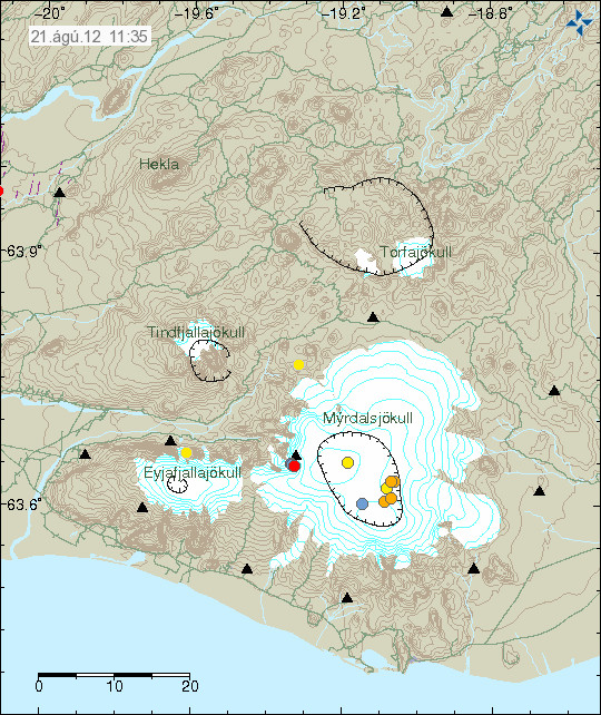
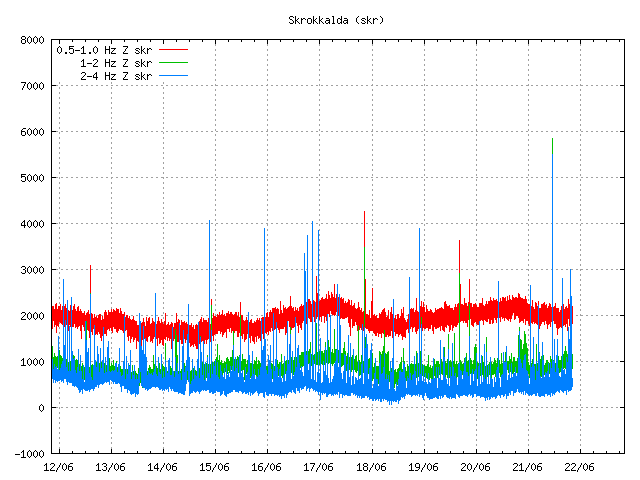
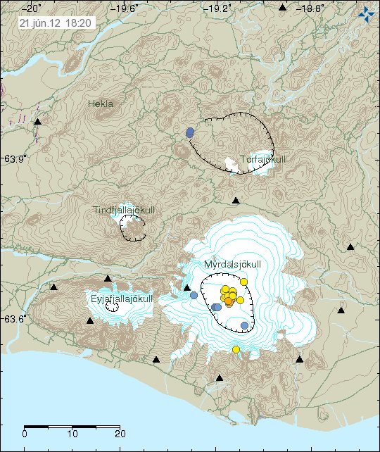
This morning at 07:03 UTC on 21. August 2012 an earthquake swarm started in Katla volcano. This earthquake swarm lasted for few minutes with the last earthquake taking place at 07:50 UTC. No harmonic tremor was detected following this earthquake swarm in Katla volcano. Update 1: The largest earthquake in this earthquake swarm had the magnitude of 2.6 at the depth of 0.1 km.


Earthquake activity in Katla volcano this morning. Copyright of this image belongs to Icelandic Meteorological Office.

It is impossible to know for sure what this activity means. But this might just be normal autumn activity in Katla volcano. I am expecting more earthquake activity in Katla volcano in next few days to weeks.

Icelandic news about this earthquake activity

Skjálfti í Mýrdalsjökli (Rúv.is, Icelandic)
Jarðskjálfti upp á 3,1 stig í Mýrdalsjökli (Vísir.is, Icelandic)
3,1 stigs skjálfti í Mýrdalsjökli (mbl.is, Icelandic)

Blog post updated at 15:18 UTC on 21.08.2012. I have not yet fully recovered from the heat wave. I forgot the important information about this swarm. They have now been added.

Earthquake in Katla volcano today (17.08.2012)

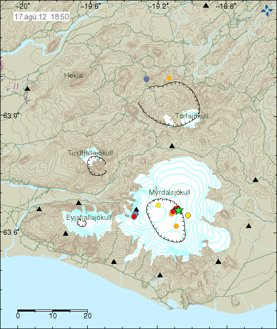
Today at 15:48 UTC there was an magnitude 3.8, at the depth of 0.1 km in Katla volcano. This earthquake took place on the caldera rim in Katla volcano. No major harmonic tremor was detected following this earthquake. However some harmonic tremor was detected. But it was minor. This might have been hydro-thermal-activity or magma on the move. It is impossible to know for sure what is the case now. This earthquake did appear clearly on my geophone network. Mostly on the geophone station at Skeiðflöt and Heklubyggð.


The location of the earthquake in Katla volcano. It was located on the edge of Katla volcano caldera. Copyright of this image belongs to Iceland Meteorological Office.


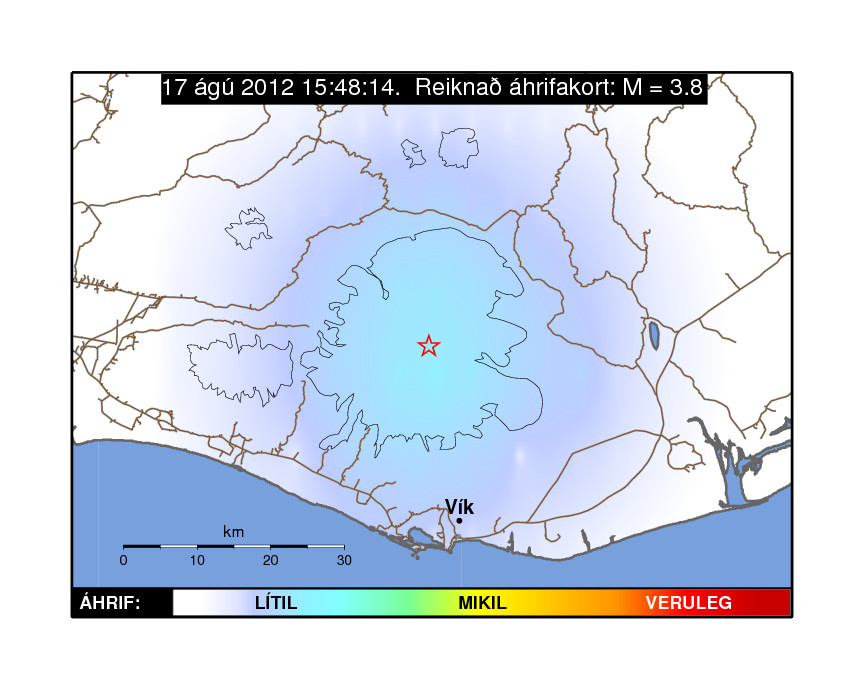
Influence map of todays ML3.8 earthquake. This suggests that it was not felt in nearby populated areas. Copyright of this image belongs to Iceland Meteorological Office.


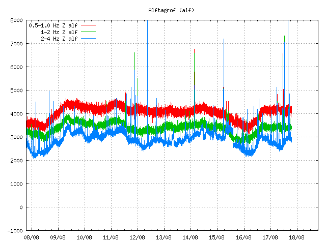
Tremor plot that clearly shows the earthquake of today. The spikes are the earthquakes that have been taking place in Katla volcano or close by areas. This is Alftagrof SIL station. Copyright of this image belongs to Iceland Meteorological Office.


This tremor plot shows some minor harmonic tremor following the earthquake in Katla volcano. The spikes show the earthquake from Katla volcano and areas close by. This is Austmannsbunga SIL station. Copyright of this image belongs to Iceland Meteorological Office.

It is impossible to know what this means exactly. But Katla volcano has been quiet since around middle of July. It remains to be seen if earthquake activity is picking up again or if this was just an single event.

Icelandic news about this earthquake

Jarðskjálfti í Mýrdalsjökli (Rúv.is, Icelandic)
Jarðskjálfti í Mýrdalsjökli (Vísir.is, Icelandic)
Jörð skalf við Austmannsbungu (mbl.is, Icelandic)

Blog post updated at 18.08.2012 at 11:51 UTC. Blog post title fixed for the future.

Quiet in Iceland earthquake wise

Currently it remains quiet in Iceland in terms of earthquakes and other geological activity. I am using that chance to have a bit of summer break. I am also going to move in August, so there is that. I am not moving back to Iceland. I am just moving inside Denmark. From Åbenrå to a small town named Padborg. But I think smaller towns work better for me then larger towns.

Because I am moving. I have to pay double rent in August. I hope that I do not have to pay double rent in September and October (that means more and new overdraft for me. Something I do think is an bad thing for me). This is going to leave me bit out of pocket. So all support is welcomed.

I am going to be on part-break until after I move to Padborg. But if anything major happens. I am going to write about it soon as possible.

Katla volcano

Katla volcano continues to have small earthquake swarm. What that means is still unclear. Largest earthquake in few days was earlier this week. That earthquake had the magnitude of 2.6 and had the depth of 0.3 km. Several smaller earthquakes did take place following this earthquake swarm. Since then Katla volcano has remained quiet. Small glacier floods are still a high risk from Mýrdalsjökull glacier.

Small glacier flood from Mýrdalsjökull glacier (Katla volcano)

According to Rúv News this evening. A small glacier flood started flowing from Mýrdalsjökull glacier (Katla volcano) few days ago. According to local farmer in the area. Glacier floods like this are common and several have taken place during this summer, none of them have created damage. The current glacier flood is from a glacier river called Leirá river. This glacier flood is from an cauldron somewhere close to middle of Mýrdalsjökull glacier. There is small risk of damage to local roads and fiber optics cable in the area. Some glacier breakage has been reported in the glacier where the floods comes from.

I am going to update this blog post if anything major happens with this glacier flood.

Update 1: It now appears that this glacier flood is now appearing on Rjúpnafell SIL station. So far just on this only SIL station. But that might change at any time if this glacier flood grows in size.


The tremor from the glacier flood can be see at the end of this harmonic trace. The spike is an earthquake in Katla volcano. Copyright of this image belongs to Iceland Meteorological Office.

Icelandic news about this.

Lítið hlaup í Leirá (Rúv.is, Icelandic)

Blog post updated at 00:07 UTC on 14.07.2012.

Minor earthquake swarm in Katla volcano

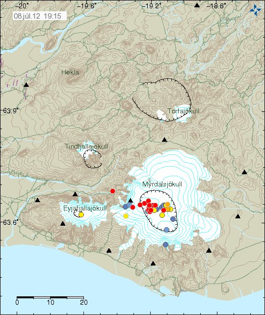
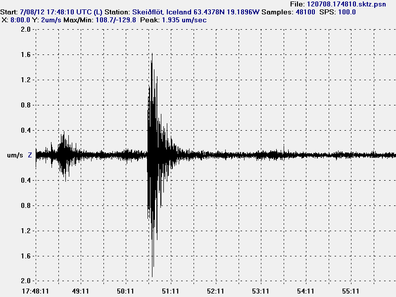
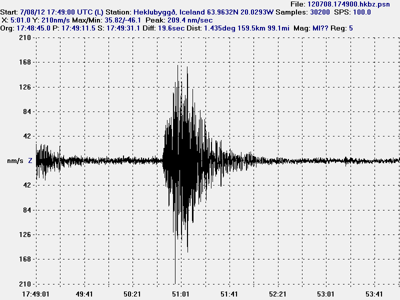
This Sunday is not quiet when it comes to earthquake activity in Iceland. Earlier today a small earthquake swarm started in Katla volcano. The largest earthquake in this swarm had the magnitude 2.3 according to the automatic SIL system. The largest earthquake did appear clearly on Skeiðflöt and Heklubyggð geophone stations. But Skeiðflöt geophone station is closest to the area where this earthquake swarm was taking place.


Earthquake swarm in Katla volcano. Copyright of this picture belongs to Iceland Meteorological Office.


The earthquake trace on Skeiðflöt geophone station. This is filtered at 1Hz. I have not located this earthquake trace (no P and S wave markers). This image is released under Creative Commons Licence. Please see CC Licence page for more details.


The earthquake trace from Heklubyggð geophone station. This is filtered at 1Hz. I have not located this earthquake trace (no P and S wave markers). This image is released under Creative Commons Licence. Please see CC Licence page for more details.

It is impossible to know what happens next in Katla volcano. But it is monitored heavily, so if anything happens. It is going to show up almost in real time on the internet.

GPS monitoring of Ice cauldron on Mýrdalsjökull glacier

In the news on Rúv yesterday (07.07.2012) they did tell about real time GPS monitoring of ice cauldron in Mýrdalsjökull glacier. But it is hoped that with this real time GPS monitoring they can give out warning sooner when a ice cauldron empties it self of the water it holds.

The news about this can be found here on Rúv News in Icelandic.

GPS-tæki komið í sigketilinn (Rúv.is, Icelandic, video)

Earthquake activity in Katla volcano and on SISZ

It has been quiet for the past weeks in Iceland. I do not know if that is changing. But this is the short update of what has been taking place in Iceland earthquake wise during this quiet period.

Katla volcano

Since Katla volcano earthquake spike in late April to middle of June. Sine then it has been rather quiet in June and what has passed of July. Today and yesterday there has been some earthquake activity in Katla volcano. But nothing like was seen in April to June.


Earthquake activity in Katla volcano during past few days. Copyright of this picture belongs to Iceland Meteorological Office.

South Icelandic Seismic Zone (SISZ)

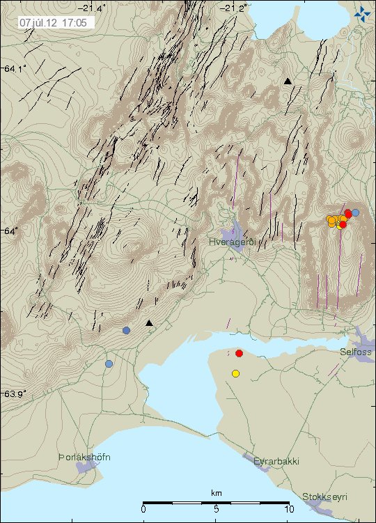
Intresting earthquake activity has been taking place in South Icelandic Seismic Zone for few days now. Currently the activity is on the northern end of the fault that broke in the year 2008. This is most likely just an earthquake swarm in the fault area that is continuing to adjust after the Mw6.3 earthquake in the year 2008.


Earthquake activity on SISZ during the past few days and hours. Copyright of this picture belongs to Iceland Meteorological Office.

As for SISZ. This is just an earthquake activity. There is no volcano activity in this area of Iceland. But SISZ is a fault zone that moves N-S (W-E compared to Reykjavík). So with every major earthquake on SISZ, it is slowly moving south as the new rift zone (Iceland East rift zone) moves south at the same time. This is a slow progress. Takes millions of years and has been ongoing for million of years already.

Minor earthquake swarms in Iceland

It has been quiet in Iceland during the past few weeks. Besides activity in Katla volcano and Kolbeinsey ridge. Nothing of interest has been going on in Iceland. Here is however the overview of activity in Iceland during the past few hours.

Kolbeinsey Ridge

Some minor earthquake activity has been taking place in Kolbeinsey Ridge during the past few hours. This earthquake swarm is small in nature, with largest earthquakes reaching the magnitude 2.4. Otherwise it remains quiet in this area.


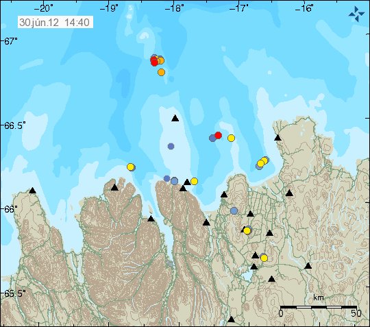
Earthquake activity in Kolbeinsey Ridge. Just north of Grímsey Island. Copyright of this image belongs to Iceland Meteorological Office.

Kolbeinsey ridge has seen some activity during past few weeks. But it might just be normal tectonic earthquakes taking place. So far nothing suggest any volcanism nature of this earthquake activity.

Krýsuvík volcano

During the past few hours. Krýsuvík volcano did see some earthquake activity. This activity is most likely to be tectonic in nature. As Reykjanes peninsula has frequent earthquake swarm that are tectonic in nature.


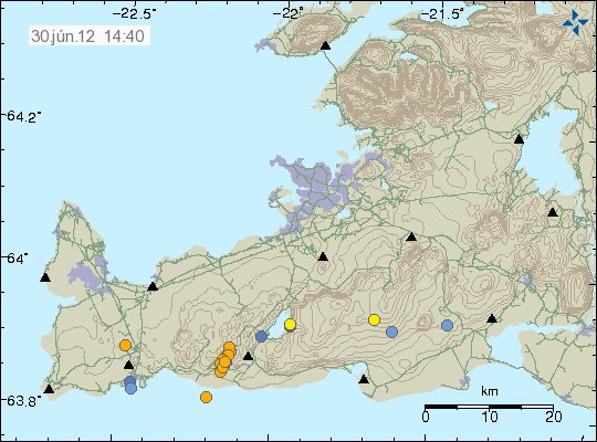
Earthquake swarm on Reykjanes. It is located within Krýsuvík volcano. This was small earthquake swarm. Copyright of this image belongs to Iceland Meteorological Office.

It remains rather quiet on Reykjanes besides this minor earthquake swarm today.

Katla volcano

After rather interesting activity during the past few weeks. It seems that Katla volcano is slowing down in earthquake activity. For now at least. But it is impossible to know for sure if current quiet sense is going to continue in Katla volcano.


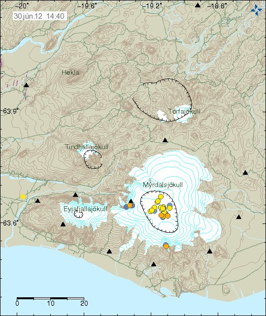
Earthquake activity in Katla volcano during past few days. The activity is mostly concentrated into Katla volcano caldera. Copyright of this image belongs to Iceland Meteorological Office.

Besides this top of the activity. All is quiet in Iceland. Both in volcanoes and earthquakes. That might however change at any time without warning. It happens often in Iceland. I also want to remind people of my geophone web page. Where earthquakes can sometimes be seen soon after they have taken place.

Earthquake swarm in Katla volcano today (24.06.2012)

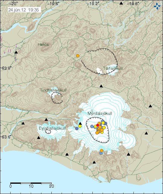
Earthquake swarm started in Katla volcano at 13:33 UTC. This earthquake swarm lasted until 14:26 UTC (24 June, 2012). Most of the earthquakes in this swarm where small. Less them magnitude ML1.0 in size. The largest earthquakes did have magnitude of ML1.3 and ML2.0. No harmonic tremor did take place during this earthquake swarm. However, harmonic tremor data from IMO suggests a lot of hydro-thermal activity under Mýrdalsjökull glacier. This might result in small glacier floods coming from Mýrdalsjökull glacier in hours to days time. There is also a good chance that new earthquake swarm starts in Katla volcano at any time. Since there has been pattern of repeated earthquakes swarms in Katla volcano for several weeks now.


Earthquake activity in Katla volcano today. The newest earthquake also appears on this image. Copyright of this image belongs to Iceland Meteorological Office.


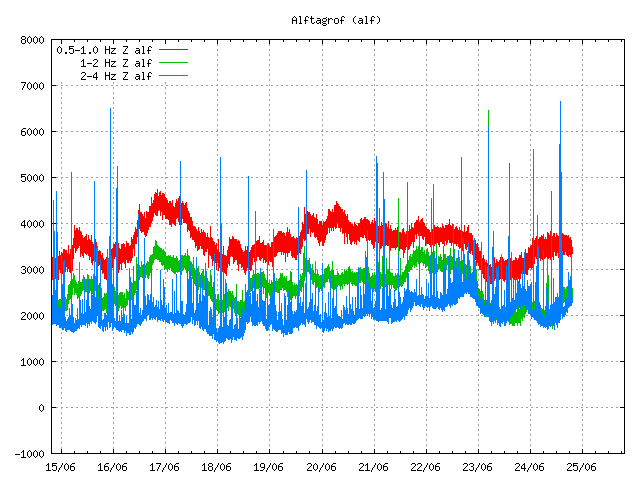
The harmonic tremor level at Álftagrof SIL station. This is normal background movement. There are however clues that hydro-thermal activity might have increased under Mýrdalsjökull glacier following this earthquake swarms. Copyright of this image belongs to Iceland Meteorological Office.


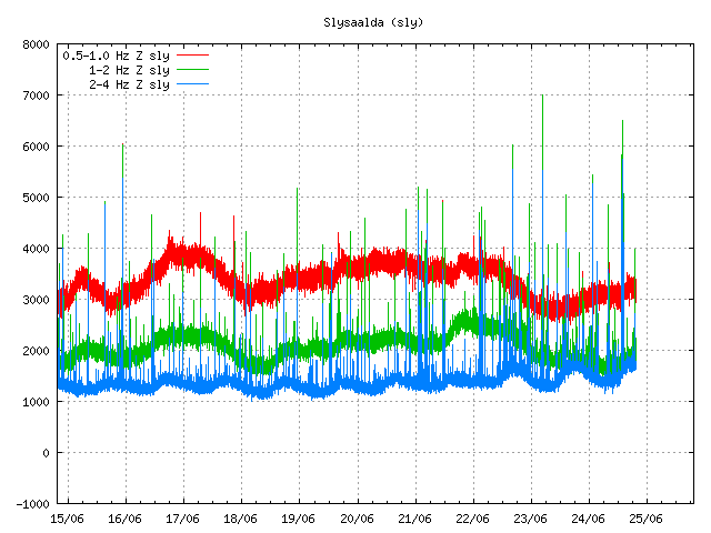
Harmonic tremor at Slysaalda SIL station. This is normal background noise. Spikes are earthquakes in Katla volcano. In this image there are also minor clues about increased hydro-thermal activity in Katla volcano. Copyright of this image belongs to Iceland Meteorological Office.


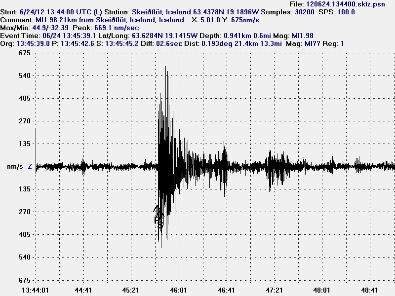
The earthquake at 13:45 UTC on Skeiðflöt geophone. This trace is filtered at 1Hz. This image is released under Creative Common Licence. See CC Licence page for more details.


The earthquake at 13:45 UTC on Heklubyggð geophone. This is filtered at 1Hz. This image is released under Creative Common Licence. See CC Licence page for more details.

It is hard to know for sure what happens next in Katla volcano. But I am sure this activity is currently taking place is going to continue. This does however not say anything about possibility of an eruption in Katla volcano. That possibility remains unclear, as earthquake activity does not mean that an eruption is imminent. For the moment, there are just earthquake swarms taking place in Katla volcano. But that can change without warning. Until then less speculation on what is taking place in Katla volcano is best (in the news media anyway).

Blog post updated at 08:34 UTC on 25.06.2012.

Earthquake swarm in Katla volcano, Kolbeinsey ridge, Hveravellir geothermal area

It has been a bit busy day earthquake wise in Iceland. But there has been more activity today then in past few weeks in Iceland. But it has been really quiet for a long time now in Iceland. But let’s start with the largest earthquake of the day.

Kolbeinsey Ridge

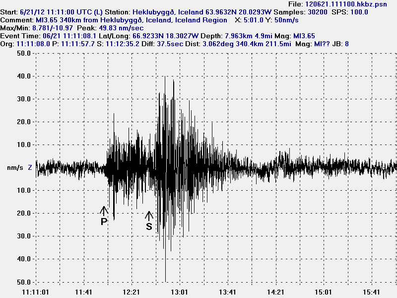
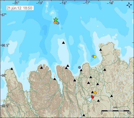
Today at 11:11 UTC there was an earthquake with the magnitude of ML3.65. This earthquake was not felt since it was more then 100 km away from nearest human population in Iceland. The earthquake took place on Kolbeinsey Ridge. It last erupted in the year 1755. No known eruption is known in this area since then. My geophone network did record this earthquake properly. The signal was strongest at my Hvammstangi geophone station. But it was also recorded on my Heklubyggð geophone station. On other geophone stations. The signal was too weak to be properly detected by my geophone.


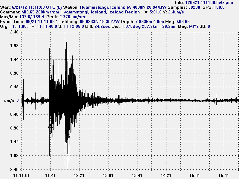
The ML3.65 magnitude earthquake as it was recorded on my Hvammstangi geophone. This image is released under Creative Commons licence. Please see the CC Licence page for more details.


The ML3.65 magnitude earthquake as it was recorded on my Heklubyggð geophone. It is filtered at 1Hz. This image is released under Creative Commons licence. Please see the CC Licence page for more details.


The location of the earthquake. Copyright of this picture belongs to Iceland Meteorological Office.

Hveravellir geothermal area

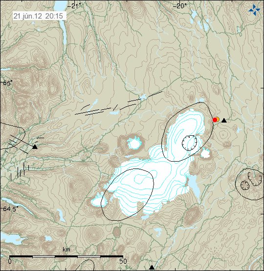
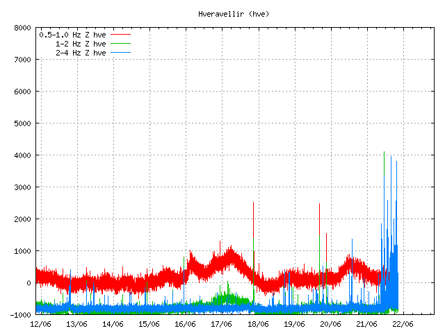
There is an earthquake swarm ongoing (or it might be over. I have no good way to know that currently) at Hveravellir geothermal area. I only know there is an earthquake swarm there because of the tremor recording on Hveravellir geothermal area. But only two earthquakes have been large enough to appear on earthquake map on IMO web page.


The two earthquakes that did appear on IMO earthquake map. Copyright of this picture belongs to Iceland Meteorological Office.


However, Hveravellir SIL station did show that more was going on then did appear on the earthquake map. Most of this earthquakes are too small to appear automatic on the earthquake list. Some might even be too weak to be properly located by the SIL network. Copyright of this picture belongs to Iceland Meteorological Office.


Some of this activity did also appear on Skrokkalda SIL station I think. Copyright of this picture belongs to Iceland Meteorological Office.

Katla volcano

Katla volcano did have an new earthquake swarm during the night. This earthquake swarm had around 30 or so earthquakes. Most of them where located almost in the central caldrea. This type of swarm activity has now been ongoing since end of April, when it started rather sharply with an earthquake swarm. Since then it has had many earthquake swarm. But the current rate of earthquake swarm is around 1 to 3 earthquake swarm pr. Week. Normally they are in an new area inside the Katla volcano caldera.

My geophone station at Skeiðflöt records most of the earthquakes if the background noise is not too high during that time.


The earthquake activity in Katla volcano last night. Copyright of this picture belongs to Iceland Meteorological Office.

So far. This is just normal earthquake activity. It does not signal any chance of eruption activity so far. But this earthquake pattern is interesting. What it means is a different matter. So far, nobody knows for sure at this point in time. This activity seems to change hydrothermal activity inside Katla volcano caldera. This has also created minor glacier floods from Katla volcano caldera. But the flood have been seen on instruments that record water conditions in Múlakvíls glacier river. Glacier floods are marked by higher conductivity of the water, darker color and stronger sulfur smell (rotten egg smell). What happens next in Katla volcano is anyone guess. As Katla volcano has proven to be unpredictable volcano.

New earthquake swarm in Katla volcano on 11. June 2012

Today from 04:00 to around 08:00 UTC this morning. There was an earthquake swarm in Katla volcano. This earthquake swarm was not large in the magnitude of the earthquakes. With the largest earthquakes being around ML2.0 in magnitude. There has been slight increase in conductivity in Múlakvísl river following this earthquake swarm. That suggests water is now leaking from hydro-thermal vents in Mýrdalsjökull glacier. So far no change in harmonic tremor has been seen. So for now, this are just earthquakes taking place inside Katla volcano caldera.


The earthquake swarm in Katla volcano this morning. Copyright of this picture belongs to Iceland Meteorological Office.

It is difficult to know what happens next in Katla volcano. As it is bit unclear what is exactly taking place in Katla volcano. With the lack of harmonic tremor following this earthquake swarms. This simply might just be normal summer earthquake swarms taking place. But Katla volcano is well known for that type of behavior during the summer in Iceland. With the most earthquake activity taking place in July and August.