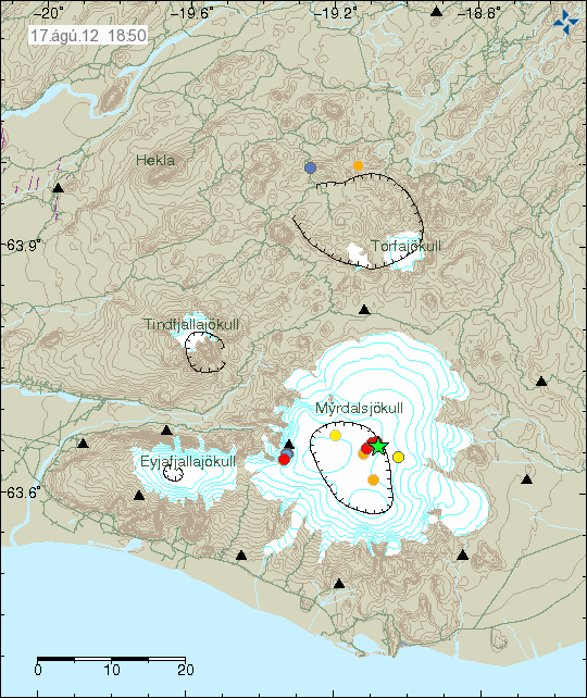
Today at 15:48 UTC there was an magnitude 3.8, at the depth of 0.1 km in Katla volcano. This earthquake took place on the caldera rim in Katla volcano. No major harmonic tremor was detected following this earthquake. However some harmonic tremor was detected. But it was minor. This might have been hydro-thermal-activity or magma on the move. It is impossible to know for sure what is the case now. This earthquake did appear clearly on my geophone network. Mostly on the geophone station at Skeiðflöt and Heklubyggð.

The location of the earthquake in Katla volcano. It was located on the edge of Katla volcano caldera. Copyright of this image belongs to Iceland Meteorological Office.

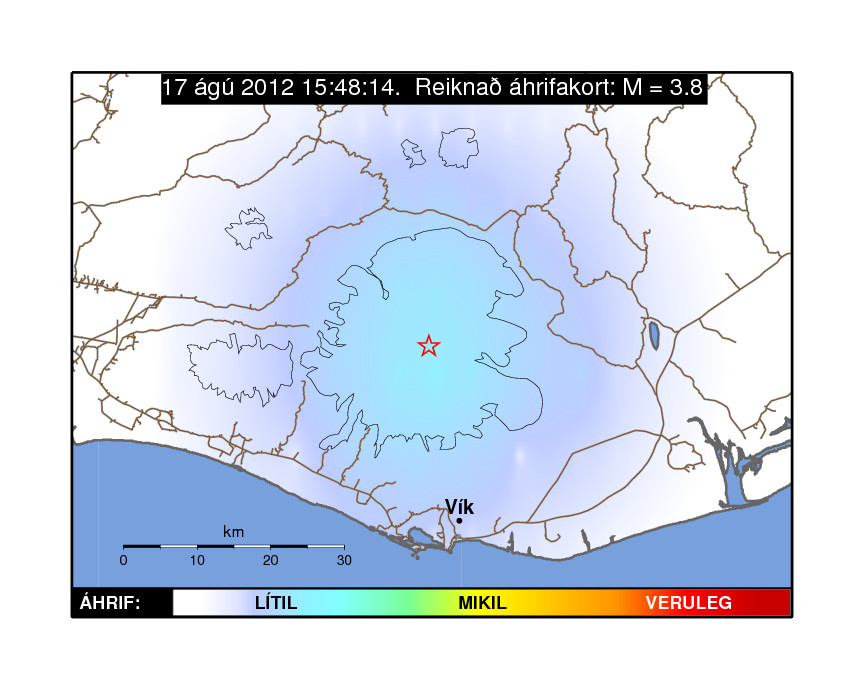
Influence map of todays ML3.8 earthquake. This suggests that it was not felt in nearby populated areas. Copyright of this image belongs to Iceland Meteorological Office.

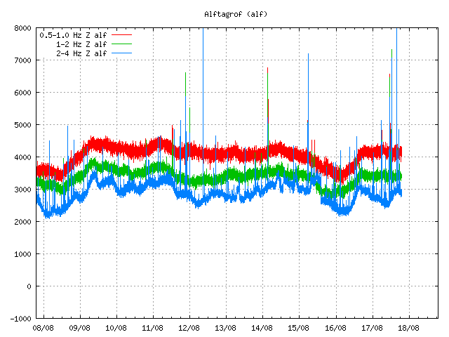
Tremor plot that clearly shows the earthquake of today. The spikes are the earthquakes that have been taking place in Katla volcano or close by areas. This is Alftagrof SIL station. Copyright of this image belongs to Iceland Meteorological Office.

This tremor plot shows some minor harmonic tremor following the earthquake in Katla volcano. The spikes show the earthquake from Katla volcano and areas close by. This is Austmannsbunga SIL station. Copyright of this image belongs to Iceland Meteorological Office.
It is impossible to know what this means exactly. But Katla volcano has been quiet since around middle of July. It remains to be seen if earthquake activity is picking up again or if this was just an single event.
Icelandic news about this earthquake
Jarðskjálfti í Mýrdalsjökli (Rúv.is, Icelandic)
Jarðskjálfti í Mýrdalsjökli (Vísir.is, Icelandic)
Jörð skalf við Austmannsbungu (mbl.is, Icelandic)
Blog post updated at 18.08.2012 at 11:51 UTC. Blog post title fixed for the future.
