List of known eruptions in Grímsfjall volcano and connected volcanoes

Here is an list of eruptions in Grímsfjall volcano and Þórðarhyrna volcano based on data from Global Volcanism Program and documented eruptions. In most cases, eruptions that took place in the early 10 to 16th century are poorly documented if they where smaller eruptions. This even goes on somewhat into the 20th century.

Year ~8230BC +-50 years. Area of activity, unknown. Size VEI=6. Known as Saksunarvatn tephra layer. Dating done with Radiocarbon (corrected).

Year ~4550BC +-500 years. Area of activity, Laki. Size VEI=0. Dating method, Tephrochronology.

Year ~3550BC +-500 years. Area of activity, S of Þórðarhyrna. Dating method, Tephrochronology.

Year ~1950BC +-100 years. Size VEI=2 Area of activity, Raudholar and Brunuholar. Dating method, Tephrochronology

Year ~50BC. Size VEI=2. Area of activity, Halsagigur. Dating method, Tephrochronology

Year ~910AD. Area of activity, ?. Dating method, Tephrochronology.

Year ~960AD. Area of activity, ?. Dating method, Ice core.

Year ~1010. Area of activity, ?. Dating method, Ice core.

Year ~1060. Area of activity, ?. Dating method, Tephrochronology.

Year ~1090. Area of activity, ?. Dating method, Ice core.

Year ~1150. Area of activity, ?. Dating method, Ice core.

Year ~1190. Area of activity, ?. Dating method, Ice core.

Year 1230 +- 10 years. Area of activity, ?. Dating method, Ice core.

Year 1270 +- 10 years. Area of activity, ?. Dating method, Ice core.

Year 1290 +-10 years. Area of activity, ?. Dating method, Ice core.

Year 1310 +-10 years. Area of activity, ?. Dating method, Ice core.

Year 1332, November. Area of activity, ?. Size VEI=2. Dating method, historical documents.

Year 1341, May. Area of activity, ?. Size VEI=2. Dating method, historical documents.

Year ~1350. Area of activity, ?. Dating method, Ice core.

Year ~1354. Area of activity, ?. Dating method, historical documents.

Year 1369. Area of activity, ?. Dating method, Ice core.

Year 1370 +-10 years. Area of activity, ?. Dating method, Ice core.

Year 1390 +-10 years Area of activity, ?. Dating method, Ice core.

Year 1430 +-10 years. Area of activity, ?. Dating method, Ice core.

Year 1450 +-10 years. Area of activity, ?. Dating method, Ice core.

Year ~1469. Area of activity, ?. Dating method, Ice core.

Year 1470 +- 10 years. Area of activity, ?. Dating method, Ice core.

Year ~1471. Area of activity, ?. Dating method, Ice core.

Year 1490 +- 10 years. Area of activity, ?. Dating method, Ice core.

Year ~1500. Area of activity, ?. Dating method, Ice core.

Year ~1509. Area of activity, ?. Dating method, Ice core.

Year 1510 +- 10 years. Area of activity, ?. Dating method, Ice core.

Year 1521 +- 10 years. Area of activity, ?. Dating method, Ice core.

Year 1530 +- 10 years. Area of activity, ?. Dating method, Ice core.

Year 1598. November 7. Area of activity, ?. Size VEI=3?. Dating method, historical documents.

Year 1603. October 31. Area of activity, possibly Grímsvötn. It is unclear. Dating method, historical documents.

Year 1610. Area of activity, ?. Dating method, Ice core.

Year 1619. July 29. Area of activity, ?. Size VEI=2. Dating method, historical documents.

Year ~1622. Area of activity, ?. Dating method, Ice core.

Year 1629. Area of activity, ?. Size VEI=2. Dating method, historical documents.

Year 1632. Area of activity, ?. Dating method, Ice core.

Year 1638 February 24 +- 4 days. Area of activity, ?. Size VEI=2. Dating method, historical documents.

Year 1659 November. Area of activity, ?. Size VEI=?. Dating method, historical documents.

Year 1681 April 10. This might not be an eruption in Grímsfjall volcano.

Year 1684 November 5 +- 4 days. Area of activity, ?. Size VEI=2. Dating method, historical documents.

Year 1697. Area of activity, ?. Size VEI=?. Dating method, historical documents.

Year 1706 October 15 +- 45 days. Area of activity, ?. Size VEI=2. Dating method, historical documents.

Year 1716 October 6. Area of activity, ?. Size VEI=2. Dating method, historical documents.

Year 1725 February. Area of activity, ?. Size VEI=2. Dating method, historical documents.

Year 1730. Area of activity, ?. Size VEI=?. Dating method, historical documents.

Year 1753 October 15 +-45 days. Area of activity, ?. Size VEI=2?. Dating method, historical documents.

Year 1768. This eruption might not have taken place in Grímsfjall volcano.

Year 1774. Area of activity, ?. Size VEI=?. Dating method, historical documents.

Year 1783 to 1785 May. Stop date May 25 1785. Area of activity, Laki, Lakagígar. Size VEI=4+. Dating method, historical documents.

Year 1794. Eruption might not have been in Grímsfjall volcano. Somewhere in West Vatnajökull.

Year 1816 May. Area of activity, ?. Size VEI=?. Dating method, historical documents.

Year 1823 February 4 +-4 days. Area of activity, Grímsvötn-Þórðarhyrna. Size VEI=2. Dating method, historical documents.

Year 1838 June. Area of activity, ?. Size VEI=2. Dating method, historical documents.

Year 1854. Area of activity, ?. Size VEI=2. Dating method, historical documents.

Year 1861. This eruption is uncertain.

Year 1867 August 29. Area of activity, ?. Size VEI=1. Dating method, historical documents.

Year 1873 January 8, it ended in August. Area of activity, ?. Size VEI=4. Dating method, historical documents.

Year 1883 January 15, it ended in April 15 +-5 days. Area of activity, ?. Size VEI=2. Dating method, historical documents.

Year 1887 August 15, it ended in the year 1889. Area of activity, Þórðarhyrna. Size VEI=2. Dating method, historical documents.

Year 1891 November, it ended in March 16 1892. Area of activity, ?. Size VEI=2. Dating method, historical documents.

Year 1897. Location of this eruption in uncertain. Area of activity, ?. Size VEI=2. Dating method, ?.

Year 1902 December, this eruption ended in the year 1904 on 12 January. Area of activity, Grímsfjall and Þórðarhyrna. Size VEI=4. Dating method, historical documents.

Year 1910. Area of activity, ?. Size VEI=?. Dating method, ?.

Year 1919. This eruption is uncertain.

Year 1922 September 29 +-1 day. This eruption ended on October 23. Area of activity, ?. Size VEI=2. Dating method, historical documents.

Year 1933 November 29 +-1 day. This eruption ended on December 9 +-1 day. Area of activity, North of Grímsvötn Caldera. Size VEI=1. Dating method, historical documents.

Year 1934 March 30, this eruption ended on April 7 in the year 1934. Area of activity, Close to south caldera wall. Size VEI=2. Dating method, historical documents.

Year 1934. This eruption is uncertain. But it took somewhere in Vatnajökull glacier.

Years 1938 May. Area of activity, 8 km south of Svartibunki. Size VEI=1. Dating method, historical documents.

Uncertain eruptions the years 1939 June, 1941 April, 1945 September 25, possible VEI=1 eruption, 1948 February.

Year 1954 January 15 +-45 days. Area of activity, ?. Size VEI=1. Dating method, historical documents.

Year 1954 July, this eruption is uncertain. Area of activity, north and south part of the caldera. Size VEI=1?. Dating method, historical documents.

Year 1972 March. This eruption is uncertain.

Year 1983 May 28. This eruption ended on June 2. Area of activity, close to the south part of the caldera wall. Size VEI=2. Dating method, historical documents.

Year 1984 August 20 (or around that date). This eruption is uncertain.

Year 1996, September 30. This eruption ended on November 6. Area of activity, Gjálp fissure. Size VEI=3?. Dating method, historical documents.

Year 1998, December 18. This eruption ended on 28 December. Area of activity, South Caldera wall. Size VEI=3. Dating method, historical documents.

Year 2004 November 1. This eruption ended on November 4. Area of activity, South West and east sides of the caldera. Size VEI=3. Dating method, historical documents.

Year 2011, May 21. This eruption ended on May 30. Area of activity, South West part of the caldrea. Size VEI=3. Dating method, historical documents.

This is just short overview of the eruptions that have taken place in Grímsfjall volcano and in Þórðarhyrna volcano. It does not contain a lot of details on them. Please not that this blog post might contains errors. If you see them. Please comment on them and I am going to fix them soon as I can.

This blog post is going to be updated with time.
Historical eruption of Grímsfjall volcano of the year 1783 to 1785

The year 1783 is something that is going to live in historical memory of the Icelandic people for long time to come. The historical memory of Icelanders still remember the eruption of Laki that took place 229 years ago. This eruption is among Iceland biggest eruption in historical times and since Iceland got populated around the year 600 (or around that time, according to new data). It is unclear when the exact eruption started in Grímsfjall volcano and in Þórðarhyrna volcano (a smaller volcano south-west of Grímsfjall volcano, it is inside Grímsfjall volcano fissure swarm). But what is known is that this eruption started sometimes in May.

The eruption started in Grímsfjall volcano it self, it is unclear where exactly it started. Creating a glacier flood that did go down Þjórsá that same month in some part. But was documented that Þjórsá was darker and had worse smell then normally and had more water in it. It was also documented that Skaftá did have more water in it and was darker and had bad smell early spring in Iceland (that means late April or early May). But the glacier flood that must have taken place after an eruption started are not well documented in history best to my knowledge. From what I can read it seems that the eruption of Grímsfjall volcano started in the main volcano (unknown where exactly). The years 1755 and to the year 1785 seems to have been extremely active in terms of volcano activity in Iceland. But that year there was also an eruption on the Reykjanes Ridge that created a short lived Island. It did however only last few months at the best. It is possible that the eruption on the Reykjanes Ridge was in the area of Eldey or close to it. But it is impossible to confirm it for sure.

It is not known when the actual eruption started in Grímsfjall volcano or in Þórðarhyrna volcano. But it has been assumed from what I can gather that Þrórðarhyrna volcano was also erupting during this eruption. But the reason for that might well be due to dike intrusions from Grímsfjall volcano might have started an eruption in Þórðarhyrna volcano. But best to my knowledge, there have not been many eruptions in Þórðarhyrna volcano since the eruption in the year 1783 (or around that time).

According to documented history, the fissure eruption started around 8. June 1783. This fissure eruption had growing earthquake swarms before it took place. This was due (but they did not know this at the time for obvious reasons). When the eruption started, it started with a large ash cloud that did go down Skaftárhrepp and nearby area. Following this ash cloud was a lot of gas pushing up with the erupted material. But blue haze was reported in historical documents about this eruption. The problem with the carbon-monoxide did not get any better . Given the year this did happen, there are holes in the event as they did happen. But by 12th of June 1783 the lava had already filled several canons at least and had already destroyed a lot of farmland and farms. But it is documented that lava bombs where known to have been found up to 112 km distance from the eruption. The total fissure length is around 25 km long. It is among Iceland longest eruption fissure in historical times. But Askja volcano had an fissure eruption that was around 20 km long in its eruption episode around the year 1875 to the year 1961, when it took a break that is continuing to this day.

Based on historical documents. It seems that this eruption had two phases. The the first one started with an eruption in the south part of what is now the eruption fissure of Laki. The second one was when eruption craters did open up north part of the fissure after several months of eruption on the south part of the eruption fissure. But by that time the eruption had already diminished in strength at the same time, or before that. It is hard to know from historical documentation what actually did happen at this time. But the eruption is believed to have stopped on 26 May 1785.

Many of the eruption craters did make ash, not lava. The ash layers from those craters where up to 2 meters thick at the distance of 500 meters in some areas. It is also believed that the eruption strokes from many of the craters where up to 800 to 1400 meters high when they where at the tallest. During this eruption there was a sour rain, along with other deadly effects that did follow this eruption. It did also happen during this eruption that many animals did die due to ash poisoning, and gas poisoning from the eruption. Just as humans did at this time. But at this time Iceland did not have any functional government that was able to handle this type of natural disaster. The amount of volcanic gases also had effects around northern hemisphere. But this effects did create huge problems in Europe, Canada, U.S and in Russia from best of my knowledge (it might however not be correct).

Many people might believe that after such a big eruption Grímsfjall volcano would stop for a long time. This was not the case. Only 22 years after the major eruption of the year 1783 to 1785 Grímsfjall volcano had an new eruption. This was smaller, only having the VEI scale of 2. But Laki eruption has the VEI scale of 4+. Before the Laki eruption, there had been an other eruption in the year 1774, but it was an minor VEI=2 eruption. Last eruption in Þórðarhyrna and Grímsfjall volcanoes was in the year 1902. That was an VEI=4 eruption that lasted from December 1902 and until January 1904.

For this reasons I classify Grímsfjall volcano (including also Þórðarhyrna volcano) one of the dangerous volcanoes in Iceland. I do think it might be even be more dangerous the Katla volcano all considered. But this is just my personal opinion and nothing else.

Based on following references

Skaftáreldar 1783 (Icelandic)
Grímsvötn (Icelandic)
The eruption that changed Iceland forever (BBC News)

Blog post updated at 01:49 UTC on 22.03.2012.

Quiet period ongoing in geology, except in current erupting volcanoes

Everything seems to be quiet in Iceland and around the world. Nothing major is taking place in regards to earthquakes or volcano activity. So I do not have a lot to report on at current time. If this quiet period continues I am going to write about something in Iceland geological history that I know of. Nothing long, just short and as detailed as I can make it.

Last week volcano activity

Smithsonian/USGS Weekly Volcanic Activity Report

New Activity/Unrest: | Bezymianny, Central Kamchatka (Russia) | Cleveland, Chuginadak Island | Ijen, Eastern Java (Indonesia) | Iliamna, Southwestern Alaska | Lamongan, Eastern Java (Indonesia) | Marapi, Sumatra (Indonesia) | Nevado del Ruiz, Colombia | Tungurahua, Ecuador

Ongoing Activity: | Karymsky, Eastern Kamchatka (Russia) | Kilauea, Hawaii (USA) | Kizimen, Eastern Kamchatka (Russia) | Puyehue-Cordón Caulle, Central Chile | Sakura-jima, Kyushu | Santa María, Guatemala | Shiveluch, Central Kamchatka (Russia) | Villarrica, Central Chile

Rest of this report can be found here, http://www.volcano.si.edu/reports/usgs/

I hope to have more to write on soon. But it is hard to know for how long this quiet time is going to continue.

Interesting earthquake activity in El Hierro volcano

Over the past two weeks there has been interesting earthquake activity in El Hierro volcano in Canary Islands. What is so interesting about this earthquakes is the fact they are getting more shallow every day or so. Currently the most shallow activity that has been taking place is around 6km depth. But this is an rise from about 12 km depth.

What this means in my opinion is that magma is most likely rising to the surface at the location where the earthquakes are currently taking place (dike intrusions). This did happen before the first eruption in Eyjafjallajökull volcano. So it is an important to keep an eye on this earthquakes and where they happen, as eruption might take place in nearby area of this earthquakes. As magma might, and most likely is going find an clear path to the surface soon. The last part of that before an eruption might happen with no noticeable earthquakes at all. They might well be just over ML2.0 in magnitude or smaller.


Earthquake activity in El Hierro volcano over the past 10 days. Copyright of this image belongs to ING.

It is impossible to know for sure when or if an eruption happens in this area. But I find that is most likely going to be the case given the current activity. When and where is impossible to know for sure at current time.

Eruption in Etna volcano

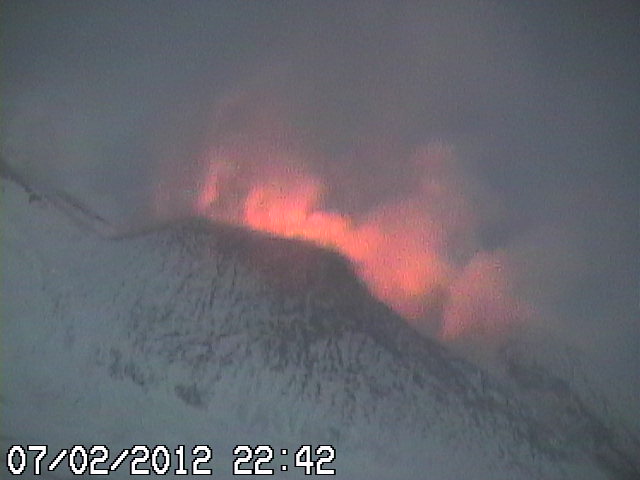
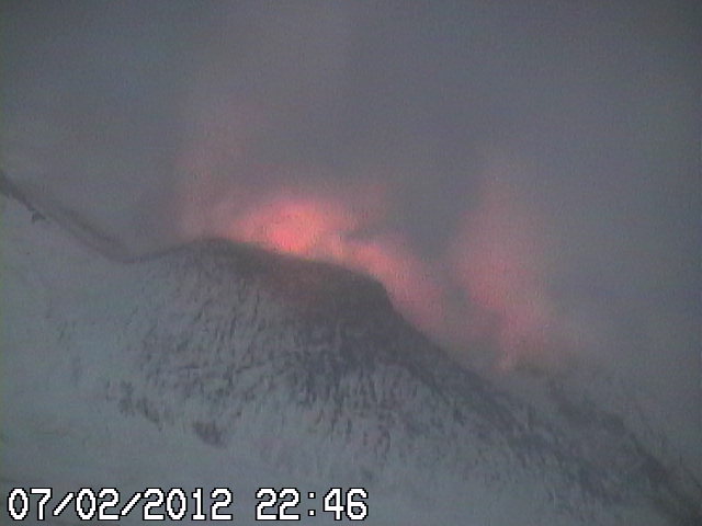
Tonight around 21:00 UTC an eruption started in Etna volcano. From the views of the web cameras that watch Etna volcano. This eruption seems to be rather small. I do not expect it to get any bigger.


Web camera picture of the eruption in Etna volcano. Copyright of this picture belongs to Radio Studio 7, Italy.


Web camera picture of the eruption in Etna volcano. Copyright of this picture belongs to Radio Studio 7, Italy.

Eruptions in Etna volcano are frequent, so this event is no surprise that it is currently taking place. Live web camera feed can be found here.

Random minor eruptions in El Hierro volcano

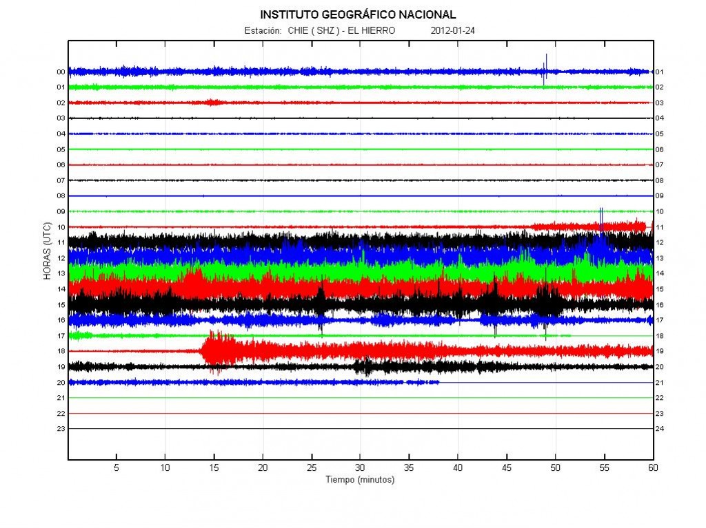
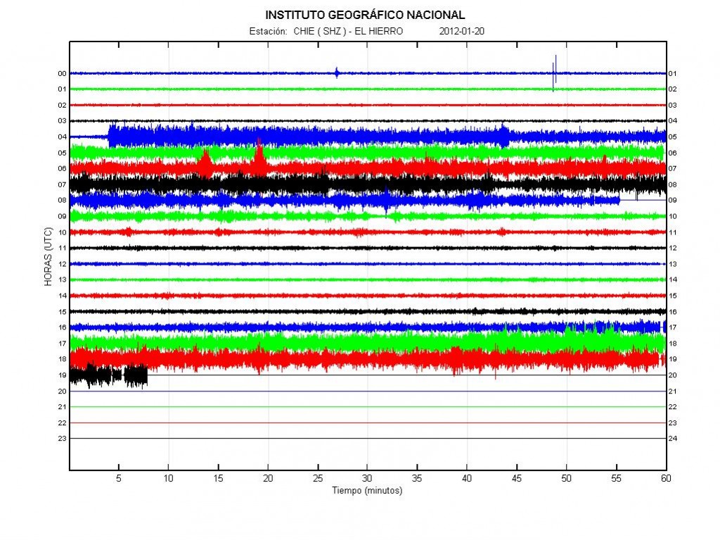
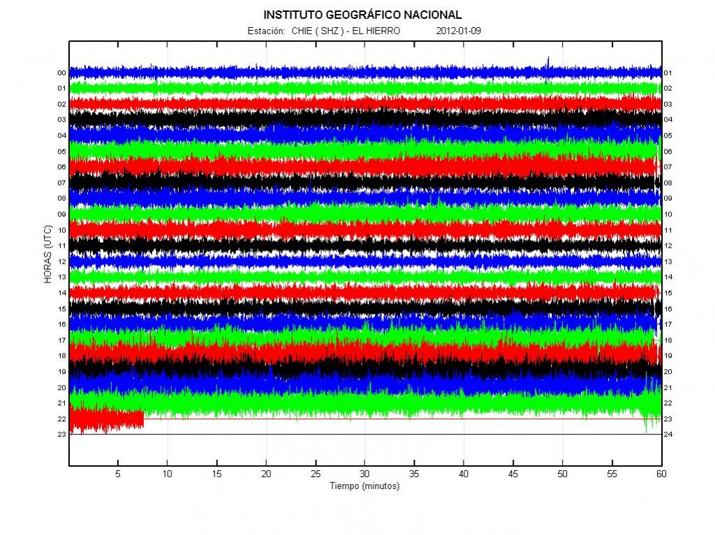
It seems that the main eruption is over in El Hierro volcano, for now anyway. For the moment there are minor eruptions taking place in El Hierro volcano. This minor eruptions happen at random times and between them nothing is happening. This is clear by the harmonic tremor data from the sensors that are on the El Hierro Island it self.

This type of behavior is not a big surprise. I fully expected this to happen when this eruption started. The main risk now is that new vents might open up in new places without any warning at all. This seems to have already have happened to some extend. As I have been getting unconfirmed reports that new vents have opened up in this new eruption episodes that have only lasted for few hours. So far this new vents have not opened up on land. But this pattern of eruption increases the risk of that significantly. As magma appears to looking for a way out. But does not find the way out that last, or does not have the pressure to maintain an new vent open for long period of time. The vent that erupted the longest is estimated to be around 125 meter below the surface. So it has been guessed that its above 750 meters high (this is unconfirmed).


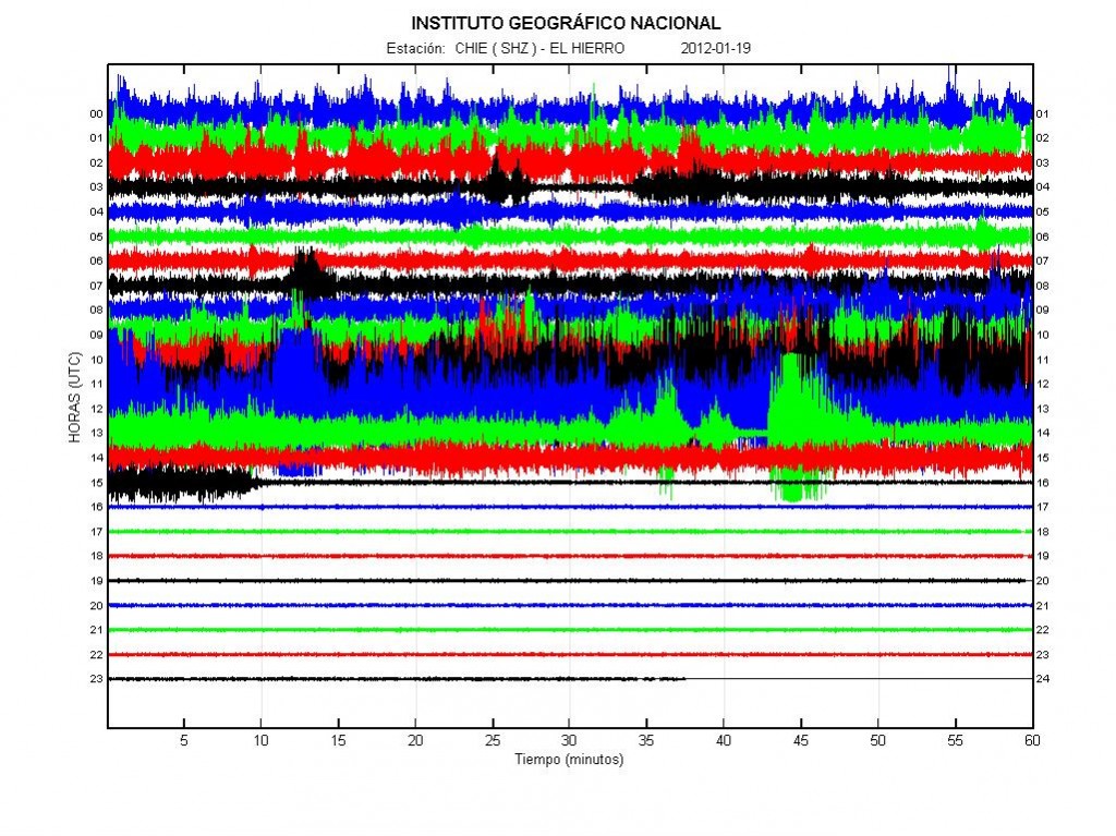
Harmonic tremor and lows in El Hierro volcano today. Copyright of this picture belongs to IGN (Instituto Geográfico Nacional).


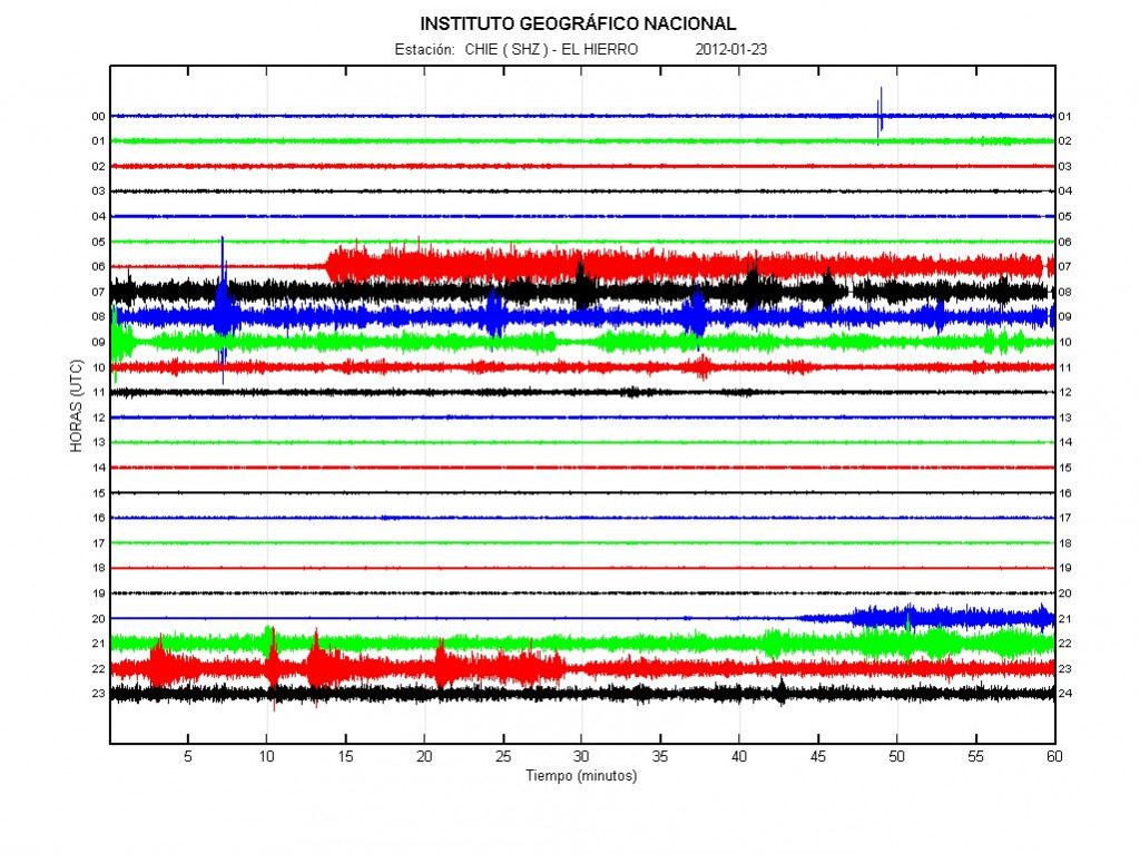
The harmonic tremor activity yesterday (23.01.2012). As can be seen the activity starts, then stops again. This means that new vents are opening up again. Or that the older vents are opening up and starting to erupt again before stopping. Copyright of this picture belongs to IGN (Instituto Geográfico Nacional).


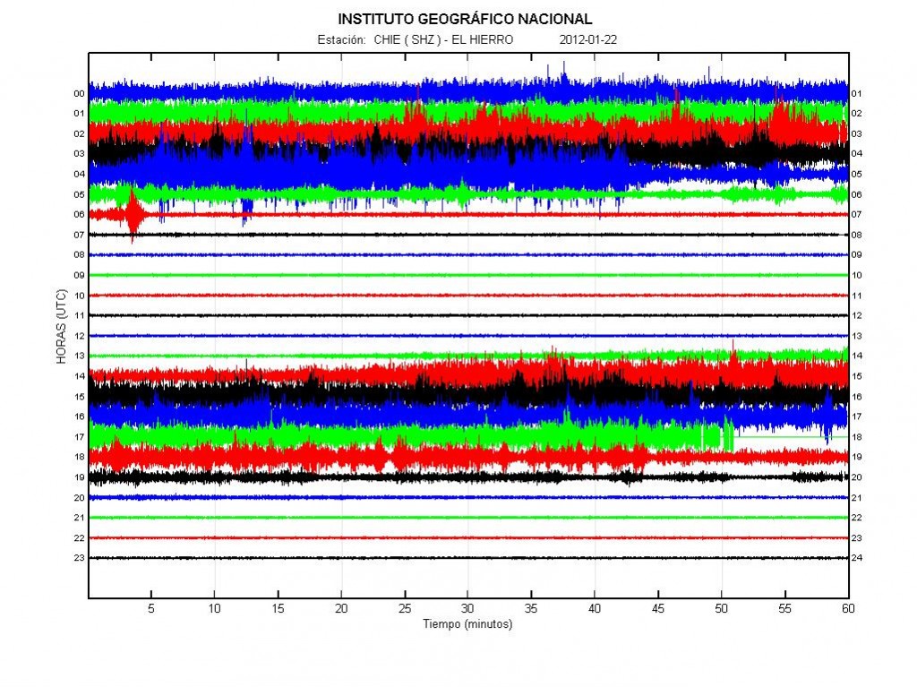
The activity on 22.01.2012. This as same in the past two days. Activity start before stopping again. Copyright of this picture belongs to IGN (Instituto Geográfico Nacional).

As for what happens in El Hierro volcano in the next weeks to months. It is close to impossible to know for sure what happens. As what happens next depends on the magma flowing into El Hierro volcano. It seems that this eruption is not over. Even if it continues with short breaks between eruption events.


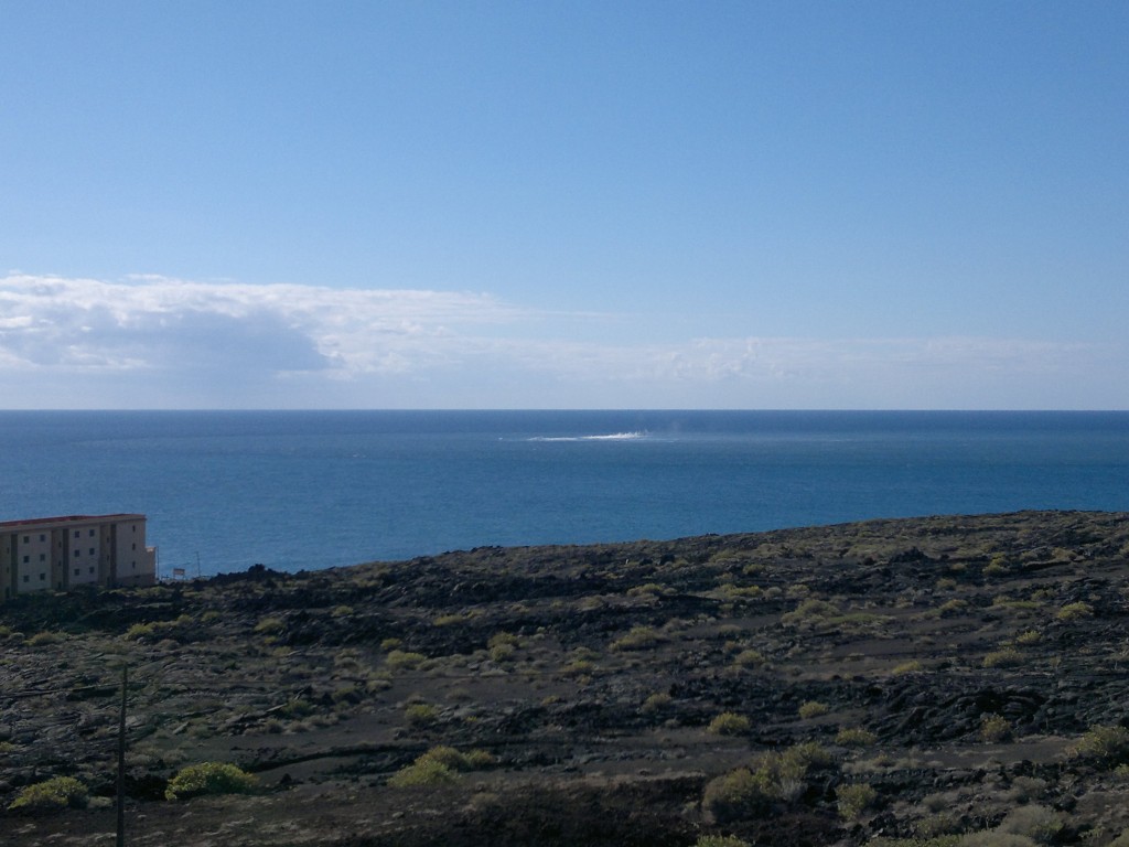
Picture of the activity today (24.01.2012). I got this picture by email. Click on the picture for full size. Copyright holder of this picture wish to remain anonymous. Used with permission.

This picture clearly shows the active area today. There is also an highly active hydro-thermal area where the eruption took place, or have been taking place. There is also some chance of dike intrusions in this area creating new hydro-thermal areas. But dike intrusions can take place without any earthquake activity. If there is an earthquake activity, it does not need to have high amount of earthquake activity. Harmonic tremor can and often increases if an dike intrusion is taking place.

El Hierro volcano eruptions ends (again)

Based on the harmonic tremor data in the past few hours it seems that the eruption in El Hierro volcano has ended again. How long or if the eruption has really ended now is impossible to know at the moment. However it is clear based on the tremor activity that all eruption activity has ended and it did so suddenly and after sharp increase in activity several hours before that.


The activity in El Hierro volcano today. Notice the spikes when the eruption suddenly gains energy and how fast it dies out based on the tremor data. Copyright of this image belongs to IGN (Instituto Geográfico Nacional).

Even if the eruption has ended. For the moment anyway. The area where the eruption took place is going to have hydro thermal activity for several months to comes, and up to many years if there are any shallow dike intrusions in the base of El Hierro volcano (and Island). I do not yet know if the eruption has ended, or if this is just an brake in the current eruption cycle. But next few hours to days are going to make it clear if this is an break or not. But I would not be surprised if the eruption started again at the same location, or an new one. As this is shield volcano and there eruption pattern often have breaks in them for shorter and longer periods of time.

Update 1: It has been sad that the graph has once again been re-scaled. To what size I do not know for sure. But in an comment on Facebook it was sad to be around -36dB. If that is the case. I am wrongly interpreting the data. Because of that. I have no idea what is going on in El Hierro volcano at the moment.

Update 2: It seems that activity has renewed again in El Hierro volcano. It started around 04:06 UTC and lasted until around 10:00 UTC. Then it started again at 16:00 UTC and is currently ongoing. This is now an eruption that happens in episodes. That means there are going to be longer and shorter breaks between eruptions in El Hierro volcano.


Activity in El Hierro volcano today. The increase in harmonic tremor marks the start of new eruption in El Hierro volcano. Copyright of this image belongs to IGN (Instituto Geográfico Nacional).

Blog post updated at 00:50 UTC on 20.01.2012.
Blog post updated at 19:31 UTC on 20.01.2012.

New video of the eruption in El Hierro volcano

The eruption in El Hierro volcano continues with on and off rhythmic at the moment. So fluxuations in the harmonic tremor plots can be rather huge. That is from considerable amount of tremors down to no harmonic tremors at all.


The harmonic tremor in El Hierro volcano. Copyright of this picture belongs to IGN (Instituto Geográfico Nacional).

Here is also an video of the eruption in El Hierro volcano. I do believe that this pictures are rather new. But I am not sure. The audio is Spanish.

It is impossible to know for how long El Hierro volcano is going to keep up the current eruption pattern. But this pattern might stop at any time, without any warning at all.

Renewed eruption activity in El Hierro volcano

Since yesterday there has been an renewed eruption activity in El Hierro volcano. Harmonic tremor has not seen big increase however. This suggest that this new eruption so far is small and mot procuring a lot of lava to the surface. Some floating pyroclastic has been spotted on web cameras and by local people when they come up to the surface. This eruption activity appears be intermittent at the moment. Going on and off every few hours to days.


The harmonic tremor from the eruption in El Hierro volcano. Harmonic tremor remains low however, so there is not a lot of energy in this eruption at the moment. Spikes in the tremor chart are most likely explosions taking place in the eruption area. Copyright of this picture belongs to IGN (Instituto Geográfico Nacional).

The eruption appears to have started again following an new dike intrusion from great depth into El Hierro volcano. This was followed by few earthquakes. All of them where small. If more new magma flows into El Hierro volcano this new eruption episode is going to increase in strength and in power. But it is hard to be sure if that is going to happen or not.


Eruption area in El Hierro volcano. This new eruption seems to be closer to the coast line then before. Copyright of this picture belongs to INVOLCAN. Picture is via Eruption blog (Erik Klemetti)

It is impossible to know what happens next in El Hierro volcano. So watching is important thing to do.

Other blogs about this new eruption.

Renewed Activity at El Hierro in the Canary Islands (Wired Science)

Eruption starts again then stops again in El Hierro volcano

Few weeks ago the eruption in El Hierro volcano stopped for few hours. Before it did restart at lower levels for few days. Then it stopped again. This type of behavior is not so unexpected as it seems that El Hierro volcano did get some minor magma injection in past few days and around the time the eruption did restart. But this injection of new magma was followed by minor earthquake swarm in El Hierro volcano, with one of the earthquake having the depth of 34 km (automatic depth estimate I think). But this new injections of magma seems to be small compared to the amount of magma that has already been injected into and erupted already in El Hierro volcano.


Harmonic tremor yesterday (03-01-2012) in El Hierro volcano. Copyright of this picture belongs to IGN (Instituto Geográfico Nacional).


Harmonic tremor today (04-01-2012) in El Hierro volcano. Copyright of this picture belongs to IGN (Instituto Geográfico Nacional).

Current level of harmonic tremor in El Hierro volcano suggests an small eruption in the area. But there is now an highly active hydro-thermal area where the eruption started and has been taking place for the past three months. But it is going to take several weeks and up to years for this area to cool down. Then there is also the chance of hydro-thermal activity in the area if there is an dike intrusion into the rock of the El Hierro volcano that has not erupted. If that is the case as might well be. It is going to decades and up to hundreds of years to cool down.

For the moment however the main eruption event in El Hierro volcano is over and it is going to remain like that until new magma is injected into volcano. But that might not happen for hundreds to thousands of years if the current sequence of events that led to current eruption is over. But only time is going to tell us what happens next is El Hierro volcano. As volcanoes are unpredictable in there nature.