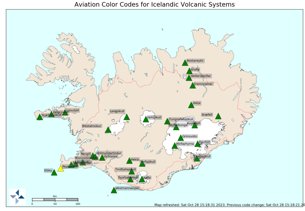
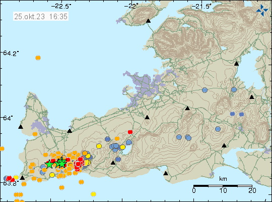
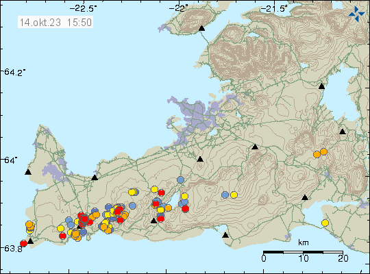
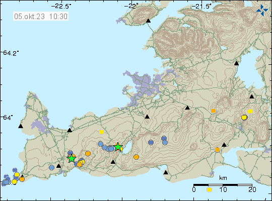
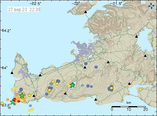
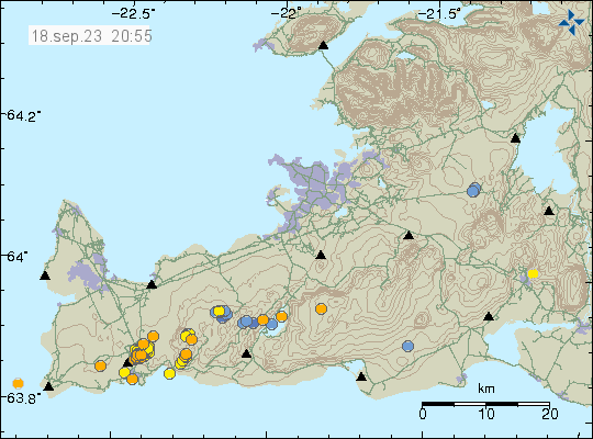
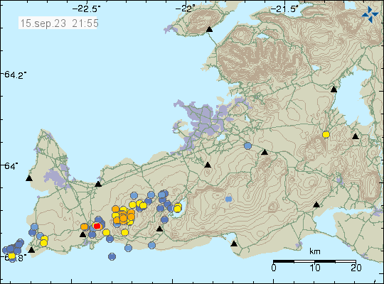
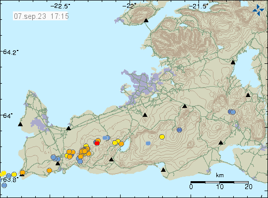
Dyke intrusion into Fagradalsfjall volcano

Today (7. September 2023) an tyke intrusion took place in Fagradalsfjall volcano. The main depth of the dyke intrusion is at around 7 km depth. All earthquakes following this dyke intrusion where small in magnitude, from Mw0,1 in magnitude and up to Mw1,0 in magnitude. This seems to be a rather large dyke intrusion, since part of it does not create any earthquake activity at all because of earlier dyke intrusions at this depth in this part of Fagradalsfjall mountain.

Earthquake activity in Fagradalsfjall volcano shown here with orange dots because all earthquakes are small. A area of dots just east of Keilir mountain, showing more earthquake activity.
Earthquake activity in Fagradalsfjall volcano. Copyright of this image belongs to Icelandic Met Office.

Morgunblaðið (link below) is reporting that inflation has now reached 15mm in this area. This is really soon after the end of the eruption, since in last three eruptions, dyke intrusions and other early signs of activity that an eruption is about to happen starts around three to six months earlier before an eruption happens at the ten month time, as has been the case in the last three eruptions. It is possible that next eruption is going to happen earlier than last three eruptions. It is possible to know when next eruption is going to happen.

Icelandic News about this

Skjálftavirkni og vísbending um kvikusöfnun (mbl.is, Icelandic)

Dyke intrusion into Brennisteinsfjöll volcano

During the night of 26. August 2023 an dyke intrusion started in Brennisteinsfjöll volcano. This was in the form of many small earthquakes, most of them did not reach magnitude Mw1,0. What gives this away as an dyke intrusion is the fact the deepest earthquake in this swarm had a depth of 21,1 km. There was interestingly, a lot of surface earthquakes. I am not sure on why that is.

Yellow dots in Brennisteinsfjöll volcano the east of Fagradalsfjall volcano on Reykjanes peninsula. A lot of smaller earthquakes all over the Reykjanes peninsula on this map. Time on map is 26. August 2023 at 17:00 Icelandic time.
Earthquake activity in Brennisteinsfjöll volcano. Copyright of this image belongs to Icelandic Met Office.

There’s no risk of eruption at the moment from Brennisteinsfjöll volcano. Earthquake activity is too low and this process is clearly not far along now for an eruption too happen. That might change without much warning at some point.

Strong earthquake swarm close to Geirfugladrangur on Reykjanes ridge

Yesterday (13. August 2023) an large earthquake swarm took place close to Geirfugladrangur (small rock island, population birds) on the Reykjanes ridge. The largest earthquake had a magnitude of Mw4,5 and was felt to Akranes town and possibly in other nearby towns on Reykjanes peninsula. There where not many reports about this earthquake being felt. Something above 400 earthquakes took place during the most active phase of this earthquake swarm.

A lot of green stars on Reykjanes ridge, a little off the coast of Iceland. Along with a lot of yellow dots showing the age of the earthquakes. A lot of dots showing earthquakes in other areas on the Reykjanes peninsula.
Earthquake activity on the Reykjanes ridge. Copyright of this image belongs to Icelandic Met Office.

This earthquake swarm seems to be ongoing. It is at the moment, at much slower rate than before. There are clues that suggest this might have been a earthquake activity connected to magma movements in this area. Its difficult to be sure, because this area is under the ocean and measuring what is going on gets more difficult as future away from land activity happens. Eruption at this distance is going to appear on the Icelandic Met Office SIL network.

Update on the eruption close to Litli-Hrútur on 23. July 2023 at 21:22 UTC

This is a short update. Since there is not a lot of information about this.

  • The crater might collapse at any time without warning. Geologists that monitor the eruption have noticed that the crater has started to get larger and is now full of lava. This means it is going to collapse. What direction is not known. It is my view that it is going to collapse to the east because of least resistance in that direction.
  • When the crater collapses the lava is going to flow more than 100m/s in whatever direction it flows.
  • Tourists are in high danger close the crater because of this collapse risk.
  • Dyke intrusion has been detected east of Keilir mountain. Along with increased ground temperature, that means the magma is at shallow depth in the crust. This area might erupt soon in similar way as is now happening close to Litli-Hrútur.

This is all the information I have now and only thing that has changed in the eruption in the last 13 days.

Icelandic News

Veggir gígsins muni hrynja innan skamms (Vísir.is)

Update on the eruption at Litli-Hrútur on 11th July 2023 at 17:18 UTC

This article is short. The eruption is mostly stable at the writing of this article but the situation can change quickly without warning.

  • The eruption has changed in last few hours. It seems to be in only one crater that is slowly forming. The eruption has stopped at the north most end of the eruption fissure. At the writing of this article.
  • The dyke now extends 1 km under Keilir mountain in the direction of north-east. This might be a new dyke intrusion and not connected to the dyke that started the current eruption. This might result in a second eruption soon, but its too early to know for sure at the writing of this article.
  • The eruption started large fires in the moss and other plants in this area around Litli-Hrútur. This has resulted in massive toxic smoke in this area.
  • There’s a high risk of the volcano gas from the eruption, along with the toxic smoke from all the plants and moss burning.
  • Interestingly, while earthquake activity has dropped it has not stopped. Why that has happened is a bit of a mystery, it might be connected to the possible new dyke that has formed under Keilir mountain.
  • Yesterday (10. July 2023) the longest the fissure extent was at 1500 meters or 1,5 km. Since then it has gone down to one erupting crater that seems to be 50 meters to 100 meters long.
Map of the magma dyke and the eruption fissures on a map from Icelandic Met Office and others. Orange area between Keilir and to Meradalir valley show the danger area around the eruption area.
Map of the danger area around the eruption. The orange area is the danger zone that people should not travel over. Copyright of this image belongs to Icelandic Met Office and others.


It is impossible to know how long this eruption is going to last. Since dyke intrusions are poor magma containers this eruption might be a short one if there isn’t a constant supply of fresh magma from the deep mantle. Its too early to know if that is the case here. I have also noticed that once the eruption ends in any area, that area is not going to erupt again. When the eruption ends, it ends forever and that makes this a single eruption activity or crater rows. This area might be Monogenetic volcanic field (Wikipedia).

Since this type of eruptions are mostly uneventful and just continue. I plan on only posting updates when there are some news or changes to the eruption happen.

Update at 17:41 UTC

ISOR is reporting that their station called FAF (Fagradalsfjall) has to be moved because the lava is flowing directly at it. They are going to find a new location for this station. This report can be seen here on Facebook in Icelandic.

Update on the eruption at Litli-Hrútur on 10th July 2023 at 18:41 UTC

This is a short update because events are changing quickly.

  • Length of the eruption fissure is uncertain, reports are conflicting. The numbers I’ve seen are from 200 meters to 900 meters long. This also might be a case of growing fissure eruption.
  • Harmonic tremor on the SIL station Fagradalsfjall continues to grow. Suggesting that the eruption is increasing in power since it started. This sometimes happens in lava eruptions.
  • The lava is flowing to the south. It might reach Meradalir valley in about one  week to three weeks. Some of the lava is flowing to the north, but a lot of less of it and is only expected to flow in the nearby area. There is no risk at current time for any damage to infrastructure or property.
  • There’s a risk of new fissures opening up in this area without warning.
  • This area is remote and difficult to go towards. Police has closed roads for the time being for safety reasons.

I’ll post new update soon as I have any new information or if anything changes. Experience has shown that this type of eruptions are rather uneventful for a longer time periods. I’ll adjust my updates in accordance with that.

Strong earthquake 1,4 km east of Keilir mountain

Today (9. July 2023) at 22:22 UTC an earthquake with magnitude of Mw5,2 happened 1,4 km east of Keilir mountain. This earthquake did shake Keilir mountain and resulting a small dust cloud. This earthquake is connected to inflation that is happening just south of Keilir mountain, rather than being connected directly to magma movements in this area.

A lot of green stars close to Keilir and Fagradalsfjall on Reykjanes peninsula map. Time on map is 9th July 2023 at 23:15 UTC.
Strong earthquake activity in Fagradalsfjall mountain and Keilir mountain. Copyright of this image belongs to Icelandic Met Office.

There’s a risk of more strong earthquakes like this in this area until an eruption starts.

Update on activity in Fagradalsfjall – Keilir mountains on 9th July 2023 at 16:11 UTC

This is a short update, because there’s little to report.

  • Three earthquakes with magnitude above Mw4,0 took place north east of Keilir mountain in the last 24 hours.
  • Earthquake activity is increasing north-east and north of Keilir mountain. Why is unclear, it is a possibility that magma is creating a path for it self that way.
  • The magma seems stuck in the crust and there doesn’t seems to have stopped the inflow of magma from the deep mantle. This is going to result in increased pressure in the dyke until an eruption happens.
  • Risk of strong earthquakes is high and might get higher until an eruption starts.


Heavy earthquake activity remains in Fagradalsfjall - Keilir area. With the new activity area north-east of Keilir mountain. Time on map is 9 July 2023 at 15:55 UTC.
Heavy earthquake activity in Fagradalsfjall – Keilir mountain. Copyright of this image belongs to Icelandic Met Office.

Since the start of this activity, around 12000 earthquakes have been recorded by Icelandic Met Office according to the news. Strongest earthquake at the writing of this article is at magnitude Mw4,8.

Update on the activity in Fagradalsfjall mountain on 7th July 2023 at 14:28 UTC

This is going to be a really short article. Because an eruption might be about to start. Difficult to be sure, but there’s a chance. Eruption has not started at the writing of this article.

  • Largest earthquake in the last 24 hours seems to be a magnitude Mw4,3. I no longer can keep up with all this earthquake activity.
  • Inflation in area close to Keilir has reached 200mm (20cm) in less than 48 hours when this started.
  • Inflow of magma is estimated to be 88m3/s and that is a lot of magma moving and moving fast.
A lot of earthquakes in Fagradalsfjall mountain. Too many earthquakes too count and too many green starts.
Heavy earthquake activity in Fagradalsfjall mountain. Copyright of this image belongs to Icelandic Met Office.

It is unclear where the eruption is going to happen. But there has been a drop in earthquake activity that strongly suggest that magma is close to finding a path to the surface. According to measurements, the magma is now less than 1 km away from the surface.