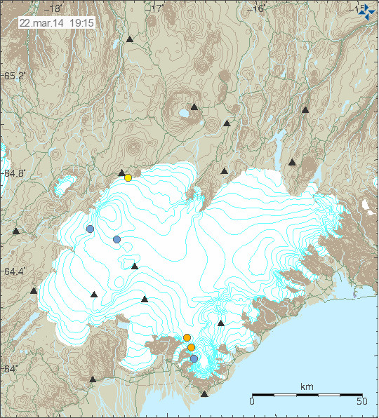
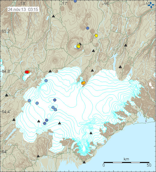
Today (27-March-2014) an earthquake swarm took place in Grímsfjall volcano. This activity is connected to current minor glacier flood from Grímsvötn glacier lake that is now taking place. The glacier flood it self is an minor and is about the same size as an glacier flood from Grímsvötn glacier lake in November-2012.
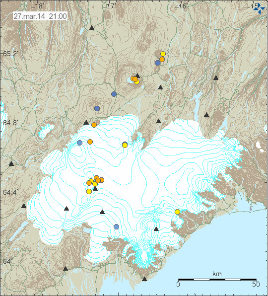
Earthquake activity in Grímsfjall volcano today (27-March-2014). Copyright of this image belongs to Icelandic Meteorological Office.
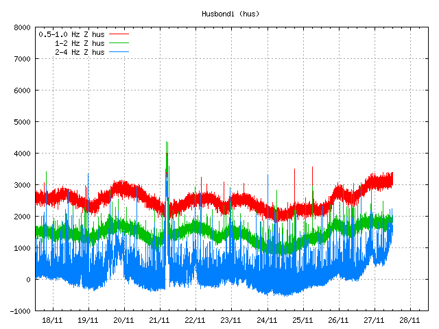
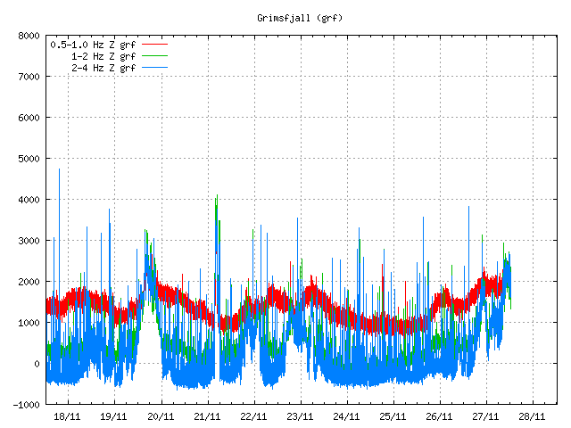
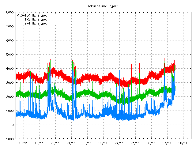
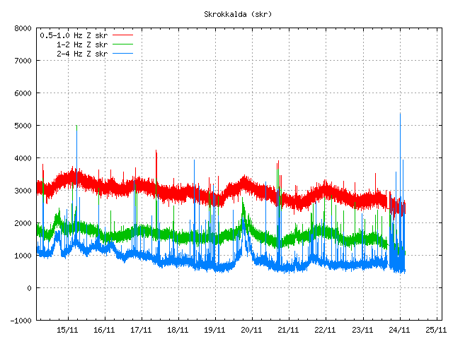
Harmonic tremor has been increasing in Grímsfjall volcano following this glacier flood. The leading idea is that the glacier flood is creating this high frequency harmonic tremors. This idea however remains unconfirmed at current time.
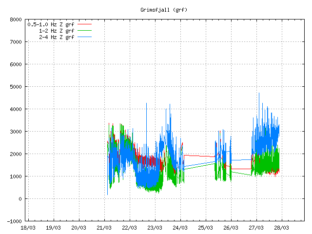
Harmonic tremor at 21:13 UTC on 27-March-2013 at Grímsfjall volcano. The harmonic tremor starts at the end of this plot. Copyright of this image belongs to Icelandic Meteorological Office.

Harmonic tremor at 22:55 UTC on 27-March-2014. As can be seen the high (blue line) harmonic tremor is increasing at the moment. Copyright of this image belongs to Icelandic Meteorological Office.
At present time there is nothing to suggest that an eruption has or is about to start in Grímsfjall volcano. However Grímsfjall volcano is unpredictable and highly active when it comes to eruptions. If an eruption starts in Grímsfjall volcano it might do so without an warning. Earthquake activity in Grímsfjall volcano would increase sharply just before the eruption would start as was the case before the eruption in 2011 (covered here). More detailed monitoring can of Grímsfjall volcano and other volcanoes in Vatnajökull glacier can be found here (Icelandic).
Advertisement: As I did say few days ago. I am adding advertisement back to my websites. Since I need to eat and pay the bills. There however has been a minor issue with my Google Adsense account. An issue that has so far not yet been resolved by Google. Once its resolved I am going to go trough the process of getting my account approved again. I was too detailed back in January when I closed down my Google Adsense account. I hope to have advertisements back before some volcano erupts in Iceland.