This information is going to get outdated quickly.
This is the short update on status on the activity in Bárðarbungu volcano.
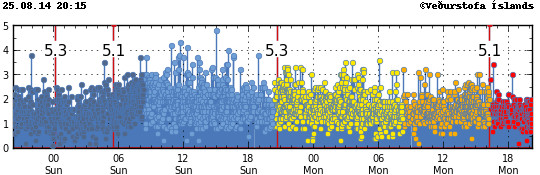
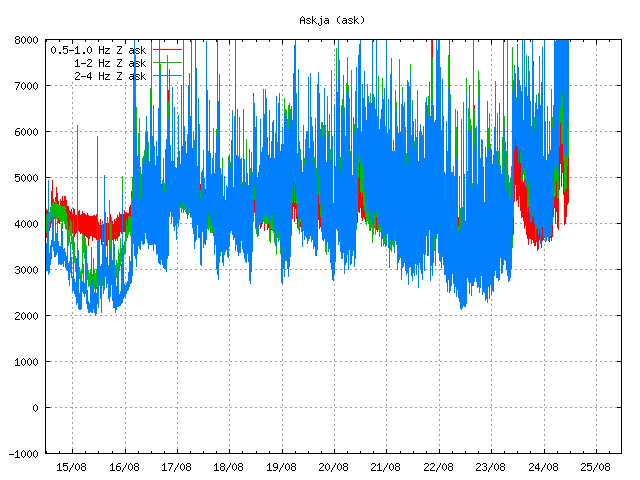
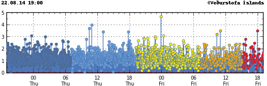
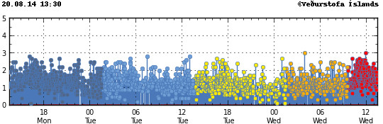
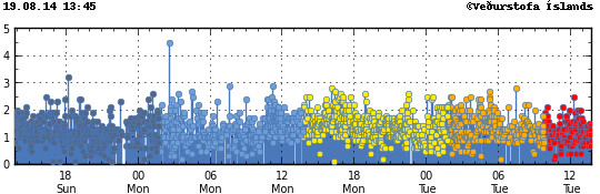
- Current activity is mostly unchanged. Earthquake activity remains high and there are around 1000 earthquakes every 24 hours.
- According to the news today and Icelandic Met Office data, the dyke doesn’t appear to be getting longer. It is now around 37 km long.
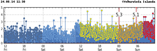
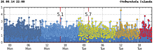
- Largest earthquake since 2008 took place in Bárðarbunga volcano on 26-August-2014 at 01:26 UTC. It had the magnitude of 5,7 and took place in Bárðarbunga caldera. Second medium earthquake took place today at 11:56 UTC and had the magnitude 4,6. It was felt in Akureyri.
- There are no signs of magma going to the surface as of writing of this article. I do expect that change quickly.
- It is now my view that after the magnitude 5,7 earthquake the risk of an eruption Bárðarbungu caldera has increased from what it was. I don’t know yet if an such eruption is going to take place. I however find it to be the most likely outcome based on current status.
The magnitude 5,7 earthquake that took place on 26-August-2014 is the strong earthquake in Iceland since 2008, when a magnitude 6,3 earthquake happened between Selfoss town and Hveragerði in the South Seismic Zone in Iceland (often just called SISZ). Earthquake activity remains high in the north end of the dyke, with strongest earthquake today having the magnitude 4,6. With many more magnitude 3,0 and stronger earthquakes taking place. There are still over 1000 earthquakes being recorded every 24 hours in area where the dyke is located (about 20 km east of Trölladyngja).
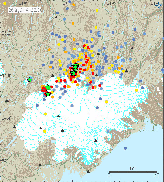
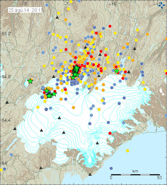
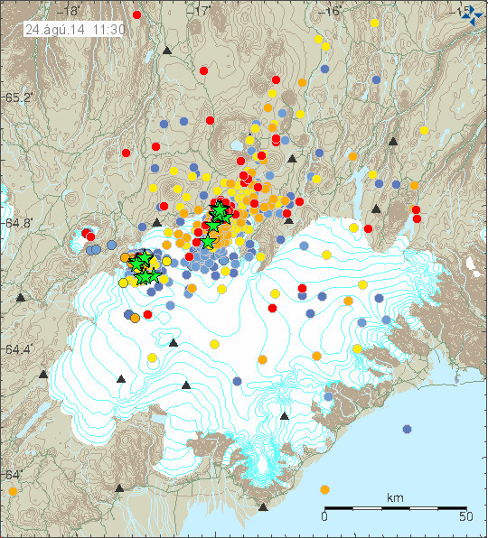
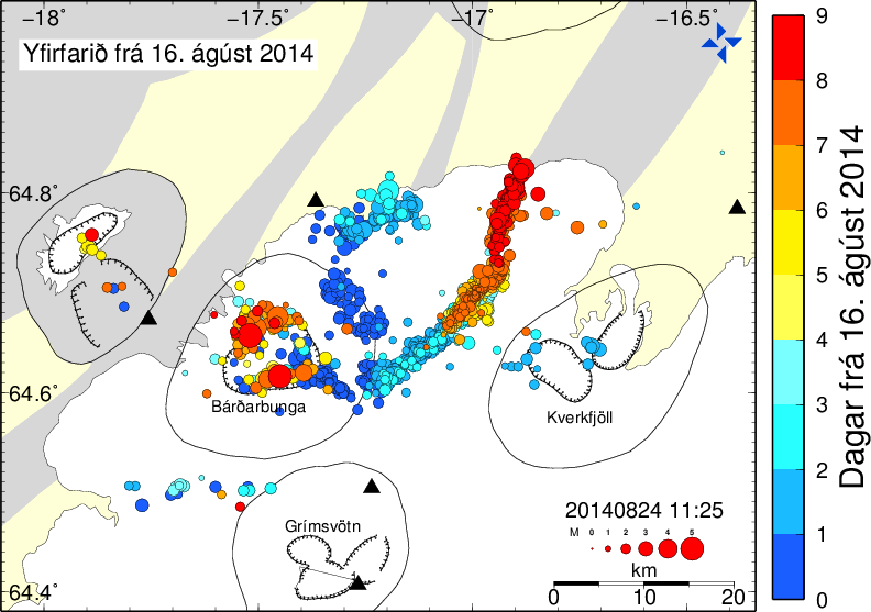
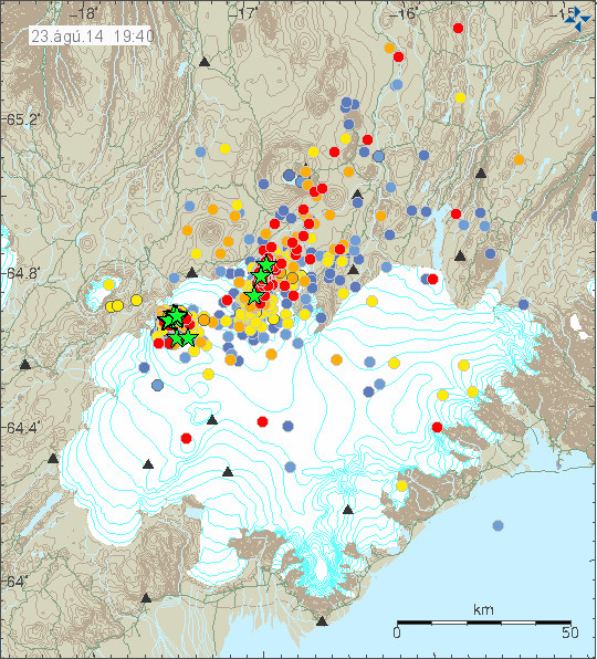
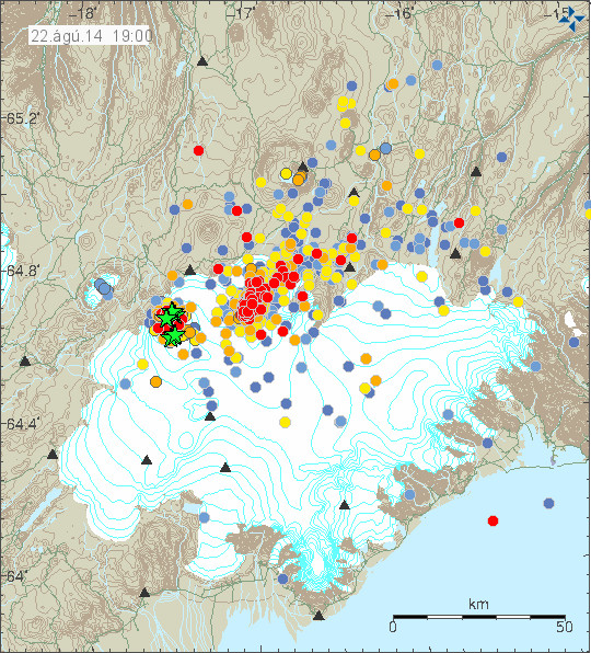
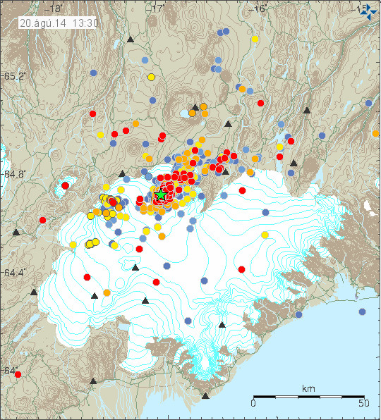
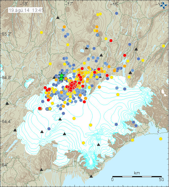
Earthquake activity in Bárðarbunga volcano today. This map is already outdated. Copyright of this image belongs to Icelandic Met Office.
Earthquake activity remains extremely dense in the dyke from Bárðarbunga volcano. Copyright of this image belongs to Icelandic Met Office.
Total lack of earthquake at the start of the dyke suggest that the flow of magma is now smooth and it is flowing without any resistance to the north end of dyke. Where the dyke seems to have hit a resistance in the crust that he is not able to break at current time. I don’t know if the earthquakes that have been taking place today are going to change that. But if this resistance in the crust holds there is a chance it there are going to be even large earthquakes that are going to take place at this location. What magnitude is to expect is difficult to know for sure, but the crust in this area is able to make earthquakes above magnitude 5,5, but how far up the scale it goes I do not know.
There has been some deep earthquake activity taking place according to the automatic data, but since it is automatic data it might be wrong. The deepest earthquake that I did see to day took place today had a automatic depth of 29,3 km with quality of 90,10. There is a chance this dyke might get into connection of other deep dyke in this area. This are dykes that form deep in the crust at depth of more then 30 km, they don’t make any earthquakes when they form since the crust material in this region of the crust is soft and is unable to break and does not make an earthquake as result. I do not know what happens if this dyke manages to connect to an dyke that might have formed in the deeper range of the earth crust in this area. It is also a highly unlikely outcome, for the moment however it is not impossible. Since the dyke now has problems pushing north, and as an result of that it seems to be pushing a little bit down as result. It is clear that once it can not extent any future down or to the sides, it is going to go up. I am not expecting the flow of magma into the dyke to drop any time soon. That might happen, it is just unlikely to happen given the current data. Estimated amount of magma is around 350 million m³ today (26-August-2014).
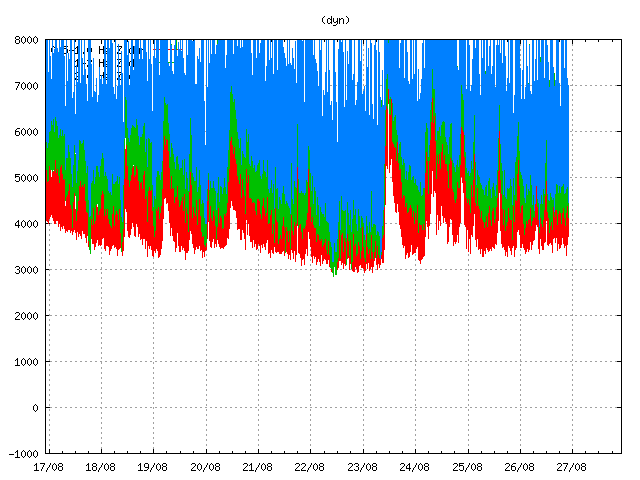
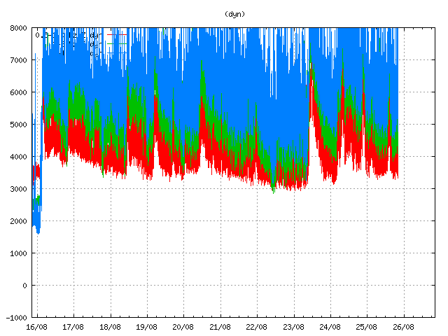
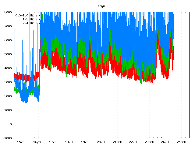
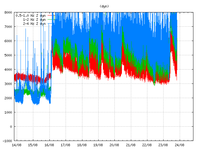
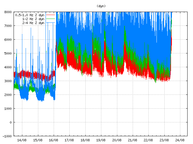
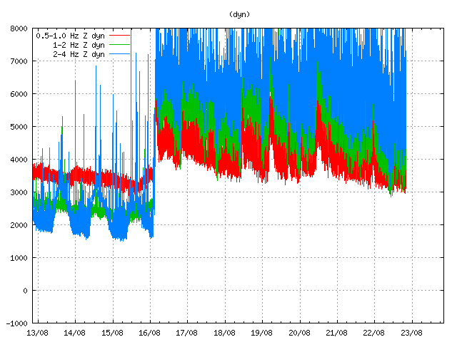
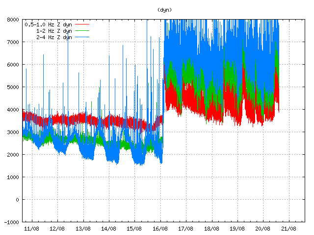
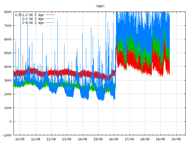
Harmonic tremor remained high in Bárðarbunga volcano due to magma flow in the dyke. This is Dyngjuháls SIL station. Copyright of this image belongs to Icelandic Met Office.
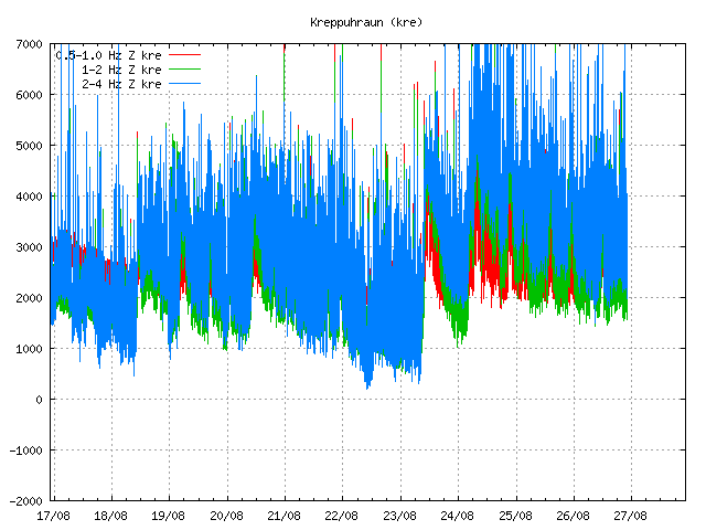
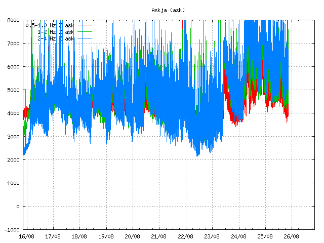
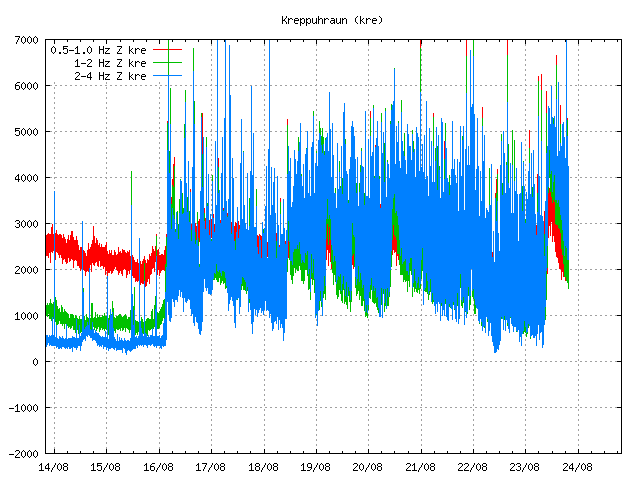
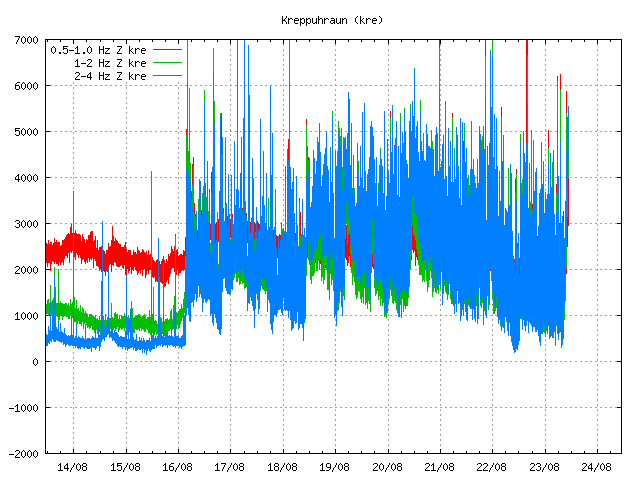
Here is the harmonic tremor in Bárðarbunga on the SIL station in Kreppuhraun. Copyright of this image belongs to Icelandic Met Office.
The harmonic tremor shows that the dyke inflow continues as I did write about above. It also shows one important thing, the flow of magma into the dyke and presumably into Bárðarbunga volcano is not even. It happens in short periods of high inflow with lower periods between them.
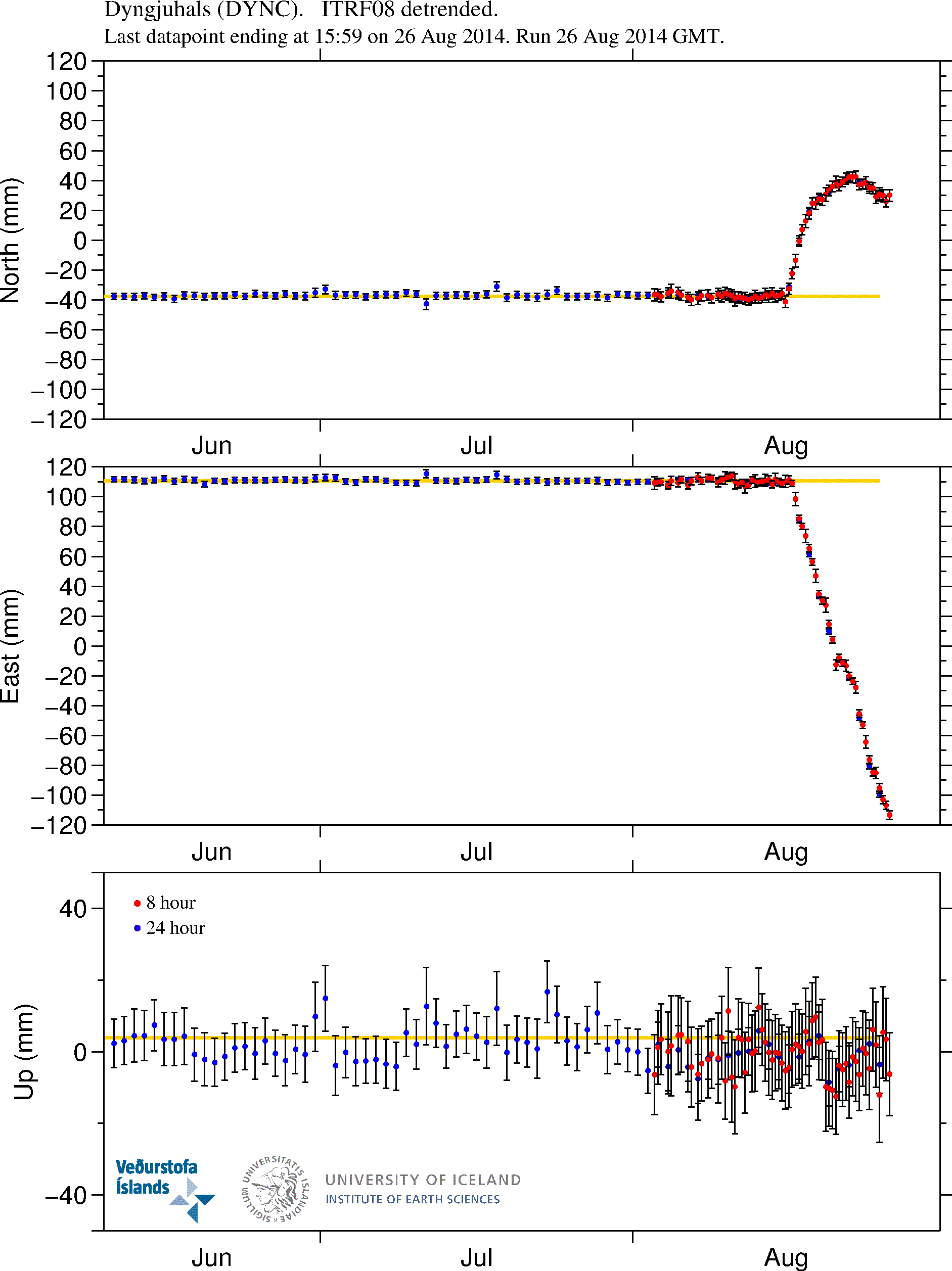
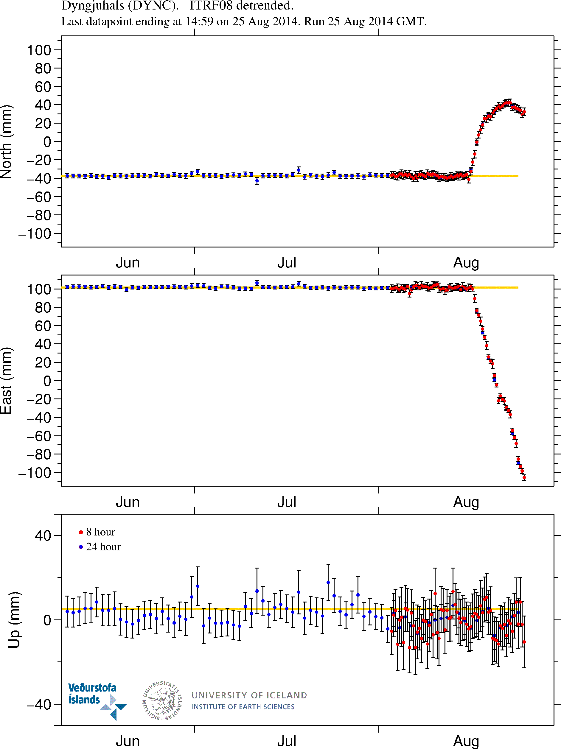
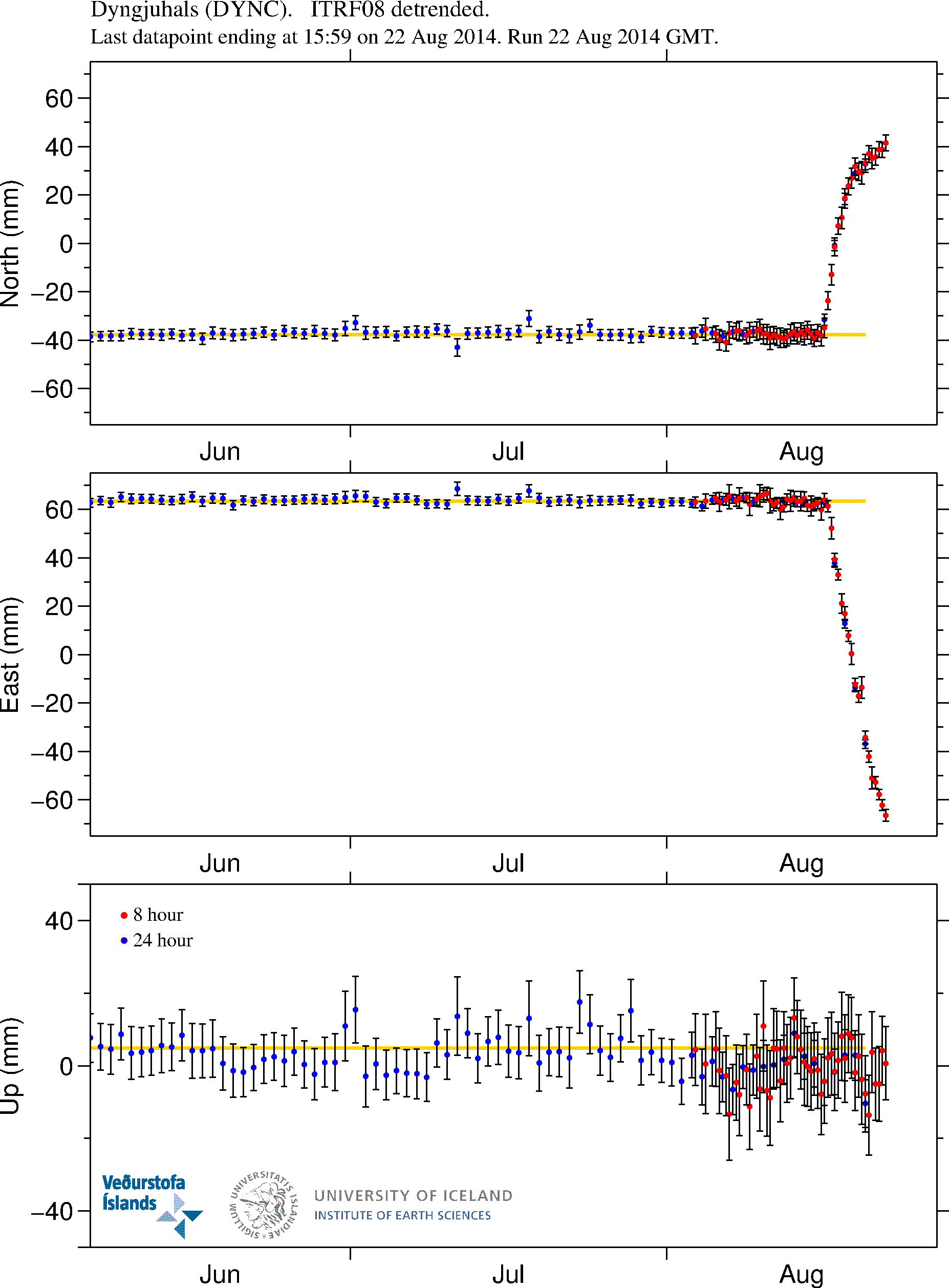
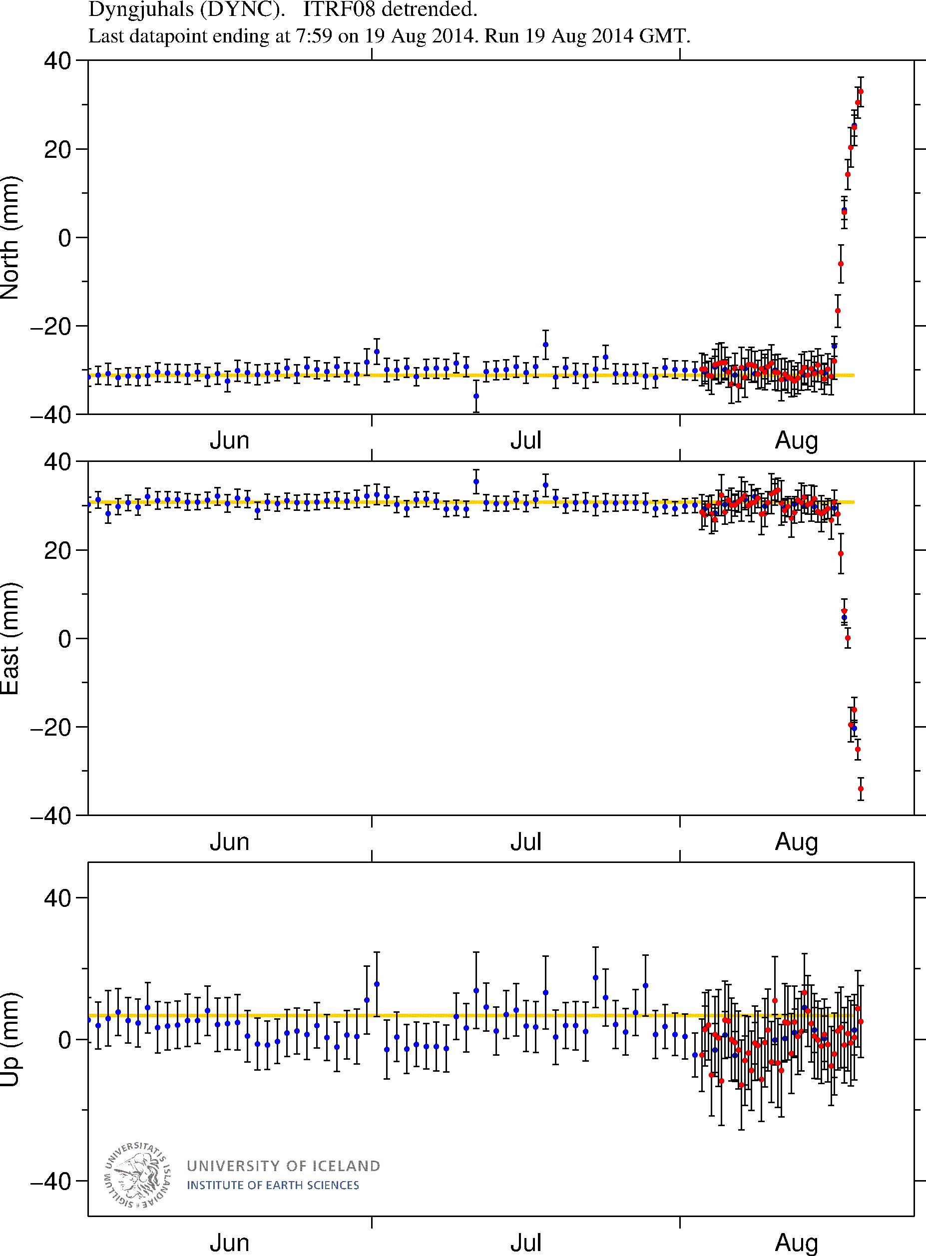
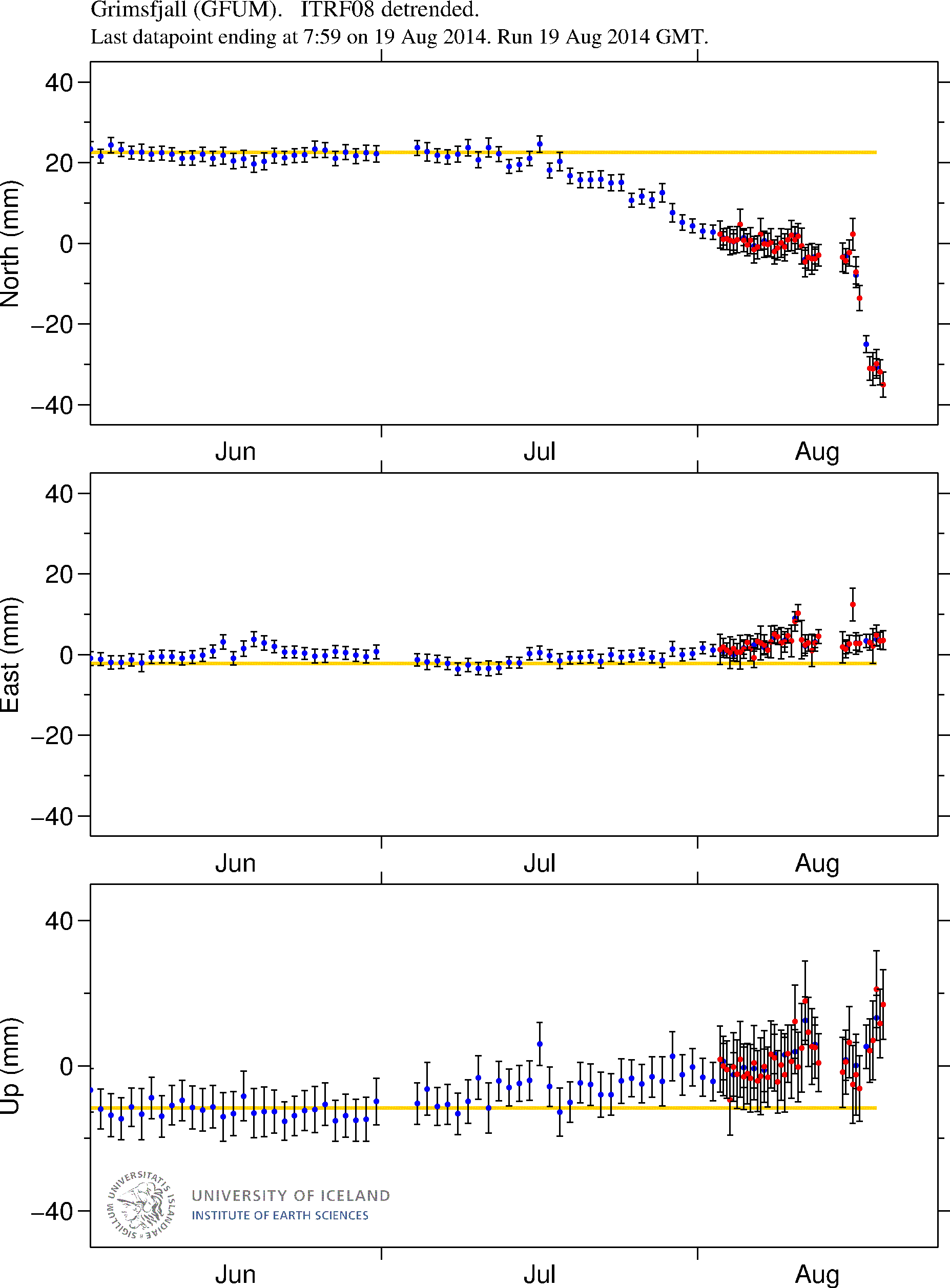
GPS data show the magma continues to flow into the dyke at 5 to 10 km depth. More GPS plots can be found here. Copyright of this image belongs to University of Iceland.
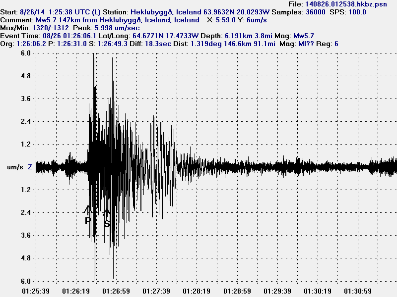
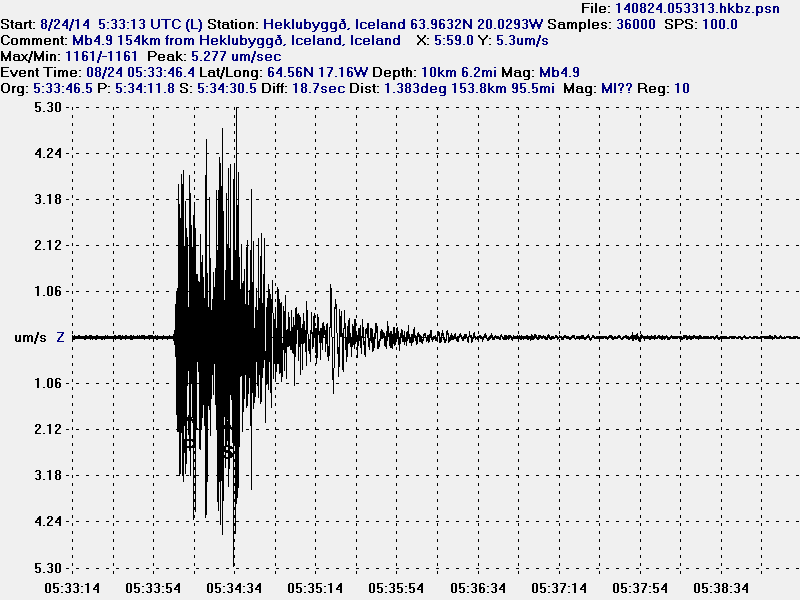
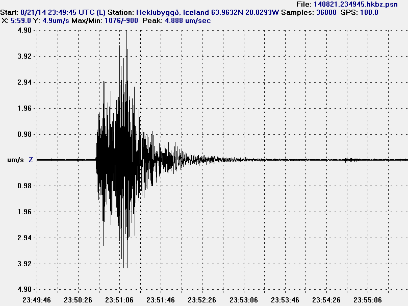
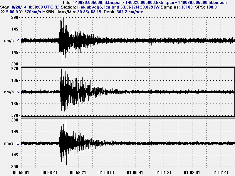
The magnitude 5,7 earthquake as it appeared on my geophone in Heklubyggð. This image is released under Creative Commons licence. See CC Licence page for more details.
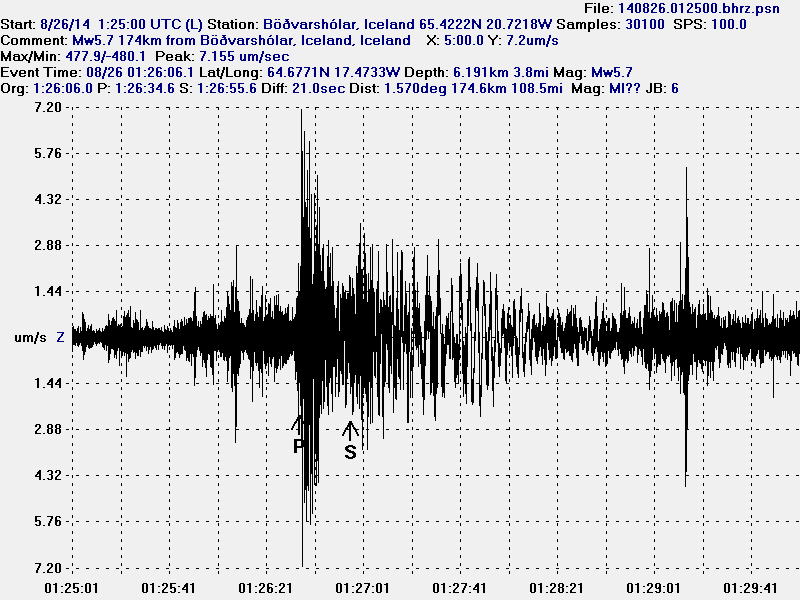
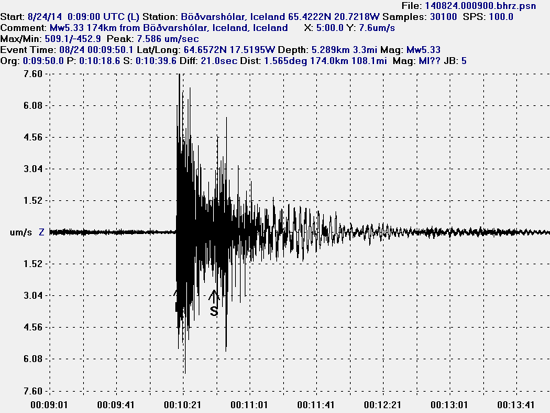
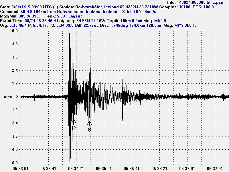
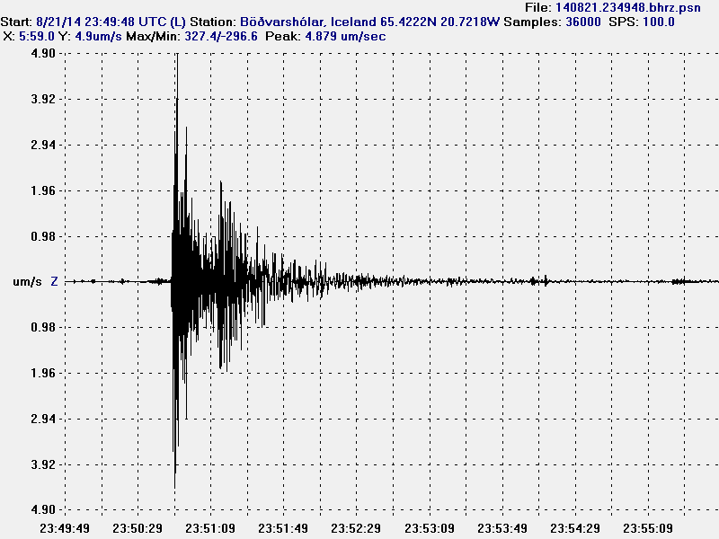
The magnitude 5,7 earthquake as it appeared on my geophone in Böðvarshólar. This image is released under Creative Commons licence. See CC Licence page for more details.
What this has told me is that there is far more magma in Bárðarbunga volcano then appear at first sight. How much of it can actually erupt in an eruption I do not know. But this seems to be far more complicated then I first thought, it is not just a dyke pushing out of Bárðarbunga volcano. There is also a lot more magma inside the magma chamber that is starting to look for an way out, at least from the looks of current activity. The glacier inside the caldera is 700 meters thick so the magma inside the magma chamber that is directly below the caldera is under this extra pressure from the glacier. Once that magma overcomes the pressure of the glacier an eruption is going to start in the caldera, until that time we might see more dyke activity going north and south of Bárðarbunga volcano. Since the magma is going to go first the easiest way out. How much pressure has to be inside the magma chamber to overcome the pressure of the 700 meter thick glacier inside the caldera I do not know. All I know is that it is a high number on any pressure scale.
As of this writing a new magnitude 5,1 (more on EMSC website here) has taken place in Bárðarbunga volcano caldera. Larger earthquake appear clearly on my geophones that can be viewed here.