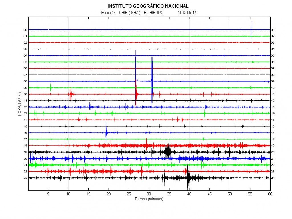
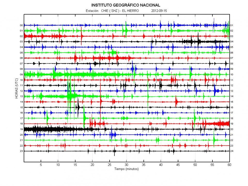
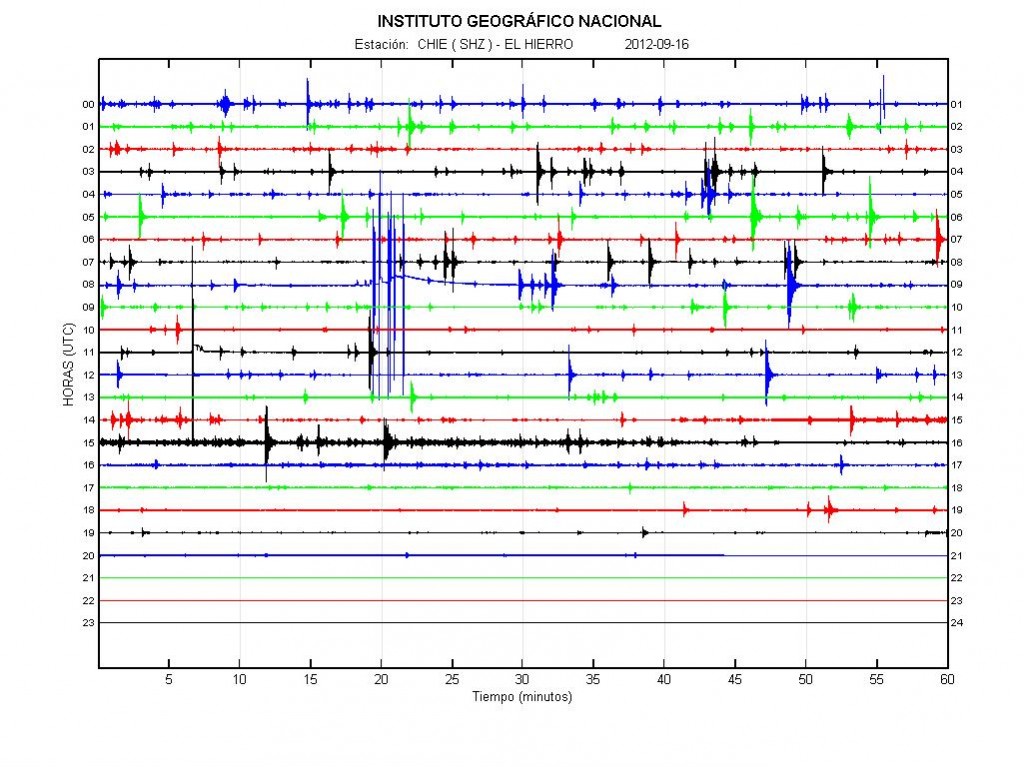
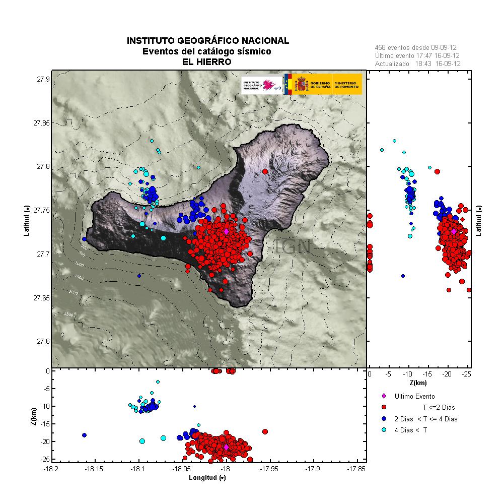
Special report: New magma injection at depth in El Hierro volcano

While I have returned to just covering Iceland volcano and earthquake activity. It does not mean that I have stopped to watch the earthquake activity in El Hierro volcano at present time.

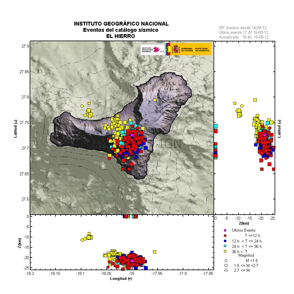
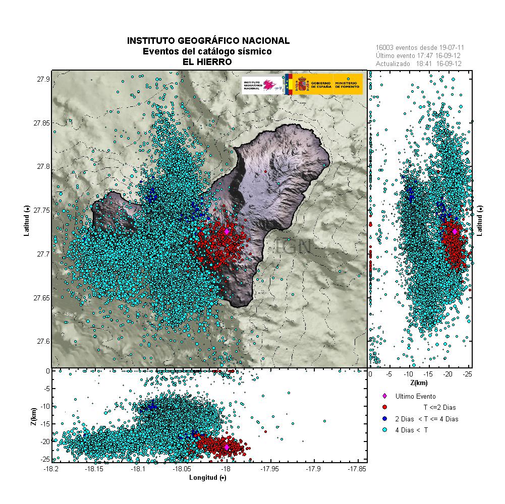
New earthquake activity with the depth of 15 to 28 km have been taking place in El Hierro volcano today (04.06.2012). Minor earthquake activity has also taken place on 29. May, 1. June, 3. June. But this where not many earthquakes. Nothing suggests that eruption has resumed in El Hierro volcano. However an new injection of magma into El Hierro volcano might have increased hydro-thermal activity in earlier eruption vents, or moved older magma that is already high up in the fissure that was eruption. That however does not mean that the eruption has resumed. But there is nothing in the data from El Hierro volcano to suggest that an eruption has resumed at this point.

For the moment, it is mostly quiet in El Hierro volcano. I fully expect that to continue for the time being. At least it is clear that more needs to happen in El Hierro volcano before an new eruption starts in El Hierro volcano. So for the moment, there is nothing to worry about in my opinion.

Craters in Grímsfjall volcano clearly visible

The craters from last years eruption in Grímsfjall volcano are clearly visible on new pictures that Rúv did release in the evening news. There also seems to be some increase in hydro-thermal activity in Grímsfjall volcano. Based on the pictures and what was reported in the Rúv news this evening (02.06.2012).

When the eruption was at it largest last year, the crater was around 1.5 km in size. But once the power started to drop in the eruption, the single crater did turn into several small craters. The glacier is slowly closing this new crater. In few years time, there are not going to be many signs in this are that an large eruption took place there.

The new images can be viewed in this news on Rúv news web page.

Gígarnir í Grímsvötnum greinilegir (Icelandic, Video)

Minor earthquake swarm in Katla volcano

Today (28.05.2012) at 11:22 UTC an small earthquake swarm did start in Katla volcano. This earthquake swarm did end at 12:28 UTC. This is small earthquake swarm, both in numbers of earthquakes and in the magnitude of the earthquakes in the swarm. With the largest earthquake having the magnitude of ML1.4. The depth of this earthquake swarm was around 0.1 km, but that gives the depth around 100 meters or so. Following this earthquake there has been some minor disturbance at Álftagróf SIL station. But because it only appears on one SIL station. This change might have its origin in something else. Like human traffic, local wind etc. For the moment I cannot rule that out.


The change in tremor at Álftagróf SIL station. This change in tremor might not be because of Katla volcano. But something else. Please keep that in mind. Copyright of this picture belongs to Iceland Meteorological Office.

If the tremor changes at Álftagróf SIL station where from Katla volcano. They where highly local and did not show up on other SIL stations for some unknown reason. That has happened before, but the SIL network was not as dense around Katla volcano back then.


Image of the active area in Katla volcano. Copyright of this picture belongs to Iceland Meteorological Office.

I find it most likely reason for this earthquake swarm where some changes in hydrothermal areas inside Katla volcano caldera. All hydrotheraml areas in Katla volcano are under high pressure due to the glacier that is on top of them. So changes might not happen without some earthquake activity as did happen few hours ago. This is also not in any way a sign that Katla volcano might be about to erupt. This is far too low earthquake activity for such event to be starting. There is an chance of small glacier flood following this earthquake swarm in next 8 to 24 hours. But it is far from certain that is going to happen.

Quiet time continues in Iceland geology

It has been rather quiet in Iceland during past few weeks. This seems to be continuing to some extent. There are few earthquakes and nothing noticeable is taking place in Icelandic volcanoes at the moment. While this quiet time is currently I am going to enjoy the summer a little bit. I am also trying to survive the heatwave that has been taking place in Denmark + Northern Europe for the past 10 days. As currently I am not used to type of heat (over 25C). But that is going to take some time until I do.

I am going to try and write something while it is quiet in Iceland. But this quiet time is going to mean longer time between blog posts. But I am sure that something of interest is going to happen soon in Iceland.

Internet connection problem at Skeiðflöt geophone station

I have been having this issue for some time. I have already tried to fix it already. But that solution has not worked, and if I want to move to 3G connection it is going to cost me at least 15900 ISK, 97€, $123, 726 DKK. The problem is rather continued connection dropout. The connection that I am currently using is a 2Mbps ADSL connection that owners of the farm have, but over an poor phone line that does not carry ADSL signal so well (as I suspect is the case rather then anything else that I have think of before). There is an good 3G 900 signal in this area. So my solution would be to move this to 3G internet, rather then anything else. The connection charge pr month would be 1690 ISK (10€, $13, 77DKK) for 3GB of data. With that move. I should solve the connection dropout issues permanently.

This appears on my geophone web page with lack up updates for the Skeiðflöt geophone station. If it was connected normally, as it is going to be soon. This would result in green lines all over the helicorder image. Something that is not good, and makes it harder for me to monitor Katla volcano in real time. I plan on fixing this next month by switching over to 3G connection at that location. So I guess that June is going to be a bit broke for me as well (thankfully, there is cheap food in Denmark that I can buy. But I am still going to be broke). But I am going to work out the money issue somehow in the end.

Krísuvík volcano inflates and deflates regularly

It seems that Krísuvík volcano is inflating and deflating on regular basic. I do not know how regular this change is. But it has been noticed by Icelandic scientists how are bit puzzled by this behavior. Last inflation episode did last until end of the year 2011. Since then deflation did start again and is currently ongoing. It is uncertain if what this means. At the moment it is too early to know for sure if this means if that Krísuvík volcano is getting ready for an eruption. But if there was an eruption in Krísuvík volcano, it would be Hawaiian eruption so no volcano ash. Volcano ash eruption would only take place if an eruption started in Kleifarvatn lake. But the effects of that would be limited to local area (Reykjavík and other nearby towns). It would not create any global problems, as many would want to believe.

Inflation and deflation period have been the years 2009, from January to September. In May 2010 inflation did start again, that inflation period lasted until end of the year 2011. Since then deflation has been taking place. Today there is continues GPS monitoring in Krísuvík volcano. But it is unknown if this type of behavior has taken place before in Krísuvík volcano. But for now Krísuvík volcano is being monitored both with GPS and the SIL network. What happens next anyone guess.

Icelandic news about this.

Land rís og sígur í Krýsuvík (Rúv.is)

Earthquake activity in Herðubreið is not volcanic in nature

The earthquake activity in Herðubreið during past few days is not volcanic in nature, or magnetic in nature. It is purely tectonic in nature. But the faults that have been moving are vertical, not horizontal as so many earthquake faults. Earthquakes are common in this area, as it on the eastern rift zone. The fault lines in this area of Iceland are highly active at times. Iceland Metorlogical Office has released this interesting information about the earthquake activity in this area during the past few years.


The first fault plane in Herðubreið. This one has the direction of N41°A. Copyright of this image belongs to Iceland Meteorological Office.


The second fault plane in Herðubreið. This second fault has the direction of N221°A (49°). Copyright of this image belongs to Iceland Meteorological Office.

Most of the earthquakes are on the depth of 5 to 6 km according to IMO.


The earthquake activity in Herðubreið the days 14 to 17 of May 2012. Copyright of this image belongs to Iceland Meteorological Office.


Earthquake activity in Herðubreið during the years 2005 to 2006. Copyright of this image belongs to Iceland Meteorological Office.


Total amount of earthquakes in Herðubreið from the years 2005 to 2012. This clearly shows that activity in this area has been rather constant during this period. Copyright of this image belongs to Iceland Meteorological Office.

The area in question is outside Askja volcano main fissure swarm. It is also outside Kverkjföll volcano main fissure swarm. So this earthquakes are tectonic in nature. But even so this area has erupted in the past. But for now. It is just earthquakes and not magma on the move, or breaking its path up to the surface as was case in Upptyppingar tuff mountain. The images are from Week 20 overview (what is up about it) at IMO web site.

Special report: Magnitude Mw6.1 earthquake hit northern Italy, many aftershocks recorded

At 04:03 CEST (02:03 UTC) an earthquake with the magnitude of Mw6.1 did happen in north Italy. This earthquake was in an area that has seen a lot of earthquake activity during past several months now. But earthquake activity did start in this area late last year (2011). This earthquake did create a lot of damage in north Italy according to news reports. At least seven people have died from this earthquakes and well over 50 people have been injured because of this earthquake. Many historical sites have been damaged or completely ruined in this earthquake. I do not know what type of fault that did break. But data suggest that it was a slip fault that did break. I am unsure on directions of the fault that did break.


The earthquake in Italy as I did record it in Aabenraa, Denmark. There was a lot of surface waves following this earthquake. But those waves can be seen after the S-wave of the earthquake. This image is released under Creative Commons Licence. See CC Licence page for more details. Owner of this image is Jón Frímann Jónsson. Software used is WinQuake.


Local map of the Mw6.1 earthquake in North Italy. Copyright of this image belongs to EMSC.


The magnitude Mb5.2 earthquake in Northern Italy. I did not record this earthquake as clearly as the strongest one. This image is released under Creative Commons Licence. See CC Licence page for more details. Owner of this image is Jón Frímann Jónsson. Software used is WinQuake.


Local map of the Mb5.2 aftershock in North Italy. Copyright of this image belongs to EMSC.

What is most interesting about this earthquake is that it was had a pre-earthquake with the magnitude of ML4.2 about an hour to two hours before the main earthquake did happen. Web page of EMSC is not working properly at the moment. So I can’t check the time of the pre-earthquake at the moment. There have been more then dozen aftershocks less then Mb4.0 in size. But there have also been several earthquakes with the magnitude of Mb4.5. This aftershock activity continues at the moment.

Update 1: According to EMSC the pre-earthquake took place at 23:13 UTC on 19.05.2012.


Local map of the ML4.0 earthquake that took place at 23:13 UTC on 19.05.2012 in North Italy. This appears to be clearly pre-earthquake to the larger one. Copyright of this image belongs to EMSC.

I am going to update this blog post as more information are published.

English news about this earthquake.

At least 7 dead after quake rocks northern Italy (CNN.com)
Deadly northern Italy earthquake hits heritage sites (BBC News)
In pictures: Italy earthquake (BBC News)

Blog post updated at 15:44 UTC (17:44 CEST) on 20.05.2012.