Earthquake swarm on Reykjanes Ridge last night (16.09.2012)

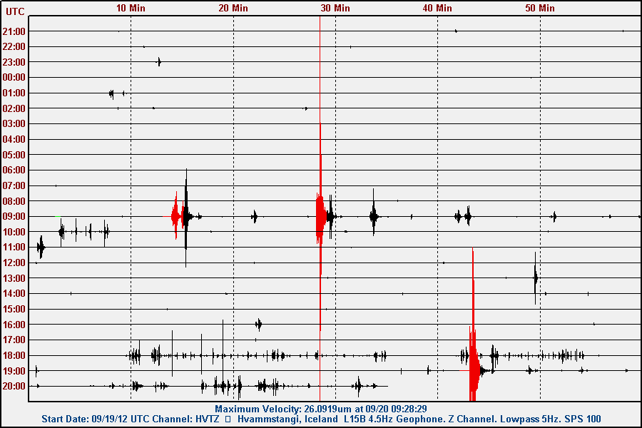
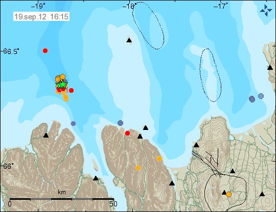
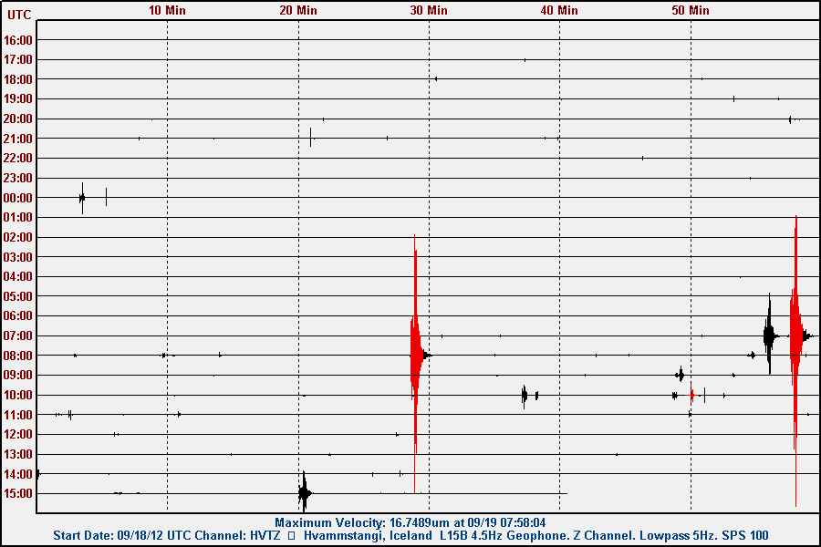
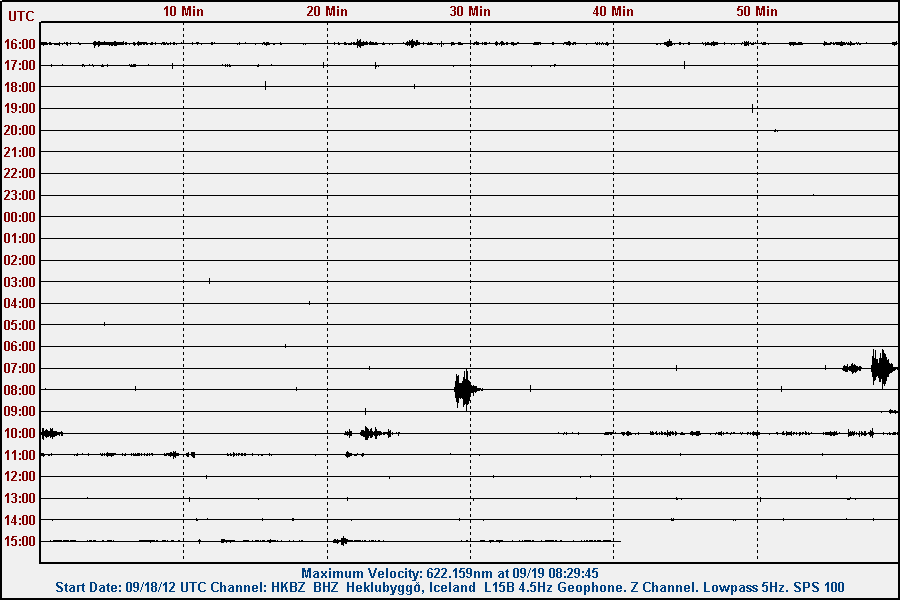
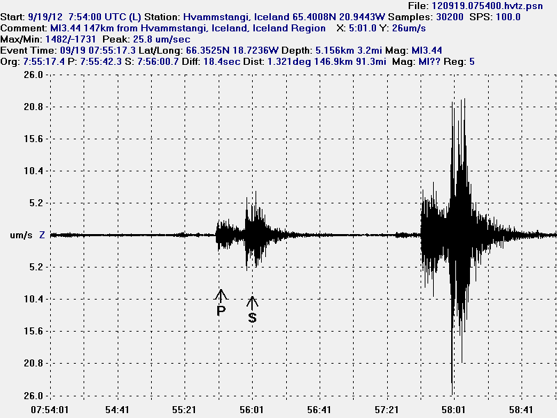
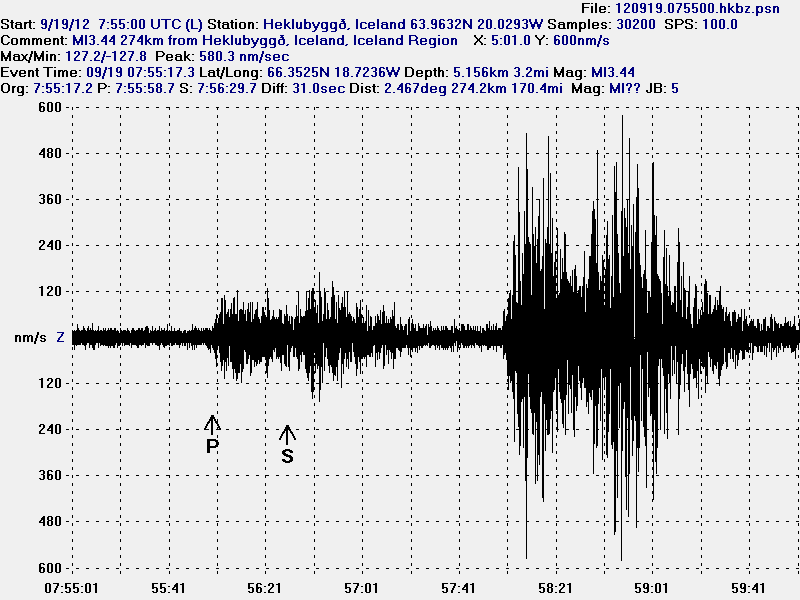
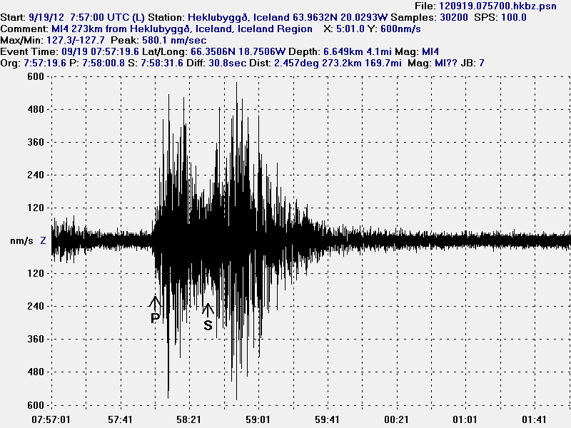
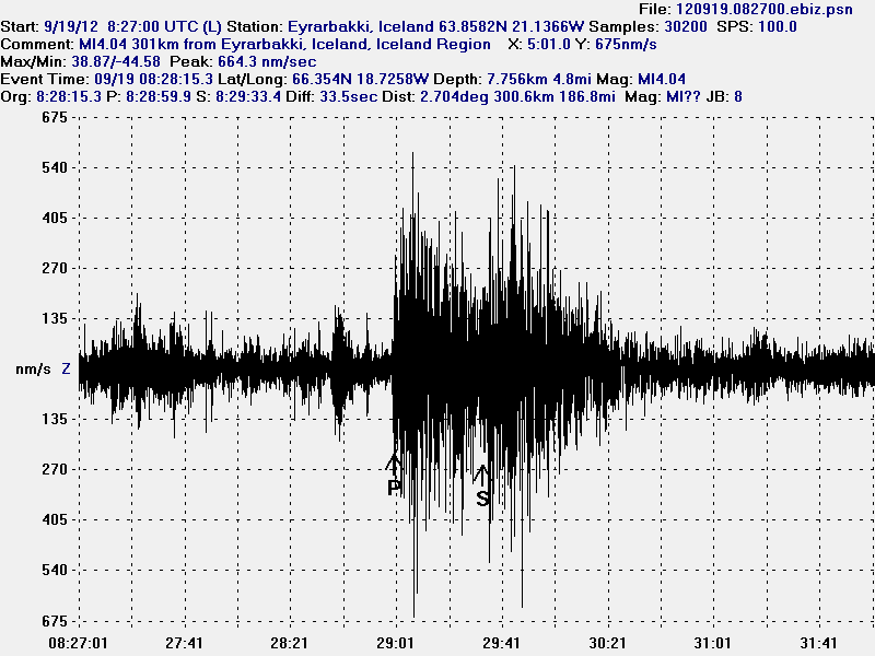
Last night there was an earthquake swarm on Reykjanes Ridge. Possibly on one of the volcanoes that are in this area of Iceland. The earthquake swarm lasted for several hours. Strongest earthquakes in this swarm had the magnitude of 3.5. With the depth from 23 km and up to 0.3 km. Strongest earthquakes in this swarm where visible on my geophone network.


The earthquake swarm on the Reykjanes Ridge. Copyright of this image belongs to Icelandic Meteorological Office.

Last earthquake swarm in this area was on 8. February 2012. There was also earthquake activity deep on the Reykjanes Ridge. With two earthquakes that did get the magnitude 4.4 (EMSC) at 12:51 UTC. The second earthquake took place at 14:30 UTC and had the magnitude of 4.4 (EMSC). This earthquake activity is far enough from land that only the largest earthquakes are detected.

But there seems to be a lot of earthquake activity both south and north of Iceland (Jan Mayen earthquake activity). But this not connected activity as such. But it is known that activity on Reykjanes Ridge happens in jumps. It is an question if such time has come that an new activity episode is about to start on the Reykjanes Ridge. But last major episode in activity on the Reykjanes Ridge ended about 671 years ago. But there is one eruption documented off the coast in the year 1926 according to Global Volcanism Program. That activity did last for 4 days or so.

I am not sure what is going to happen next on the Reykjanes Ridge. But I am going to report it best to my ability. With the best information that I can get when the time comes.

Icelandic news about this earthquake activity

34 skjálftar frá miðnætti (mbl.is, Icelandic)

Blog post updated at 02:47 UTC on 17.09.2012

Askja lake deeper then original measurements did show

After measurements taken this summer. It has now been learned that Askja lake is deeper then estimated from earlier measurements that where taken in the year 1963 by the Sigurjóni Rist. Volcanologist Ármann Höskuldsson has been working on this measurements during the summer months in Iceland. The raw data shows the Askja lake depth is 257 meters where it is deepest. But this is 40 meters deeper then earlier measurements did show.

It is not known why Askja lake is now deeper then earlier measurements did show. But it is possible that soil might have been sinking down, or something of that nature. But next summer scientists the raw data is going to be properly analyzed. By then scientists are going to know the exact depth of Askja lake. Along with how the bottom of the lake actually looks like.

Rúv News about this

Öskjuvatn dýpra en áður var talið (Rúv.is, Icelandic)

Continued earthquake activity on Kolbeinsey Island ridge

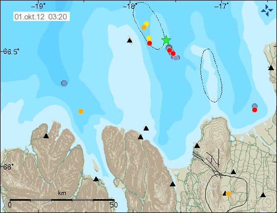
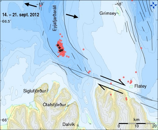
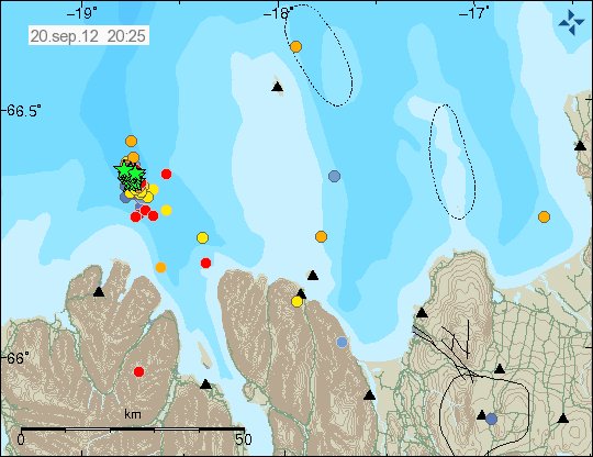
In the past few days there has been considerable earthquake activity in Kolbeinsey Island ridge. Many of the earthquakes have been reaching the magnitude of at least 3.0. But some of it might be underestimation. As this earthquake activity is taking place far off Iceland coastline and far away from the SIL network. But that makes detection of earthquakes more difficult. Along with effects of weather and ocean waves that often prevent detection of smaller earthquakes in this area.


The location of the earthquake activity in Kolbeinsey Island ridge. Copyright of this image belongs to Icelandic Meteorological Office.

This is not the only activity in this area in the past few weeks. But the largest earthquake in this area was an magnitude 4.4 to 4.6 few weeks ago. So the activity in this area seems to be connected to something major. It is an question if this is due to volcano eruption currently taking place in this area now. But with depth of up to 4 km. It is impossible to know that for sure without actually going there on an ship. But given current weather. That is not going to happen any time soon. Maybe not for several years in fact.

Deep earthquake in Eyjafjallajökull volcano

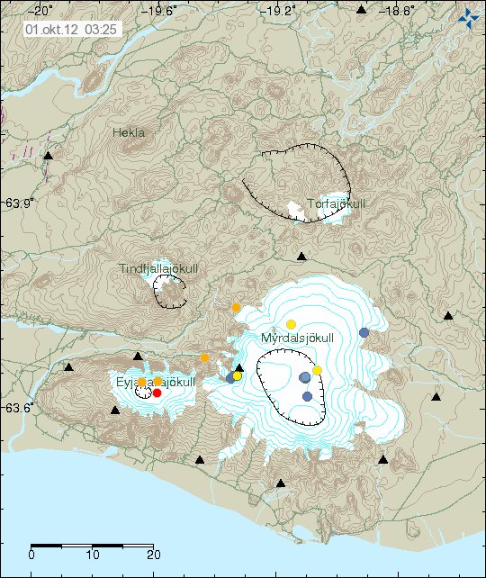
On 11.09.2012 at 10:24 UTC there was an deep earthquake in Eyjafjallajökull volcano. The magnitude of this earthquake was 0.8. It had the depth of 14.9 km. But that is among the deepest that happens in Eyjafjallajökull volcano. But before and during the eruption of Eyjafjallajökull volcano in the year 2010 the most depth of earthquake detected at that time was around 30 km.


The earthquake in Eyjafjallajökull volcano. Copyright of this image belongs to Icelandic Meteorological Office.

I do not expect this earthquake to mean anything. This is just single earthquake that now happen from time to time in Eyjafjallajökull volcano. But after the eruption in the year 2010 there has almost been no earthquake activity in Eyjafjallajökull volcano.

Volcano ash from Eyjafjallajökull volcano

Even if there are now two years since the eruption in Eyjafjallajökull volcano the local area continues to have problems with volcano ash from it. In certain wind direction the volcano ash is blown up and carried out to the sea. This wind direction is mostly when wind is blowing from north and does not carry any snow or rain with it. So today and maybe in next few days. The local people that live in the area around Eyjafjallajökull volcano to live in ash cloud from the eruption two years ago.

I did try to find an MODIS picture of this volcano ash storm. But I did not have any luck doing so.

Icelandic news about this wind blown ash

„Stödd í öskubakkanum“ (DV.is)

Katla volcano geology and features

Here is a short blog post about the geology and the features of Katla volcano. This article is based on science and my knowledge of Katla volcano. It might not be error free and up to date. But I do my best in that regards. But as I cannot afford to buy published or subscribe to web pages that publish science articles about volcanoes in Iceland. I do my best with what I can get for free online (that is often some amount of articles). So my information might be outdated, or might have been replaced by new research that I might not know about. But I use peer-reviewed articles when they are available to me.

Evolution of Katla volcano

Katla volcano is an caldera volcano. It formed in the classic way the caldera forms. The formation of Katla volcano took place around before Holocene, but the data that is available in sediments around Katla volcano only go far as ~8400 years. So it is unknown when Katla volcano formed. Instead of water. Katla caldera has glacier that is from 300 to 740 meters thick where it is thickest. For comparison, Hofsjökull volcano glacier is around 650 meters thick where it is thickest (from what I have read, newer studies might have changed that assessment). The exact age of Katla volcano is currently unknown, but it has been suggested that it is of Pleistocene age (2.6 ma to 11,700 years). The shape and form of Katla volcano during this time period is also unknown today. It is also believed that Eyjafjallajökull volcano is considerable older then Katla volcano. But Eyjafjallajökull volcano is among Iceland oldest volcanoes. Being around 750000 years old according to studies into it.

Katla magma chamber and activity

Katla magma chamber goes trough evolutionary changes every 4000 to 6000 years according to estimates and data gathered by scientists. In the past 12000 years, since last ice age it has gone trough that process twice. But this means current set of magma pluming inside Katla volcano is not going to last for more then few thousands of years at best. I do not know exactly what this changes in Katla volcano pluming mean in terms of eruption. But I find it most likely to be nothing in real terms. It has been noted with study into geological past of Katla volcano that it experiences period of high and low activity. Katla volcano has high and low in it’s eruption activity. Based on data from the past 12.000 years. Currently Katla volcano is having a low period activity. That means fewer eruptions with long quiet time between them. As has been the pattern for the past 1100 years or so. This is according to survey data on activity in Katla volcano for that time period. I do not know if changes in Katla volcano magma chamber influences this low and high period of volcano activity in Katla volcano.

Katla lava

Katla volcano erupts basalt lava normally. On extremely rare occasions Katla volcano erupts magma that is andesite in nature. But that is really rare occurrence in nature. I expect next eruption in Katla volcano to be basalt in nature. But no lava is going to flow due the glacier that is on top of Katla volcano. But that is going to create an ash cloud that is not so different from Grímsfjall volcano ash cloud seen in the May 2011 eruption. As the magma in the two volcanoes are mostly basalt in nature. But that maks for darker but also more large ash particle (less small ash particles). So the ash cloud is not going to create the same problem as Eyjafjallajökull volcano ash cloud did in the year 2010.

Reference articles

Katla volcano, Iceland: magma composition, dynamics and eruption frequency as recorded by Holocene tephra layers (2007)
Bergrún Arna Óladóttir & Olgeir Sigmarsson & Gudrun Larsen & Thor Thordarson

Strong earthquake on Kolbeinsey Island ridge yesterday (06.09.2012)

Yesterday (06.09.2012) there was an earthquake about 200 km off Kolbeinsey Island. It was maybe on the Kolbeinsey Island or on SPAR fault zone in this area. I am not sure what is the actual case here. The earthquake had the magnitude of 4.4 and up to 4.7. Its magnitude has not yet been confirmed (EMSC web page can be found here). I do not know why that it. But this sometimes happen. This earthquake was not felt. But I did record it on my geophone network on two stations.


The location according to IMO. The second green star is an magnitude 3.6 earthquake in Jan Mayen. Copyright of this image belongs to Icelandic Meteorological Office.


The location according to EMSC. Copyright of this image belongs to EMSC.

This earthquake is one the strongest earthquakes that have been taking place in this area for the past few weeks. I do not know what is exactly happening in this area. This might be volcanic activity. But given depth of 2 km there. It is hard to know for sure. As any signs of eruption won’t appear on the surface of the ocean. Given that winter storm season has started in this area. Any sign of eruption are going to lost in the ocean waves. This area of the mid-Atlantic ridge might have more earthquakes in coming days to weeks.

Ongoing earthquake swarm in Breinnisteinsfjöll volcano / SISZ

Since yesterday (02.09.2012) there has been ongoing earthquake swarm in Breinnisteinsfjöll volcano / SISZ (south iceland seismic zone). It is impossible to know how this earthquake swarm is going to proceed. But from what I can tell. It does not seem like it is going to be over any time soon. It is also an possibility that current earthquake swarm is part of an larger stress change in the area. But for now it is too early to know for sure what it means in the long term. Current earthquake activity is ongoing. With almost no breaks or stops. Most earthquakes have the magnitude of 0.1 and up to 2.0. But no larger earthquakes have been detected so far. The first earthquake in this earthquake swarm had the magnitude of ML4.4. Depth of this earthquakes is from 3 to 7 km (in that range).


The earthquake activity in Breinnisteinsfjöll volcano. The earthquakes align them self on an fault line that almost directly north-south direction. Copyright of this image belongs to Icelandic Meteorological Office.

It is impossible to know what is going to happen next in this earthquake swarm. But strong earthquake should not be ruled out for now. This might also activate nearby fault lines if the activity intensifies. As that sometimes happens in Iceland. Whatever happens next in this area. It is worth keeping an eye on the progress of this earthquake swarm.

Icelandic news about this earthquake swarm

Enn skelfur undir Bláfjöllum (mbl.is)
Enn skelfur í Bláfjöllum (Rúv.is)

Harmonic tremor pulse activity maybe in Hamarinn volcano

Today (02.09.2012) a harmonic tremor pulse did start in Hamarinn volcano (best guess) (Bárðarbunga volcano). This harmonic tremor pulses are intermittent and normally last for up to 20 to 30 min., at the time. What is creating them is hard to say. But this might just be hydro-thermal activity taking place in Hamarinn volcano. This might also be magma on the move inside Hamarinn volcano. But nothing is confirmed so far. I do not expect anything to be confirmed any time soon.

The harmonic tremor pluses appear on the end of the traces on this image. They are bit hard to spot for the untrained eye. But they appear as higher then background noise change in the tremor plot image.


The harmonic tremor pulse as it appears on the SIL station at Grímsfjall volcano. This is high resolution image from this IMO web page. Copyright of image belongs to Icelandic Meteorological Office.


The harmonic tremor pulse at Skrokkalda SIL station. Copyright of image belongs to Icelandic Meteorological Office.


The harmonic tremor pulse at jok SIL station. Copyright of image belongs to Icelandic Meteorological Office.


Harmonic tremor pulse at dyn SIL station. Copyright of image belongs to Icelandic Meteorological Office.

It is impossible to know what this means exactly. But so far there are no signs of eruption in the area. This activity is less then activity in July 2011 that was created by an minor eruption in Hamarinn volcano. Stronger harmonic tremor pluses appear on SIL station at longer distance. But for now (when active) most of the activity only appears on SIL stations closest to the Vatnajökull glacier. I am going to continue to monitor the current situation. I will update or make a new blog post about what is going on if anything happens.

Magnitude 3.2 earthquake on the Reykjanes peninsula

Today (01.09.2012) at 16:33 UTC there was an earthquake with the magnitude of ML3.2. The depth was 7.6 km. Following this earthquake there was an swarm of smaller earthquakes following the first earthquake. None of those have been above magnitude 2.0. The earthquake took place in the Reykjanes volcano most likely. But it appears tectonic in nature. Rather then volcanic.


The magnitude ML3.2 earthquake on the Reykjanes peninsula. Copyright of this image belongs to Icelandic Meteorological Office.

It is hard to know for sure if this activity is going to continue. But since this earthquakes. Activity in this area has stopped. But it might resume at later time.

Icelandic news about this earthquake

Jarðskjálfti á Reykjanesskaga (Rúv.is)
3,2 stiga skjálfti við Grindavík (mbl.is)