
Yesterday the Department of Civil Protection and Emergency Management declared uncertainty level for Öræfajökull volcano. Aviation colour code was also moved up to yellow alert level (can be viewed here).
Current status is that a ice cauldron has formed in the centre of the Öræfajökull volcano caldera. It is about 1 km wide and around 21 to 25 meters deep according to early measurements. This is the first time in documented history that such ice cauldrons has formed in Öræfajökull volcano. It is now believed that the ice cauldron has been emptying it self all week resulting in smell of sulphur in Kvíá glacier river. The glacier river can be viewed here on Google Maps Street View. Currently there is not a lot of earthquake activity happening in Öræfajökull volcano. This is to be expected (I guess). It is also worth noting that Öræfajökull volcano did do in few months what took Eyjafjallajökull volcano 16 years to do until an eruption happened.
There is not a lot of details on earlier eruptions from Öræfajökull volcano. Earliest eruption to our in time took place between 1727 and until 1728 (289 years). Before that an eruption took place in 1362 (655 years) and lasted for five months. Currently I don’t have a lot of information about the current status. This is due to lack of measurements as it was not expected that Öræfajökull volcano would do this even if earthquake activity was happening in the volcano. It was only from October (it seems) that it was figured out that something was going on in Öræfajökull volcano.
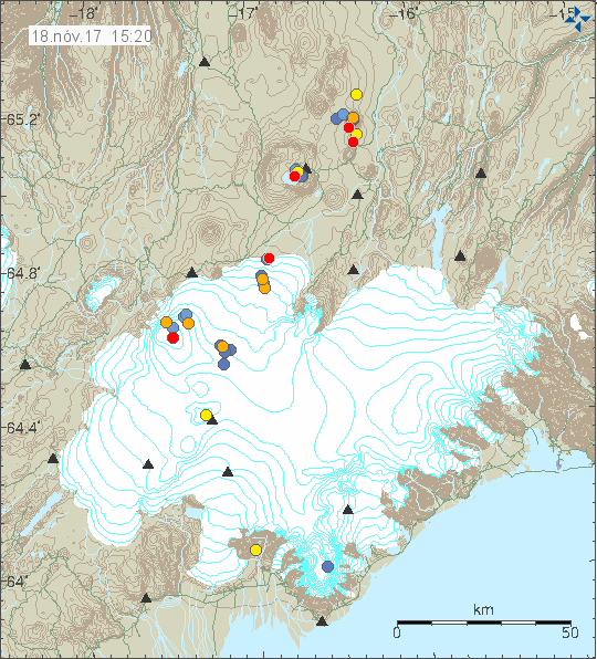
No earthquake activity in Öræfajökull volcano during the past 48 hours (blue dot in the south part of the image). Copyright of this image belongs to Icelandic Met Office.
Images of the new ice cauldron can be found here on Icelandic Met Office website.
I’ll post new information in this article as needed. If anything major happens I’ll write a new article.
Article updated at 16:26 UTC. Added information that I forgot.
There was also inflation found in Öraefajökull volcano. http://www.mbl.is/frettir/innlent/2017/11/10/thekktar_eldstodvar_ad_thenjast_ut/
There seems to be a link between Öraefajökull and the Eastern Rift Zone.
https://link.springer.com/content/pdf/10.1007%2Fs00410-013-0959-1.pdf
Could be that not only climate changes, but also the rifting underway in Iceland (Bárdarbunga!) influences also other volcanoes.
Is there something quietly brewing under the ice? If there was some fresh, hot basalt actively rejuvenating older rhyolite-like stuff how would this manifest itself on the surface?
“A major silicic eruption in 1362 CE was Iceland’s largest historical explosive eruption”
Thanks Jon , you have been busy today.
According to
http://theconversation.com/is-icelands-tallest-volcano-awakening-87132
eruptions of Öræfajökull volcano can be complicated.
The uncertainty level at Öræfajökull volcano is going to remain for next few days.
Is it possible that after the two big earthquakes the bad weather has masked any eruption?
Not the weather, because you would see ash or mineral traces on the glacier by now, but the glacier itself perhaps. Acc. to German Wikipedia, the caldera is about 550 m deep and filled with ice.
But geophysicist Magnús Tumi Gudmundsson says, there is (just?) a new and intensive high temperature system in the middle of the caldera under the ice. (see: IngeB, 22:58)
BTW: Google translates “ketill” often by “caldera”, which is wrong. A ketill is a cauldron,much smaller than a caldera, calderas are sort of very big craters, whereas this cauldron phenomenon means indentations within a big glacier cap covering a volcano, like here in case of Öraefajökull. See the photo links here by others.
So it is the heat from below that melts the the glacial ice from below causing part of the caldera glacial to collaps and form an ice cauldron?
This is heat from magma source in Öræfajökull volcano due to magma movements.
A few small EQ’s showing up in the area atm
New player in the game:
The Dalek (-look-alike) ash-radar, which we know from BB eruption, standing all alone on mount Vaðalda, will be installed next to the volcano.
https://twitter.com/i/web/status/932279168905240581
This is the new cauldron. I believe the photo is taken during the scientific surveillance flight yesterday. In the middle, not the broken ice on the right.
https://pbs.twimg.com/media/DO-wj6DX0AA7EvB.jpg
Photo is from MT Guðmundsson.
While writing this, there seems to be an eq swarm… http://hraun.vedur.is/ja/drumplot/drumplot/hox_highpass_2.0.png
Interesting development! It is worth remembering that Jon has been reporting on the increasing activity in Öraefajökull long before it was news-stuff, sulphur smell and yellow alert levels.
Also, another reminder about the newly installed IMO stations in the area:
http://www.vedur.is/media/frettir-myndasafn-2017/medium/stodvar.JPG
Why didn’t they put at least one station closer to the caldera or the caldera rim?
Needs to be on solid rock, not ice…
Being located at the outer edge of the glacier, there must be some exposed bedrock, surely? Maybe not, I have no idea. But even if there is, maybe it would be too difficult to access, thus making maintenance nearly impossible.
First earthquake swarm appeared in Öræfajökull volcano on 22-August-2011. I wrote about it here.
http://icelandgeology.net/?p=1347
Rhyolite crptodome…cough cough 😉
No cryptodomes needed here. This is an Icelandic central volcano and as in most central volcanoes, the rhyolite is not crypto, but very well visible in the flanks of the volcano / mountain massif, like here in Sandfell. https://commons.wikimedia.org/wiki/Category:%C3%96r%C3%A6faj%C3%B6kull#/media/File:2005-05-29_13_58_32_Iceland-Sandfell.JPG
http://ruv.is/frett/jokullinn-ad-gera-sig-klaran
Stunning aerial photos!
http://www.mbl.is/frettir/innlent/2017/11/20/gjoskuflod_faeru_hratt_nidur_hlidar/
About the biggest eruption in Öraefajökull since beginning of settlement in Iceland (1362):
– http://folk.uio.no/rtronnes/Publ-sci/JVGR07-Selbekk-RhyoliteMagma-Or-1362AD.pdf
– http://www.sciencedirect.com/science/article/pii/S0377027308004381
On the other hand, it could a) be some 16-18 years til the glacier volcano has its next eruption and b) most of the known eruptions were not very big (citing geophysicist and professor Magnús Tumi Gudmundsson).
You have to cite him correctly:
“Holocene volcanic activity before the 1362
eruption was modest, with two minor lava
flows on the east side of the volcano. One is
on the lowlands west of Kvíárjökull while the
other is higher up on the slopes in Vatnafjöll
on the north side of Kvíárjökull.
Tephro chronology of soils around Öræfajökull has
been studied, suggesting that a few, relatively small rhyolitic eruptions
occurred during the period
(Guðmundsson, 1998). Thus, apart
from the 1362 eruption, activity in Öræfajökull has been
modest in Holocene times.”
http://www.vedur.is/gogn/vefgogn/jokulhlaup/haettumat/oraefajokull_markarfljotsaurar/bok_en/chapter_II.pdf (2.3. Volcanic production rate and Holocene activity).
He also mentions a volume growth of 0,25 cubic kilometre every thousand years since approx. 800.000 years ago and that considering the erosion due to ice and jökulhlaups the long-term mean eruption rate must have been considerably higher.
I had another source, see IngeB 22:58, don’t know the haettumat.
Full text of
Volcanogenic floods in Iceland: An assessment of hazards and risks at Öræfajökull and on the Markarfljót outwash plain. Reykjavík: IMO, IES-UI, NCIP-DCPEM.
is due to importance publicly available among others at IMO :
http://en.vedur.is/hydrology/hazard-risk-assessments/glacial-outburst-floods/markarfljotsaurar-oraefajokull/
http://www.ruv.is/frett/jardhraeringar-gaetu-verid-undanfari-eldgoss
The last informations are from the a.m. interview by national broadcasting company RÚV.
Current snow storm in Iceland is going to last until Sunday or Monday.
Latests news is that the water samples show that the hydrothermal system has just gotten warm and doesn’t show any sign of magma powering it at this point.
It seems that magma is at this point only entering Öræfajökull volcano at depth resulting in earthquake activity at shallower depth at the moment.
Evolved magma causing geothermal activity,causing glacial melt,purely heat driven event ,hence no indication of magma interaction in glacial melt.Seismic activity driven by evolved magma induced heating of shallow crust driven by the upwelling of primitive magma at depth…but that’s just a guess
A geology professor with ISOR (company) says that an eruption has already started in Öræfajökull volcano. His reasoning is that hydrothermal activity does only starts when magma is at shallow depth in Öræfajökull volcano.
This does make sense if the magma is of rhyolite magma and slow moving. I’ll post the news when it’s published at Vísir.is (in Icelandic).
Interesting!
What would the professor say to the BB-activity, which Shane C posted here?
http://icelandgeology.net/?p=7199#comment-74968
– a couldron filled with water
– a second one coming steam out of it
– high conduktivity in Jökulsá á Fjöllum!
This is even a step further than Öræfajökull shows at the moment!
Meanwhile a few kilometers away…
Some earthquakes show up under Þórðarhyrna (belongs to Laki-Grimsvötn system) with 2,7 to 4,1 km depth.
Bárðarbunga volcano is not connected to Öræfajökull volcano. Since Öræfajökull volcano is on its own volcano belt that contains the following volcanoes.
Öræfajökull
Esjufjöll
Possible unnamed volcano
Snæfell (east Iceland).
This map shows this properly. Along with low hydrothermal areas of Iceland.
http://www1.mms.is/jardfraedi/pictures/kort_isor.jpg (red dots are hydrothermal areas above 100C, orange dots are hydrothermal areas with temperature between 30C to 80C.)
https://commons.wikimedia.org/wiki/File:Volcanic_zones_of_Iceland.svg
Here is the article I did mention in earlier comment. It’s in Icelandic but it argues that eruption started in Öræfajökull volcano at least 1 month ago. The magma is then rhyolitic (Felsic) in nature and is now pushing up lava dome under the glacier. This article also says that the glacier in the caldera is up to 540 meters thick. If this is the case parts of Iceland are going to have serious ash problems in next few months as the rhyolitic lava dome breaks trough the glacier and becomes unstable. Next earthquake swarm might give more information about what’s going on in Öræfajökull volcano.
http://isor.is/frettir/hugleidingar-um-eldsumbrot-i-oraefajokli (Icelandic)
The eruption in 1362 was rhyolitic in nature.
https://www.nhm.uio.no/english/research/arctic/min-geo/vulkan-island.html
It was also Plinian eruption.
https://en.wikipedia.org/wiki/Plinian_eruption
Extra links (mostly for me so I won’t forget them).
http://isor.is/frettir/kjarni-roksemdafaerslunnar-um-eldsumbrot-i-oraefajokli
News (Icelandic), http://www.visir.is/g/2017171129164/kvika-komin-upp-undir-yfirbord-oraefajokuls
As I said rhyolite cryptodome… 🙂
Not a cryptodome. This is a lava dome. Cryptodomes are at shallow depths in a volcano. This lava dome once it’s confirmed is going straight up in the Öræfajökull volcano caldera.
See, https://en.wikipedia.org/wiki/Lava_dome#Cryptodomes
Thank you, Jón, for all of your work.
Some more activity at Öraefajökull, according to vedur.is site (http://en.vedur.is/earthquakes-and-volcanism/earthquakes/vatnajokull/ ). As usual, it’s hard to see these earthquakes both in the drumplots and tremor plots.
Ok, now there’s some clearly visible activity on HOX drumplot. And I don’t think this is wind. Still ongoing.
https://i.imgur.com/miV82RT.png
That’s wind noise. It’s off the coastline but it’s still wind noise.
See here, http://en.vedur.is/weather/forecasts/elements/#type=wind
There is also a lot of ocean wave noise when it hits the beach.
Ok, thanks for the correction (and the link)! A quick glance at the main weather page (http://en.vedur.is/weather/forecasts/areas/centralhighlands/) showed no wind speeds worth mentioning.
However, I did notice that there was no evident change in the red and green bands on the tremor plot.
Article about volcanoes like Öræfajökull and why this means that Öræfajökull is going to erupt.
https://www.earthmagazine.org/node/21527
Short ‘blog entry’ by Dave McGarvie on Öræfajökull’s previous eruptions and its recent activity:
http://www.open.ac.uk/scotland/news/blogs/icelands-tallest-volcano-%C3%B6r%C3%A6faj%C3%B6kull-awakening?utm_source=Twitter&utm_medium=social&utm_campaign=SocialSignIn