
Here are few images of the last earthquakes in the large earthquake swarm that took place in Katla volcano 28 – 30-September-2016. The alert status for Katla volcano has been downgraded from Yellow to Green.
Earthquake information from Heklubyggð geophone
I was only able to record few earthquakes from the swarm in Katla volcano. Along with the largest earthquakes that happened. Most of the earthquakes where hybrid earthquakes or Volcano tectonic earthquakes, few low frequency earthquakes took place, but I recorded them really poorly due to weather and strong wind at the time in south Iceland. More information about earthquake volcano types can be found here (USGS) and here (alaska.edu). There are no P and S wave markers in this images. I didn’t have the time to process this earthquakes properly yet.
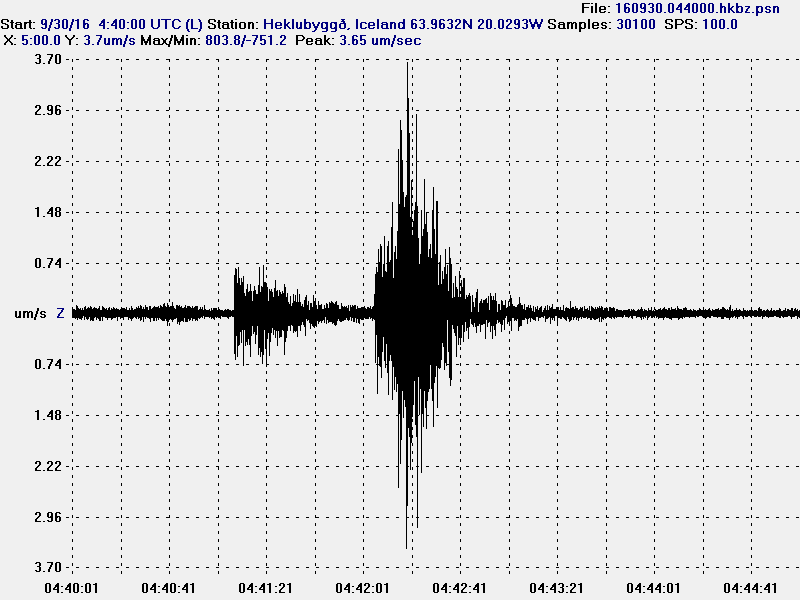
The first earthquake appears to be hybrid earthquake. The second earthquake appears to be a volcano tectonic earthquake. This image is under Creative Commons Licence, please see CC Licence page for more details.
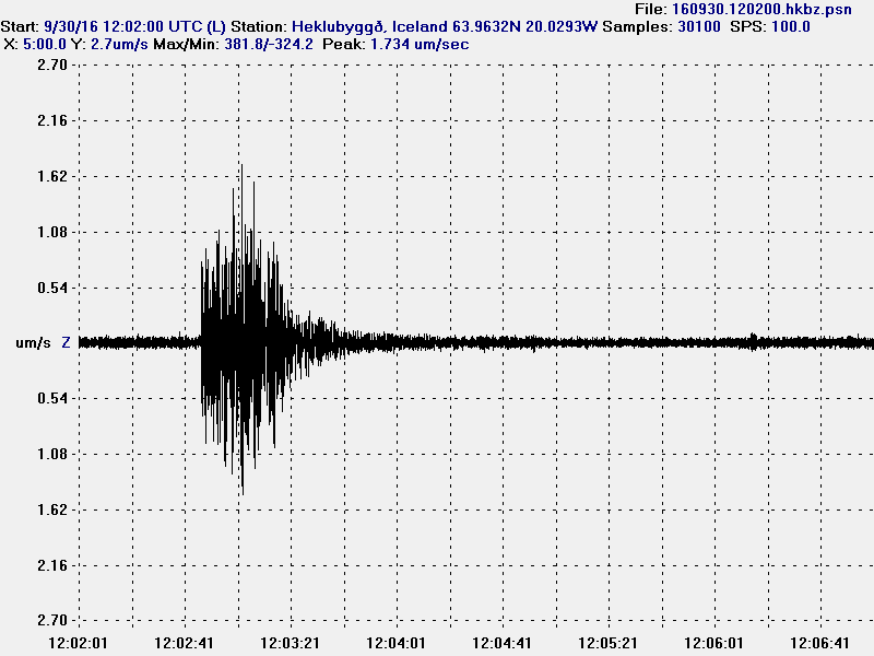
This appears to be a volcano tectonic earthquake. This image is under Creative Commons Licence, please see CC Licence page for more details.
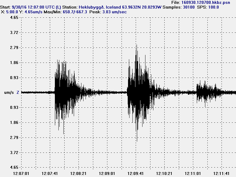
The first earthquake appears to be volcano tectonic earthquake, the second earthquake appears to be two earthquakes happening at once. Making analyse of what type this is difficult. The last earthquake appears to be a hybrid earthquake. This image is under Creative Commons Licence, please see CC Licence page for more details.
The largest earthquakes all appear to be volcano tectonic earthquakes. Other earthquakes where difficult to record due to high wind noise at that time.
GPS information
I finally found the GPS information website for Katla volcano. There isn’t much change on most of GPS station around and on Katla volcano. The most change is happening in Austmannsbunga (AUST) inside the caldera. Other GPS stations do now show this change, suggesting that it might be highly localised change not appearing on other GPS station for now. This doesn’t look like a error or a fault in the measurements. The GPS website for Katla volcano can be found here.
Dear Jon.
Thank you for the blog. It is very interesting and I follow it when I have the time. I know practically nothing about volcanos and the related earthquakes but am catching up slowly via your blog.
If you have the time, I’d be glad to know if these volcanic tectonic earthquakes give us anything more than knowing the next eruption is slowly brewing in the mountain.
Another question regards Laki. Was 1893 the only time it erupted? Why do scientists not fear a second eruption from Laki?
More questions of course but two will do.
Thank you
Arik
The Laki 1783 eruption was fissure eruption, just like the eruption in Holuhraun (Bárðarbunga). It was just a much larger version. The volcano responsible for this fissure eruption was either Grímsfjall or Þórðarhyrna, maybe it was a mix of both volcanoes I’m not sure.
There is no reason to worry about a new eruption like Laki until it happens, as its not possible to predict or even know that a fissure eruption is on the way.
Details.
https://en.wikipedia.org/wiki/Laki
http://news.bbc.co.uk/2/hi/8624791.stm
http://icelandreview.com/stuff/ask-ir/2014/11/05/holuhraun-compared-laki-eruption?language=en
Wednesday
05.10.2016 08:22:39 64.677 -17.451 3.3 km 3.7 99.0 5.5 km NE of Bárðarbunga
Another one…
Wednesday
05.10.2016 08:29:49 64.684 -17.386 0.1 km 3.0 99.0 8.3 km NE of Bárðarbunga
Off-topic but BB has thrown a couple of green stars.
So they were all false alarms.
Jon, have you a link for the drumplots? Mine’s dead. Thanks.
Try this:
http://hraun.vedur.is/ja/drumplot/
Here is the link to Iceland Met Office drump plots.
http://www.jonfr.com/webicorders/tremoren.htm
Here is a link to my geophones.
http://www.jonfr.com/webicorders/tremoren.htm