
For the last 48 hours around 217 earthquakes have been detected in south Tjörnes Fracture Zone. Largest earthquake so far had the magnitude of 3,2 with depth of 6,2 km. Current depth of the earthquakes taking place shows that this are nothing more than tectonic earthquakes. This is not a volcano related activity so far. I doubt that is going to change for now.
Earthquake activity in Tjörnes Fracture Zone. Copyright of this image belongs to Iceland Met Office.
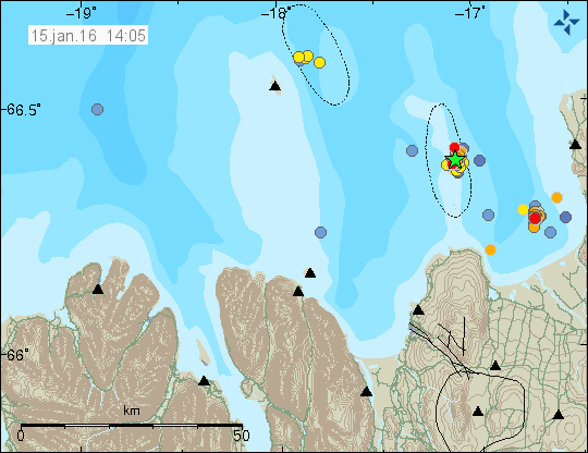
New earthquake swarm also started south of the earthquake swarm that started on 12-Januar-2016. So far that earthquake swarm has remained small, but dense in the number of detected earthquakes. Both earthquake swarms are minor at the moment. The fault area that is moving moves 20mm/year in right hand move, the rift in this area is also 5mm/year. This earthquake swarm is also small, compared to an earthquake swarm that took place in 2013 along the same fault (article about it can be read here. Article about start of that earthquake swarm in 2013 can be found here). It is not possible to know if this earthquake swarm is going to escalate or not. Current activity doesn’t rule it out.
Weather notice
There is a good chance that what remains of hurricane Alex to hit Iceland next week if it goes that path. The weather system might miss Iceland but I don’t know at this point if that is going to happen. If the remains of the hurricane get to Iceland I’m going to write a weather warning if the weather forecast gets really bad.
This article has been updated at 15:26 UTC.
Magnitude mb 4.7
Region ICELAND REGION
Date time 2016-01-16 05:51:44.9 UTC
Location 61.00 N ; 28.13 W
Depth 10 km
Distances 474 km SW of Reykjavík, Iceland / pop: 113,906 / local time: 05:51:44.9 2016-01-16
441 km SW of Keflavík, Iceland / pop: 7,930 / local time: 05:51:44.9 2016-01-16
432 km SW of Grindavík, Iceland / pop: 2,539 / local time: 05:51:44.9 2016-01-16
http://www.emsc-csem.org/Earthquake/earthquake.php?id=482628
I see two now out there the one Jan mentioned :
Time 2016-01-16 05:51:45 UTC Loc 61.095°N 28.110°W Mag 4.7 Depth 10.0km.
and now a second one :
Time 2016-01-16 13:06:37 UTC Loc 60.709°N 27.893°W 4.5 Mag also at the same depth of 10.0 km
Should we see others along the rift as an issue to watch as a full rift action or is this all just a resettling of local sections of it?
Interesting set of quakes at depth under Bárðarbunga!
Credit: Icelandic Met. (Meteorological) Office
Saturday
16.01.2016 14:02:39 64.595 -17.183 11.3 km 0.7 99.0 17.2 km ESE of Bárðarbunga
Saturday
16.01.2016 14:01:59 64.598 -17.215 16.0 km 1.2 99.0 15.6 km ESE of Bárðarbunga
Saturday
16.01.2016 14:01:48 64.599 -17.190 14.8 km 2.4 99.0 16.7 km ESE of Bárðarbunga
Saturday
16.01.2016 14:01:21 64.593 -17.209 17.4 km 1.1 99.0 16.1 km ESE of Bárðarbunga
Saturday
16.01.2016 14:01:10 64.597 -17.199 12.6 km 1.2 99.0 16.4 km ESE of Bárðarbunga
http://en.vedur.is/earthquakes-and-volcanism/earthquakes/vatnajokull/#view=map
This is a dyke intrusion into Bárðarbunga volcano. So far it’s a minor activity so I won’t write about it currently.
I suspect there might be a large earthquake swarm on it’s way in Bárðarbunga volcano. If it happens I’m going to write about it soon as it starts and is confirmed. It might not happen, but I’m rather sure it’s going to happen.
Jon there is a photo of Bard Caldera from the 15.01.2016 showing some sort of large crack and what looks like an outflow of dirty water in the Caldera. Comments please as to what this is.
https://scontent-lhr3-1.xx.fbcdn.net/hphotos-xtf1/t31.0-8/12593892_1244505388897256_4430156313012729163_o.jpg
There is no water flow from the caldera. The glacier on top of it did sink during the Holuhraun eruption in 2014 – 2015. You can see new cauldrons in Bárðarbunga volcano caldera edge, they continue to be deep even during the winter snowfall.
I agree with Stan: the grey smudge is Holuhraun/Nonahraun, and the “crack” is two rivers – the Svartá on the left running into the Jökulsá á Fjöllum.
It is holohraun i think
Thanks for that. It was just that on the computer, I could zoom in and the grey area seemed to have come from the crack/line. Which made little sense as the ground seemed to slope the other way. I also could not find the grey area on earlier sat photos, or on google world. It seemed to be a newish feature.
That feature is new lava field, still warm enough to melt snow I guess. Compare: http://en.vedur.is/media/jar/myndsafn/full/Holuhrauns-jadar_loka.jpg