
At 18:59 UTC today (13-February-2015) a magnitude 7,1 earthquake (USGS) took place deep south of the Reykjanes Ridge. EMSC is reporting this earthquake having the magnitude of 6,8 (link). This earthquake was 1401 km south of Reykjavík, Iceland.
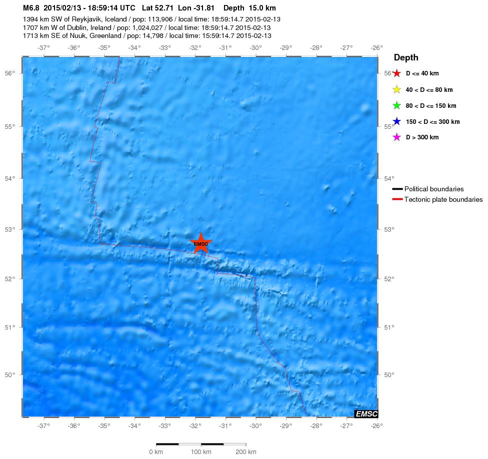
Location of the magnitude 7,1 earthquake. Copyright of this image belongs to EMSC.
Several pre-earthquake took place, with magnitude 5,3 and 4,9 (automatic magnitude). Largest aftershock so far had the magnitude of 5,3 (automatic magnitude). Due to distance from land this earthquake was not felt and it did not create any damage. More earthquake activity should be expected in this area for next few days to weeks.
da xing sober up dude
the difference between a geologist a Volcanologist ,about a 1000 degree
Please do not troll the comments. At worst I am going to delete such comments and place you in permanent moderation.
Hunker down Jon just when u feel better the funk lets u know its schedule
Sir, congrats is that the first 7 on your array
Better don’t write here when you are drunk or high. Thanks
It appears from USGS that this area is know for EQ activity with five other earthquakes of M 6.3-7.0 occuring within 250 km of yesterdays M 7.1. One of these five was a M 7.0 event on the same day in 1967. What are the chances of an M 7.1 and and M 7.0 earthquake occurring in such close proximity on the same day separated by so many years? Metronomic Nature!
Looks like a transform fault between the Reykjanes Ridge and another portion of it resp. the MAR. http://www.britannica.com/EBchecked/topic/602598/transform-fault
Has the eruption stopped for now?? hardly any eqs to speak of, and nothing visible on the Mila cams.
Darkness will reveal the answer to that wial (assuming you can see it on mila).
Having just looked at Bard cam 1 it seems to have snow covering the lens!
USGS has yesterdays M 7.1 on the Charlie-Gibbs Fracture Zone!
In the view I had earlier, the eruption should have been visible — arguably anyway. It’s getting near the date they predicted it would stop anyway.
Please keep questions about Bárðarbunga volcano eruptions in the articles about it. You have a better chance of answer there than in other articles.
Looking at both cams, did the eruption stop? No steam cloud!
Another Quake.
Magnitude mb 4.6
Region REYKJANES RIDGE
Date time 2015-02-15 09:08:19.0 UTC
Location 52.56 N ; 32.39 W
Depth 10 km
emsc
There was also an M 4.7 on Reykjanes Ridge @ 04:36
52.714°N 33.414°W. (USGS)
10.0 km depth (Charlie-Gibbs Fracture Zone)