This morning (19.09.2012) at 04:53 UTC the earthquake swarm that has been ongoing in TFZ (Tjörnes Fracture Zone) started to intensify. But it was not until 07:55 UTC the first strong earthquake did happen. But then a magnitude 3.0 earthquake did take place about 20 km north-east of an town named Siglufjörður. The largest earthquakes have been felt in Siglufjörður, Ólafsfjörður and Sauðárkrókur and possibly more towns close to this area of activity on TFZ. The largest earthquake so far had the magnitude of ML4.3, other earthquakes had the magnitude 3.0, 3.4, 4.0 and 3.2. The depth of this earthquake swarm is from 17 km and up to 2 km or so. This area does not have any active volcanoes. But it highly active when it comes to earthquakes. But spreading in this area of Iceland is up to 50mm/year.
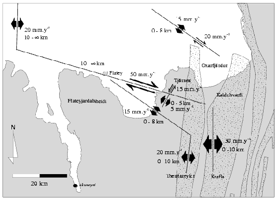
This image shows part of the Tjörnes Fracture Zone. It is from this science paper here. Copyright of this image belongs to Icelandic Meteorological Office/Hjorleifur Sveinbjornsson

Earthquake swarm at 15:10 UTC. As can be seen here on this image where the earthquake swarm is taking place. Copyright of this image belongs to Icelandic Meteorological Office.
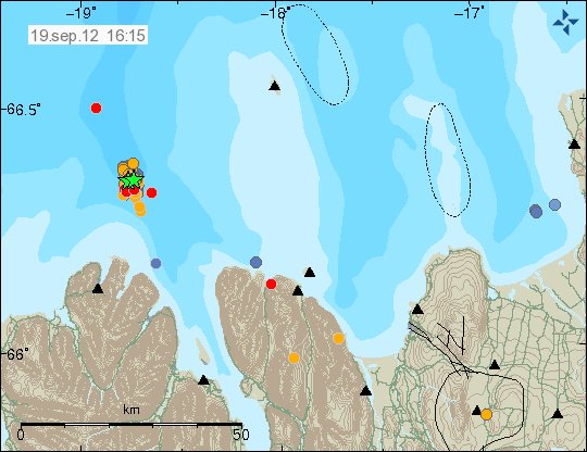
The earthquake swarm at 16:15 UTC. This image has few new earthquakes that have taken place in this earthquake swarm since the picture from 15:10 UTC. Copyright of this image belongs to Icelandic Meteorological Office.
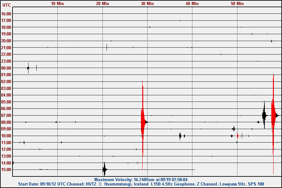
The earthquakes as they did appear on my Hvammstangi geophone. This image is released under Creative Commons Licence. Please see CC page fore more details.
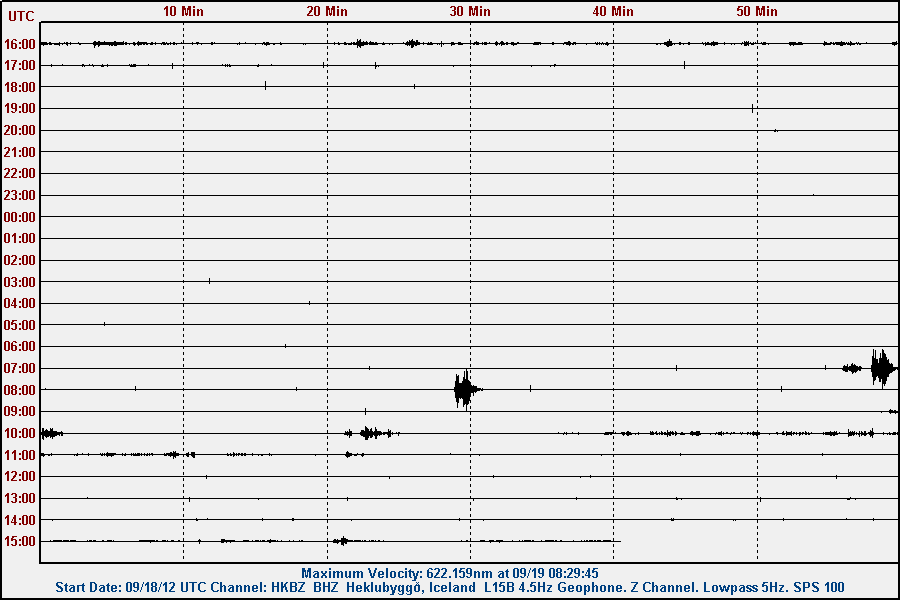
The earthquakes as they did appear on my Heklubyggð geophone. This image is released under Creative Commons Licence. Please see CC page fore more details.
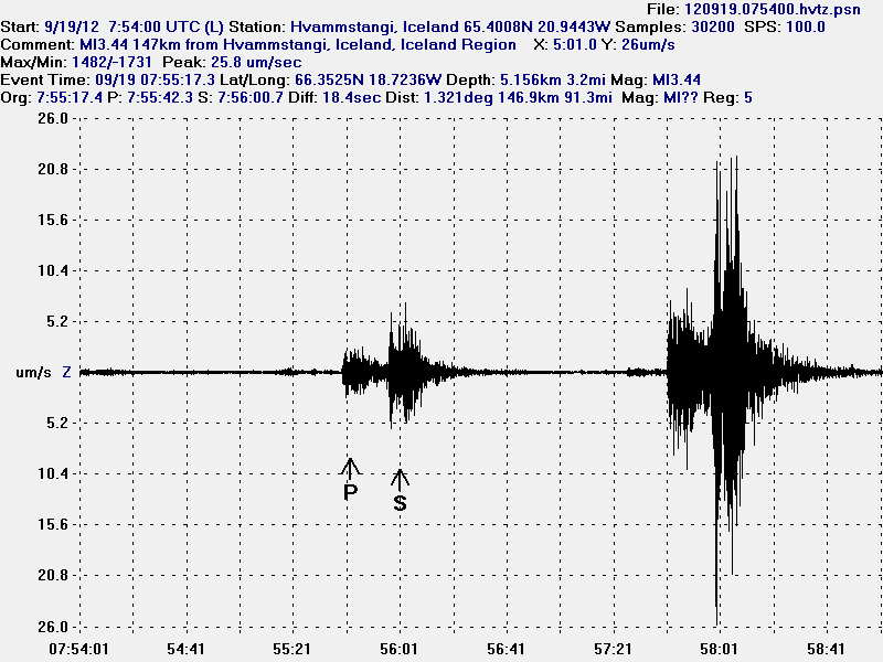
The magnitude ML3.0 earthquake on TFZ. This image is released under Creative Commons Licence. Please see CC page fore more details.
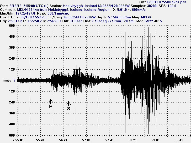
The magnitude ML3.0 earthquake on TFZ. This image is released under Creative Commons Licence. Please see CC page fore more details.

The magnitude ML4.3 earthquake on TFZ. This image is released under Creative Commons Licence. Please see CC page fore more details.
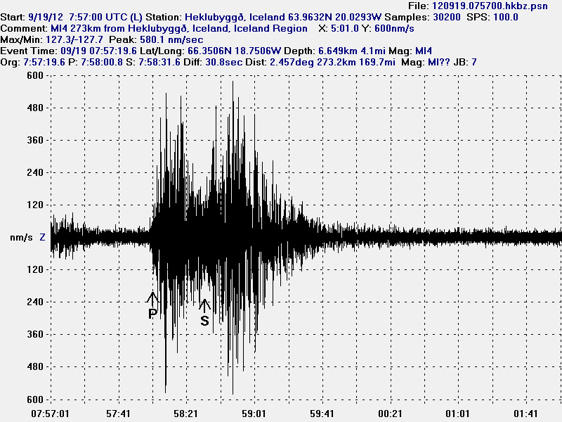
The magnitude ML4.3 earthquake on TFZ. This image is released under Creative Commons Licence. Please see CC page fore more details.

The magnitude ML4.3 earthquake on TFZ. This image is released under Creative Commons Licence. Please see CC page fore more details.

The magnitude ML4.0 earthquake on TFZ. This image is released under Creative Commons Licence. Please see CC page fore more details.

The magnitude ML4.0 earthquake on TFZ. This image is released under Creative Commons Licence. Please see CC page fore more details.
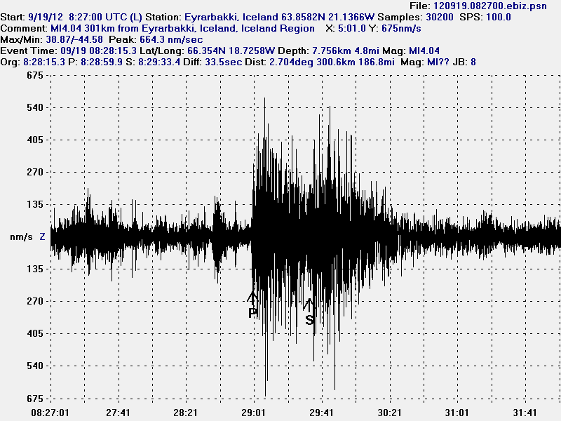
The magnitude ML4.0 earthquake on TFZ. This image is released under Creative Commons Licence. Please see CC page fore more details.
The last earthquake was at 16:52 UTC. That was magnitude 2.0 earthquake. But it is hard to know if this earthquake swarm is over or not. I am going update this blog post or make a new one if any new major development take place in TFZ. Larger earthquakes in this area cannot be ruled out at this time.
Icelandic news about this earthquake
Harðir jarðskjálftar fyrir norðan (mbl.is)
Skjálftahrina fyrir norðan (Vísir.is)
Jarðskjálfti 4,3 í Eyjafjarðarál (Rúv.is)
Enn skelfur undan Tröllaskaga (Rúv.is)

A new swarm has started…
Yes. The largest earthquake so far is ML4.1. It is currently ongoing. Appears clearly on my geophone in Hvammstangi and on Heklubyggð.
Do we see a short harmonic tremor here? Any suggestions? http://hraun.vedur.is/ja/oroi/fla.gif
Does show up this strong only for FLA.
There are no volcanoes in the earthquake area. This is an technical problem with the SIL station. Along with noise from the earthquake swarm that is currently taking place.
This is interesting! IMO hints, that major earthquake activity at TFZ may be linked to Krafla’s eruptions.
http://www.eldgos.is/snarpir-jardskjalftar-nordur-af-siglufirdi/
Yes. When there was an earthquake activity there, this area had Mb6.3 earthquake in the year 1976 (as appears on the map). This was during rifting event in Krafla volcano. It had large stress changes in this area during that period of eruptions.
Current activity is just tectonic in nature. As there are no volcanoes in this part of Iceland.
New earthquake. Early reports suggest magnitude 4.2. But this has not yet been confirmed.
New blog post is up on the latest earthquake.