
Here are pictures of Tröllaskagi from a town called Sauðárkrókur.
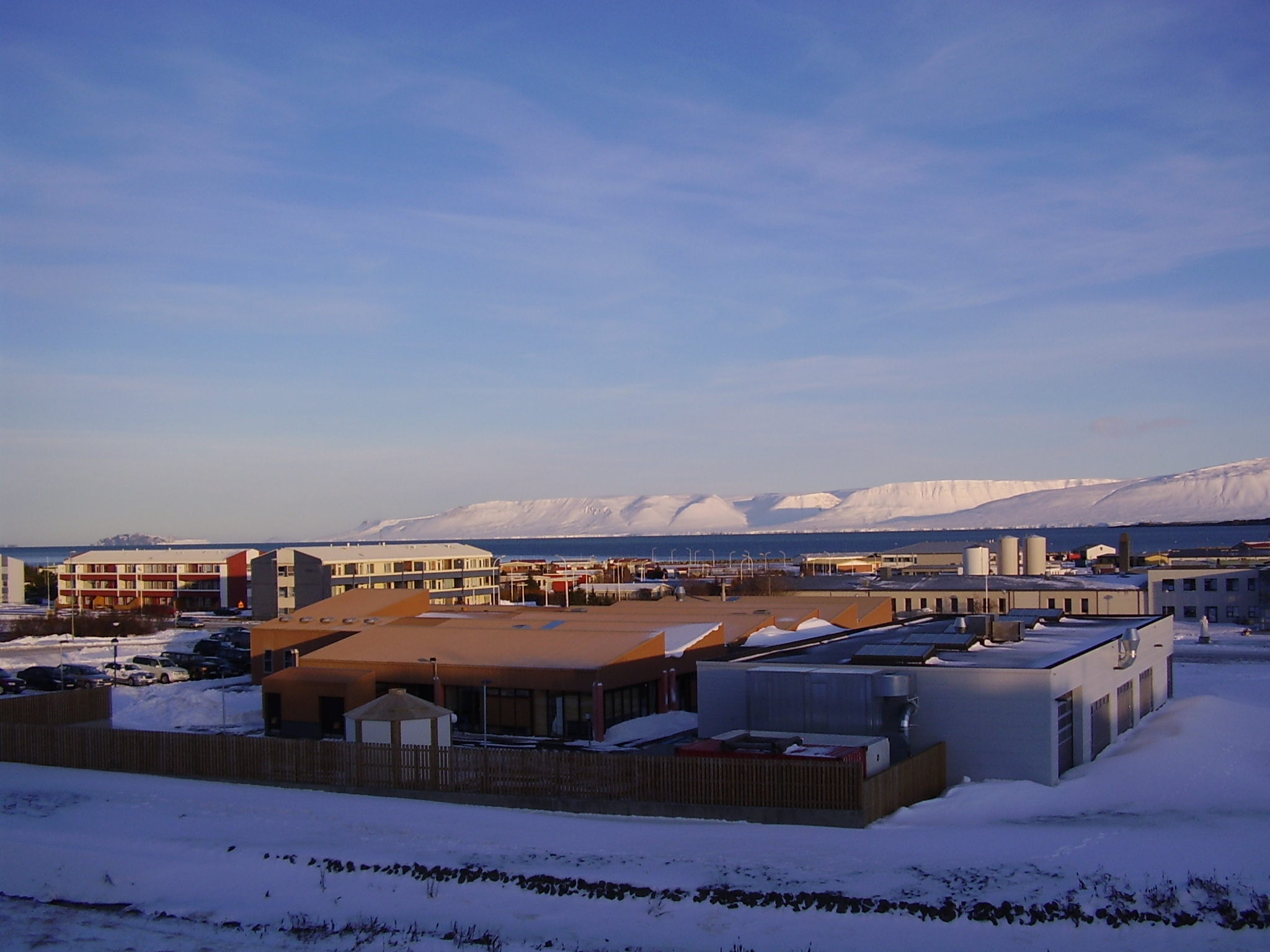
Tröllaskagi to the north from Sauðárkrókur. Click on the picture for larger resolution.
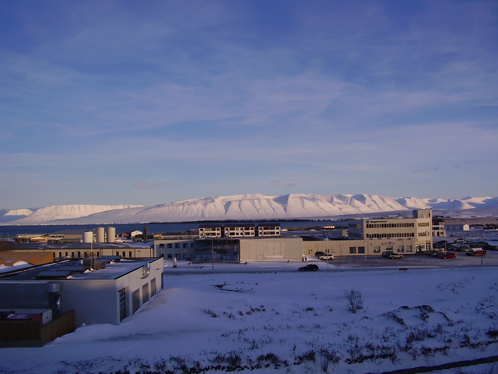
Tröllaskagi to the east from Sauðárkrókur. Click on the picture for larger resolution.
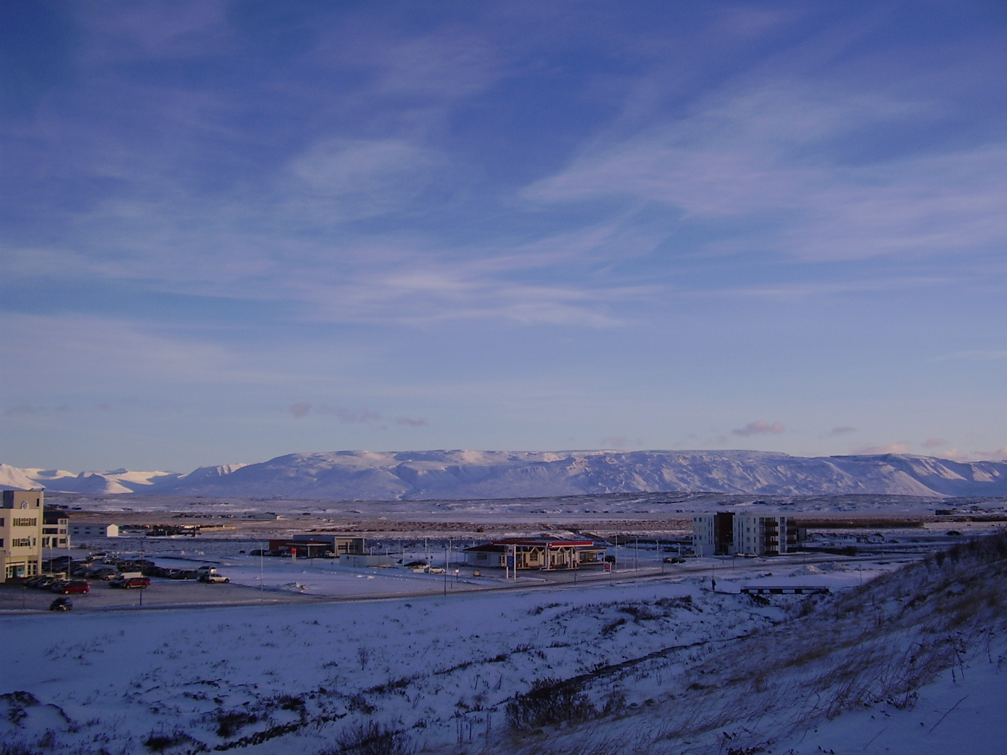
Tröllaskagi to the south from Sauðárkrókur. Click on the picture for larger resolution.
Tröllaskagi is a really mountainous region of Iceland. Few people live there. But there are some farms in few of the deep wallies there. But not many to my knowledge. This area also once hosted a large glacier. But there are few remains left of it today. This area is mixed in rock. But this rock also holds a different age and origin far as I know. There are theories that this might be a old continent crust that make up Tröllaskagi.
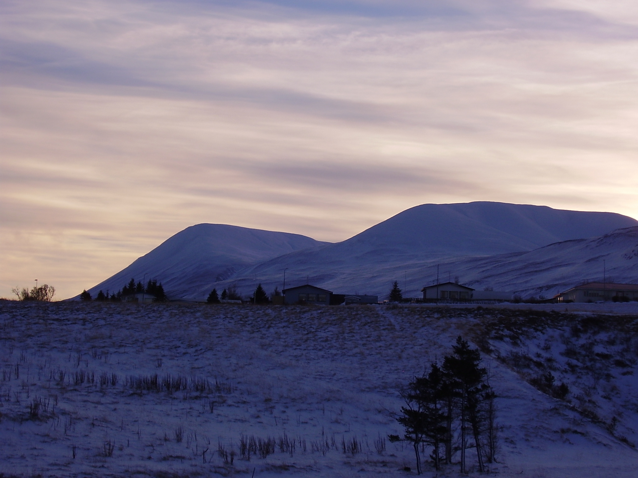
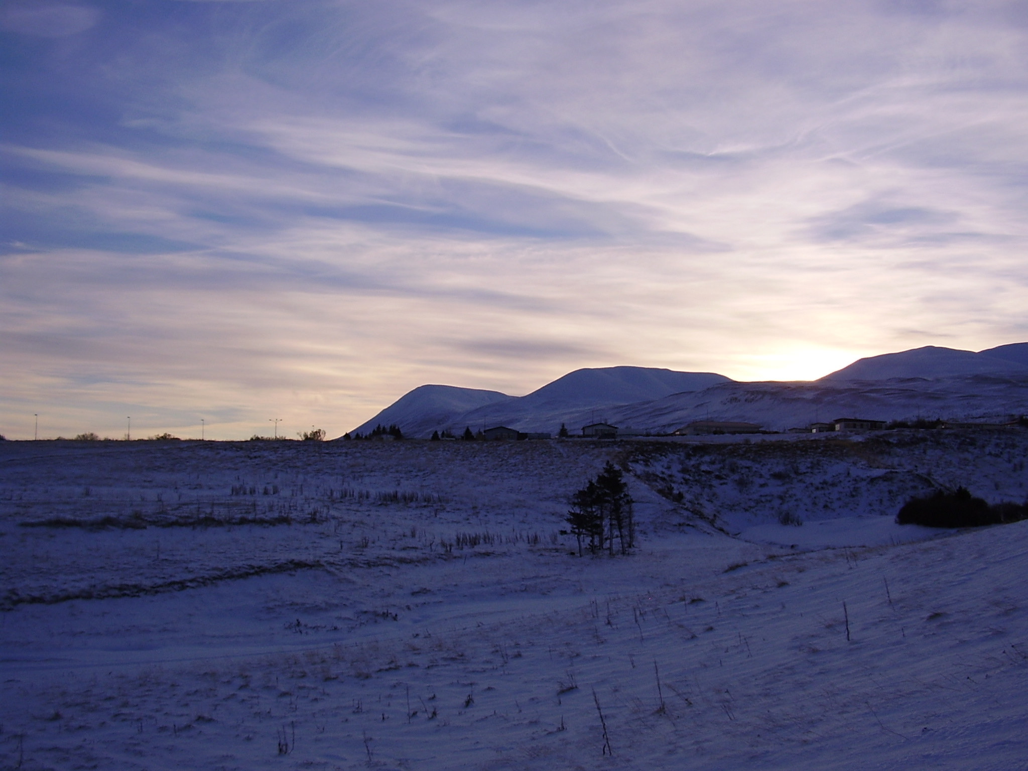
The extinct volcano
There are more interesting things around Sauðárkrókur then just Tröllaskagi. This caldera is one of the visible features from Sauðárkrókur. The current conclusion about this caldera it is extinct. While I personally don’t agree with that and believe that it might still be active given it shape. I have no way to prove it, unless it starts to erupt all of a sudden. This is a stratovolcano with a small caldera. This volcano formation is small compared to many other Icelandic volcanoes. Both active and extinct.
A zoom in of the extinct volcano caldera. Click on the picture for higher resolution of it.
A wide angel view of the extinct volcano caldera. Click on the picture for higher resolution of it.
A Google Map view of the extinct caldera from the above. It is a bit hard to see it from above.
The volcano also is on a rift zone that for some unknown reasons is not active at the moment. But a study on this rift zone can be found here (pdf) in English. I don’t know if this rift zone is going to get re-activated in the future or not. Currently there are few to none earthquakes in this rift zone.
Sneaking up on us with new blogposts now?
Nice volcano.
Wouldn’t a bit of quake activity and a nice sturdy increase of tremor put it back on the dormant-side of things at least? Does it really need an eruption to go from inactive to a “higher” status. Or perhaps on Iceland a Volcano kind of needs to erupt to get good attention due to there being so many?
There is a dormant volcano named Snæfell east of Vatnajökull. It does not make any earthquakes and it has not erupted for a least 12,000 years. But they mark it today as dormant. But few years ago it was marked extinct. So things often change in Iceland when a study is made.
I also didn’t sneak anything. I let you know the older blog post about this new one. 😉
Hehe!
You cought me un-aware 🙂 I need to put up a mirror so I see you coming with a post!
Nice post, loved the beautifull pictures!
Jón: Thanks for the new post. There is always something new coming from Iceland an your blog.
Thanks for posting this Jón, always something new to explore on your blog.
Grímsvötn let us know that it’s still thinking about it’s next move:
Tuesday 16.11.2010 03:58:51 64.451 -17.207 1.1 km 1.7 90.01 6.1 km NNE of Grímsfjall
What kind of East-West movement is there annually for the whole of Iceland? I mean the Eurasian/Atlantic plate movement?
I had a look at Myrdaljökulls GPS and all stations are moving east. Now this is logical since REYK is moving west on the atlantic plate and Myrdalsjökull east on the eurasian plate.
But it would be nice to see the “real” movement which is caused by magma.
Here is a good paper on that I believe. Yes, I do read this type of stuff. 🙂
http://www-old.isor.is/~ah/walker/IAVCEI_2_Ch17.pdf
According to another paper, REYK has a North component of 20.1 ± 0.4 mm/yr, East component of 11.5 ± 0.4 mm/yr, and Vertical component of 4.0 ± 1.0 mm/yr.
(“GPS Velocities Relative to ITRF-97 and Weighted RMS Scatter, Not Corrected for Coseismic Offsets and Volcano Effects“)
So, it would be a matter of backing out REYK’s movement to get the “world reference” motion since everything in the graphs if referenced to REYK.
The undigested (yet) paper that this is from: http://www.geosc.psu.edu/people/faculty/personalpages/plafemina/lafeminaetal_jgr_05.pdf
BTW, this seems to be a dandy little paper that covers what we were ruminating in the last thread… accumulated strain.
Thanks for your great blog. I really like how you share first-hand information about Iceland with the rest of the world.
May I comment on the “unknown reason” for why the Skagi rift zone is currently inactive and will probably not be active again in the future?
The reason is that the plate boundary in Iceland moves slowly westwards relative to the stable Iceland Mantle Plume (Hot Spot). This leads to a relocation of the rift zone every few million years, a process also called “rift jump”. The Skagi-Snaefellsnes rift zone was active some 15 million years ago. Rift jumps don’t occur suddenly, that means, there is an overlap in time when a new rift zone establishes and the old one becomes inactive. 7 million years ago the west volcanic zone that is active today began to establish and the Skagi rift zone became extinct. 4 million years ago the east volcanic zone began to establish. Today the east and the west volcanic zone coexist in an overlap stadium. However, we already see that the west volcanic zone is much less active. So with time the west volcanic zone will become extinct and the spreading will take place only along the north and the east volcanic zone.
That means also that rift jumps are the reason why there are so many extinct volcanoes exposed outside the rift zone. The older (Tertiary) parts of Iceland like the west fjords and the whole of eastern Iceland is full of them. If you are interested in the extinct volcanoes, let me know. I’ve worked with some of them, and they are really one of my scientific passions.
@Dara:
Wow, a new knowledgeable information source! My address is ” morp heus at dna internet dot net ” (inside quotes remove spaces and read like they are usually read).
Do you have any review and/or general articles to start with this topic?
Okay, that was one heck of a first post, welcome to the crowd, the moose-brew is in the corner bar and coffee is in the pot!
🙂
If you have some interesting paper, just post a link here in the comments. I am sure to read it. If I find it interesting.
I am mostly into active volcano. But I do believe that history is important to learn from.
Thanks everyone for the warm welcome 🙂
I’m actually a structural geologist working with mechanical processes within volcanoes. My PhD thesis was partly about extinct eastern Icelandic volcanoes. It is freely availabe at webdoc.sub.gwdg.de/diss/2009/burchardt/burchardt.pdf In the second chapter, there’s also a section about rift jumps citing the most important papers on this topic. The chapters in the thesis are reprints of papers I published. If you want to have original PDF copies, let me know what you are interested in.
Thanks a lot, Dara*!
I’v downloaded your thesis and will start reading.
(Falls ich etwas brauche werde ich das wissen lassen.)
@Dara*:
What’s your take on Skellefteå area? They keep mining the ancient, iron-rich magma ores, and some “visionaries” are afraid, that some day they will activate again…
@ Jack: the mines around Skellefteå are not mined for the iron, but for copper and precious metals. Perhaps you were thinking of the Kiruna area. Sounds like strange visionaries to my ears.
@Jack:
Nope, that is one of the least likely places for a volcano to erupt. But I know where the idea comes from.
One of my mining-geologist friends has an end of the world theory he brings up every time he is drunk. And since he is the mining engineer for one of the mines in question some people (conspirationalists) gives him credence. Knowing him well I would say it is a case of bad pizza and to much “hembränt”. It kind of scares him that his theories have gotten out on the internet since they have been wildly exagerated and misunderstood.
Kirunavaara-field is an extinct volcanosystem. But the only way for that to go would be on the day they have mined it down to the crust. But in 20 years time they will be down at the old magma-chamber. It is currently the worlds deepest mine at 1300 metres.
Swedish volcanos are as likely as finnish banana-farms 🙂
@Carl:
Actually there are already small banana farms in Finland!
Finland, the Newest Banana Republic in the World.
I don’t think that there are any chances for any eruption in Sweden in the next millions of years. The Baltic shield is a pretty unexiting place, volcanically speaking 😉
Oh no, quite the contrary – we have some very interesting old volcanoes.
And don’t forget the Fenno-Scandian Fracture Zone between sweden and finland… Produce yearly quakes and have a closing motion of about 5mm annualy. Poor finns, in a million years or so they will be stuck with us again!
Kippis!
Heh. Skål på den!
@Dara: Thanks so much for your educational post! Until Dr. le Strange writes the “Volcanoes For Dummies” book, I heavily rely upon the comments written in layman’s terms.
It would not be me writing it. I am a physicist, not a geologist or vulcanologist.
But I once translated the Opera for Dummies when I needed beer-money as a student.
Just a random fact: one of the Eyjafjallajokull cam’s is back on! 🙂
http://live.mila.is/eyjafjallajokull-fra-thorolfsfelli/
And it is sharper then ever. I wish they had that camera when the eruption was. Seems like they are upgrading all three of them.
Hope they will get that quality over at Vatnajökull if she starts bopping.
You asked for it – well this one’s not really a volcano web cam, but Esjufjöll is right back there. I spotted seals sailing on ice today; put some pics on Eruptions blog’s Tuff Teams Facebook page.
Jökulsárlón
Semi hypothetical question here since it seems like we all believe that something in the Vatnajökull is going to go sooner or later. We are after all having Bardarbunga, Esjufjöll, Grimsfjöll, Kverkfjöll, Hamarinn and Öraefajökull at least to “hope” for.
What actually would be needed, more than a high-def XYZ axis accelerometer, helicorder, vibrometer, 3D-geophone, power-source (wind or solar), high-def GPS-tracker, transmitter and the rest of it, so that Jón could have a kick-ass measuring station up there. (If Jón is interested). What more would be needed? Webcams? Place to build it in (bunker?). Where?
Bonus for us ordinary volcanophiles would be more data we can misinterpret:)
I’d like to have my hands on data from a sensitive, low-noise vibrometer with 0,1 Hz – 100 Hz full-power bandwidth with insignificant signal due to weather effects!
Then you want a short period seismometer. You can get one here, http://www.geoinstr.com/sensors.htm
But those cost a fortune.
But I am currently using this type of hardware that you can buy here, http://www.seismicnet.com/infoequip.html#datalogging
(geophone + amplifier board + digitizer + gps clock)
The price is something around $600 for the whole set.
I have some of the equipment on hand, the vibrometer is off the shelf, but… What is needed to get things like that up and running?
How is the logistiks and infrastructure up there?
You need a windows PC with a program called WinSDR. That is what I use today.
There is not much infrastructure around this. But some if you connect this to the internet.
But I am not following if you want to put up a geophone station too record earthquakes or to do something else.
Thing is that I have some hardware scrapping about that could be used.
So my semi-hypothetical question is if it could be put into use without me having to schlogg up onto Vatnajökull (which wont happen in the near future). I might even be able to mooch some other hardware like a small solarcell setup and such.
But I don’t know what is up there. Is there any connectivity to get signals through? Is there electricity? Is there a house or hut there that might be used? Things like that you know.
Tuesday
16.11.2010 18:43:20 64.650 -16.680 1.1 km 2.8 90.08 3.2 km WNW of Kverkfjöll
Tuesday
16.11.2010 17:36:11 64.653 -16.682 19.2 km 1.8 67.62 3.5 km WNW of Kverkfjöll
Tuesday
16.11.2010 03:58:51 64.449 -17.213 0.1 km 1.8 99.0 5.7 km NNE of Grímsfjall
Luis, I think most guys here routinely follow the Icelandic quakes at
http://en.vedur.is/earthquakes-and-volcanism/earthquakes/
There currently is a quiet time happening in Iceland at the moment. Not a lot happening earthquake and volcano wise.
Ya got to be careful with a statement like that. It occasionally prods the guy lurking in the corner to make a plot about it…
Quakes Per Day as appearing on http://en.vedur.is/earthquakes-and-volcanism/earthquakes/
http://i55.tinypic.com/2qdbudf.png
I have a automatic counter on earthquakes in Iceland. 🙂
You can see it here, http://157.157.215.56/mrtg/localhost_eq.html
This my home sever, on ADSL1 connection. So it might be slow to connect to.
Very nice.
Good implementation of MRTG. I had a few encounters with it several years ago. Once you got it set the way you liked it and doing the right counts, it yielded beautiful traffic graphs. (well, beautiful in the counting data sort of way)
EQ frequency sharply up in So Calif. The San Jacinto fault has been pretty busy including a 3.2 in Riverside.
What perks my ears is this one:
Mag 3.0 November 18, 2010 at 01:38:30 UTC
Location 33.972°N, 116.582°W
Depth 10.7 km (6.6 miles)
That pretty near the San Gorgonio Pass. That’s where the San Andreas (and about four other fault lines) turn westward in from the Salton Sea valley (it’s got a real name other than that, I just can’t think of it)
I think you are referring to the Coachella Valley. Yes, that perked my ears too. Its the first time I have seen an EQ in the SAF in quite some time and its near a major loading stress point. There were 3 EQ in the Coachella Valley on each of the 3 SAF related faults on 11/17. I am expecting the EF and/or SJF to have a somewhat larger quake in the coming weeks/months similiar to the 5.4 that occurred in July. All these So Calif quakes are very active lately and they follow in line within days when ever there is high activity on the Laguna Salada and after shocks of the 7.2 El Mayor.
I’m unable to see a caldera on the Google map.
It is hard to spot. But it is there. Here is a different study about this area. It is also interesting.
http://www-old.isor.is/~ah/dr/AH3_topography.pdf
I looked at the piece of map on page 3 of that paper. From the Tinná volcano I see several fault lines leading to the south. I think they are pointing to the area of the latest eq swarm there. Am I right?
Thanks, but I did not mean mistrusting your statement.
very good blog 🙂
I love it, Jon! And so many articles to read too.
(Now I just need a new inkcartridge because reading on screen I don’t like)
An interesting new article was published in Nature today (thanks go to Raving for the alert):
Intrusion triggering of the 2010 Eyjafjallajökull explosive eruption.
Sigmundsson et al., 2010; Nature 468:426 – 430.
I haven’t had time to read it fully, but a brief skimming showed an interesting paper indeed.
If you can’t get it yourself, I can e-mail you a copy if you let me know where to. (Sorry, I can’t post a link to the PDF due to copyright issues.)
I’m interested? How can I send you my email?
Let’s try this: The file is temporarily available at:
http://www.mediafire.com/?3qd1jv39wnrdk94
But it is password protected. The password is the name of our favorite Icelandic volcano (including the umlaut).
I think everyone with real interest will be able to get the file now.
Thank you very much, Holger. Worked fine for me, but you must type the correct word in a text processor and then paste it so that the password works (with the umlaut).
Thanks!
Definitely many thanks.
Now here’s the weird part. I think I saw Sill 2 in the plots when it activated. There was a rush of quakes in a line at about that depth towards the central vent just as it was getting ready to go. Not that I had any warning, it’s just that it showed up in the quake data.
A very interesting read, thank you! However, there are a few aspects missing from the paper:
* There were two flank eruptions, albeit geographically in the same area.
* The importance of the mag 3+ earthquake which seemingly closed the flank conduit and ended the Fimvörduhalsi flank eruptions.
* The timing of the eruption could be, and was, predicted by an analogy to a solid projectile penetration of a homogenous armour plate.
Henrik:
I must be dim-witted today:)
What in Nadjiwoons name of confusion do you mean with your third paragraph?
“The timing of the eruption could be, and was, predicted by an analogy to a solid projectile penetration of a homogenous armour plate.”
Do you mean that the accuracy of the eruptions was in geological terms predicted that accurate?
Well, to my knowledge the eruption per see was expexted and predictted, but not in Fimmvörduhals at all. And they also missed the jump from Fimmvörduhals to Eyjafjallajökull proper.
So my analogy would be:
* The eruption was predicted equally well as a bullet fired during a shoot-out at high noon in O.K. corral, but that missed the target and ricoched on on horse and bounced on a donkey before hitting the target.
Ie, correct time, wrong place, wrong things happening. (Which is about as good as it gets with volcanos.)
Thanks Holger!
For anyone who has problems getting scientific articles, there is a livejournal community that can help (and they are very fast and can find practically anything):
http://community.livejournal.com/article_request/
Thanks Holger!
It worked fine for me – another interesting read.
Alright, I’ve taken down the article so that I don’t offend the copyright holder and its lawyers (they are known to be vigilant).
If you still want/need this article you’ll need to post your e-mail address and I can e-mail it to you (once I spot your request).
You could use fileservices like filedropper, where its quite unlikely that somebody traces you.
The Sigmundsson article appears to be an expansion of his address at Keilir:
http://en.keilir.net/static/files/conferences/eyjaaviation/session6/freysteinn-abstract-keilir.pdf
Heavy movement in GFUM-GPS station.
During the last few days there has been another episode of rapid movement at Grimsjöll. The second after Ice was removed.
Nominal changes East. North, 20mm in 3 orbits. Up 25mm in 5 orbits.
And the link for those who do not have it:
http://hraun.vedur.is/ja/vatnajokulsvoktun/gps_skrokkalda.html
I am sorry, wrong link, here is the correct one:
http://hraun.vedur.is/ja/vatnajokulsvoktun/gps_grimsfjall.html
Nope Carl. If, on March 16th, you regarded the interior of Lady E as an armour plate an took into account a) the rate at which magma as evidenced by the depth of eqs, and b) the fact that with a homogenous armour plate hit by a solid projectile (as opposed to the APDSFS high-velocity rounds that invoke plasma effect), only the middle 2/3rds contribute to resitance, you’d get an estimated five more days until an eruption.
That was a nice thought, and now I understand you.
But still 5 days in geological terms would be like missing with one atom-layer hitting the ablative armour of Eyja. I would say that is a “dead hit”.
Also nice that they “hit” it, but after two bounces and in the back so to speak.
Förkyld, mer kaffe för mig…
And for those who would like to see how a plot of high tremoring looks, here is one of Vestmannaeyar. It is quite literally off the chart.
http://hraun.vedur.is/ja/oroi/ves.gif
Isn’t it just offline?
Yes it is, but that was not my point. The chart is halted at the time it was still active. It went offline 07/10Notice the drop down below 8000 on 27/09.
What is odd is how badly Vestmannaeyar is monitored. It is after all highly active and was the center for two of the most famous eruptions in modern time.
Recent small swarms at Upptyppingar.
Magma related?
http://www.cprm.gov.br/33IGC/1353112.html
and
http://adsabs.harvard.edu/abs/2007AGUFM.S43A1037R
Jon, your thoughts??
This is magma related, as there is a lot of magma down there in the cooling process at the moment.
Cooling process? Could you explain this?
It appears that the magma that is in the crust there is stuck. While it is there, it is going to cool down for a long time.
Here is the location of the magma as shown by earthquakes.
http://vulkan.blog.is/users/b9/vulkan/img/upptok_-_ve_urstofan.jpg
The depth, http://vulkan.blog.is/users/b9/vulkan/img/faerast_ofar_962603.jpg
A respective view, http://vulkan.blog.is/users/b9/vulkan/img/thversni_og_e_lisvi_nam.jpg
Here is the blog post the picturs are from. It is in Icelandic, http://vulkan.blog.is/blog/vulkan/entry/1020316/
One learns new things every day.
A new type of Icelandic volcanism for me. “The too shy to erupt volcano”.
Jón, If my Icelandic is good enough, which it probably isn’t. Upptyppingar/Herdubreidartögl is then filled to the brim with magma and showed pretty much every sign of going to erupt in 2007, but the magma got stuck under the surface?
Second question:
If I got it right they believe that the water content in the magma was low, and if I have understood that correctly might indicate that gas content might also be low?
I also observed that this “shy volcano” seems to have a very simple magma reservoir in the beginning. (If I understand, those maps are from 2007?) But there is a progression of reservoir complexity (the movement of quake swarms).
Why I always go on about the reservoir complexity is that the gas-release mechanism from any lava is a mathematical function of the surface-area of the magma reservoir. A simple tube or ball releases substantially less than a more complex form due to less surface area.
If I knew the gas and water content of the magma under the area I could probably mathematically prove that it couldn’t break through during the first quake-swarms.
But I am far from sure that it is still the case since the area has evolved it’s magma reservoir. It is at the end of the quake-swarms presented on the mapps you cited more then 2 orders of magnitude more complex than in the beginning with a gas-release potenital four orders of magnitude higher.
Ie, it seems like everyone has decided that this “shy volcano” does not have the force to break through to the surface, when the truth is that it has instead changed it’s internal plumbing so that it can break through.
It either is compelx enough by now, or is so close that it would take very little.
The mathematical modell of “magma reservoir complexity gas release index” I have been playing with for 2 months now gives that it is on the thresh-hold of erupting. It is s a really dangerous system that need close attention.
In this case, just Upptyppingar. The case with Herðubreiðartögl is that it is a fault in the area that moves often. No magma involved.
I do believe that the Upptyppingar is a volcano in making. Something in the line of Cerro Negro.
See here, http://en.wikipedia.org/wiki/Cerro_Negro
http://www.volcano.si.edu/world/volcano.cfm?vnum=1404-07=
16:19:29 65.089 -16.249 7.8 1.0 67.51 5.3 km N af Upptyppingum
15:13:57 65.089 -16.249 7.8 0.6 44.94 5.3 km N af Upptyppingum
08:01:51 65.077 -16.242 1.3 0.9 43.01 4.0 km N af Upptyppingum
Those swarms that kind of goes back and forth between Herdubreid and Upptyppingar via Herdubreidartögl is a bit fascinating.
Herdubreid wont go off if I have understood it correctly since it is “stone-dead” for being a volcano. But I have been suspicious of the Herdubreidartögl down to Upptyppingar for half a year now. But I have not seen any related tremor increases from either Mókollar or Svartarkot-stations.
I have put these swarms on my personal “anomalous reading that might be a wannabee-volcano in need of a beer”-list. Of course together with Krísúvik-beer dike.