Fossil of a tree found in road tunnel work

A long time a volcano erupted in Iceland. This volcano spewed out basalt lava field (Hawaii style). This lava did flow over a forest that was nearby and killing all the trees in it. Few weeks ago and several million years later and few kilometres down the remains of this forest was found. Since one of the tree did fossilize in the lava. As the tree was engulfed in the lava it did turn to charcoal that was later removed by water and leaving the empty imprint of the tree in the bedrock.

The remains of the tree are now clearly visible in the road construction tunnel. The hole after the tree is full of water and part of it has been removed by the tunnel digging. Picture of it along with news can be found in the link below.

Fossil of a tree found in tunnel construction

Far eftir trjábol í Vaðlaheiðargöngum (Rúv.is, Icelandic, Picture)

New mountain found deep west of coast of Iceland

Marine Research Institute (of Iceland) has found new mountain off the coast of Iceland. The mountain is in a plateau in the same area. But it rises up from the ocean floor about 450 meters. The area that was mapped had the size of 300 square kilometer. Depth of the ocean at this location is around 1400 meters. This mountain is possibly an old tuff mountain (volcano). But that is not confirmed. According the news, this mountain has youthful look to it and around three craters where spotted on it. The age in this area is around 20 million years. So this might be a extinct volcano from the time period when volcano activity was ongoing in this area. But it most likely has never been above the coast line.


The unnamed mountain on the ocean floor off the west coast of Iceland. Copyright of this image belongs to Marine Research Institute.

They found more then just this mountain in this survey. They also found more mud volcanoes off the coast of Iceland. Some of them are reaching 350 meters off the ocean floor.


Mud volcanoes appears as spikes in this image. This image has has things four times larger then they actually are. Copyright of this image belongs to Marine Research Institute.

There are many more unknowns off the coast of Iceland. As the ocean floor is largely unexplored today. As are many other parts of the ocean floor around the world.

Icelandic news about this

Stórt og mikið neðansjávarfjall birtist með fjölgeislamælingum djúpt vestur af Íslandi. (hafro.is, Icelandic, pictures)
Hafró: Fundu 450 m hátt neðansjávarfjall vestur af Snæfellsnesi – tífalt stærra en Ingólfsfjall (Pressan.is, Icelandic)

Blog post updated at 06:25 UTC on 02.08.2012. Correct English name for Hafrannsóknarstofnun added.

Pictures of a old volcano rift zone

Here is a picture of what remains of Snæfellsnes – Húnaþing Rift zone. But this rift zone was activity about 4 million years ago. I do not know why this part of the rift zone is visible. But it seems to have escaped glacier erosion during past 4 million years since it became extinct.


The visible part of the Snæfellsnes – Húnaþing rift zone that was active about 4 million years ago. The farm in this picture is called Bjarghús. This picture is released under Creative Common Licence. Jón Frímann Jónsson took this picture on 24.03.2012.


This is where the visible rift zone disappear back into the ground. Its visibility resumes at distance. This picture is released under Creative Common Licence. Jón Frímann Jónsson took this picture on 24.03.2012.


The Snæfellsnes – Húnaþing rift zone is number two on this picture. What can be seen above ground is just a small part of it. This picture has been released under public domain licence. See this web page here for more details. This picture is not 100% correct on the details on the rift zones in Iceland. But is a good start for it.

Older blog post about this area can be found here. I am not expecting any eruption in this area. But it is always a possibly of a volcanic cone popping up in area like this. As the closest volcanoes to this area are only at the distance of 80 to 90 km south of it. But that is the Langjökull volcano, in the north part of it.

Old rift zone in Iceland

Here are two pictures of an old rift zone in Iceland. This rift zone was active until about 7 million years ago or so. This cliffs that I show here on this picture are from this old rift zone. It was volcanic long time ago. But not any more. This area however holds an good amount of unknown fissures and fault lines that might become active one day and create earthquakes in this area. But the years that I have been in this area I have never felt an earthquake. But I have recorded earthquake somewhere in this area. But it was an minor one. Less then ML1.5 in size. This area also used to be under ocean for several million years before it became dry land.


This is the old rift zone that was active until 7 million years ago. Click on the picture for full size. This picture is released under Creative Commons Licence. See the licence page for more details.

There is still an chance of this area to get new volcanoes in far future. Like did happen on Snæfellsnes. But this rift zone did pass trough there also. In this old rift zones there are several old volcanoes. I have covered them before on this blog. But that blog post can be found here.

More articles on this area

The Iceland Hotspot (academic.emporia.edu)
Iceland 2003 Keck Junior Research Project Geology of an Abandoned Oceanic Rift: The Skagi Area, North-Central Iceland (people.usd.edu)

Extinct volcanoes in Hungathing Vestra county, Iceland

Here is an picture of how an ~5 million year old extinct volcano looks out. This pictures also show an old dike intrusion that might have gone up to the surface on that time. But I think it is hard to know that for sure, as erosion has changed the landscape a lot over the past 10 million years or so. So it hard to know for sure how deep this magma dike did actually form or if it was connected to an crater on the surface.


About 5 to 8 million years old dike intrusion into sedimentary rock that pre-dates this dike intrusion. I do not know by how much older the surrounding rock actually is. But it has small fossils in them.


The volcano that did create this old dike intrusion. The rocks in the area (old lavas) suggest that this was mostly basalt that did erupt from this volcano. But this volcano was on the old Snæfellsnes-Skagi Rift Zone.


Rift Zones in Iceland. Picture is from Wikipedia. See original copy here along with copyright information. Please note that this picture is NOT completely correct in regards to the facts. But is good for basic illustration of the rift zones in Iceland. Note that this is picture is missing the Skagafjörður Rift Zone (failed rift zone).


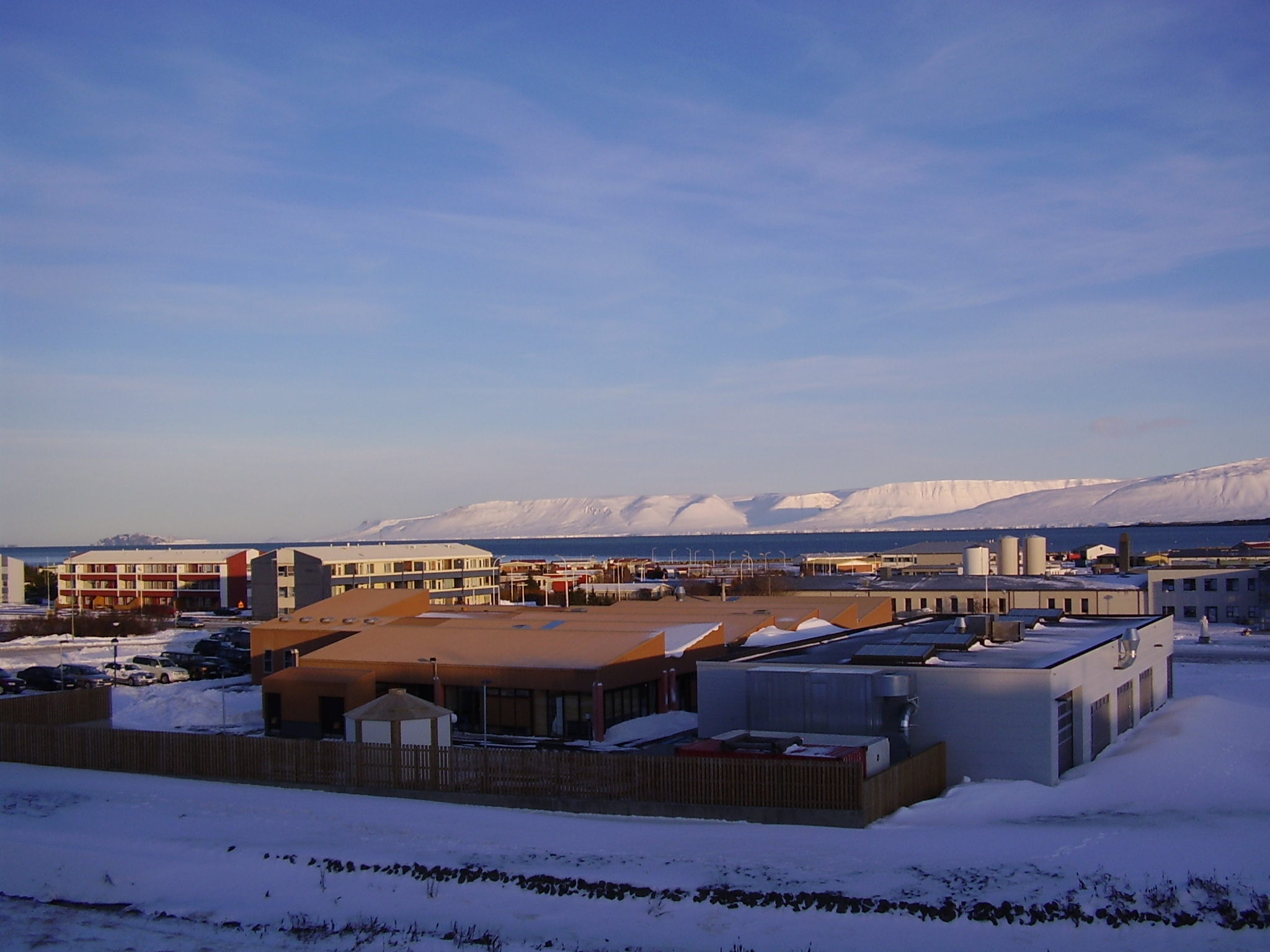
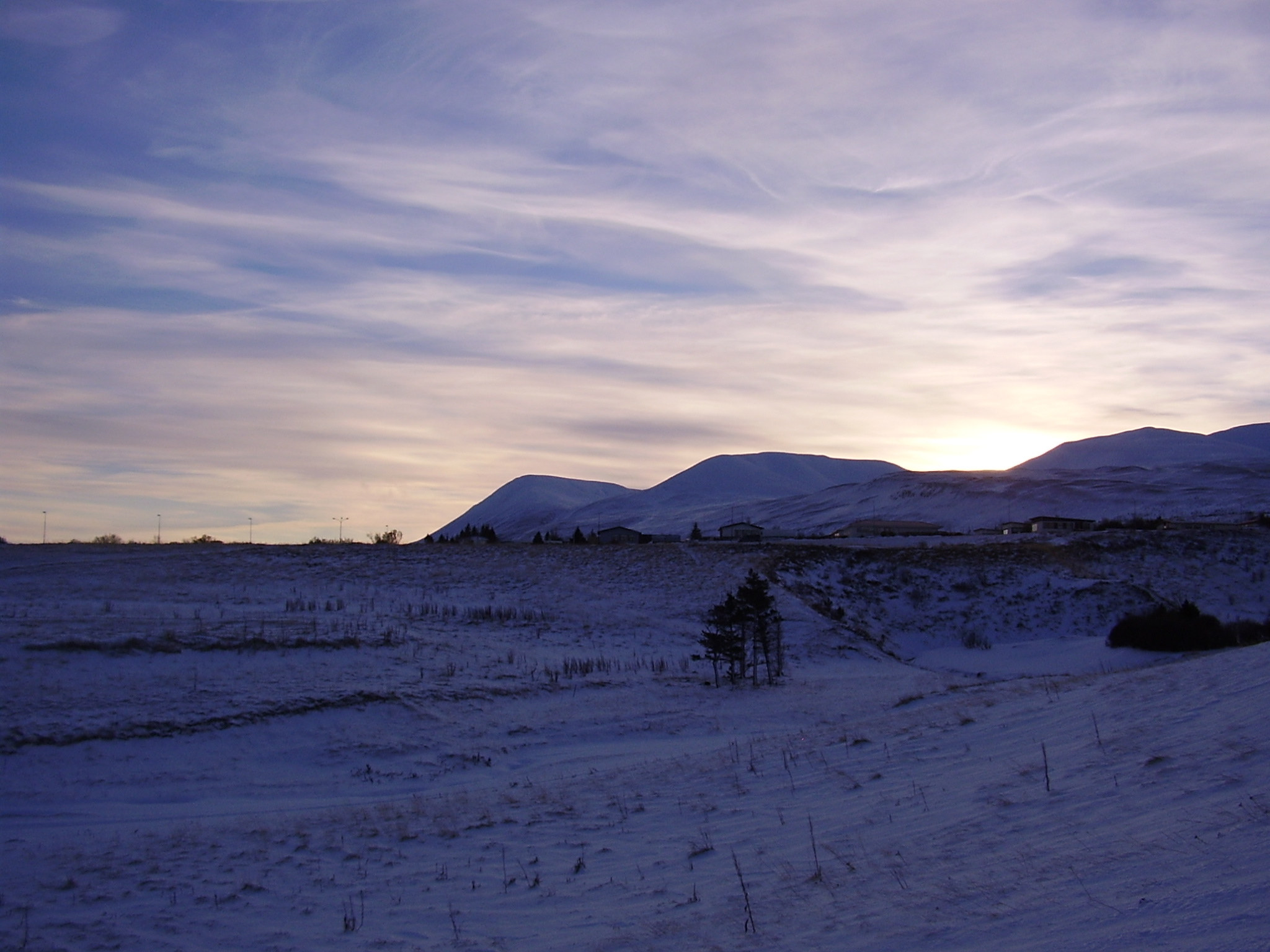
Picture of what can be seen of the Snæfellsnes-Skagi rift Zone. (I think it is the correct name for it). The mountain behind it is also an massive old volcano that was active at the same time as this rift zone. The houses there belong to my mon and dad (also on the picture below this one). They run an sheep farm.


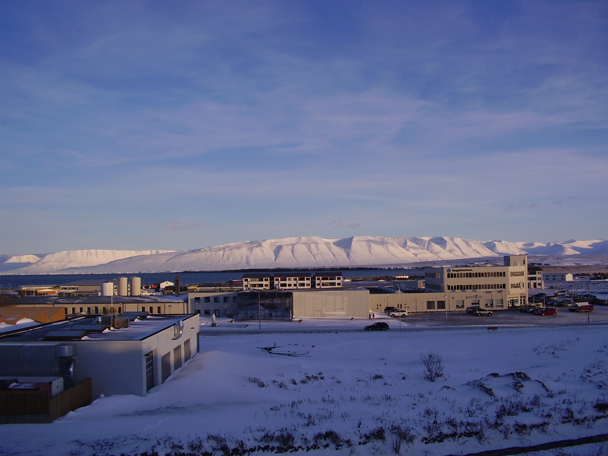
Picture of Snæfellsnes-Skagi rift Zone to the north. The same volcano as on picture above can also been seen on this picture. But what is not seen is the third volcano that is in this area (also extinct). But glacier activity did remove all major traces of that volcano long time ago.

I am going to post more pictures of this area during the summer. Even if it is just small part of Iceland, it has an lot of geological history to show. All of it is connected to volcanism and glacier activity over the past 8 million years (or about that) time. Too see full size of the pictures, just click on them.

Tröllaskagi and a extinct volcano

Here are pictures of Tröllaskagi from a town called Sauðárkrókur.

Tröllaskagi to the north from Sauðárkrókur. Click on the picture for larger resolution.

Tröllaskagi to the east from Sauðárkrókur. Click on the picture for larger resolution.

Tröllaskagi to the south from Sauðárkrókur. Click on the picture for larger resolution.

Tröllaskagi is a really mountainous region of Iceland. Few people live there. But there are some farms in few of the deep wallies there. But not many to my knowledge. This area also once hosted a large glacier. But there are few remains left of it today. This area is mixed in rock. But this rock also holds a different age and origin far as I know. There are theories that this might be a old continent crust that make up Tröllaskagi.

The extinct volcano

There are more interesting things around Sauðárkrókur then just Tröllaskagi. This caldera is one of the visible features from Sauðárkrókur. The current conclusion about this caldera it is extinct. While I personally don’t agree with that and believe that it might still be active given it shape. I have no way to prove it, unless it starts to erupt all of a sudden. This is a stratovolcano with a small caldera. This volcano formation is small compared to many other Icelandic volcanoes. Both active and extinct.

A zoom in of the extinct volcano caldera. Click on the picture for higher resolution of it.

A wide angel view of the extinct volcano caldera. Click on the picture for higher resolution of it.


View Larger Map

A Google Map view of the extinct caldera from the above. It is a bit hard to see it from above.

The volcano also is on a rift zone that for some unknown reasons is not active at the moment. But a study on this rift zone can be found here (pdf) in English. I don’t know if this rift zone is going to get re-activated in the future or not. Currently there are few to none earthquakes in this rift zone.

The extinct volcanoes of Iceland

I am going to post some information when I have the time about volcanoes that you never hear about in the news. The volcanoes in Iceland that have finished there work and have now gone extinct and no longer make ash clouds or lava. Iceland is full of those volcanoes and they are part of Iceland. What they do is tell us the history of Icelandic volcanism and how the volcanoes them self evolved over time and what they did do in that time.

I don’t have any good pictures or maps of extinct volcanoes in Iceland at the moment. But lucky for me I currently live on top of one at the moment. Both where I am in school and at home. Here is a view to the top of the volcano at my home. Picture is taken in summer 2008.

For me this history is important, as we can learn from it about today volcanoes and how they might behave when erupting.