Earthquake in Krýsuvík-Trölladyngja volcano east of Keilir mountain

Today (26-Mars 2025) at 15:06 UTC an earthquake with magnitude of Mw3,2 took place in Krýsuvík-Trölladyngja volcano, just east of Keilir mountain. There has not been a lot of aftershock activity following this earthquake.

Green star just north of lake Kleifarvatn and east of mount Keilir. The map has a lot of smaller dots showing earthquake activity in other areas of Reykjanes peninsula.
The earthquake activity on Reykjanes peninsula. Copyright of this image belongs to Icelandic Met Office.

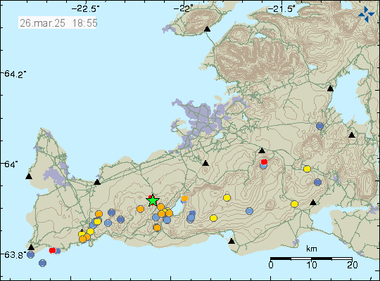
This earthquake activity is possibly because of inflation in Svartsengi volcano. Since that results in stress changes along the Reykjanes peninsula, but mostly in the area closest to it. More earthquake activity can happen without warning in this part of Reykjanes peninsula.

Leave a Reply

Your email address will not be published. Required fields are marked *

This site uses Akismet to reduce spam. Learn how your comment data is processed.

StatCounter - Free Web Tracker and Counter