Hengill volcano man made earthquake swarm

The man made earthquake swarm in Hengill volcano that happened today seems to have subsided, as it is most likely that Orkuveita Reykjavíkur has stopped pumping down water into the new drill hole that they where using today.

Over 400 earthquakes have been recorded in this man made swarm. I am not sure on the depth on most of the earthquakes. But it is in the range of 1 to 10 km from what I can tell. The largest earthquake in this earthquake swarm was ML3.4 in size, it had the depth of 3.9 km.
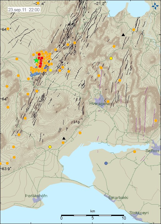

The man made earthquake swarm in Hengill volcano. Copyright of this image belongs to Icelandic Met Office.

I am going to post earthquake traces on Sunday or Monday. I am currently not at “home” (where my main computers are located), as I am taking this weekend off (if nothing large happens this weekend).
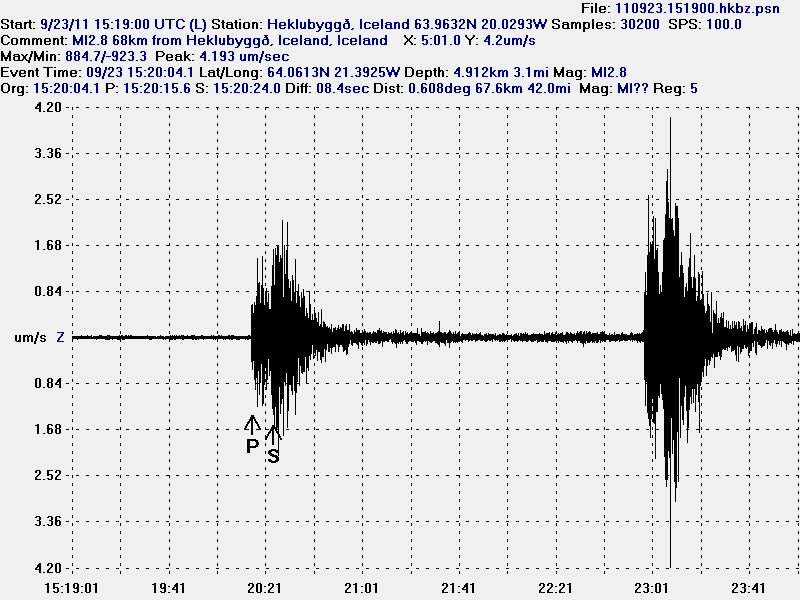

Two of the earthquakes from the man made earthquake swarm in Hengill volcano. This picture is released under Creative Common Licence. See licence web page for more details.

It is hard to know what happens as Orkuveita Reykjavíkur continues to pump down water into Hengill volcano. All that can be done is too wait and see what happens.

Blog post updated at 21:48 UTC on 26. September 2011.

Earthquakes in Katla volcano, strong sulphur smell in Múlakvísl river before the earthquake happened

This morning there has been some earthquake activity in Katla volcano. But it has also been reported in the news this morning that a really strong sulphur smell was found around 06:00 UTC on nearby farm to Múlakvísl river this morning. But this was before the earthquake did happen. I am not sure if this sulphur smell continues to be felt in the area close to Katla volcano. No changes in water hight has been detected in Múlakvísl glacier river.

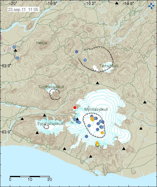
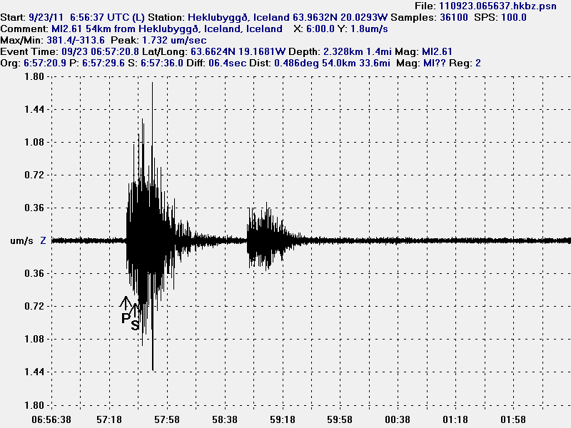
The ML2.6 earthquake in Katla volcano was on 2.3 km depth. This was mostly a dike intrusion into the bedrock of the Katla volcano caldera.


The earthquake swarm this morning in Katla volcano. Copyright of this picture belongs to Iceland Met Office.


High resolution of the Katla volcano earthquake this morning. Along with correct depth and size. This picture is released under Creative Commons licence. See Licence page for more details.

As before. This is just a wait and see what is going to happen in Katla volcano as before.

Icelandic News of the sulphur smell in Múlakvísl glacier river.

Brennisteinslykt fannst við Múlakvísl í morgun (Vísir.is, Icelandic)
Brennisteinslykt við Múlakvísl (mbl.is, Icelandic)

Update 1: According the news on Rúv this activity suggests that hydrothermal activity is continuing to increase in Katla volcano caldera. But the news also says that this activity is something like that did happen from the year 2002 to the year 2004, when hydrothermal activity did increase before it started to get lower again. It is also pointed out my Matthew Roberts that Múlakvísl glacier river is sensitive to changes in Mýrdalsjökull glacier and small floods can happen without any warning in it due to increased hydrothermal activity.

Rúv news in Icelandic about this.

Bendir til aukinnar jarðhitavirkni (Rúv.is, Icelandic)

Blog post updated at 13:07 UTC, 23 September 2011.

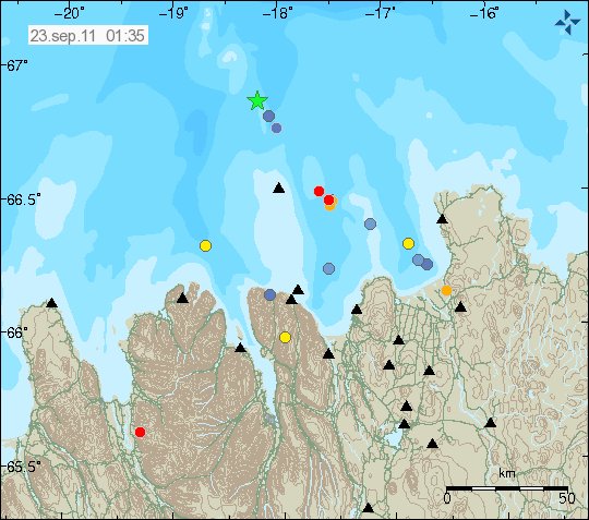
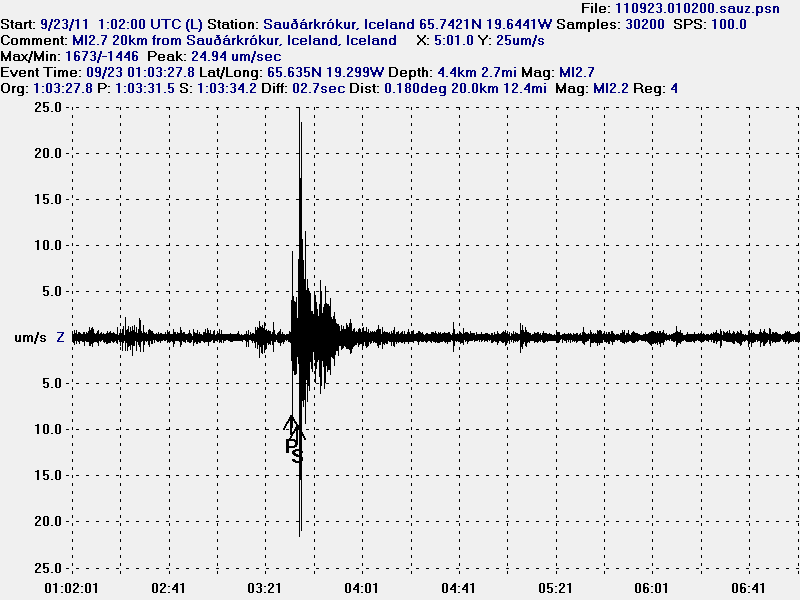
A ML2.7 earthquake in Skagafjörður rift zone (mostly extinct one)

This earthquake is a odd one. But it is rare that earthquakes happens in this are of Iceland. But it is not unheard of. As there have even been small earthquake swarm in this area few years ago (2 or 3 years ago I think). This area is part of Skagafjörður rift zone (pdf file) (also known as Skagafjörður Volcanic zone), but that is believed to be a failed rift zone that formed in about 1.7 million years ago. Just around when current eastern rift zone started to form in Iceland.


The ML2.7 earthquake is the left corner of this image, a bit far away from TFZ earthquake zone. Copyright of this image belongs to Icelandic Met Office.


The ML2.7 earthquake seen from Sauðárkrókur geophone that I am going to run until December 2011. Sadly, no live gif image of it due to network issues. Please note that this geophone is in a noisy location. This picture is released under Creative Commons Licence. See licence web page for more details.


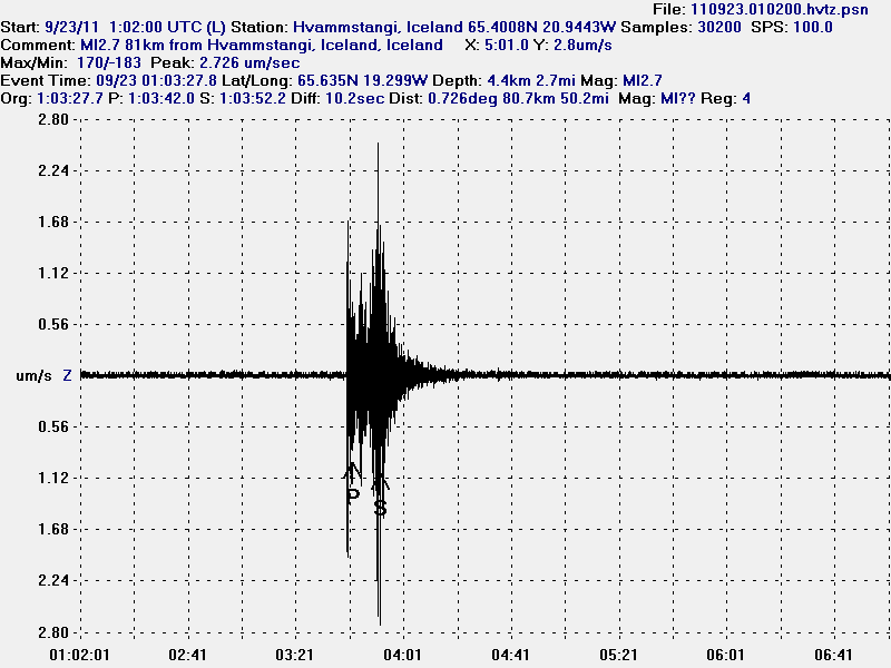
The ML2.7 seen on Hvammstangi geophone. Sadly, no live gif image of it due to network issues. This picture is released under Creative Commons Licence. See licence web page for more details.

I do not know if there are going to be more earthquakes in this area. But it seems that this earthquake has happened in a area with known faults from post-glacial times (they are on my geological map of Iceland). So for now all that can be done is to wait and see what happens next this this area. But I am not expecting anything special in terms of more earthquake activity. There are no active volcanoes in this area.